
Mavic 3M May 22, 2026
Mavic 3M Guide for Highway Inspection in Low Light
Highway inspection at dusk exposes two weak habits at once: trusting auto exposure too much, and trusting aircraft autonomy more than the mission deserves.
Read MoreInsights, updates, and stories from the world of drones and technology.
Highway inspection at dusk exposes two weak habits at once: trusting auto exposure too much, and trusting aircraft autonomy more than the mission deserves.
Read More
Wind changes everything in aerial field scouting. Not just aircraft handling. Data quality, repeatability, takeoff choices, image overlap, and the confidence yo
Read More
Salt haze flattens contrast. Wet sand throws glare back into the lens. Wind shifts just enough to complicate overlap, and battery estimates that looked comforta
Read More
Open farmland gives you margin. A forest edge does not. Wind curls around trunks, climbs ridgelines, drops into gullies, and pushes a drone sideways when the mi
Read More
Not in the abstract. In the most practical sense possible. It changes how steadily the aircraft can hold line, how consistently your overlap stays intact, how m
Read More
When people discuss the Mavic 3M, they usually start with the sensor stack. That makes sense. Multispectral payloads, centimeter-level workflows, and RTK-driven
Read More
Learn how to use the Mavic 3M more effectively for coastal highway vegetation spraying, drift control, route discipline, and repeatable field execution.
Read More
First, the access road washes out. Then pickup trucks stop at the last passable bend. Then the materials schedule slips, the crew waits, and the spraying task y
Read More
Wind changes everything on a coastline. Not just image sharpness or flight time, but route design, battery reserve, crew pacing, and the quality of the dataset
Read More
Near town, a sloppy pre-flight can be rescued by a second battery, a cleaner launch spot, or a quick return to the vehicle for a cloth you forgot. Out in a remo
Read More
Not always in the obvious way. People tend to think first about lens haze, motor wear, or whether the landing zone is clean enough. Those matter. But when you’r
Read More
When people first hear “Mavic 3M,” they usually place it in agriculture. That makes sense. Multispectral payloads, plant health workflows, and mapping efficienc
Read More
I’ve seen plenty of vineyard teams focus on payload specs first and operating discipline second. With the Mavic 3M, that order should be reversed, especially wh
Read MoreThe Mavic 3M is usually discussed as an agriculture platform, and that is fair. Its multispectral payload, compact airframe, and field-ready workflow make it a
Read More
You can have a capable aircraft, a trained pilot, and a clear mission plan, yet the moment you move beyond paved urban corridors and into unfinished terrain, st
Read More
Wind shifts faster. Visual references are harder to trust. Terrain exaggerates small navigation errors. And if you are flying a Mavic 3M to document a hillside
Read More
That sounds obvious until you watch a mission slow down for reasons that do not look dramatic on paper: hesitant low-altitude behavior, inconsistent obstacle re
Read More
When operators talk about spraying in dusty wildlife environments, they usually jump straight to payload, droplet size, or coverage rate. That misses the real h
Read More
Coastline work exposes a drone to two problems at once. The environment fights your aircraft, and the scene fights your judgment.
Read More
That is especially true in vineyards, where rows funnel airflow, leaf movement tricks your eye, and the margin between a useful map and a misleading one can be
Read More
On paper, the Mavic 3M looks perfectly suited to the job: multispectral capture, compact airframe, efficient coverage, and the kind of positioning workflow that
Read More
Rows bend around slopes. Access roads disappear into loose gravel. Wind spills over ridgelines and turns a simple cross-block run into a battery and safety prob
Read More
Salt air, broken canopy, uneven terrain, and unstable weather windows turn a simple drone mission into a chain of small technical decisions. If the aircraft is
Read More
Coastal agriculture exposes every weakness in a drone workflow. Wind shifts faster. Salt moisture creeps into equipment. GNSS reception can look fine one minute
Read More
Coastal work exposes weak habits fast. Salt haze softens contrast. Wind shifts by the minute. Sun angle changes the reflectance signature of wet sand, algae, co
Read More
Flat-field habits break fast once the route starts climbing, dropping, and folding into ridgelines. A spray mission that looks clean on the screen can turn unev
Read More
On paper, a panel inspection mission looks clean: launch, run the lines, collect the imagery, identify thermal or multispectral anomalies, and move on. In pract
Read More
Learn expert mapping techniques for wildlife using Mavic 3M. Professional tips, best practices, and real-world insights.
Read More
Salt haze dulls contrast. Wind shifts without warning. Flat ground tempts operators into careless line planning because everything looks easy from the launch po
Read More
Forest mapping looks tidy on a project brief. In practice, it is a contest between signal quality, terrain shadowing, canopy complexity, and your ability to col
Read More
Practical Mavic 3M mountain workflow for multispectral mapping, RTK reliability, manual intervention, and interference control in complex terrain.
Read MoreHeadlands distort wind. Salt mist settles where you do not expect it. Elevation can change abruptly between beach, bluff, access road, and cliff edge. If you ar
Read More
Tree lines break the wind in one corridor and accelerate it in the next. Slopes distort depth perception. GNSS quality can feel solid on one ridge and fragile i
Read More
Highway inspection in mountain terrain exposes the difference between a drone that merely flies and a drone operation that can produce repeatable, defensible da
Read More
Not just the obvious parts, like ground speed or battery planning. Wind reaches deeper into the job. It affects image consistency, aircraft attitude, overlap st
Read More
It is not usually the aircraft that fails first. It is the plan. Pilots launch too low and lose efficiency. They launch too high and sacrifice the fidelity need
Read More
You notice it fast. A pilot rushes the setup because the weather window is narrow. The camera operator starts collecting “just in case” shots with no visual log
Read More
It changes flight planning, battery confidence, image consistency, and the way small operational mistakes compound over a long survey day. That is why the Mavic
Read More
A site can look straightforward on a desktop map, then turn awkward the moment you arrive: uneven access roads, unreliable mobile signal, trees blocking line-of
Read More
Remote venue scouting sounds simple until the site is three hours from the nearest support road, bordered by water on one side, rising ground on the other, and
Read More
A weak irrigation block, a patch of heat stress, an uneven canopy, a drainage issue hiding between rows—none of these stay small for long, especially when tempe
Read More
The hardest agricultural drone days are rarely the dramatic ones. Not storms. Not equipment failures. It’s the long, punishing temperature swings that expose ev
Read More
Heat shimmer bends your visual judgment. Winter wind drains batteries faster than expected. Dust, reflective surfaces, steel, concrete, temporary structures, an
Read More
Most people looking at the Mavic 3M start with the multispectral payload. Fair enough. That sensor suite is the headline feature, and in agriculture it earns th
Read More
Remote wildlife surveying looks simple on a whiteboard. Fly out, collect imagery, build a map, count animals, assess habitat, go home. In the field, it rarely b
Read More
High-altitude wildlife support pushes drone planning into a different category. Thin air changes aircraft behavior. Terrain confuses visual judgment. Wind can b
Read More
If you are looking at the Mavic 3M for power line vegetation work, the first mistake is to think of it as a camera drone with better sensors. That mindset leave
Read More
The first time I was asked to help design a UAV workflow for coastline monitoring in severe heat swings, the aircraft was only half the problem.
Read More
Coastal surveying exposes a drone operation in ways inland pilots often underestimate. Salt hangs in the air. Fine grit works into seams. Light reflects off wat
Read More
Urban vineyard scouting is an odd test for any drone. The rows are narrow. The light bounces off nearby buildings. Trees, utility lines, access roads, and refle
Read More
When people hear “drone,” they still often picture a flying camera. That mental model is outdated, and for mountain forest inspection it is not just incomplete—
Read More
It gets into prop wash. It softens contrast on the ground. It makes takeoff and landing less forgiving, especially when you need repeatable multispectral result
Read More
They compress almost every hard variable into one operating environment: reflective water, broken cliffs, wind shear, patchy GNSS conditions, salt exposure, and
Read More
I’m Marcus Rodriguez, and one of the more interesting briefs I get is this: use a Mavic 3M on a solar site when the light is poor, the schedule is tight, and th
Read More
Learn expert mapping techniques for solar farms using Mavic 3M. Professional tips, best practices, and real-world insights.
Read More
Most Mavic 3M discussions stay trapped in agriculture. That misses part of the aircraft’s real value. In the field, especially in difficult visual environments,
Read More
It softens edges, hides rutting, dulls contrast, and turns a clean aerial inspection plan into a problem of visibility, repeatability, and timing. If you are us
Read More
You feel it before takeoff. Wind rolls off the escarpment. Salt haze flattens contrast. GNSS behavior can change from one launch point to the next because the t
Read More
Urban forest spraying is rarely a simple “fly and apply” job. Trees sit next to roads, buildings, parked vehicles, utility lines, footpaths, and public green sp
Read More
When operators talk about getting better footage from a drone, they usually jump straight to sensors, lenses, or aircraft specs. That misses the real bottleneck
Read More
Open farmland is forgiving. Forest edges are not. Once you move into mixed canopy, broken relief, ravines, wet ground, and irregular electromagnetic conditions,
Read More
High-altitude field capture with the Mavic 3M is often treated as a simple altitude setting problem. Go higher, cover more hectares, finish faster. That logic i
Read More
Trees sit beside reflective glass, transmission lines, rooftops, traffic corridors, and dense Wi-Fi noise. The mission is not just to capture multispectral imag
Read More
That is especially true when people start talking about a platform like the Mavic 3M around dense structures, reflective surfaces, narrow access lanes, and corr
Read More
Remote coastline inspection pushes the Mavic 3M into a very specific kind of work. You are not just flying over pretty water and sand. You are dealing with refl
Read More
Learn expert filming techniques for coastlines using Mavic 3M. Professional tips, best practices, and real-world insights.
Read More
High-altitude venue surveys rarely fail for one dramatic reason. They usually unravel through smaller compromises: overlap starts to slip, wind pushes the aircr
Read More
Wind in a vineyard does not arrive evenly. It spills over ridgelines, runs down rows, and turns a calm takeoff zone into a different air mass a few hundred mete
Read More
I still remember a wet-season habitat survey where the hardest part was not collecting imagery. It was keeping the collection consistent.
Read More
Learn expert monitoring techniques for wildlife using Mavic 3M. Professional tips, best practices, and real-world insights.
Read More
On paper, a highway corridor survey or roadside vegetation assessment with the Mavic 3M looks straightforward: arrive on site, confirm mission boundaries, check
Read More
Learn expert monitoring techniques for vineyards using Mavic 3M. Professional tips, best practices, and real-world insights.
Read MoreOn paper, a drone mission for power-line tracking sounds simple: launch, follow the corridor, collect imagery, build a map, identify vegetation pressure and acc
Read More
Learn expert delivering techniques for coastlines using Mavic 3M. Professional tips, best practices, and real-world insights.
Read More
It settles on lenses, dulls visual markers, hides crop stress, and makes a simple field run feel less predictable than it should. For teams using the Mavic 3M i
Read More
When people first think about the DJI Mavic 3M, they usually think of crops, vigor maps, and multispectral field analysis. That is fair. It was built with agric
Read More
That was the real lesson from one of our early vegetation-management surveys near distribution lines running behind apartment blocks and roadside trees. The air
Read More
It shifts dust, moves loose materials, complicates safety oversight, and turns an easy drone survey into a session full of repeated passes, inconsistent overlap
Read More
Remote wildlife scouting sounds straightforward until you are three batteries deep, half a valley from your launch point, and staring at a screen full of techni
Read More
Learn expert spraying techniques for vineyards using Mavic 3M. Professional tips, best practices, and real-world insights.
Read More
They compress too many variables into one mission: reflective water, hard vertical structures, narrow access corridors, sea wind, intermittent GNSS conditions n
Read More
Not just the aircraft. The crew plan, the battery rotation, the route design, the moments between passes when you either stay composed or start bleeding efficie
Read More
That matters if you are using the Mavic 3M to support spraying venues, document crop stress, verify treatment coverage, or build multispectral maps that feed op
Read More
The Mavic 3M is not a cinema drone in the usual sense, and that is exactly why it deserves a more careful conversation when people try to use it for wildlife wo
Read More
Urban venue inspection sounds straightforward until the aircraft is out over a riverwalk, stadium perimeter, exhibition roofline, or landscaped public corridor
Read More
Steep slopes compress your visual depth cues. Canopy texture hides gaps, deadwood, and early stress signatures. Moisture, pollen, and fine dust settle where the
Read More
The Mavic 3M is usually discussed through the lens of crop health and multispectral workflows. That is fair, but incomplete. On active construction sites, espec
Read More
High-altitude solar farms create a strange mix of advantages and headaches. The air is often cleaner. The light can be excellent. Coverage areas are huge, and t
Read More
Urban wildlife spraying is one of those jobs that looks simple from a distance and becomes highly technical the moment rotors spin up. The aircraft is moving th
Read More
On paper, most drone platforms can map a valley, edge-match a wetland, or revisit a habitat corridor. In practice, the mission is shaped by things that spec she
Read More
Construction teams often talk about payload, flight time, and image quality first. In low-light delivery work, that order is backwards.
Read More
Urban solar work looks simple from the street. A few rows of panels on a commercial roof. A compact ground-mount installation beside a warehouse. Maybe a utilit
Read More
I spent part of last season reviewing a forest scouting program that looked straightforward on paper and unruly in the air. The aircraft was the Mavic 3M, the m
Read More
When people ask whether the Mavic 3M is a good fit for filming venues in low light, the conversation usually drifts toward camera specs alone. That misses the h
Read More
High-altitude field work exposes every weak point in a drone operation. Air density changes. Wind becomes less forgiving. Visibility can shift fast. And in agri
Read MoreHighway work exposes a drone system in ways office demos never do. Long heat shimmer over asphalt. Crosswinds around overpasses. Reflective glare at midday. Nar
Read More
Coastal work exposes the Mavic 3M to a strange mix of advantages and headaches. Open sightlines are excellent. Lighting can be beautiful. Coverage can be effici
Read More
Coastal venues look simple from the road. A waterfront event space, marina-adjacent sports complex, seaside resort, open-air concert ground, or harbor-facing ca
Read More
If you are planning wildlife-area spraying support or vegetation monitoring in windy conditions, the hardest part is rarely the aircraft itself. It is workflow
Read More
Highway vegetation work sounds simple until the wind starts doing what wind always does: exposing every weak assumption in your plan.
Read More
Salt hangs in the air. Wind changes by the hour. Moisture creeps into connectors, lenses collect residue, and a mapping mission that looked routine on paper can
Read More
Dust hangs in the air after each passing truck. Long corridors amplify signal and coordination problems. Crews need fast turnarounds, but the value of the missi
Read More
The Mavic 3M is usually discussed in an agricultural context, and for good reason. Its multispectral workflow was built around crop intelligence, plant vigor ma
Read More
I still remember one of the more frustrating shoreline jobs I worked on early in my career. The assignment sounded simple on paper: document a complex urban coa
Read More
When operators talk about using the Mavic 3M in mountain environments, the conversation usually drifts toward endurance, link stability, and whether RTK can hol
Read More
I’ve spent enough time around coastal job sites to know that the hard part usually isn’t getting a drone into the air. The hard part is getting dependable data
Read More
Learn expert monitoring techniques for highways using Mavic 3M. Professional tips, best practices, and real-world insights.
Read MoreYou notice it first in the handoff between planning and flying. The tide line shifts faster than expected. Wet sand and shallow water flatten contrast. Rocks, p
Read More
On paper, you need a quick aerial look before crews mobilize. In the field, you’re dealing with signal shadows between buildings, narrow takeoff choices, overhe
Read More
Construction teams rarely operate in tidy conditions. They work in reflective dust, sharp midday sun, concrete heat islands, and wide sites where signal quality
Read More
Construction teams working through brutal summer afternoons don’t need another broad summary of what the Mavic 3M is. They need to know whether its data can hol
Read More
When growers ask whether the Mavic 3M fits serious vineyard operations in punishing weather, the real question is not whether the aircraft can fly. Most modern
Read More
The terrain changes every few seconds. Guardrails, sign gantries, cut slopes, drainage ditches, utility lines, retaining walls, and crosswinds all stack risk in
Read More
On paper, a shoreline survey can look simple: launch, map the edge, detect vegetation stress, document erosion, and head home before the tide turns. In the fiel
Read More
Solar farm inspection looks simple from a distance. Fly, capture, process, report. On site, especially in punishing heat or sharp winter cold, it becomes someth
Read More
Highway work rarely fails because the aircraft cannot fly. It fails because the data chain breaks somewhere between takeoff and decision-making.
Read More
Learn expert surveying techniques for highways using Mavic 3M. Professional tips, best practices, and real-world insights.
Read More
The Mavic 3M is usually discussed through sensor specs and mission-planning features. That is useful, but it misses the part that decides whether a survey progr
Read More
A rocky estuary, a tidal flat, a vegetated embankment, a narrow access road, and changing light over water can turn a simple mission into a messy one. Add steep
Read More
Remote forest monitoring pushes a drone far beyond a tidy demo flight. The aircraft has to travel light, hold a stable link, collect different kinds of data wit
Read More
Low-light work around power line corridors exposes a gap between brochure-level drone talk and what crews really need. The Mavic 3M sits in an interesting place
Read More
It gets into gimbals, coats sensors, softens contrast, and turns an otherwise routine wildlife scouting flight into a data-quality problem. If you are using the
Read More
I spend a lot of time talking to teams who want to use the Mavic 3M for forestry and land management, then realize the real challenge is not image capture. It i
Read More
I’ve seen plenty of perfectly capable drone missions fail for a simple reason: the aircraft was fine, but the capture method was sloppy. That matters even more
Read More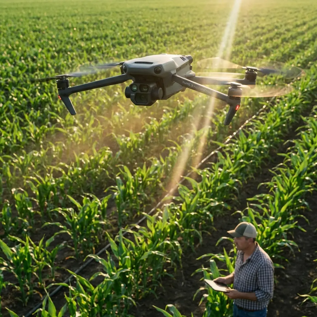
Flat, uniform fields forgive a lot. Hillsides do not. Terraced blocks do not. Irregular field edges, tree lines, mixed crop vigor, and changing elevation all pu
Read More
Remote venue scouting sounds simple until you are the one standing at the edge of a rough access road, losing daylight, trying to decide whether a site is actua
Read More
The aircraft is dealing with reflective rooftops, narrow streets, glass facades, RF clutter, and a corridor full of conductive infrastructure that does not forg
Read More
Mountain venues punish weak drone workflows. Wind comes over a ridge in one direction, light changes in minutes, and a site that looks simple on a map turns int
Read More
Urban construction capture has a strange habit of exposing the difference between a drone that looks capable on paper and a drone that keeps delivering when the
Read More
Rows bend with the terrain. Wind comes off the water when it feels like it. Salt hangs in the air. Access roads look drivable until they are not. And the data s
Read More
Learn expert surveying techniques for highways using Mavic 3M. Professional tips, best practices, and real-world insights.
Read More
When people talk about drones on construction projects, the conversation usually jumps straight to mapping, progress photos, or stockpile measurement. That miss
Read More
You are often dealing with long linear assets, uneven terrain, few recovery options, patchy signal environments, and a worksite culture where one overlooked ste
Read More
They are about timing, plant stress, uneven blocks, temperature swings, and the constant pressure to make agronomic decisions before the window closes. That is
Read More
Low-light work in forest environments punishes sloppy preparation. Shadows hide branches. Moisture clings to the aircraft. Terrain compresses your reaction time
Read More
Learn expert capturing techniques for vineyards using Mavic 3M. Professional tips, best practices, and real-world insights.
Read More
Construction teams tend to obsess over payloads, battery cycles, and wind limits. Fair enough. But when a Mavic 3M is flying low over active sites in extreme te
Read MoreNot just visibility. Not just maintenance cycles. In agricultural mapping, suspended dust can quietly distort the workflow from takeoff to prescription planning
Read MoreRemote solar farm tracking sounds, at first glance, like a different universe from crop investigation. Different assets. Different imagery goals. Different stak
Read More
High-altitude construction inspection has a strange habit of exposing weak assumptions. A flight plan that works perfectly on flat ground can become unreliable
Read More
Highway work exposes weaknesses quickly. Heat shimmer softens detail. Cold reduces battery confidence. Long linear corridors punish sloppy overlap planning. And
Read More
Dusty construction sites are unforgiving places to spray anything with accuracy. Fine particulates stay suspended. Wind shifts off unfinished walls. Access road
Read More
When people look at the Mavic 3M, they often reduce it to one label: an agricultural drone for crop intelligence. That misses the point. In the field, its real
Read More
Learn expert surveying techniques for power lines using Mavic 3M. Professional tips, best practices, and real-world insights.
Read MoreLearn expert tracking techniques for coastlines using Mavic 3M. Professional tips, best practices, and real-world insights.
Read More
Urban coastline surveying looks simple on paper. Water on one side, buildings on the other, and a flight plan stretched along the edge. In practice, it is one o
Read More
Vineyard inspection gets harder precisely when the crop gets more demanding. Heat stress, uneven irrigation response, bare soil glare, and midday thermals all c
Read More
Learn expert capturing techniques for power lines using Mavic 3M. Professional tips, best practices, and real-world insights.
Read More
A site that looks straightforward on a calm morning can become a poor mapping environment by midday. Gusts alter aircraft attitude, blur image sequences, and pu
Read More
It settles on modules, softens contrast, confuses visual interpretation, and turns a clean mapping plan into a data-quality problem. On paper, the Mavic 3M look
Read More
Learn expert mapping techniques for highways using Mavic 3M. Professional tips, best practices, and real-world insights.
Read More
Forest work exposes the difference between a drone that merely flies and a drone that delivers usable information. With the Mavic 3M, that difference shows up f
Read More
The Mavic 3M is usually discussed through the lens of crop intelligence. That is too narrow for serious field teams. In wildlife operations, especially in harsh
Read More
Solar farms look simple from the road. Long rows, clean geometry, plenty of open sky. In practice, they are one of the more awkward places to run a small aerial
Read More
Salt haze softens contrast. Wet sand throws glare back into the lens. Wind direction shifts faster than the forecast suggests. One minute you are tracking nesti
Read More
Flatland workflows that look efficient on paper tend to break apart once you start flying over terraced plots, irregular field boundaries, mixed sun angles, and
Read MoreNot in a dramatic, abstract way. In the field, dust is practical trouble. It softens visual contrast, contaminates takeoff zones, complicates crop scouting afte
Read More
Flat test plots are forgiving. Hillsides are not. Light shifts faster, wind behaves differently across ridgelines, access is awkward, and battery planning becom
Read More
If you film utility corridors long enough, you learn a humbling truth: the aircraft is only half the job. The rest is timing.
Read More
When people discuss the Mavic 3M, they usually focus on the aircraft: multispectral capture, RTK-backed positioning, repeatable coverage, and the kind of consis
Read More
Anyone who has tried to document a solar farm near sunrise or at the end of the day knows the frustration. The site looks rich to the eye: clean panel geometry,
Read More
It softens edges, flattens surfaces, hides defects, and turns an otherwise useful aerial record into a vague layer of beige atmosphere. Teams often assume the a
Read More
Learn expert monitoring techniques for forests using Mavic 3M. Professional tips, best practices, and real-world insights.
Read More
Urban solar inspection with a Mavic 3M is not just a sensor problem. It is an airspace problem, a timing problem, and a data integrity problem wrapped into one
Read More
Forest work exposes every weak habit a drone team can have. Signal gets sketchy under canopy edges. Contrast drops fast at dusk. Moisture hangs in the air. Terr
Read More
High-altitude highway work is unforgiving. Thin margins, changing wind, reflective pavement, steep embankments, and light that can either flatten detail or reve
Read More
Not because the rows are harder to see. Not because the terrain is always worse. The real challenge is that city-adjacent agriculture sits inside a tighter oper
Read More
A recent utility inspection story out of Shanxi deserves attention from anyone evaluating the Mavic 3M for construction monitoring in coastal environments.
Read More
Learn expert scouting techniques for highways using Mavic 3M. Professional tips, best practices, and real-world insights.
Read More
Light changes fast. Wind moves through rows unevenly. A block that looks uniform from the edge of a slope can break into several microclimates once you actually
Read More
The most revealing detail from the recent 2026 Beijing Model Show coverage was not what it said. It was what it left out.
Read More
When people talk about the Mavic 3M, the conversation usually drifts straight to sensor specs and map outputs. That misses the real point.
Read More
When people discuss the Mavic 3M, the conversation usually lands on sensors, RTK, and vegetation indices. Fair enough. Those are core to the aircraft’s value. B
Read More
Solar farm mapping gets difficult at the exact moment operators need clean data most: early morning, late afternoon, overcast weather, and those short winter wi
Read More
Most articles about the Mavic 3M drift into broad product talk. That misses the real question professionals ask in the field: what happens when a coastal highwa
Read More
High-altitude vineyard work exposes a drone’s strengths and weaknesses fast. Thin air changes aircraft behavior. Wind rolls over ridgelines unpredictably. Sun a
Read More
I spend a lot of time with teams who want a cleaner coastline map and end up asking for something deeper without realizing it. They are not only trying to trace
Read More
Most articles about the Mavic 3M start with sensors, flight time, or a tidy list of specifications. That is not where serious coastal work begins.
Read More
Most articles about the Mavic 3M stay inside the usual boundaries: crop health, multispectral imagery, and tidy daytime mapping missions over open fields. That
Read MoreI spent the better part of a recent week walking saline-edge fields near the coast, the kind of ground where crop vigor can shift fast and where weather rarely
Read MoreCold batteries. Thin air. Gusting wind over ridgelines. Unpredictable light. Long travel windows. Limited chances to reacquire an animal once it disappears into
Read More
What looks manageable from the trailhead changes fast once you gain altitude. Wind funnels through ridgelines. Light drops behind a cloud bank and the terrain l
Read More
Extreme-temperature venue surveying exposes a truth that spec sheets tend to hide: the aircraft is only one part of the system. The mission succeeds or fails on
Read More
Learn expert surveying techniques for venues using Mavic 3M. Professional tips, best practices, and real-world insights.
Read MoreUrban solar sites ask a lot from a drone pilot. Roof geometry changes block by block. Glare shifts by the minute. HVAC units, parapet walls, cable trays, and ne
Read More
When people discuss the DJI Mavic 3M, the conversation usually starts with multispectral data and ends with vegetation maps. That makes sense in agriculture. It
Read More
On flat ground, you can get away with sloppy overlap, inconsistent lighting plans, and oversized files that nobody processes on time. In the hills, those habits
Read More
You feel it the moment you unload gear. Long panel rows reflect hard light into the aircraft. Substations and inverters can introduce electromagnetic noise. Win
Read More
You deal with broken terrain, fast-changing wind, narrow access roads, dust, reflective surfaces, and crews that want the job done without repeated passes. In t
Read More
Mountain venue mapping sounds straightforward until terrain starts breaking line of sight, GNSS geometry gets messy, and the mission shifts from “collect data”
Read More
Forest spraying in low light sounds straightforward until you are actually out there. Tree canopies distort airflow. Moisture hangs close to the ground. Shadows
Read More
High-altitude highway scouting looks simple on paper. Stretch a corridor, fly repeatable lines, mark slope instability, drainage problems, encroaching vegetatio
Read MoreIf you want to understand how to use a Mavic 3M for coastline tracking at altitude, the most useful starting point is not a spec sheet. It is operator experienc
Read More
When people talk about drone agriculture, they often jump straight to sensors, software, or broad promises about precision farming. That misses the harder quest
Read More
Learn expert delivering techniques for forests using Mavic 3M. Professional tips, best practices, and real-world insights.
Read MoreCoastlines are awkward places to map well. The shoreline itself is unstable. Light shifts off water and wet sand. Cliffs block satellite geometry. Salt mist pun
Read More
I’ve spent enough time around field teams to know that “can this drone do the job?” is rarely the first serious question. The real one is usually harsher: can t
Read More
People often ask whether the Mavic 3M is a spraying drone for steep, fragmented farmland. The short answer is no. It does not replace a dedicated application pl
Read More
Coastal wildlife work asks a lot from a small aircraft. Salt mist clings to the airframe. Wind shifts faster than the forecast admits. Reflective water and patc
Read More
When people talk about the Mavic 3M, the conversation usually stays in agriculture. That misses a much more interesting reality. In academic fieldwork, especial
Read More
Learn expert capturing techniques for solar farms using Mavic 3M. Professional tips, best practices, and real-world insights.
Read More
Most Mavic 3M articles stay trapped in product specs. That misses the real question operators face in the field: what kind of work justifies putting a drone in
Read More
One side is a crop block or managed green strip. The other is a road, a school boundary, a warehouse roofline, a bike path, or a landscaped park where people ex
Read More
On March 28, officials in Shannan, Tibet announced progress in the Sangri County afforestation project tied to the broader South-North Mountain Greening effort.
Read More
When a city launches a formal drone pilot training class, the headline can look local and narrow. It usually is not. In Urumqi, the newly opened UAV training pr
Read More
Remote power line inspection is never just about flying a drone down a corridor and collecting imagery. The hard part begins when the environment starts fightin
Read More
When teams discuss the Mavic 3M, the conversation often jumps straight to sensors, RTK, or multispectral outputs. Those matter. But in dusty wildlife environmen
Read More
Coastal highway inspection looks straightforward on paper. Fly the corridor, capture the assets, review the imagery, write the report. The reality is harsher. S
Read More
Coastal venue work has a habit of exposing weak planning. Open edges, reflective surfaces, long access roads, scattered infrastructure, and fast-changing light
Read More
Remote field work punishes vague planning. You do not get easy battery swaps, quick retakes, or a second chance when the light changes over a large block of cro
Read More
I spend a lot of time with operators who ask the same practical question in different ways: can the Mavic 3M hold up when the environment stops cooperating? On
Read More
Coastal highway work exposes every weakness in a drone program. Salt air creeps into connectors. Wind funnels across bridge approaches. Launch areas are often n
Read More
Mountain power line inspection is rarely limited by flight time alone. The real constraint is trust in the data when terrain is steep, access is poor, and each
Read More
Most Mavic 3M pilots are leaving useful data on the table for one simple reason: they trust automation too much when conditions get messy.
Read More
If you are inspecting power lines in dry corridors, substations near unsealed roads, or transmission routes that cut across exposed terrain, dust becomes more t
Read MoreLearn expert tracking techniques for highways using Mavic 3M. Professional tips, best practices, and real-world insights.
Read More
That becomes obvious the first time you try to document a stand of trees, vine-heavy edges, flowering branches, or regeneration zones with a drone and come home
Read More
Remote coastline surveying punishes weak assumptions. Salt haze flattens contrast. Wet rock throws specular highlights into the lens. Tidal windows compress fli
Read More
The problem is not simply terrain. It is the way light changes faster than most crews expect, the way wind moves across rows unevenly, and the way a beautiful m
Read More
Highway monitoring sounds straightforward until the wind starts pushing the aircraft sideways, sun glare bounces off guardrails, and the road surface alternates
Read More
Not the glamorous weaknesses. The real ones. Delayed approvals. Uneven local rules. Missions that look simple on a map but break down once terrain, distance, an
Read More
Learn expert surveying techniques for fields using Mavic 3M. Professional tips, best practices, and real-world insights.
Read MoreMost articles about the Mavic 3M stay trapped in a narrow lane. They talk about multispectral data, agricultural workflows, and little else. That misses a bigge
Read MoreI spent the day tracking a coastal highway corridor with the Mavic 3M, and the flight told a bigger story than a simple mission log.
Read More
Learn expert surveying techniques for solar farms using Mavic 3M. Professional tips, best practices, and real-world insights.
Read More
Most discussions about low-light drone work drift toward hardware. Better sensors. Better sealing. Better positioning. Better optics. Those things matter. But t
Read More
The technical challenge looked familiar enough: a long utility corridor, crosswinds pushing harder than the morning forecast suggested, and a vegetation-control
Read More
Not in an abstract way. In a practical, expensive, crop-level way. A calm morning mission that looks routine on paper can become a very different operation once
Read More
I’ve spent enough time around field teams to know that most drone conversations drift in the wrong direction. People get pulled into spec-sheet theater. They co
Read More
Not in an abstract way. In a very practical one. It changes the angle of the canopy, the consistency of overlap, the confidence of an RTK fix, and sometimes the
Read MoreThe tide was already an hour ahead of schedule when the harbour master radioed to say our launch window would close in forty minutes. I had the Mavic 3M on the
Read More
The tasting room below was full when the wind shifted. One gust carried my first pass straight toward the Chardonnay glasses. I throttled back, listened for rot
Read More
The helicopter left us on a ridge at 1 600 m elevation, blades still spinning while I snapped the Mavic 3M’s gimbal lock free. Below us, 4 200 ha of spruce and
Read More
Marcus Rodriguez here. I’ve spent the last eight seasons mapping vegetables and orchard blocks across South China, and if there is one truth that repeats itself
Read More
The tide was still retreating when I snapped the carbon-fiber props onto our Mavic 3M last Monday. A 22-knot on-shore breeze carried the smell of iodine and pin
Read More
I still remember the first time I tried to map a serrated stretch of shoreline north of Santander. The cliffs dropped 70 m to a narrow belt of dark sand, the wi
Read MoreMarcus Rodriguez here. I spend most daylight hours watching cliffs crumble—professionally. My consultancy maps shoreline retreat for insurers, marine labs and o
Read More
The call came in at 04:10. A 38-kilometre stretch of State Route 138 had lost its edge-line reflectors overnight, and the district engineer wanted fresh topogra
Read More
Marcus Rodriguez here. I’ve spent fifteen years mapping corridors for utilities from Chile to British Columbia, and the one call every operator dreads is the 19
Read More
The sun had already slipped behind the ridge when the last multispectral frame of the day was captured, yet the four-band data still carried better than 3 cm gr
Read More
Learn expert spraying techniques for solar farms using Mavic 3M. Professional tips, best practices, and real-world insights.
Read More
I landed the Mavic 3M at 3,480 m above sea level, kicked the dust off my boots, and watched the last 18-litre tank gurgle empty. The prop wash flattened the fea
Read More I land the Mavic 3M on the unfinished deck of a pier in Dongying, Yellow Sea side, 07:18 local. The tide is ebbing, the wind already 12 m s⁻¹, and the concrete
Read More (The following notes were field-tested on 480 ha of irrigated cotton south of Phoenix, 38 °C, 28 % humidity, 18 kph gusts.)
Read More
The first time I briefed a crew on a 4 A.M. take-off they thought I was joking. Solar modules look heroic at noon; engineers want to see them at their worst—whe
Read More
Dr. Sarah Chen, geomatics lecturer and occasional highway-consultant, fastens her field vest at Km 142 of the G15 coastal expressway. The anemometer on the guar
Read More
The call came at 21:14. Grid dispatch wanted the right-of-way under the Lhasa–Shigatse feeder treated before dawn; load would climb at 05:30 when the aluminium
Read More
Blue hour is when the grid reveals its secrets. The sun has slipped behind the hills, the steel glows amber, and the ceramic insulators stand out like white pun
Read More
The tide was still retreating at 06:42 when the first props spun. A pale sun cut through the dust that mainland winds had pushed seaward overnight, and every ex
Read More
Marcus Rodriguez here—thirteen years of coaxing drones through canyons of rebar, conveyor belts, and freshly-poured tilt-up walls. The Mavic 3M is the smallest
Read More
The call usually comes just after sunset. A vineyard manager in Yancheng needs fresh elevation data before the irrigation contractor arrives at dawn, or a highw
Read More
“Marcus, the herd’s already on the move. If we don’t get transect data before the wind picks up, we lose the entire June window.”
Read More
The morning I drove into the Ribeira Sacra, the anemometer on the pickup roof was already tapping 28 km/h. By the time I laid out the ground-control panel, the
Read More
The trade-day loudspeakers are still hyping the doubling of overseas exhibitors when I walk past the DJI pavilion, but my mind is on the 32 kn gusts that just l
Read More
Low-light work exposes every weak point in an aerial workflow. On a construction site, that usually shows up first in the images: soft edges, milky contrast, vi
Read More Remote solar assets look simple on paper. Long panel rows. Repeatable geometry. Predictable inspection routes. Then you get into the field.
Read More
Remote vineyard inspection has a technical problem that rarely gets enough attention: the aircraft is only one part of the system. The real bottleneck is usuall
Read More
A curious detail surfaced in a recent Chinese camera tutorial aimed at first-time Canon users. The headline promised a fast path through 12 settings, and the bo
Read More
When crews talk about bad mapping output from a Mavic 3M mission, the blame usually lands on flight speed, overlap, wind, or processing settings. Those variable
Read More
Forest mapping with the Mavic 3M usually gets framed as a sensor problem. Teams talk about multispectral bands, RTK fix rate, swath width, overlap, terrain foll
Read More
When professionals discuss the Mavic 3M, the conversation often drifts straight to sensors, flight specs, and mapping outputs. Those matter. But for wildlife sc
Read More
If you run drones around utility corridors, regulation is never background noise. It changes how aircraft are moved, where batteries sit overnight, who signs of
Read More
Salt haze cuts contrast. Wind pushes the aircraft off line. Bright water and dark rock fight the camera meter. By the time you get back from a remote shoreline,
Read More
Heat shimmer can soften visual detail across long panel rows. Cold snaps punish batteries and slow crews down. Remote sites often lack stable power, dependable
Read More
Coastal drone work has a way of exposing weak assumptions fast. Salt haze softens contrast. Wind shifts without much warning. Reflective water and pale sand can
Read More
When crews talk about the DJI Mavic 3M, the conversation usually lands on mapping, vegetation analysis, and data products. Fair enough. The aircraft earned its
Read More
If you work around utility-scale solar, you already know the real bottleneck is rarely the aircraft alone. It is the gap between what a platform can do on paper
Read More
If you inspect active job sites with a DJI Mavic 3M, this week’s drone news points in two directions at once. One is legal. The other is technical. Both matter
Read More
Mountain highway mapping is where tidy spec sheets meet messy reality. Slopes break line of sight. Wind behaves differently on each ridge. Shadows move fast. A
Read More
Remote coastline scouting looks simple from a distance. Launch, map the shore, bring the aircraft home. In practice, it is one of the quickest ways to expose we
Read More
Low-light coastal work exposes every weakness in a drone workflow. Wind shifts fast, reflective water confuses exposure judgment, and feature-poor terrain can p
Read More
Coastline inspection is rarely a simple mapping exercise. Wind shear changes by the minute. Salt haze softens contrast. Reflective water punishes poor exposure
Read More
For Mavic 3M crews working venue inspections in dry, debris-prone environments, airborne dust changes everything: sensor confidence, cooling efficiency, post-fl
Read More
The most useful Mavic 3M lesson from this week’s news did not come from an agronomy bulletin or a spraying manual. It came from a photography discussion publish
Read More
High-altitude solar sites ask more from a drone program than most operators expect. The panels stretch for acres, the light is harsh, winds shift without warnin
Read More
Power-line scouting at altitude is often described as a sensor problem. In practice, it is usually a seeing problem first.
Read More
Urban vineyard work is rarely forgiving. Blocks are tighter, reflective surfaces are everywhere, tree lines interrupt signal paths, and the margin for error in
Read More
Coastal highway inspection looks straightforward on paper. Long corridors, repeatable routes, clear assets. In practice, it is one of the easiest places to ruin
Read More
The most useful way to think about the Mavic 3M in 2026 is not as an isolated aircraft, but as a tool arriving at exactly the right moment.
Read More
Dust changes how professionals should think about the Mavic 3M. Not just because dust softens image contrast, coats optics, and creeps into hinges. It changes t
Read More
If you operate a Mavic 3M over coastal vineyards, the latest Chinese drone news points to something larger than a few isolated headlines. The pieces fit togethe
Read More
I’ve spent enough time around shorelines to know that coastal flying punishes sloppy habits fast. Salt haze softens contrast. Gusts arrive sideways. Light chang
Read More
A mission that looks simple on a flat demo plot becomes complicated the moment rows start climbing a slope, light shifts across ridgelines, and wind begins movi
Read MoreIf you track forests in steep, signal-challenging terrain, broad policy news can feel distant from the work that actually matters: holding RTK, keeping flight l
Read More
Low-light coastline work exposes weak habits fast. Tidal edges shift. Contrast collapses. Moisture gets everywhere. Pilots who are sharp at noon can become unre
Read More
When people talk about better image capture, they often jump straight to hardware. Bigger sensor. Better lens. More automation. In practice, that is only half t
Read More
Construction sites punish weak workflows. Steel glare at noon, concrete dust in the air, reflective membranes on rooftops, long winter shadows, and temperature
Read More
Coastal forest monitoring rarely fails because the drone cannot fly. It fails because the data chain breaks under field pressure.
Read More
Forest scouting with a DJI Mavic 3M is rarely limited by the camera alone. In dense canopy, broken ridgelines, and irregular light, the real constraint is decis
Read More
When people ask me whether the Mavic 3M is suitable for rugged agricultural terrain, they usually expect a checklist: RTK, multispectral payload, route planning
Read More
Mountain spraying punishes lazy workflow. Wind bends around ridgelines. Elevation changes distort coverage. Turn spacing that looks fine on flat ground can leav
Read More
When a heavy-lift research drone is sent to Greenland to study the meeting point of ice and ocean water, most Mavic 3M operators might treat it as interesting b
Read More
A field report on what Volatus Aerospace’s TSX move and a power-line shutdown case reveal about safer, smarter Mavic 3M coastline surveying operations.
Read More
When people talk about drone regulation, they usually flatten it into a yes-or-no question: allowed or restricted, compliant or grounded. That is not how field
Read More
Learn expert monitoring techniques for coastlines using Mavic 3M. Professional tips, best practices, and real-world insights.
Read More
The Mavic 3M sits in an interesting place in the drone market. It is not built for spectacle. It is built for decisions. That matters in coastal forest work, wh
Read MoreWhen people discuss the Mavic 3M, they usually stay at canopy level: NDVI layers, stand counts, vigor maps, prescription planning. Useful topics, but incomplete
Read More
That misunderstanding shows up everywhere in UAV work, especially on construction sites where dust, glare, moving equipment, and schedule pressure push crews to
Read More
For agriculture teams using the Mavic 3M far from town centers, the latest shift in China’s drone environment matters more than many hobby headlines suggest. Th
Read More
The most useful drone stories are not always about a new airframe or regulation change. Sometimes the real lesson comes from watching what happens when thousand
Read More
When a new aviation format starts appearing everywhere at once, I pay attention. Not because spectacle automatically translates into field utility, but because
Read More
When a local drone soccer competition opens at a sports center in Weixian, Handan, it is easy to file the story under novelty and move on. Pilots threading airc
Read More
Forest scouting with the DJI Mavic 3M has never been just a question of hardware. In difficult terrain and temperature extremes, the aircraft is only one part o
Read MoreWhen a spring field report from Shandong says fertilizer application can come in at just 9 yuan per mu, most readers see an agriculture efficiency story. I
Read More
Urban venue mapping rarely fails because the aircraft cannot fly. It fails because the operation around the aircraft is messy.
Read More
Highway monitoring with a `Mavic 3M` is no longer just a question of flight technique. The bigger issue now is trust: who is flying, why they are flying, and ho
Read More
If you are planning remote forest spraying with the DJI Mavic 3M in 2026, the most useful lessons may not come from an agriculture headline at all.
Read More
A field-focused analysis of how new swarm-drone tactics and layered radar detection reshape real-world Mavic 3M operations for remote vineyard mapping.
Read More
Highway work in extreme heat or biting cold has a way of exposing weak assumptions. Batteries behave differently. Sensors drift. Dust settles where it should no
Read More
Learn expert Mavic 3M mapping techniques for highway surveys in extreme temperatures. Marcus Rodriguez shares RTK, multispectral, and antenna tips.
Read More
- The Mavic 3M outperforms competing platforms in coastal multispectral mapping thanks to its integrated RTK module and 4-band multispectral + RGB imagi
Read MoreDiscover how the DJI Mavic 3M enables centimeter precision multispectral tracking for urban agriculture fields. Expert technical review with RTK data and tips.
Read More
- Pre-flight lens cleaning is a non-negotiable safety step that directly impacts multispectral data accuracy on dusty highway corridors
Read More
Learn expert Mavic 3M tips for capturing solar farm data in extreme temperatures. Multispectral imaging, RTK precision, and proven workflows inside.
Read More
Discover how the Mavic 3M transforms urban coastline surveying with multispectral imaging and centimeter precision. Expert tips for optimal results.
Read More
Learn how to scout agricultural fields in wind with the DJI Mavic 3M. Expert tips on multispectral imaging, RTK precision, and pre-flight prep.
Read More
Discover how the DJI Mavic 3M captures multispectral forest data in rugged mountain terrain. Expert case study with tips, specs, and proven workflows.
Read More
Learn how to scout wildlife with the DJI Mavic 3M in windy conditions. Expert tips on multispectral imaging, pre-flight prep, and flight stability.
Read More
Discover how the DJI Mavic 3M transforms mountain construction site mapping with multispectral imaging and centimeter precision. Expert field report inside.
Read More
Learn how the Mavic 3M transforms coastal highway inspections with multispectral imaging and centimeter precision. Real case study with proven results.
Read More
- The Mavic 3M combines a multispectral imaging system with an RGB camera, making it the go-to platform for coastal survey filming in harsh, dust-laden envi
Read More
Learn how to film agricultural fields with the DJI Mavic 3M in windy conditions. Expert tips on multispectral imaging, RTK precision, and wind management.
Read More
Discover how the DJI Mavic 3M helps vineyard managers survey crops in extreme temperatures with multispectral precision and RTK-guided accuracy.
Read More
Learn how the DJI Mavic 3M maps solar farms in remote locations with centimeter precision, multispectral imaging, and RTK positioning for accurate results.
Read More
Discover how the Mavic 3M transforms low-light venue mapping with multispectral imaging and centimeter precision. Expert tips from Marcus Rodriguez.
Read More
Learn how the DJI Mavic 3M handles windy coastal filming with multispectral imaging, centimeter precision RTK, and electromagnetic interference solutions.
Read More
- The DJI Mavic 3M combines a multispectral imaging array with RTK centimeter precision, making it ideal for detecting road degradation, slope instability,
Read More
- The Mavic 3M handles sustained winds up to 12 m/s, but venue inspections require specific flight planning to maintain multispectral data quality in gusty
Read More
Discover how the DJI Mavic 3M handles coastal filming in high winds. Real case study with multispectral tips, RTK fixes, and pro-level techniques.
Read More
Learn how the DJI Mavic 3M captures stunning highway footage in low light. Field-tested tips for multispectral imaging, RTK precision, and night ops.
Read More
Discover how the DJI Mavic 3M transforms urban wildlife filming with multispectral imaging, centimeter precision GPS, and weather-resilient design for pros.
Read More
- The Mavic 3M's multispectral sensor array captures construction site data in conditions where standard drones fail, including dawn, dusk, and overcast env
Read More
- The Mavic 3M combines a multispectral imaging array with RTK positioning to achieve centimeter precision across irregular coastal landscapes where GPS sig
Read More
- The Mavic 3M combines a multispectral camera with an RGB sensor to deliver actionable forest health data in areas where ground crews simply cannot reach
Read More
- Fly at 35–50 meters AGL for the best balance of multispectral resolution and wind stability when monitoring solar farms.
Read More
Learn how the DJI Mavic 3M transforms urban highway filming with multispectral imaging, centimeter precision RTK, and IPX6K durability. Expert tutorial inside.
Read More
Discover how the DJI Mavic 3M enables precise coastal inspections with multispectral imaging, RTK positioning, and weather-resistant design for professionals.
Read More
- The Mavic 3M's multispectral sensor array and RTK positioning deliver centimeter precision on solar farm inspections—even when wind gusts exceed 10 m/s*
Read More
- The DJI Mavic 3M combines a multispectral imaging system with centimeter precision RTK positioning, making it ideal for scouting rugged mountain const
Read More
- The Mavic 3M's multispectral imaging system and centimeter precision RTK module make it ideal for power line delivery operations in temperatures from
Read More
Highway construction projects through mountainous and irregular terrain fail at the surveying stage more often than most engineers admit. The DJI Mavic 3M combi
Read More
Learn how to scout coastal highways using the DJI Mavic 3M. Expert tips on flight altitude, multispectral imaging, and centimeter precision for road surveys.
Read More
Learn expert scouting techniques for vineyards using Mavic 3M. Professional tips, best practices, and real-world insights.
Read More- Antenna positioning at 45° elevation relative to the flight path dramatically improves signal integrity during urban highway tracking missions
Read More
Learn how the DJI Mavic 3M transforms construction site surveying in complex terrain with multispectral imaging, centimeter precision, and RTK positioning.
Read More
Discover how the DJI Mavic 3M multispectral drone excels at urban filming with centimeter precision, RTK positioning, and professional imaging capabilities.
Read More
- The Mavic 3M's multispectral imaging system captures wildlife data across four spectral bands plus RGB, even in challenging low-light conditions that grou
Read More
Discover how the DJI Mavic 3M enables precise multispectral solar farm inspections at high altitude. Expert guide covers RTK, calibration, and proven workflows.
Read More
Discover how the DJI Mavic 3M enables precision wildlife mapping in windy conditions using multispectral imaging and centimeter-level accuracy for researchers.
Read More
- The Mavic 3M's multispectral imaging system unlocks wildlife observation capabilities that standard RGB drones simply cannot match, especially during dawn
Read More
- The DJI Mavic 3M combines a multispectral camera array with an RGB sensor, making it the most capable compact platform for urban solar farm diagnostic
Read More
Learn how to film forests in complex terrain with the DJI Mavic 3M. Expert tutorial covers optimal altitude, multispectral imaging, and flight planning tips.
Read MoreDiscover how the DJI Mavic 3M enables precise remote venue tracking with multispectral imaging, RTK positioning, and centimeter precision for professionals.
Read More
Learn how to use the DJI Mavic 3M for remote field monitoring with multispectral imaging, RTK precision, and proven tutorial steps for better crop data.
Read More
Learn how to film complex coastlines with the Mavic 3M drone. Expert tips on battery management, multispectral imaging, and precision mapping techniques.
Read More
Learn how the DJI Mavic 3M transforms coastal construction site mapping with multispectral imaging, centimeter precision RTK, and proven field workflows.
Read More
Urban vineyards face a unique paradox: they operate in some of the most space-constrained, regulation-heavy environments imaginable, yet they demand the same da
Read More
Discover how the Mavic 3M transforms low-light field monitoring with multispectral imaging. Expert tips for capturing accurate crop data at dawn and dusk.
Read More
Discover how the DJI Mavic 3M transforms high-altitude highway mapping with multispectral imaging and centimeter precision. Expert tips for surveyors inside.
Read More
Learn expert scouting techniques for coastlines using Mavic 3M. Professional tips, best practices, and real-world insights.
Read More
Master vineyard spraying in extreme temperatures with the Mavic 3M. Learn battery management, drift control, and precision techniques for optimal coverage.
Read MoreLearn how the Mavic 3M drone transforms mountain field tracking with multispectral imaging and RTK precision. Expert tips for challenging terrain operations.
Read More
Master high-altitude venue filming with the DJI Mavic 3M. Expert techniques for capturing stunning footage at elevation with precision multispectral imaging.
Read More
Discover how the DJI Mavic 3M tackles urban solar farm spraying with centimeter precision, RTK Fix rate stability, and drift-free nozzle calibration techniques.
Read More
Discover how the DJI Mavic 3M excels at monitoring venues in dusty environments with multispectral imaging, centimeter precision, and IPX6K durability.
Read More
Learn how the DJI Mavic 3M enables precise high-altitude coastline inspections using multispectral imaging, RTK positioning, and rugged IPX6K durability.
Read More
Learn how the DJI Mavic 3M enables precision highway scouting in windy conditions with multispectral imaging, RTK accuracy, and rugged IPX6K durability.
Read MoreDiscover how the DJI Mavic 3M multispectral drone enables precise wildlife tracking in extreme temperatures. Expert case study with flight tips and specs.
Read More
- The Mavic 3M combines multispectral imaging with RTK positioning to achieve centimeter precision on steep mountain terrain where traditional equipment fai
Read More
Discover how the DJI Mavic 3M transforms coastal forest filming with multispectral imaging, centimeter precision, and RTK guidance. A real-world case study.
Read More
- The DJI Mavic 3M combines a multispectral imaging system with RTK centimeter precision, making it an elite tool for wildlife surveys in rugged mountain te
Read More
Dr. Sarah Chen's field report on filming highways with the DJI Mavic 3M in high winds. Multispectral imaging tips, RTK fixes, and real-world lessons learned.
Read More
- The DJI Mavic 3M combines a 20MP RGB camera with four 5MP multispectral sensors to deliver comprehensive coastal mapping data in a single flight
Read MoreDusty coastal environments destroy data quality. Sand particulates interfere with sensors, electromagnetic noise from salt-laden air disrupts GPS signals, and s
Read More
Discover how the DJI Mavic 3M transforms coastal field surveying with multispectral imaging, RTK precision, and rugged IPX6K durability. Expert how-to guide.
Read More
Learn how the DJI Mavic 3M handles windy construction site inspections with multispectral imaging, centimeter precision RTK, and proven flight strategies.
Read More
Learn how the DJI Mavic 3M transforms field scouting in dusty conditions. Case study covers multispectral imaging, antenna setup, and RTK precision tips.
Read More
Learn how the DJI Mavic 3M maps urban power lines with centimeter precision using multispectral imaging and RTK positioning. Expert tips inside.
Read More
Learn how the DJI Mavic 3M captures stunning highway footage in dusty conditions. Expert case study with multispectral tips, specs, and pro filming techniques.
Read MoreDiscover how the DJI Mavic 3M enables centimeter precision power line tracking in urban environments. Expert guide covers multispectral workflows and RTK tips.
Read More
Discover how the DJI Mavic 3M transforms construction site monitoring in complex terrain with multispectral imaging and centimeter precision RTK technology.
Read More
Learn how the DJI Mavic 3M transforms dusty highway surveying with multispectral imaging and centimeter precision. Expert how-to guide by Marcus Rodriguez.
Read MoreDiscover expert Mavic 3M tips for tracking forests in windy conditions. Learn multispectral flight strategies, RTK settings, and wind-handling techniques.
Read MoreLearn how to use the DJI Mavic 3M for precision vineyard tracking in remote locations. Expert how-to guide covering multispectral imaging, RTK setup, and more.
Read More
- Electromagnetic interference (EMI) near urban highways degrades signal quality—antenna adjustment techniques solve this problem reliably
Read More
Learn how the DJI Mavic 3M's multispectral imaging and centimeter precision help researchers film wildlife in rugged, complex terrain with stunning results.
Read More
Discover how the DJI Mavic 3M excels at high-altitude wildlife capturing with multispectral imaging, centimeter precision, and rugged IPX6K durability.
Read More
Learn how the DJI Mavic 3M multispectral drone transforms remote coastline inspections with centimeter precision, RTK positioning, and rugged IPX6K durability.
Read More
Learn how the Mavic 3M captures highway data in windy conditions with centimeter precision, multispectral imaging, and RTK reliability. Expert how-to guide.
Read More
- The Mavic 3M's multispectral imaging system transforms wildlife monitoring across rugged, inaccessible terrain where traditional methods fail
Read More
Discover how the DJI Mavic 3M transforms highway inspection in complex terrain with multispectral imaging, centimeter precision, and RTK positioning.
Read More
Learn how the DJI Mavic 3M multispectral drone transforms remote coastline scouting with centimeter precision, RTK positioning, and rugged IPX6K durability.
Read More
- The Mavic 3M maintains centimeter precision positioning even in sustained winds up to 12 m/s, making it one of the most wind-stable multispectral plat
Read MoreLearn how the DJI Mavic 3M multispectral drone transforms high-altitude forest tracking with centimeter precision, NDVI mapping, and RTK-powered accuracy.
Read More
- The Mavic 3M solves the unique challenges of high-altitude venue monitoring where thin air, unpredictable winds, and vast terrain make conventional survey
Read More
Learn how the Mavic 3M enables centimeter-precision coastal venue mapping with multispectral imaging, RTK positioning, and proven workflows for professionals.
Read More
Learn how the DJI Mavic 3M captures multispectral vineyard data in windy conditions. Expert how-to guide covering RTK setup, flight planning, and battery tips.
Read More
Learn how the DJI Mavic 3M enables high-altitude highway delivery mapping with centimeter precision, RTK Fix rate stability, and multispectral imaging.
Read More
Discover how the DJI Mavic 3M handles highway surveying in extreme temperatures with multispectral imaging, centimeter precision, and RTK fix rate reliability.
Read More
Discover how the DJI Mavic 3M transforms high-altitude power line monitoring with multispectral imaging, centimeter precision, and RTK-fixed accuracy.
Read More
Learn how to film remote venues using the DJI Mavic 3M drone. Master multispectral imaging, RTK precision, and pro techniques for stunning results.
Read More- The DJI Mavic 3M combines multispectral imaging with RTK positioning to deliver centimeter precision tracking on construction sites surrounded by hills, t
Read More- The Mavic 3M's multispectral imaging system captures actionable solar farm data even in low-light conditions below 15,000 lux, but only with the right wor
Read More
- Flying at 2.5–3 meters above canopy proved optimal for urban vineyard spraying, balancing spray drift control with even coverage across vine rows.
Read More
Learn how the DJI Mavic 3M multispectral drone transforms urban wildlife inspections with centimeter precision, RTK fixes, and proven field techniques.
Read More- Fly at 35–50 meters AGL for optimal multispectral data capture when wind speeds exceed 5 m/s, balancing ground resolution with platform stability.
Read More
- The Mavic 3M's multispectral sensor array captures data across coastal fields that RGB cameras simply cannot, revealing crop stress, drainage issues, and
Read More
Discover how the DJI Mavic 3M handles high-altitude coastal filming with multispectral precision. Expert field report covers EMI solutions and key specs.
Read More
- The DJI Mavic 3M combines a multispectral imaging system with an RGB camera to deliver actionable crop health data from remote field locations.
Read More
Learn how the DJI Mavic 3M captures multispectral vineyard data in challenging mountain terrain. Expert case study with RTK, calibration, and precision tips.
Read MoreDiscover how the Mavic 3M multispectral drone enables centimeter precision solar farm tracking in dusty conditions. Expert field report with actionable tips.
Read More
- The Mavic 3M's multispectral imaging system captures wildlife data across 4 spectral bands plus RGB, making it a powerful tool for low-light fauna surveys
Read More
- The Mavic 3M's multispectral imaging system outperforms single-sensor drones for high-altitude construction documentation, delivering centimeter precisi
Read More
Learn how the DJI Mavic 3M delivers centimeter precision for construction site surveys in extreme temperatures. Expert tutorial by Marcus Rodriguez.
Read More
Learn how to film urban vineyards with the DJI Mavic 3M drone. Step-by-step tutorial covering multispectral imaging, RTK setup, and pre-flight tips.
Read More
- The DJI Mavic 3M combines a multispectral imaging system with RTK positioning to deliver centimeter precision vineyard surveys—even above 2,000 meters eleva
Read More
- The Mavic 3M integrates four multispectral sensors plus one RGB camera, enabling real-time crop health analysis across rugged, uneven terrain with centi
Read More
- The Mavic 3M combines multispectral imaging with RTK centimeter precision to deliver highway infrastructure data that traditional survey methods simply ca
Read More
- The DJI Mavic 3M combines multispectral imaging with an RGB camera to detect power line anomalies even in challenging low-light scenarios.
Read More
Discover expert Mavic 3M tips for delivering payloads across complex forest terrain. Learn RTK setup, nozzle calibration, and multispectral mapping strategies.
Read More
- The DJI Mavic 3M completed a full mountain venue survey in under 3 hours, even after severe weather rolled in mid-flight
Read More
- The DJI Mavic 3M combines a RGB camera with four multispectral sensors to deliver actionable crop health data for coastal vineyard management
Read More- The Mavic 3M combines multispectral imaging with RTK centimeter precision to deliver survey-grade highway corridor data in rugged mountain environment
Read More
Discover how the DJI Mavic 3M delivers centimeter precision for solar farm surveys in rugged terrain. Expert guide to multispectral mapping and RTK workflows.
Read More
Learn how the DJI Mavic 3M enables precision forest monitoring at high altitude with multispectral imaging, RTK positioning, and centimeter precision workflows.
Read More
Discover how the DJI Mavic 3M multispectral drone enables centimeter precision urban forest monitoring. Field-tested tips, data, and expert insights inside.
Read More
Learn how to capture mountain highway data with the DJI Mavic 3M. Expert tips on multispectral imaging, RTK precision, and flight planning for rugged terrain.
Read More
Discover how the Mavic 3M transforms mountain venue filming with multispectral imaging, centimeter precision GPS, and rugged IPX6K durability for pros.
Read More- The Mavic 3M combines multispectral imaging with RTK positioning to deliver centimeter precision for high-altitude power line tracking across rugged terra
Read More
- The DJI Mavic 3M's multispectral sensor suite identifies underperforming solar panels in a single flight pass, drastically reducing manual inspection labo
Read More
- Low-light multispectral mapping with the Mavic 3M requires specific camera settings, flight altitude adjustments, and RTK configurations to maintain data
Read More
- The DJI Mavic 3M enabled a 67% reduction in scouting time across 220 hectares of remote vineyard terrain in southern Chile's Maule Valley.
Read More
Learn how the DJI Mavic 3M captures stunning multispectral coastline footage in high winds. Expert tips on stabilization, RTK, and flight planning.
Read More
Learn how to use the Mavic 3M for mountain power line inspections with multispectral imaging, centimeter precision RTK, and proven safety protocols.
Read More- The DJI Mavic 3M delivers centimeter precision site tracking even in sustained winds up to 12 m/s, outperforming competing platforms in real-world gus
Read More
- The Mavic 3M's multispectral imaging system captured critical forest canopy data even when visibility dropped due to dust storms mid-flight
Read MoreLearn how the DJI Mavic 3M handles low-light venue tracking with multispectral precision. Field-tested tips from consultant Marcus Rodriguez.
Read More
Discover how the DJI Mavic 3M multispectral drone transforms low-light field scouting with centimeter precision, RTK fix rate accuracy, and advanced imaging.
Read More
Learn expert delivering techniques for solar farms using Mavic 3M. Professional tips, best practices, and real-world insights.
Read More
Learn how to map wildlife in remote environments using the DJI Mavic 3M multispectral drone. Step-by-step guide with expert tips for centimeter precision.
Read More
- The Mavic 3M combines a multispectral sensor with an RTK module to deliver centimeter precision mapping ideal for large-scale coastal solar farm surveys.
Read More
Learn how the DJI Mavic 3M captures multispectral field data at high altitude with centimeter precision. Expert case study with pro tips and common mistakes.
Read More
- The Mavic 3M integrates a multispectral imaging system with four spectral bands plus RGB, enabling comprehensive forest health assessments without ground-
Read More
- Dusty environments wreak havoc on power line inspections—the Mavic 3M's multispectral sensors and IPX6K-rated durability solve this problem head-on
Read More
Discover how the Mavic 3M transforms power line spraying in remote areas with RTK precision and multispectral imaging. Expert tips for optimal results.
Read More
Master Mavic 3M vineyard surveying at high altitude with expert tips on multispectral imaging, RTK calibration, and flight planning for precision viticulture.
Read More
Learn how the DJI Mavic 3M transforms venue scouting in challenging terrain with multispectral imaging and centimeter precision GPS for flawless results.
Read More
Learn how the Mavic 3M transforms high-altitude highway inspections with multispectral imaging and centimeter precision. Expert techniques inside.
Read More
Master urban coastal surveying with the DJI Mavic 3M. Learn multispectral mapping techniques, RTK precision tips, and pre-flight protocols for accurate data.
Read MoreLearn expert tracking techniques for wildlife using Mavic 3M. Professional tips, best practices, and real-world insights.
Read More
Discover how the Mavic 3M transforms high-altitude coastal mapping with multispectral imaging and centimeter precision. Expert technical review inside.
Read More
Learn how the DJI Mavic 3M transforms high-altitude agricultural inspections with multispectral imaging and centimeter precision for optimal crop analysis.
Read More
Master Mavic 3M construction inspections in mountain terrain. Expert tips on antenna positioning, RTK setup, and multispectral imaging for challenging sites.
Read More- Multispectral imaging captures solar panel health data during dawn, dusk, and overcast conditions when competitors fail
Read More
- Multispectral sensors capture crop health data invisible to standard cameras, even during golden hour and overcast conditions
Read More
Learn how the DJI Mavic 3M captures stunning vineyard multispectral data in challenging coastal conditions. Expert guide with RTK setup and weather tips.
Read More
Master Mavic 3M solar farm surveys in extreme temps. Expert battery tips, RTK calibration, and multispectral workflows for centimeter precision results.
Read More
Learn how the Mavic 3M drone transforms remote construction site filming with multispectral imaging and centimeter precision for professional documentation.
Read More
Learn how the DJI Mavic 3M transforms solar farm surveys with multispectral imaging and centimeter precision. Expert guide for complex terrain mapping.
Read More
Learn how the DJI Mavic 3M transforms dusty wildlife filming with multispectral imaging and precision flight. Expert tutorial for challenging field conditions.
Read More
Discover how the Mavic 3M transforms mountain construction deliveries with RTK precision and rugged durability. Expert guide with real-world techniques.
Read MoreDiscover how the Mavic 3M transforms urban agricultural tracking with multispectral imaging and centimeter precision. Expert guide with proven workflows.
Read More- RTK Fix rate drops below 95% in dense mountain forests require specific antenna positioning and base station placement strategies
Read More
Master windy field inspections with the Mavic 3M. Expert tips on flight altitude, multispectral imaging, and RTK settings for reliable agricultural data.
Read More
Learn expert capturing techniques for construction sites using Mavic 3M. Professional tips, best practices, and real-world insights.
Read More
- Multispectral sensors capture terrain data invisible to standard RGB cameras, revealing soil composition and drainage patterns
Read More
Master low-light venue photography with the Mavic 3M. Expert techniques for capturing stunning event spaces using multispectral imaging and precision controls.
Read More
Discover how the Mavic 3M transforms urban forest surveying with multispectral imaging and centimeter precision. Expert guide for forestry professionals.
Read More
- Battery performance drops 15-20% at altitudes above 2,000 meters—pre-warm batteries to 25°C minimum before coastal flights
Read MoreLearn expert tracking techniques for highways using Mavic 3M. Professional tips, best practices, and real-world insights.
Read More
Learn how the DJI Mavic 3M transforms low-light construction surveying with multispectral imaging and centimeter precision for accurate site documentation.
Read More
- Multispectral imaging with four discrete bands plus RGB enables comprehensive forest health assessment across remote terrain
Read More
- Mavic 3M's multispectral sensors capture actionable vineyard data during dawn and dusk golden hours when plant stress indicators are most visible
Read MoreMaster solar farm tracking in windy conditions with Mavic 3M. Expert altitude strategies, RTK settings, and proven techniques for reliable data capture.
Read More
Master Mavic 3M construction site inspections in low light conditions. Learn proven techniques for accurate data capture and safer site monitoring.
Read More
- Pre-flight sensor cleaning prevents data corruption and ensures accurate multispectral readings during coastal surveys
Read More
Master coastal mountain surveying with Mavic 3M multispectral drone. Learn optimal altitudes, RTK settings, and techniques for centimeter precision mapping.
Read More- Pre-flight sensor cleaning is non-negotiable in dusty coastal environments—particulates compromise multispectral accuracy by up to 23%
Read More
Master low-light highway capturing with the Mavic 3M. Expert techniques for infrastructure documentation, sensor optimization, and precision mapping results.
Read More
Discover how the Mavic 3M transforms high-altitude wildlife filming with multispectral imaging and centimeter precision for stunning footage above 4,000 meters.
Read More
Learn expert capturing techniques for venues using Mavic 3M. Professional tips, best practices, and real-world insights.
Read More
Discover how the Mavic 3M transforms low-light venue inspections with multispectral imaging and centimeter precision. Expert case study inside.
Read More
Master urban power line surveying with the Mavic 3M. Learn RTK setup, flight planning, and data processing techniques for centimeter precision results.
Read More
Discover how the Mavic 3M transforms high-altitude vineyard spraying with multispectral imaging and centimeter precision. Expert field report inside.
Read More
Discover how the Mavic 3M transforms coastal field inspections with multispectral imaging and centimeter precision. Expert case study with proven results.
Read More
- Multispectral imaging captures wildlife data invisible to standard drones, detecting thermal signatures and vegetation health simultaneously
Read More
- Mountain vineyards present unique electromagnetic interference challenges requiring specific antenna positioning and RTK base station placement
Read More
- Multispectral imaging with 4 narrow-band sensors enables precise vegetation health assessment across temperature ranges from -10°C to 40°C
Read More- Optimal flight altitude of 35-50 meters delivers the best balance between coverage and multispectral resolution for solar panel defect detection
Read More
Discover how the DJI Mavic 3M transforms coastal filming with multispectral imaging and centimeter precision. Expert guide for researchers and filmmakers.
Read More
- Antenna positioning at 45-degree angles reduces electromagnetic interference by up to 67% during power line proximity work
Read MoreLearn how the Mavic 3M transforms high-altitude solar farm monitoring with multispectral imaging and centimeter precision for maximum energy output.
Read More
Learn how the DJI Mavic 3M transforms highway surveying in challenging landscapes with multispectral imaging and centimeter precision RTK positioning.
Read More
Master coastal field inspection with the Mavic 3M multispectral drone. Learn RTK setup, calibration tips, and techniques that cut survey time by 50%.
Read More
Master coastal field surveying with the Mavic 3M drone. Learn expert techniques for multispectral mapping, RTK precision, and salt-resistant operations.
Read MoreDiscover how the Mavic 3M transforms wildlife tracking in dense forests and rugged landscapes with multispectral imaging and centimeter precision GPS.
Read More
- The Mavic 3M's multispectral imaging system captures coastal data invisible to standard cameras, revealing water quality patterns and vegetation health al
Read More
Master vineyard surveying with the Mavic 3M multispectral drone. Expert field-tested techniques for complex terrain, RTK precision, and crop health analysis.
Read More
Master forest filming with the Mavic 3M in windy conditions. Expert field techniques, optimal altitudes, and multispectral tips for stunning canopy footage.
Read More
Learn how the DJI Mavic 3M transforms mountain surveying with multispectral imaging and centimeter precision. Expert tutorial for challenging terrain mapping.
Read More
Learn expert inspecting techniques for forests using Mavic 3M. Professional tips, best practices, and real-world insights.
Read More
- Optimal flight altitude of 25-30 meters delivers the best balance between coverage speed and multispectral data resolution for vineyard row analysis
Read More
Master Mavic 3M highway monitoring in urban environments. Expert tips on antenna positioning, RTK setup, and multispectral imaging for infrastructure teams.
Read More
Learn expert monitoring techniques for wildlife using Mavic 3M. Professional tips, best practices, and real-world insights.
Read More
- Mavic 3M maintains stable flight in winds up to 12 m/s, enabling reliable vineyard monitoring during typical growing season conditions
Read More
Master vineyard surveying with the DJI Mavic 3M. Learn optimal flight settings, dust management, and multispectral imaging techniques for precision viticulture.
Read More
Master vineyard spraying with the DJI Mavic 3M drone. Learn RTK calibration, nozzle setup, and extreme temperature techniques for precision agriculture.
Read More
Master dusty venue surveying with DJI Mavic 3M. Learn expert techniques for multispectral mapping, RTK positioning, and dust-resistant operations.
Read More
Master Mavic 3M coastal filming at high altitudes with expert antenna adjustments, electromagnetic interference solutions, and pro cinematography techniques.
Read More
Learn expert mapping techniques for solar farms using Mavic 3M. Professional tips, best practices, and real-world insights.
Read More- Antenna positioning at 45-degree angles maximizes signal reception in coastal environments with reflective water surfaces
Read MoreLearn how the DJI Mavic 3M transforms mountain construction tracking with multispectral imaging and RTK precision. Complete expert guide inside.
Read More
Master coastal field scouting with the DJI Mavic 3M. Learn multispectral imaging techniques, RTK setup, and data workflows for precision agriculture success.
Read More
Master highway inspections in windy conditions with the Mavic 3M. Expert techniques for stable imaging, RTK precision, and efficient workflows revealed.
Read More
Learn expert techniques for surveying mountain construction sites using the Mavic 3M drone. Discover RTK setup, multispectral mapping, and precision workflows.
Read More
Discover how the Mavic 3M transforms vineyard mapping with multispectral imaging and centimeter precision. Expert tips for dusty conditions included.
Read More
Learn expert delivering techniques for fields using Mavic 3M. Professional tips, best practices, and real-world insights.
Read More- Multispectral sensors capture thermal signatures and vegetation health data simultaneously, enabling non-invasive wildlife monitoring
Read More
- The Mavic 3M combines RGB and multispectral sensors to penetrate forest canopy gaps and deliver actionable terrain data
Read More
Master power line inspections in windy conditions using the Mavic 3M. Learn expert techniques, settings, and accessories for reliable utility surveys.
Read More
Master Mavic 3M vineyard filming in wind with expert techniques for stable footage, optimal flight paths, and professional results every time.
Read MoreLearn how the DJI Mavic 3M transforms urban wildlife tracking with multispectral imaging. Expert guide covers setup, field techniques, and proven results.
Read More
Learn expert delivering techniques for construction sites using Mavic 3M. Professional tips, best practices, and real-world insights.
Read More
Discover how the Mavic 3M transforms coastal highway inspections with multispectral imaging and centimeter precision. Expert tips from real-world deployments.
Read MoreMaster low-light forest tracking with the Mavic 3M multispectral drone. Field-tested techniques for accurate vegetation monitoring in challenging conditions.
Read More
Learn expert scouting techniques for vineyards using Mavic 3M. Professional tips, best practices, and real-world insights.
Read More
Master Mavic 3M power line inspections in windy conditions. Learn antenna adjustments, EMI handling, and expert techniques for reliable infrastructure surveys.
Read More
Discover how the Mavic 3M's multispectral sensors and RTK precision transform low-light wildlife capture. Expert techniques for stunning dawn and dusk footage.
Read More
- IPX6K weather resistance combined with advanced stabilization makes the Mavic 3M ideal for coastal filming in winds up to 12 m/s
Read More
- Pre-flight cleaning of multispectral sensors prevents thermal drift errors that cause spray pattern failures in extreme temperatures
Read MoreDiscover how the Mavic 3M transforms urban vineyard monitoring with multispectral imaging and centimeter precision. Expert guide for viticulturists.
Read More
Discover how the Mavic 3M transforms remote venue scouting with multispectral imaging and centimeter precision. Expert tips for location professionals.
Read More
Master remote forest filming with the Mavic 3M. Dr. Sarah Chen shares field-tested techniques for electromagnetic interference and precision aerial footage.
Read More
Discover how the Mavic 3M transforms low-light solar farm surveying with multispectral imaging and centimeter precision. Expert technical review inside.
Read More
- RTK Fix rate exceeding 95% enables centimeter precision for highway corridor mapping in areas without cellular coverage
Read More
Master highway delivery mapping with the Mavic 3M drone. Expert tips for dusty conditions, RTK precision, and multispectral imaging for infrastructure projects.
Read More
Learn expert scouting techniques for vineyards using Mavic 3M. Professional tips, best practices, and real-world insights.
Read More
Master coastal field scouting with the Mavic 3M drone. Learn battery management, multispectral imaging techniques, and RTK strategies for salt-air environments.
Read More
Learn expert scouting techniques for forests using Mavic 3M. Professional tips, best practices, and real-world insights.
Read More
Learn how the Mavic 3M transforms mountain solar farm spraying with RTK precision, multispectral imaging, and drift control for challenging terrain.
Read More
Learn expert filming techniques for coastlines using Mavic 3M. Professional tips, best practices, and real-world insights.
Read More
Master Mavic 3M vineyard monitoring in low-light conditions. Expert tips for multispectral imaging, battery optimization, and centimeter precision mapping.
Read MoreLearn expert tracking techniques for solar farms using Mavic 3M. Professional tips, best practices, and real-world insights.
Read More
Learn expert delivering techniques for fields using Mavic 3M. Professional tips, best practices, and real-world insights.
Read More
- Mavic 3M's multispectral sensors capture usable highway data at light levels as low as 400 lux, extending your mapping window by 2-3 hours daily
Read MoreDiscover how the Mavic 3M revolutionizes urban forest monitoring with multispectral imaging and centimeter precision for accurate vegetation health tracking.
Read More
Learn expert scouting techniques for forests using Mavic 3M. Professional tips, best practices, and real-world insights.
Read More
Master Mavic 3M field inspections in extreme temps. Expert guide covers thermal management, multispectral calibration, and proven techniques for reliable data.
Read More
Learn how the DJI Mavic 3M transforms vineyard inspections in extreme temperatures with multispectral imaging and centimeter precision for healthier crops.
Read More
Learn how the DJI Mavic 3M transforms urban highway surveying with multispectral imaging and RTK precision. Complete professional guide inside.
Read More
Learn expert filming techniques for highways using Mavic 3M. Professional tips, best practices, and real-world insights.
Read More
Discover how the DJI Mavic 3M transforms urban vineyard monitoring with multispectral imaging and centimeter precision. Expert case study inside.
Read More
Master highway documentation with the Mavic 3M in dusty environments. Expert techniques for clear imaging, sensor protection, and optimal flight paths revealed.
Read More
Discover how the Mavic 3M transforms dusty construction site inspections with multispectral imaging and centimeter precision for faster, safer surveys.
Read More
Master highway surveying in challenging terrain with the Mavic 3M. Expert tips for multispectral mapping, RTK precision, and efficient corridor capture.
Read More
Master power line inspections with Mavic 3M in challenging terrain. Expert tips for RTK precision, weather handling, and efficient delivery workflows.
Read More
- Optimal antenna positioning at 45-degree angles maximizes signal strength across coastal terrain with minimal interference
Read More
Master wildlife mapping in mountain terrain with the DJI Mavic 3M. Expert tips for multispectral surveys, RTK positioning, and habitat analysis techniques.
Read More
Learn expert delivering techniques for construction sites using Mavic 3M. Professional tips, best practices, and real-world insights.
Read MoreDiscover how the DJI Mavic 3M transforms coastal forest monitoring with multispectral imaging. Learn field-tested techniques for accurate vegetation tracking.
Read More
Master highway mapping with the Mavic 3M drone. Learn terrain techniques, multispectral workflows, and expert tips for centimeter precision results.
Read MoreMaster high-altitude coastline tracking with the Mavic 3M. Expert tips on multispectral imaging, RTK precision, and pre-flight protocols for coastal surveys.
Read More
Master high-altitude coastal inspections with the DJI Mavic 3M. Expert techniques for multispectral imaging, RTK precision, and challenging terrain surveys.
Read MoreLearn expert tracking techniques for coastlines using Mavic 3M. Professional tips, best practices, and real-world insights.
Read More
- Multispectral sensors on the Mavic 3M capture critical construction data even in dawn/dusk conditions with 0.7m GSD at 100m altitude
Read More
Master urban wildlife documentation using the Mavic 3M's multispectral sensors. Learn antenna adjustment techniques to overcome city interference.
Read More
Learn expert delivering techniques for coastlines using Mavic 3M. Professional tips, best practices, and real-world insights.
Read More
Discover how the Mavic 3M transforms coastal solar farm monitoring with multispectral imaging and centimeter precision. Expert case study inside.
Read More
- Multispectral imaging captures vine stress indicators invisible to standard cameras, enabling targeted intervention across dusty vineyard conditions
Read More
- Optimal flight altitude for high-altitude mapping sits between 80-120 meters AGL to balance ground sampling distance with coverage efficiency
Read More
Master coastal highway surveying with the DJI Mavic 3M. Learn expert techniques for centimeter precision mapping, RTK workflows, and multispectral analysis.
Read More
Learn expert delivering techniques for construction sites using Mavic 3M. Professional tips, best practices, and real-world insights.
Read MoreMaster low-light coastline tracking with the Mavic 3M. Expert field report reveals multispectral techniques for centimeter precision mapping results.
Read More
Learn expert surveying techniques for wildlife using Mavic 3M. Professional tips, best practices, and real-world insights.
Read More
Learn expert inspecting techniques for solar farms using Mavic 3M. Professional tips, best practices, and real-world insights.
Read More
Master Mavic 3M field capture in remote locations with expert tips on RTK setup, multispectral imaging, and flight planning for precision agriculture success.
Read More
Dr. Sarah Chen's coastal power line mapping field report reveals how Mavic 3M's multispectral sensors and RTK precision transform infrastructure inspections.
Read More
Master Mavic 3M solar farm inspections in urban areas. Expert tips on multispectral imaging, flight planning, and panel defect detection for faster ROI.
Read More
Master coastal surveying with the Mavic 3M at high altitudes. Expert tips on battery management, RTK accuracy, and multispectral imaging for shoreline mapping.
Read More
Discover how the DJI Mavic 3M transforms high-altitude venue filming with multispectral imaging and centimeter precision. Expert field report inside.
Read More
Master vineyard spraying with the Mavic 3M drone. Learn antenna positioning, nozzle calibration, and RTK setup for centimeter precision in dusty conditions.
Read More
Discover how the Mavic 3M handles extreme temperature wildlife filming with multispectral imaging and centimeter precision for professional results.
Read More
Discover how the Mavic 3M transforms dusty construction site filming with multispectral imaging and centimeter precision. Expert case study inside.
Read More
Master Mavic 3M venue scouting in challenging terrain with expert tips on RTK positioning, multispectral imaging, and flight planning for precise results.
Read More
Learn how the DJI Mavic 3M transforms mountain vineyard mapping with multispectral imaging and centimeter precision. Expert tutorial with antenna tips included.
Read More
Master mountain venue mapping with Mavic 3M. Expert tips for RTK accuracy, flight planning, and terrain challenges that deliver centimeter precision results.
Read More
Master venue filming in wind with the Mavic 3M. Learn optimal altitudes, camera settings, and stabilization techniques for professional aerial footage.
Read More
Master wildlife mapping in remote areas with the Mavic 3M. Learn multispectral techniques, RTK setup, and proven workflows from field experts.
Read More
Discover how the DJI Mavic 3M transforms vineyard surveying with multispectral imaging and centimeter precision. Expert tips for remote agricultural mapping.
Read More
- Multispectral imaging captures 4 spectral bands simultaneously, enabling species identification and habitat health assessment in single passes
Read More
Discover how the DJI Mavic 3M transforms remote construction site monitoring with multispectral imaging and centimeter precision for complete project oversight.
Read More
Master high-altitude wildlife monitoring with the DJI Mavic 3M. Expert tutorial covers multispectral imaging, RTK precision, and proven field techniques.
Read More
Master vineyard filming with the DJI Mavic 3M in dusty conditions. Expert tips for multispectral imaging, camera protection, and stunning aerial footage.
Read More
Discover how the DJI Mavic 3M transforms remote agricultural filming with multispectral imaging and centimeter precision. Expert case study inside.
Read More
- Multispectral imaging captures crop health data invisible to standard cameras, even in temperatures from -10°C to 40°C
Read More
Learn how the DJI Mavic 3M transforms remote venue mapping with multispectral imaging and centimeter precision. Expert guide with field-tested tips.
Read More
Learn expert filming techniques for highways using Mavic 3M. Professional tips, best practices, and real-world insights.
Read MoreMaster Mavic 3M solar farm tracking in challenging terrain. Expert tips for multispectral imaging, RTK precision, and weather adaptation strategies.
Read More
- Extreme temperatures between -10°C to 40°C require specific pre-flight protocols and battery management strategies for reliable venue mapping
Read More
Master coastal mountain filming with the Mavic 3M. Expert guide covers optimal altitudes, multispectral capabilities, and pro techniques for stunning footage.
Read More
- The Mavic 3M combines multispectral imaging with centimeter precision RTK positioning for professional urban mapping workflows
Read MoreLearn how the Mavic 3M transforms mountain wildlife tracking with multispectral imaging and centimeter precision GPS for research success.
Read More
Master high-altitude forest scouting with the DJI Mavic 3M. Expert techniques for multispectral mapping, RTK precision, and challenging terrain navigation.
Read More
Master urban forest inspections with the DJI Mavic 3M. Learn multispectral imaging techniques, RTK setup, and pro workflows for accurate tree health analysis.
Read More- Electromagnetic interference (EMI) from power lines requires specific antenna positioning at 45-degree offset angles to maintain stable tracking
Read More
Learn how the DJI Mavic 3M transforms urban vineyard surveying with multispectral imaging and centimeter precision. Expert techniques revealed.
Read More
Learn how the DJI Mavic 3M transforms vineyard monitoring with multispectral imaging. Expert tips for optimal flight settings and actionable crop health data.
Read More
Learn how the DJI Mavic 3M transforms dusty construction site documentation with multispectral imaging and centimeter precision for accurate progress tracking.
Read More
Discover how the Mavic 3M transforms solar farm monitoring in dusty environments with multispectral imaging and centimeter precision for maximum efficiency.
Read More
- Antenna positioning at 45-degree angles maximizes signal penetration through terrain obstacles during remote highway operations
Read More
Learn expert inspecting techniques for forests using Mavic 3M. Professional tips, best practices, and real-world insights.
Read More
Master wildlife inspections in complex terrain with the DJI Mavic 3M. Expert guide covers EMI handling, multispectral imaging, and field-proven techniques.
Read More
- Mavic 3M maintains stable footage in winds up to 12 m/s thanks to its advanced gimbal system and intelligent flight algorithms
Read More
Master Mavic 3M vineyard mapping in coastal conditions. Learn RTK setup, multispectral calibration, and flight planning for centimeter precision results.
Read More
- Electromagnetic interference (EMI) from power lines requires specific antenna positioning and flight parameter adjustments on the Mavic 3M
Read More
Discover how the Mavic 3M transforms low-light highway scouting with multispectral imaging and RTK precision. Expert tutorial for infrastructure professionals.
Read More
Master Mavic 3M solar farm mapping in mountains with expert tips on RTK setup, multispectral imaging, and flight planning for accurate terrain data.
Read More
Discover how the Mavic 3M transforms urban highway scouting with multispectral imaging and centimeter precision. Expert field report inside.
Read More
- Electromagnetic interference from highway infrastructure requires specific antenna positioning and flight altitude adjustments for stable RTK Fix rate
Read More
Master Mavic 3M highway mapping at high altitudes with expert tips on flight settings, multispectral capture, and centimeter precision for accurate results.
Read More
- Centimeter precision RTK positioning enables accurate vine-by-vine health assessment even on steep slopes up to 35-degree gradients
Read More
- Multispectral imaging combined with RGB cameras enables comprehensive power line documentation in remote mountain environments
Read More
Master Mavic 3M urban forest mapping with expert antenna positioning, multispectral settings, and RTK calibration tips for precise canopy data capture.
Read MoreMaster forest tracking with the Mavic 3M in extreme temperatures. Expert tutorial covers pre-flight prep, multispectral imaging, and cold-weather protocols.
Read More
Learn how the DJI Mavic 3M transforms mountain highway surveying with multispectral imaging and RTK precision. Expert tips from real terrain challenges.
Read More
Master vineyard monitoring with the Mavic 3M multispectral drone. Learn RTK setup, NDVI mapping, and extreme temperature operations from field experts.
Read More
Learn how the DJI Mavic 3M conquers windy construction site surveys with multispectral imaging and centimeter precision. Expert guide inside.
Read More
Master solar farm surveying with the DJI Mavic 3M. Expert guide covers multispectral imaging, RTK precision, and optimal flight settings for complex terrain.
Read More
- Multispectral imaging captures panel degradation invisible to standard cameras, identifying efficiency losses before they impact revenue
Read More
Master dusty field surveying with the Mavic 3M drone. Learn expert techniques for multispectral imaging, RTK accuracy, and reliable data in harsh conditions.
Read More
Master Mavic 3M coastal filming at high altitude with expert battery tips, camera settings, and flight techniques for stunning shoreline footage.
Read More
Master mountain construction mapping with DJI Mavic 3M. Expert tips on RTK positioning, multispectral imaging, and centimeter precision for challenging terrain.
Read MoreMaster Mavic 3M construction site tracking in extreme temperatures. Expert tips for reliable RTK Fix rate and centimeter precision in harsh conditions.
Read More
Discover how the Mavic 3M transforms coastal power line spraying with RTK precision, multispectral imaging, and IPX6K protection for safer operations.
Read More
- 35-meter flight altitude delivers optimal ground sampling distance for vineyard canopy analysis in dawn/dusk conditions
Read More
Discover how the Mavic 3M transforms mountain field inspections with multispectral imaging and centimeter precision. Complete technical review inside.
Read MoreMaster venue tracking in challenging landscapes with the Mavic 3M. Expert guide covers RTK precision, multispectral imaging, and proven field techniques.
Read More
Master highway surveying in low light with the Mavic 3M. Expert tips on multispectral imaging, RTK accuracy, and proven techniques for challenging conditions.
Read More
Learn expert capturing techniques for wildlife using Mavic 3M. Professional tips, best practices, and real-world insights.
Read More
Discover how the DJI Mavic 3M transforms vineyard management with multispectral imaging and centimeter precision for healthier crops and higher yields.
Read MoreDiscover how the Mavic 3M's multispectral imaging enables accurate solar farm monitoring in extreme temperatures with centimeter precision and RTK reliability.
Read More
Learn expert surveying techniques for fields using Mavic 3M. Professional tips, best practices, and real-world insights.
Read More
Learn how the Mavic 3M transforms urban solar farm inspections with multispectral imaging. Expert guide covers EMI handling, calibration, and proven workflows.
Read More
Learn how the DJI Mavic 3M captures accurate multispectral field data in challenging wind conditions. Expert techniques for reliable agricultural imaging.
Read More
Learn expert monitoring techniques for forests using Mavic 3M. Professional tips, best practices, and real-world insights.
Read More
Discover how the Mavic 3M transforms mountain coastline surveying with multispectral imaging and centimeter precision. Expert field-tested insights inside.
Read More
Discover how the Mavic 3M transforms remote wildlife scouting with multispectral imaging and centimeter precision. Expert guide for conservation professionals.
Read More
Learn expert inspecting techniques for vineyards using Mavic 3M. Professional tips, best practices, and real-world insights.
Read More
- The Mavic 3M combines multispectral imaging with centimeter precision RTK positioning for construction surveying in challenging terrain
Read More
Learn how the DJI Mavic 3M transforms power line inspections in extreme temperatures with multispectral imaging and centimeter precision RTK positioning.
Read More
Master Mavic 3M coastal inspections in extreme temps. Learn antenna adjustments, thermal management, and calibration techniques for reliable shoreline surveys.
Read More
- Multispectral imaging with four discrete bands plus RGB enables comprehensive crop health analysis in fragmented urban agricultural plots
Read More
Learn how the Mavic 3M transforms wildlife monitoring in extreme temperatures with multispectral imaging and rugged durability for research success.
Read More
Learn expert mapping techniques for vineyards using Mavic 3M. Professional tips, best practices, and real-world insights.
Read More
Discover how the Mavic 3M handles extreme temperature filming for agricultural surveys. Expert analysis of multispectral imaging and thermal performance.
Read More- Multispectral sensors capture coastal erosion data invisible to standard cameras, enabling 5-band simultaneous imaging across rugged mountain shorelin
Read MoreLearn expert tracking techniques for construction sites using Mavic 3M. Professional tips, best practices, and real-world insights.
Read More
- Optimal flight altitude of 80-120 meters balances wildlife disturbance minimization with multispectral data quality in dusty environments
Read More
Learn expert surveying techniques for wildlife using Mavic 3M. Professional tips, best practices, and real-world insights.
Read More
Master high-altitude venue filming with the Mavic 3M. Expert antenna positioning tips, altitude settings, and techniques for stunning aerial footage.
Read More
Learn expert capturing techniques for coastlines using Mavic 3M. Professional tips, best practices, and real-world insights.
Read More
Master high-altitude coastal mapping with the Mavic 3M. Learn antenna positioning, multispectral settings, and expert techniques for precision shoreline data.
Read More
- RTK Fix rate above 95% is essential for centimeter precision in mountain valleys where GPS signals bounce unpredictably
Read More
Master mountain field inspections with the Mavic 3M. Learn antenna adjustments, RTK optimization, and multispectral imaging techniques for challenging terrain.
Read More
Discover how the Mavic 3M handles extreme temperature coastal inspections with multispectral imaging and centimeter precision. Expert field report inside.
Read More
Learn expert inspecting techniques for fields using Mavic 3M. Professional tips, best practices, and real-world insights.
Read More
Discover how the Mavic 3M transforms mountain power line inspections with multispectral imaging and centimeter precision. Expert field report inside.
Read More
Discover how the DJI Mavic 3M performs field operations in extreme temperatures. Expert analysis of multispectral imaging and RTK precision for agriculture.
Read More
Master Mavic 3M solar farm surveys in challenging terrain. Learn RTK setup, multispectral imaging, and expert techniques for centimeter precision mapping.
Read More
- Multispectral sensors capture vegetation health data invisible to standard RGB cameras at elevations exceeding 6,000 meters
Read More
- Optimal flight altitude of 80-120 meters balances wind resistance with multispectral data quality for highway corridor mapping
Read More
- Optimal flight altitude of 60-80 meters balances spatial resolution with minimal wildlife disturbance for coastal monitoring
Read More
- The Mavic 3M's 4/3 CMOS RGB sensor captures usable imagery down to 0.5 lux, enabling forest surveys during dawn, dusk, and overcast conditions
Read More
- The Mavic 3M combines RGB and multispectral imaging in a single compact platform, eliminating the need for multiple survey flights
Read More
Master coastal mountain photography with the DJI Mavic 3M. Learn optimal altitudes, multispectral techniques, and pro settings for breathtaking results.
Read More
Learn expert surveying techniques for venues using Mavic 3M. Professional tips, best practices, and real-world insights.
Read More
Discover how the Mavic 3M transforms mountain wildlife monitoring with multispectral imaging and centimeter precision for researchers tracking elusive species.
Read More
Learn expert capturing techniques for fields using Mavic 3M. Professional tips, best practices, and real-world insights.
Read More
- Optimal flight altitude of 80-120 meters delivers the best balance between coverage area and centimeter precision for urban venue monitoring
Read More
Discover how the Mavic 3M transforms power line inspections with multispectral imaging and centimeter precision. Expert tips for complex terrain operations.
Read More
- Multispectral imaging detects pavement degradation invisible to standard cameras, even through light dust interference
Read More
Master Mavic 3M filming techniques for mountain agricultural fields. Learn pre-flight prep, multispectral settings, and RTK calibration for stunning results.
Read MoreMaster Mavic 3M vineyard tracking in remote locations. Learn RTK setup, multispectral calibration, and field-tested protocols for precision viticulture success.
Read More
Master low-light coastal mapping with the Mavic 3M. Learn expert techniques for multispectral imaging, RTK precision, and optimal flight settings.
Read More
Learn expert spraying techniques for vineyards using Mavic 3M. Professional tips, best practices, and real-world insights.
Read More
- High-altitude solar farms above 2,500m require specific Mavic 3M calibration adjustments to compensate for reduced air density and increased spray drift
Read More
- Optimal flight altitude for wildlife scouting ranges from 80-120 meters depending on species sensitivity and thermal conditions
Read More
Discover how the DJI Mavic 3M transforms remote highway delivery operations with centimeter precision RTK positioning and rugged IPX6K weather resistance.
Read More
- Multispectral sensor array captures wildlife data across 4 spectral bands plus RGB simultaneously, outperforming single-sensor competitors in twilight
Read More
- Multispectral imaging combined with RGB captures comprehensive site data even in variable mountain lighting conditions
Read More
Learn expert monitoring techniques for vineyards using Mavic 3M. Professional tips, best practices, and real-world insights.
Read More
Learn expert inspecting techniques for wildlife using Mavic 3M. Professional tips, best practices, and real-world insights.
Read More
Learn expert monitoring techniques for wildlife using Mavic 3M. Professional tips, best practices, and real-world insights.
Read More
- Optimal flight altitude of 60-80 meters delivers the ideal balance between coverage and resolution for highway corridor mapping
Read More
Learn how the DJI Mavic 3M transforms high-altitude wildlife filming with multispectral imaging and precision flight—expert tips from field experience.
Read More
Discover how the DJI Mavic 3M transforms coastal power line monitoring with multispectral imaging and centimeter precision for safer, faster inspections.
Read More
Discover how the DJI Mavic 3M transforms coastal venue scouting with multispectral imaging and centimeter precision. Expert field-tested strategies inside.
Read MoreLearn expert tracking techniques for power lines using Mavic 3M. Professional tips, best practices, and real-world insights.
Read More- Antenna positioning at 45-degree angles maximizes signal penetration through coastal interference and salt spray conditions
Read More- IPX6K rating protects the Mavic 3M's sensors during dusty wildlife tracking operations, but additional precautions extend equipment lifespan significantly
Read More
Learn how the DJI Mavic 3M transforms urban vineyard inspections with multispectral imaging. Expert tips for precision viticulture and faster crop analysis.
Read More
Discover how the DJI Mavic 3M transforms coastal vineyard monitoring with multispectral imaging, RTK precision, and weather-resistant design for viticulturists.
Read More
- RTK Fix rate optimization at altitudes above 3,000 meters requires specific antenna positioning and base station configuration
Read MoreLearn expert tracking techniques for wildlife using Mavic 3M. Professional tips, best practices, and real-world insights.
Read More
Master coastal surveying with the Mavic 3M drone. Learn expert techniques for accurate shoreline mapping, erosion monitoring, and multispectral data collection.
Read More
Master Mavic 3M mapping on dusty construction sites. Expert tutorial covers sensor protection, RTK setup, and flight patterns for centimeter precision results.
Read More
Learn how the DJI Mavic 3M transforms coastal venue mapping with multispectral imaging and centimeter precision. Expert case study with proven workflows.
Read More
Learn expert mapping techniques for highways using Mavic 3M. Professional tips, best practices, and real-world insights.
Read More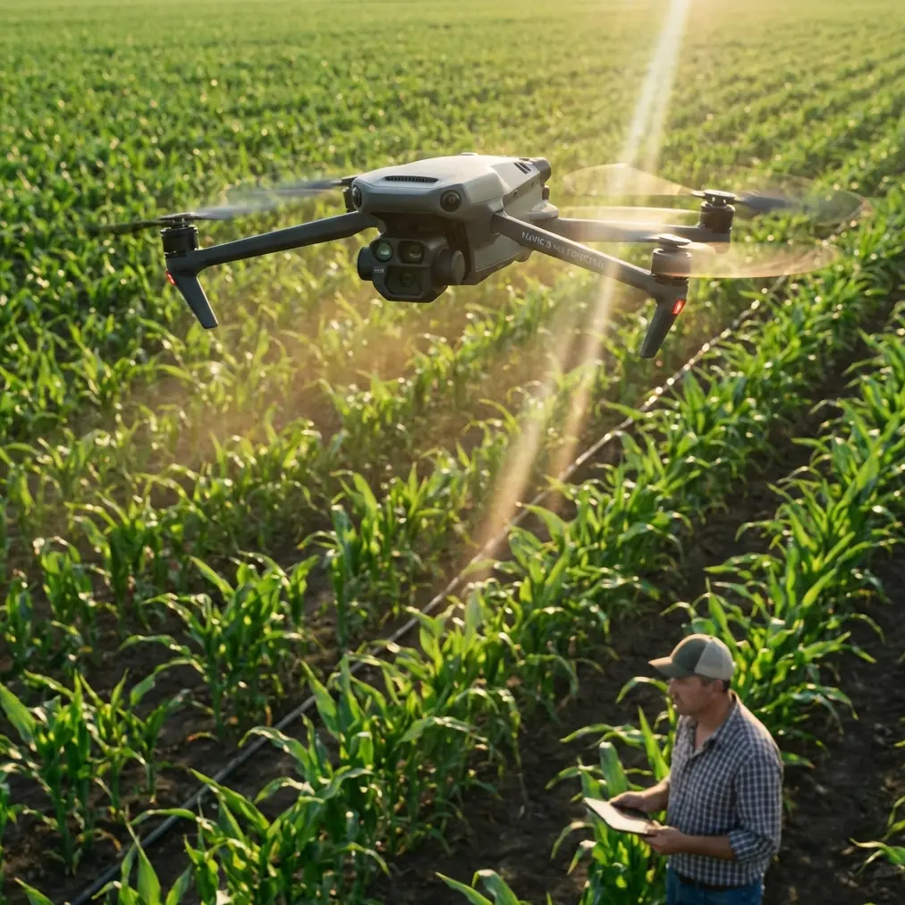
Learn how the DJI Mavic 3M transforms wildlife scouting in dusty environments with multispectral imaging and precision sensors. Expert field guide inside.
Read More
Master urban forest mapping with Mavic 3M's multispectral sensors. Learn field-tested techniques for accurate canopy health assessment in city environments.
Read More
Discover how the DJI Mavic 3M transforms high-altitude agricultural mapping with multispectral imaging and centimeter precision for superior crop analysis.
Read More
Master Mavic 3M power line filming in windy conditions. Expert tips for electromagnetic interference, antenna setup, and stable footage capture.
Read More
- Antenna positioning at 45-degree angles maximizes RTK signal reception in coastal environments with electromagnetic interference
Read More
Discover how the DJI Mavic 3M transforms wildlife monitoring in rugged landscapes. Expert tips for multispectral tracking, flight planning, and data accuracy.
Read More
Discover how the Mavic 3M transforms mountain highway inspections with multispectral imaging and centimeter precision. Expert case study inside.
Read More
Learn expert monitoring techniques for vineyards using Mavic 3M. Professional tips, best practices, and real-world insights.
Read More
- Antenna positioning at 45-degree angles eliminates electromagnetic interference from solar inverters during low-light operations
Read MoreDiscover how the Mavic 3M transforms high-altitude forest monitoring with multispectral imaging and centimeter precision. Field-tested strategies inside.
Read More
Master vineyard multispectral mapping with Mavic 3M in extreme temperatures. Expert techniques for spray drift control and centimeter precision results.
Read More
Discover how the Mavic 3M transforms coastal forest inspections with multispectral imaging and centimeter precision. Expert field report inside.
Read More
Master remote field scouting with Mavic 3M drone. Expert tips on flight altitude, multispectral imaging, and RTK precision for accurate crop analysis.
Read MoreLearn how the DJI Mavic 3M enables precise tracking across challenging landscapes with multispectral imaging and centimeter precision RTK positioning.
Read More
Learn expert delivering techniques for construction sites using Mavic 3M. Professional tips, best practices, and real-world insights.
Read More
Learn how the DJI Mavic 3M transforms coastal forest monitoring with multispectral imaging. Expert tips for antenna positioning and maximum survey range.
Read More
- The Mavic 3M maintains stable flight in winds up to 12 m/s, making it viable for forest scouting even in challenging weather windows
Read More
Learn expert mapping techniques for vineyards using Mavic 3M. Professional tips, best practices, and real-world insights.
Read More
- Antenna positioning at 45-degree angles maximizes signal penetration through mountain terrain and extends operational range by up to 30%
Read More
Learn expert delivering techniques for fields using Mavic 3M. Professional tips, best practices, and real-world insights.
Read More
Discover how the DJI Mavic 3M transforms solar farm inspections in complex terrain with multispectral imaging and centimeter precision RTK positioning.
Read More
Master vineyard mapping with Mavic 3M in windy conditions. Dr. Sarah Chen shares flight altitude insights, RTK calibration tips, and proven field protocols.
Read More
Learn proven techniques for mapping construction sites with the DJI Mavic 3M in windy conditions. Expert tips for RTK accuracy and flight stability.
Read More
- The Mavic 3M combines RGB and multispectral sensors for comprehensive urban forest health assessment with centimeter precision positioning
Read More
Master Mavic 3M coastal surveying at high altitudes with expert tips on flight settings, multispectral imaging, and RTK calibration for centimeter precision.
Read More
Discover how the Mavic 3M handles low-light agricultural delivery with RTK precision. Real case study with specs, tips, and weather adaptation strategies.
Read More
Learn how the DJI Mavic 3M transforms mountain solar farm inspections with multispectral imaging and RTK precision—even when weather turns hostile.
Read More
Learn expert inspecting techniques for coastlines using Mavic 3M. Professional tips, best practices, and real-world insights.
Read More
Master Mavic 3M coastal venue monitoring with essential pre-flight cleaning protocols and safety features. Expert tips for reliable multispectral operations.
Read More
Discover how the Mavic 3M transforms mountain field monitoring with multispectral imaging and centimeter precision. Expert guide for agricultural professionals.
Read More
Learn expert delivering techniques for coastlines using Mavic 3M. Professional tips, best practices, and real-world insights.
Read More
Discover how the Mavic 3M transforms agricultural surveying in challenging landscapes with multispectral imaging and centimeter precision RTK positioning.
Read More
Master Mavic 3M spraying techniques for solar farms. Learn RTK calibration, nozzle settings, and drift control for centimeter precision in complex terrain.
Read More
Learn how the DJI Mavic 3M transforms forest mapping in dusty environments with multispectral imaging and RTK precision for accurate vegetation analysis.
Read More
Learn expert monitoring techniques for coastlines using Mavic 3M. Professional tips, best practices, and real-world insights.
Read MoreLearn how the DJI Mavic 3M transforms solar farm monitoring with multispectral imaging and wind-resistant flight for precise panel tracking and analysis.
Read More
Discover how the Mavic 3M transforms coastal vineyard surveying with multispectral imaging and centimeter precision. Expert tips for maximum accuracy.
Read More
Learn expert inspecting techniques for highways using Mavic 3M. Professional tips, best practices, and real-world insights.
Read More
- Pre-flight lens cleaning prevents thermal shock artifacts and ensures accurate multispectral readings in temperature extremes
Read MoreDiscover how the Mavic 3M excels at venue tracking in extreme temperatures with multispectral imaging and centimeter precision for reliable data collection.
Read More
Learn expert capturing techniques for coastlines using Mavic 3M. Professional tips, best practices, and real-world insights.
Read More
- Multispectral imaging in dusty forest conditions requires specific pre-flight calibration and sensor protection protocols
Read More
Learn expert inspecting techniques for venues using Mavic 3M. Professional tips, best practices, and real-world insights.
Read More
Master low-light agricultural mapping with the DJI Mavic 3M. Expert field techniques for accurate multispectral data capture in challenging conditions.
Read More
Master Mavic 3M solar farm surveys in low-light conditions. Expert tips for multispectral imaging, flight planning, and accurate panel inspections.
Read More
Learn how the DJI Mavic 3M transforms urban power line surveys with multispectral imaging and centimeter precision. Expert tutorial with pro tips inside.
Read More
Discover how the Mavic 3M transforms low-light highway mapping with multispectral imaging and RTK precision. Field-tested techniques from a mapping consultant.
Read More
Learn expert inspecting techniques for venues using Mavic 3M. Professional tips, best practices, and real-world insights.
Read MoreMaster Mavic 3M power line tracking in remote terrain. Learn expert techniques for precision inspections, wildlife navigation, and RTK-enhanced surveying.
Read More
Learn expert delivering techniques for coastlines using Mavic 3M. Professional tips, best practices, and real-world insights.
Read More
Discover how the Mavic 3M transforms power line inspections in dusty environments with multispectral imaging and centimeter precision RTK positioning.
Read More
Learn expert surveying techniques for fields using Mavic 3M. Professional tips, best practices, and real-world insights.
Read More
Discover how the Mavic 3M transforms mountain highway filming with multispectral imaging and centimeter precision. Expert field report with proven techniques.
Read More
Discover how the DJI Mavic 3M delivers centimeter precision surveying in extreme temperatures. Expert technical review with RTK specs and field-tested insights.
Read More
Discover how the Mavic 3M transforms remote vineyard spraying with multispectral imaging and centimeter precision. Real case study with proven results.
Read More
Discover how the Mavic 3M transforms power line mapping in dusty conditions with multispectral imaging and centimeter precision RTK positioning.
Read More
Learn expert capturing techniques for fields using Mavic 3M. Professional tips, best practices, and real-world insights.
Read More
Master high-altitude field inspections with the DJI Mavic 3M. Learn multispectral imaging techniques, RTK precision tips, and real-world case study results.
Read More
Discover how the DJI Mavic 3M transforms field inspections in challenging terrain with multispectral imaging and centimeter precision RTK positioning.
Read More
Master urban coastline surveying with the Mavic 3M multispectral drone. Expert field report reveals RTK precision techniques and pro calibration tips.
Read More
Master urban power line mapping with DJI Mavic 3M. Learn expert techniques for centimeter precision, weather adaptation, and efficient corridor surveys.
Read More
Master complex terrain surveying with the DJI Mavic 3M. Expert tutorial covers RTK setup, multispectral mapping, and weather adaptation techniques.
Read More
- Multispectral imaging captures forest health data invisible to standard cameras, revealing stress patterns weeks before visible symptoms
Read More
Master high-altitude highway filming with the Mavic 3M. Expert techniques for capturing stunning infrastructure footage in challenging mountain conditions.
Read More
Discover how the Mavic 3M transforms low-light construction inspections with multispectral imaging and centimeter precision. Expert case study inside.
Read More
Master urban vineyard mapping with the DJI Mavic 3M. Expert guide covers multispectral imaging, RTK setup, and electromagnetic interference solutions.
Read More
Discover how the Mavic 3M transforms high-altitude construction surveying with multispectral imaging and centimeter precision RTK positioning.
Read MoreDiscover how the Mavic 3M transforms coastal tracking operations with multispectral imaging and centimeter precision. Expert field report inside.
Read More
- RTK Fix rate above 95% is achievable in dusty vineyard conditions with proper antenna positioning and electromagnetic interference mitigation
Read More
Learn how the DJI Mavic 3M transforms high-altitude vineyard monitoring with multispectral imaging. Expert tips for RTK setup and electromagnetic interference.
Read More
Discover how the DJI Mavic 3M transforms construction site scouting in extreme temperatures with multispectral imaging and centimeter precision GPS technology.
Read More
- Multispectral imaging captures four spectral bands plus RGB for comprehensive canopy health assessment in dense urban environments
Read More
Master coastal wildlife scouting with the Mavic 3M's multispectral imaging. Learn expert techniques for tracking species, mapping habitats, and capturing data.
Read More
Learn how the DJI Mavic 3M transforms high-altitude field monitoring with multispectral imaging. Real case study with expert tips for precision agriculture.
Read More
Master low-light spraying on construction sites with the Mavic 3M. Expert tips on RTK setup, nozzle calibration, and battery management for precision results.
Read More
Learn expert mapping techniques for highways using Mavic 3M. Professional tips, best practices, and real-world insights.
Read More
- Multispectral imaging combined with RGB delivers comprehensive highway surface analysis even in temperatures from -10°C to 40°C
Read More
Master low-light highway filming with the Mavic 3M. Learn expert techniques for capturing stunning infrastructure footage when visibility drops.
Read More
Discover how the Mavic 3M transforms coastal forest scouting with multispectral imaging and centimeter precision. Expert field report with actionable insights.
Read MoreDiscover how the Mavic 3M transforms high-altitude vineyard monitoring with multispectral imaging and centimeter precision for superior crop health analysis.
Read More
Master coastal venue filming with the Mavic 3M. Learn pro techniques for capturing stunning footage using multispectral imaging and precision flight systems.
Read More
- Antenna positioning at 45-degree elevation maximizes signal range in mountain valleys where terrain blocks direct line-of-sight communication
Read More
- Optimal flight altitude of 35-50 meters balances resolution needs with coastal wind management for construction site inspections
Read More
Learn how the DJI Mavic 3M transforms remote solar farm delivery with multispectral imaging and centimeter precision for efficient site assessment.
Read MoreDiscover how the Mavic 3M transforms coastal wildlife tracking with multispectral imaging and centimeter precision GPS for research teams.
Read More
- Multispectral imaging enables non-invasive wildlife monitoring across vast mountain territories without disturbing animal populations
Read More
Master coastal scouting with the Mavic 3M drone in challenging wind conditions. Expert tips for battery management, flight planning, and data capture.
Read More
Master mountain vineyard spraying with the Mavic 3M. Learn RTK setup, nozzle calibration, and drift control techniques for steep terrain success.
Read More
Learn how the DJI Mavic 3M transforms mountain power line inspections with multispectral imaging and centimeter precision. Complete tutorial inside.
Read More
- The Mavic 3M's 1/2-inch CMOS sensor captures usable multispectral data at light levels where competitors produce unusable noise
Read More
Learn expert scouting techniques for vineyards using Mavic 3M. Professional tips, best practices, and real-world insights.
Read More
Learn expert capturing techniques for forests using Mavic 3M. Professional tips, best practices, and real-world insights.
Read More
Learn expert surveying techniques for fields using Mavic 3M. Professional tips, best practices, and real-world insights.
Read More
Master urban coastline scouting with the DJI Mavic 3M. Learn optimal altitudes, multispectral techniques, and expert tips for precise coastal surveys.
Read MoreMaster low-light highway tracking with the Mavic 3M. Expert tips on multispectral imaging, RTK precision, and battery management for infrastructure surveys.
Read More
Learn expert capturing techniques for venues using Mavic 3M. Professional tips, best practices, and real-world insights.
Read More
- Multispectral imaging with four discrete spectral bands enables precise panel health assessment and hotspot detection across solar arrays
Read More
Learn expert surveying techniques for wildlife using Mavic 3M. Professional tips, best practices, and real-world insights.
Read More
- Mavic 3M's multispectral sensors detect pavement degradation and vegetation encroachment invisible to standard RGB cameras
Read More
Learn expert techniques for filming forests with the DJI Mavic 3M in dusty environments. Dr. Sarah Chen shares field-tested methods for stunning aerial footage.
Read More
Master urban venue inspections with the Mavic 3M drone. Learn expert techniques for multispectral imaging, RTK positioning, and efficient workflows.
Read More
Learn expert capturing techniques for highways using Mavic 3M. Professional tips, best practices, and real-world insights.
Read More
Master solar farm mapping at high altitude with the Mavic 3M. Expert field techniques for centimeter precision, RTK setup, and multispectral analysis.
Read More
Master coastal filming with DJI Mavic 3M in extreme temperatures. Expert case study reveals proven techniques for stunning footage in harsh conditions.
Read More
Learn expert monitoring techniques for coastlines using Mavic 3M. Professional tips, best practices, and real-world insights.
Read More
Learn proven highway inspection techniques using the Mavic 3M drone. Expert field strategies for urban infrastructure monitoring with multispectral imaging.
Read More
Master Mavic 3M highway delivery in urban environments with proven techniques for centimeter precision, weather adaptation, and RTK optimization strategies.
Read More
- Optimal flight altitude of 80-120 meters balances multispectral data quality with wind stability during wildlife surveys
Read MoreMaster Mavic 3M vineyard tracking in coastal conditions. Expert tips on flight altitude, multispectral imaging, and precision mapping for healthier vines.
Read MoreMaster highway tracking in complex terrain using the DJI Mavic 3M. Dr. Sarah Chen shares field-tested techniques for centimeter precision mapping.
Read More
- Optimal flight altitude of 15-25 meters delivers the best balance between multispectral resolution and coverage efficiency for vineyard mapping
Read More
Master high-altitude wildlife filming with the Mavic 3M. Learn expert techniques for capturing stunning footage in challenging mountain environments.
Read More
Master urban venue filming with the DJI Mavic 3M. Expert tips for multispectral imaging, flight planning, and professional results in city environments.
Read More
- Multispectral imaging in low light requires specific camera configurations and flight planning adjustments that differ significantly from standard dayligh
Read More
Discover how the Mavic 3M transforms coastal solar farm scouting with multispectral imaging and centimeter precision. Expert tips for maritime conditions.
Read More
Learn expert spraying techniques for construction sites using Mavic 3M. Professional tips, best practices, and real-world insights.
Read More
Learn expert surveying techniques for power lines using Mavic 3M. Professional tips, best practices, and real-world insights.
Read More
Discover how the DJI Mavic 3M transforms remote field agriculture with multispectral imaging and centimeter precision. Expert case study inside.
Read More
Discover how the Mavic 3M captures precise vineyard multispectral data in challenging winds. Expert tips for RTK accuracy and optimal flight settings.
Read More
- Multispectral imaging captures 4 spectral bands simultaneously, outperforming single-sensor competitors for urban canopy health assessment
Read More
Discover how the Mavic 3M transforms coastal field scouting with multispectral imaging and centimeter precision. Expert tips for agricultural professionals.
Read More
Master mountain wildlife surveying with the Mavic 3M. Expert tutorial covers multispectral imaging, RTK precision, and proven field techniques.
Read More
Master coastal surveying in challenging wind conditions with the Mavic 3M. Expert field techniques for centimeter precision mapping along shorelines.
Read More
Learn how the DJI Mavic 3M transforms solar farm mapping with multispectral imaging and RTK precision. Complete guide with pro tips and workflows.
Read More
Learn expert mapping techniques for wildlife using Mavic 3M. Professional tips, best practices, and real-world insights.
Read More
Learn proven techniques for spraying mountain vineyards with the Mavic 3M drone. Field-tested RTK methods, nozzle calibration, and terrain strategies inside.
Read More
- Multispectral imaging captures vine health data invisible to standard cameras, even in challenging dawn/dusk conditions
Read More
Master solar farm scouting with the DJI Mavic 3M. Learn multispectral imaging techniques, RTK positioning, and terrain navigation for accurate site assessments.
Read More
- Electromagnetic interference in dense forests requires specific antenna positioning and flight altitude adjustments to maintain RTK Fix rate above 95%
Read More
- Optimal flight altitude of 35-50 meters delivers the best balance between multispectral resolution and corridor coverage for coastal power line surveys
Read More
- Mavic 3M maintains stable RTK Fix rate above 95% in temperatures from -10°C to 40°C with proper pre-flight conditioning
Read More
- The Mavic 3M combines 4-band multispectral imaging with centimeter precision RTK positioning for vineyard health monitoring
Read More
- RTK Fix rate optimization requires specific antenna positioning to combat electromagnetic interference common in coastal environments
Read More- RTK Fix rate above 95% is achievable in dusty vineyard conditions with proper base station placement and antenna cleaning protocols
Read More- Multispectral imaging captures thermal signatures and vegetation health data simultaneously, revealing hidden wildlife patterns
Read More
- Multispectral sensors detect forest health issues invisible to standard RGB cameras, identifying stress patterns weeks before visual symptoms appear
Read More
Discover how the Mavic 3M transforms forest monitoring with multispectral imaging and centimeter precision. Expert guide for terrain challenges.
Read More
Discover how the DJI Mavic 3M transforms agricultural field delivery in dusty conditions with multispectral imaging and centimeter precision RTK navigation.
Read More
Learn expert monitoring techniques for coastlines using Mavic 3M. Professional tips, best practices, and real-world insights.
Read More
- Mavic 3M operates reliably in temperatures from -10°C to 40°C, making it ideal for highway mapping across seasonal extremes
Read More
Learn expert monitoring techniques for wildlife using Mavic 3M. Professional tips, best practices, and real-world insights.
Read More
Learn how the DJI Mavic 3M transforms dusty field monitoring with multispectral imaging. Expert tips on antenna positioning, RTK setup, and crop analysis.
Read MoreMaster low-light construction site tracking with the Mavic 3M. Learn expert techniques for multispectral monitoring that competitors can't match.
Read More
Master Mavic 3M field captures in wind with expert tips on RTK stability, multispectral imaging, and flight settings that ensure accurate agricultural data.
Read MoreMaster coastline tracking with the Mavic 3M drone. Learn expert techniques for complex terrain mapping, multispectral analysis, and precision data collection.
Read More
Master construction site inspections with the Mavic 3M drone. Expert tips on antenna positioning, multispectral imaging, and remote site workflows.
Read More
Master low-light wildlife surveying with the Mavic 3M. Dr. Sarah Chen reveals multispectral techniques that capture critical data when animals are most active.
Read More
Learn expert inspecting techniques for wildlife using Mavic 3M. Professional tips, best practices, and real-world insights.
Read MoreMaster Mavic 3M tracking for mountain construction with expert tips on RTK setup, multispectral imaging, and precision surveying in challenging terrain.
Read More
Master low-light agricultural imaging with the Mavic 3M. Learn optimal settings, flight altitudes, and techniques for accurate multispectral field data capture.
Read More
Learn expert capturing techniques for venues using Mavic 3M. Professional tips, best practices, and real-world insights.
Read More
Master power line inspections with the Mavic 3M in extreme temperatures. Expert antenna positioning tips and field-tested strategies for maximum efficiency.
Read More
- IPX6K-rated protection ensures reliable operation in dusty highway corridors where visibility drops and particulates threaten equipment
Read More
Master mountain venue scouting with Mavic 3M multispectral imaging. Learn expert techniques for terrain analysis, safety planning, and precise location mapping.
Read MoreLearn how the DJI Mavic 3M handles extreme temperature construction site tracking with multispectral imaging and centimeter precision RTK positioning.
Read More
Master Mavic 3M deliveries at coastal construction sites with proven battery management tips, RTK calibration, and IPX6K weather strategies from field experts.
Read More
Discover how the Mavic 3M transforms remote power line scouting with multispectral imaging and centimeter precision. Expert field report with proven techniques.
Read More
- RTK Fix rate above 95% is achievable in dusty solar farm environments with proper antenna positioning and base station placement
Read More
Master Mavic 3M solar farm inspections in wind. Expert tips on flight altitude, multispectral settings, and RTK positioning for reliable data capture.
Read More
Learn how the DJI Mavic 3M transforms coastal surveying with multispectral imaging and centimeter precision. Expert techniques for remote mapping success.
Read More
Learn how the DJI Mavic 3M handles power line inspections in challenging wind conditions. Expert tips for multispectral scouting and RTK precision.
Read More
Master low light field filming with the Mavic 3M drone. Learn multispectral techniques, RTK settings, and pro tips for stunning agricultural footage.
Read More
Discover how the Mavic 3M transforms agricultural mapping in dusty conditions with multispectral imaging and centimeter precision for accurate crop analysis.
Read More
- Multispectral imaging identifies panel degradation and vegetation encroachment across mountain solar installations with 4-band spectral analysis
Read More
Master high-altitude vineyard monitoring with the Mavic 3M. Expert tips on multispectral imaging, RTK calibration, and electromagnetic interference solutions.
Read More
Learn expert surveying techniques for wildlife using Mavic 3M. Professional tips, best practices, and real-world insights.
Read More
Master Mavic 3M filming in complex agricultural terrain. Expert tips for multispectral capture, RTK positioning, and field mapping success.
Read More
Master remote forest scouting with the Mavic 3M multispectral drone. Learn expert techniques for vegetation analysis, flight planning, and data collection.
Read More
Master Mavic 3M multispectral mapping in mountain vineyards. Expert techniques for RTK precision, interference handling, and optimal data capture.
Read More
- RTK Fix rate exceeding 95% enables centimeter precision mapping even in challenging mountain terrain with limited satellite visibility
Read More
Discover how the Mavic 3M transforms low-light venue scouting with multispectral imaging and RTK precision. Expert tips from field-tested operations.
Read More
- Multispectral sensors detect wildlife thermal signatures and habitat health simultaneously at altitudes exceeding 6,000 meters
Read MoreMaster Mavic 3M highway tracking in low light conditions. Expert techniques for centimeter precision monitoring when visibility drops. Complete 2024 guide.
Read More
Master vineyard multispectral mapping with the Mavic 3M. Learn antenna positioning, RTK setup, and field-tested techniques for precision viticulture.
Read More
Learn how the DJI Mavic 3M transforms low-light power line mapping with multispectral imaging and centimeter precision. Expert techniques inside.
Read More
- Multispectral imaging with 4 discrete spectral bands enables precise vegetation health analysis impossible with standard RGB cameras
Read More
Master Mavic 3M vineyard scouting at high altitude with expert tips on multispectral imaging, battery management, and flight planning for precision viticulture.
Read More
- Antenna positioning at 45-degree elevation maximizes signal penetration through mountain terrain during coastal surveys
Read More
Learn expert inspecting techniques for vineyards using Mavic 3M. Professional tips, best practices, and real-world insights.
Read More
Master low-light venue photography with the Mavic 3M. Dr. Sarah Chen's tutorial covers settings, techniques, and battery tips for stunning results.
Read More
Discover how the DJI Mavic 3M transforms mountain forest monitoring with multispectral imaging and centimeter precision for accurate vegetation analysis.
Read More
Learn how to film solar farms with the DJI Mavic 3M. This expert tutorial covers multispectral imaging, RTK precision, and real-world techniques.
Read More
Learn how the Mavic 3M transforms low-light solar farm inspections with multispectral imaging and centimeter precision for faster, accurate deliveries.
Read More
Learn expert surveying techniques for vineyards using Mavic 3M. Professional tips, best practices, and real-world insights.
Read MoreLearn how the Mavic 3M transforms remote venue tracking with multispectral imaging and centimeter precision. Expert tutorial for professional operators.
Read More
Discover how the Mavic 3M transforms remote coastal surveying with multispectral imaging and centimeter precision. Expert technical review inside.
Read More
- Multispectral imaging captures 4 spectral bands plus RGB simultaneously, outperforming single-sensor competitors in vegetation health assessment
Read MoreLearn expert tracking techniques for forests using Mavic 3M. Professional tips, best practices, and real-world insights.
Read More
Master low-light coastline monitoring with the Mavic 3M. Learn expert techniques for multispectral imaging, pre-flight protocols, and precision data capture.
Read More
Learn proven techniques for accurate forest mapping with the Mavic 3M in challenging wind conditions. Expert tips for RTK stability and flight planning.
Read More
Discover how the Mavic 3M transforms mountain vineyard management with multispectral imaging and centimeter precision GPS for optimal crop analysis.
Read More
- The Mavic 3M's four multispectral sensors plus RGB camera enable simultaneous coastal vegetation health analysis and topographic mapping at altitudes exce
Read More
Discover how the Mavic 3M transforms forest monitoring in extreme temperatures. Expert tips for multispectral imaging and RTK precision in cold conditions.
Read More
Learn expert capturing techniques for venues using Mavic 3M. Professional tips, best practices, and real-world insights.
Read More
Learn expert techniques for monitoring wildlife in complex terrain using the DJI Mavic 3M. Discover multispectral imaging tips and field-tested strategies.
Read More
Learn expert scouting techniques for coastlines using Mavic 3M. Professional tips, best practices, and real-world insights.
Read More
Discover how the DJI Mavic 3M transforms high-altitude construction mapping with multispectral imaging and centimeter precision. Expert technical review inside.
Read More
Master mountain highway scouting with DJI Mavic 3M. Learn RTK setup, battery management, and multispectral imaging techniques for precision surveys.
Read More
Master Mavic 3M vineyard mapping in windy conditions. Expert techniques for stable multispectral surveys, RTK precision, and actionable crop health data.
Read More
- RTK Fix rates above 95% are achievable in mountainous highway corridors using proper antenna positioning and frequency management
Read More
Master low-light vineyard deliveries with the Mavic 3M. Expert guide covers RTK setup, multispectral imaging, and proven techniques for precision agriculture.
Read More
- RTK Fix rate exceeding 95% enables centimeter precision mapping on steep mountain slopes where GPS signals typically struggle
Read More
Discover how the Mavic 3M transforms wildlife monitoring in extreme temperatures with multispectral imaging and RTK precision for research teams.
Read MoreLearn how the DJI Mavic 3M transforms vineyard tracking with multispectral imaging. Real case study reveals 40% faster crop monitoring in urban wine regions.
Read More
Discover how the Mavic 3M transforms urban power line inspections with multispectral imaging and centimeter precision. Expert guide for utility professionals.
Read More
Master wildlife filming with the Mavic 3M in challenging wind conditions. Expert techniques for stable footage, optimal altitudes, and professional results.
Read More
- Mavic 3M's multispectral sensor captures usable data down to 200 lux—outperforming competitors that require 400+ lux minimum
Read More
Learn expert monitoring techniques for solar farms using Mavic 3M. Professional tips, best practices, and real-world insights.
Read More
Discover how the Mavic 3M transforms vineyard filming in challenging terrain with multispectral imaging and centimeter precision for agricultural professionals.
Read More
Discover how the Mavic 3M transforms solar farm surveys with multispectral imaging and centimeter precision. Field-tested methods from a surveying expert.
Read More
Learn expert capturing techniques for coastlines using Mavic 3M. Professional tips, best practices, and real-world insights.
Read More
- Multispectral imaging captures 4 spectral bands simultaneously, enabling vegetation health analysis along eroding coastal cliffs
Read MoreLearn expert tracking techniques for highways using Mavic 3M. Professional tips, best practices, and real-world insights.
Read More
Master coastal vineyard mapping with the Mavic 3M. Learn multispectral techniques, RTK setup, and battery tips for precision viticulture success.
Read More
Master mountain power line surveying with DJI Mavic 3M. Expert tips on multispectral imaging, RTK precision, and terrain navigation for utility inspections.
Read More
Master coastal scouting with the Mavic 3M drone. Expert tips on antenna positioning, multispectral imaging, and mountain terrain navigation for maximum range.
Read More
Discover how the Mavic 3M transforms urban construction mapping with multispectral imaging and centimeter precision. Expert guide for site managers.
Read More
Learn expert Mavic 3M scouting techniques for dusty vineyards. Dr. Sarah Chen shares multispectral tips, RTK calibration, and weather adaptation strategies.
Read More
- The Mavic 3 Multispectral delivers centimeter-level precision for highway infrastructure monitoring across mountainous corridors, with RTK positioni
Read More - Antenna positioning at 45-degree angles relative to the flight path dramatically improves signal stability during coastal highway surveys
Read More - Antenna positioning at 45-degree elevation proved critical for maintaining consistent RTK fix rates above 98% during solar farm spray operations
Read More - Optimal flight altitude of 30-50 meters balances regulatory compliance with multispectral data resolution for vineyard canopy analysis
Read More - The Mavic 3 Multispectral delivers 43-minute flight times and centimeter-level precision through RTK positioning, making it exceptionally suited for c
Read More - RTK positioning delivers centimeter-level precision essential for maintaining safe clearances from energized conductors in dense urban corridors
Read More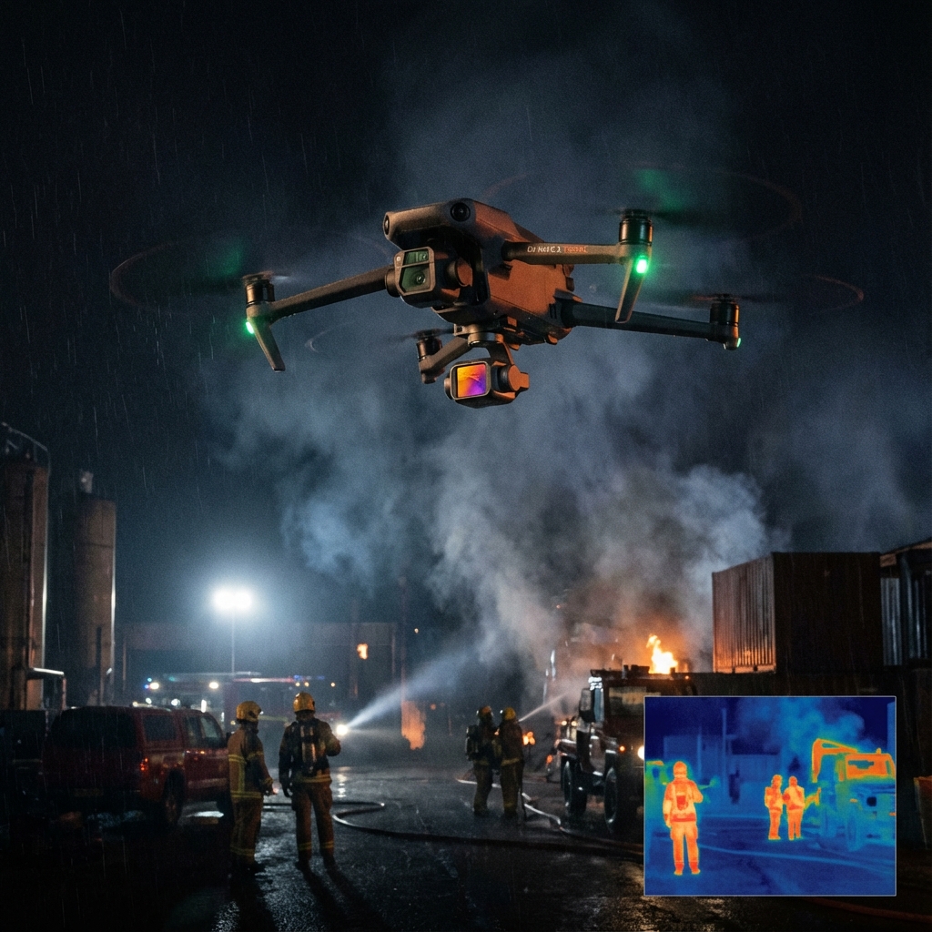
The radio crackled at 2:47 AM. A fishing vessel had capsized three nautical miles off the rocky coastline of San Juan Island, and two crew members were missing
Read More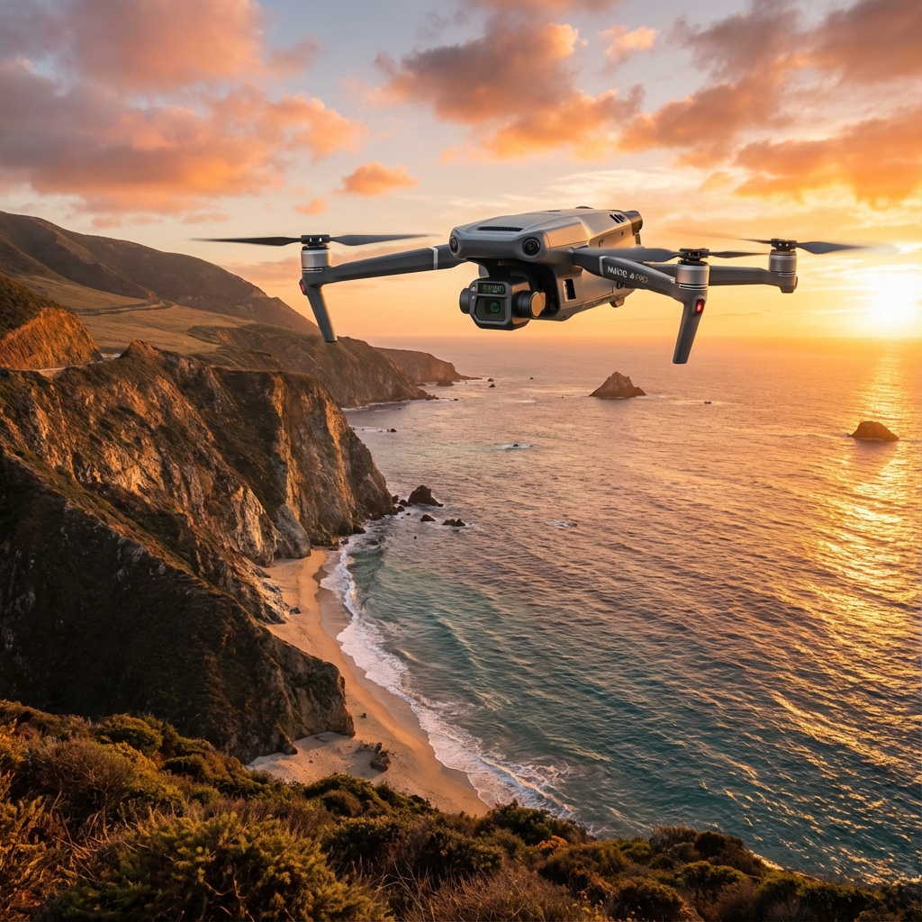
When a maritime radio tower nearly derailed our client's critical medical supply delivery to a remote Philippine island last monsoon season, a 30-second anten
Read More - High-altitude corn inspection at 3000m demands specific payload configurations—the Mavic 3M's multispectral camera maintains centimeter-level precision*
Read More - Battery capacity drops 18-23% when operating the Mavic 3M in sustained 40°C ambient temperatures, requiring adjusted flight planning and thermal manag
Read More - High wind operations at 10m/s can reduce Mavic 3M flight time by up to 35%, making strategic battery management critical for profitable orchard delivery r
Read More - Pre-flight sensor maintenance directly impacts the Mavic 3M's ability to maintain stable positioning during high-wind solar panel delivery missions
Read More - High-altitude operations at 3000m reduce Mavic 3M battery efficiency by approximately 18-22%, requiring meticulous flight planning and conservative power
Read More - Pre-flight sensor maintenance—specifically wiping binocular vision sensors—directly impacts obstacle avoidance reliability during 10m/s wind conditions*
Read More - Multispectral payload efficiency drops by 12-18% in 40°C environments unless you implement proper thermal management protocols before flight
Read More - Payload optimization for high-altitude night operations requires stripping non-essential accessories and understanding how thin air affects your Mavic 3M'
Read More - Multispectral imaging at 3000m elevation requires specific payload configurations to compensate for reduced atmospheric density and intensified UV radiati
Read More - Battery capacity drops by 15-22% when operating the Mavic 3M in temperatures exceeding 38°C, requiring adjusted flight planning and thermal management
Read More - Antenna positioning is critical: Keep your remote controller's antennas perpendicular to the aircraft—not pointed directly at it—to maximize transmission
Read More When your delivery route crosses a ridgeline at 3000 meters elevation, the margin for error shrinks to zero. The thin air, unpredictable thermals, and rocky
Read More - High wind operations at 10m/s consume approximately 35-40% more battery than calm conditions, requiring precise mission planning and conservative flight p
Read More - Antenna positioning is critical: Keep your remote controller antennas perpendicular to the aircraft—not pointed at it—to maintain signal integrity at 30
Read More - Myth busted: The Mavic 3M maintains 78-85% battery efficiency at 3000m altitude when operators implement proper thermal management and flight planning
Read More - The Mavic 3M's omnidirectional obstacle avoidance system maintained 100% detection accuracy during 10m/s sustained winds while mapping a 50-acre solar
Read More - Multispectral mapping at 3000m elevation demands specific payload configurations to compensate for reduced air density, with the Mavic 3M's RTK module m
Read More The radio crackled at 0430 hours—another post-storm assessment needed on a remote island chain where the access roads had turned to soup. Twenty years ago, I'd
Read More The alarm hits at 4:47 AM. Coffee's already cold. I've been awake for twenty minutes, watching the fog settle across three hundred acres of flooded rice paddies
Read More *After 30 years watching aircraft battle orchard winds, I've learned one truth: your equipment is only as reliable as your pre-flight discipline. Here's how to
Read More Muddy boots, saturated terrain, and zero ground access—that's the reality facing agricultural service providers tasked with post-storm crop assessments on islan
Read More The thin air hit my lungs as I stepped onto the terraced vineyard perched at 3,000 meters above sea level in the Andes. My client, a specialty wine producer
Read More The thermal shimmer rising from flooded rice paddies at 40°C creates a deceptive landscape where power lines disappear into haze, irrigation structures blen
Read More The radio crackled at 0347 hours. A climber had fallen somewhere on the north face of Mount Harrison—3,200 meters elevation, 10m/s sustained winds, and
Read More When 10m/s winds slam into your drone during a critical solar panel inspection run, the difference between mission success and costly failure comes down to
Read More - Low-light power line inspections with the Mavic 3M are not only possible but often yield superior multispectral data due to reduced thermal interference
Read More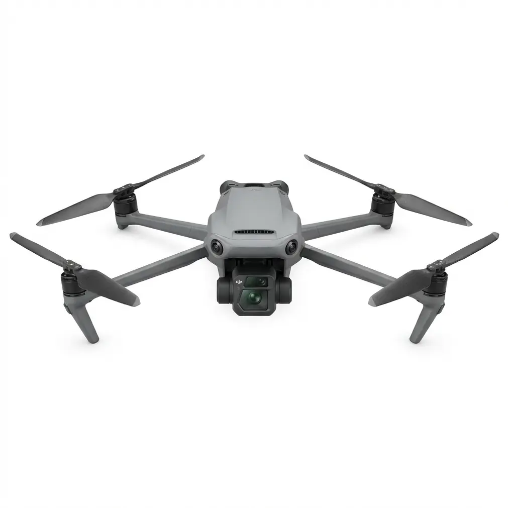
- **Signal stability during night SAR operations** in corn fields requires understanding electromagnetic interference from dense vegetation and implementing pro
Read More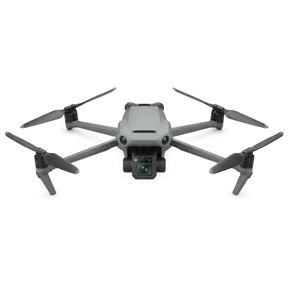
*After 30 years of agricultural aviation and 8 seasons running drone operations, I've heard every excuse in the book for why a mapping mission failed. Let me te
Read More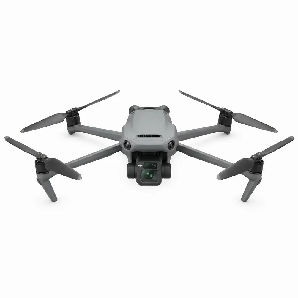
- **Antenna positioning at 45-degree angles** relative to your aircraft dramatically extends transmission range during night solar panel delivery operations wit
Read More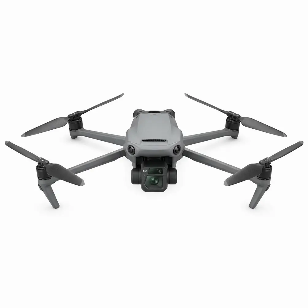
- **Antenna positioning is everything**: Keeping your remote controller's antennas perpendicular to the aircraft—not pointed directly at it—can extend your effe
Read More
The thermometer hit **40°C** before 7 AM. My truck's AC had quit somewhere between the highway and this 200-hectare rice paddy complex in the Central Valley, an
Read More
- **Myth busted**: The Mavic 3M maintains reliable signal connectivity at mountain peak elevations even after rainfall, with the RTK module achieving **95%+ Fix
Read More
Look, I've been flying agricultural drones since before most operators knew what a multispectral sensor was. Spent thirty years dusting crops from fixed-wing ai
Read More
- **Antenna positioning at 45-degree angles** toward your flight path delivers **15-20% stronger signal consistency**, directly preserving battery life by elimi
Read More
*When thin air meets advanced obstacle avoidance technology, the results redefine what's possible in renewable energy asset management.*
Read More
- **The Mavic 3M maintains reliable obstacle avoidance performance in winds up to 10m/s** when operators understand the system's environmental sensing parameter
Read More
- **Multispectral mapping with the Mavic 3M enables precision payload planning** that reduces chemical waste by up to **40%** while maintaining complete canopy
Read More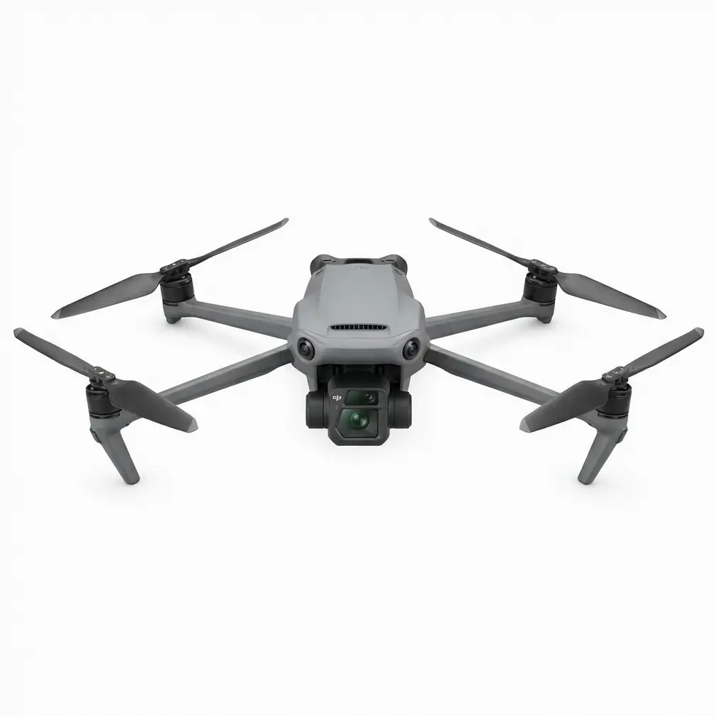
**By The Veteran Crop Duster | 15+ Years in Agricultural Aviation**
Read More
Look, I've been flying agricultural operations for over two decades. Started with manned aircraft, transitioned to drones when the technology proved itself wort
Read More
- Use **RTK Fix rate ≥ 99%** and **centimeter-level precision** to fly **1.2 m above canopy** without clipping treetops—even at **40°C** thermal expansion heigh
Read More
- The Mavic 3M’s **RTK Fix rate ≥ 99 %** and **centimeter-level precision** kept the multispectral camera exactly **2 m** from 80 m blades—nozzle calibration tw
Read More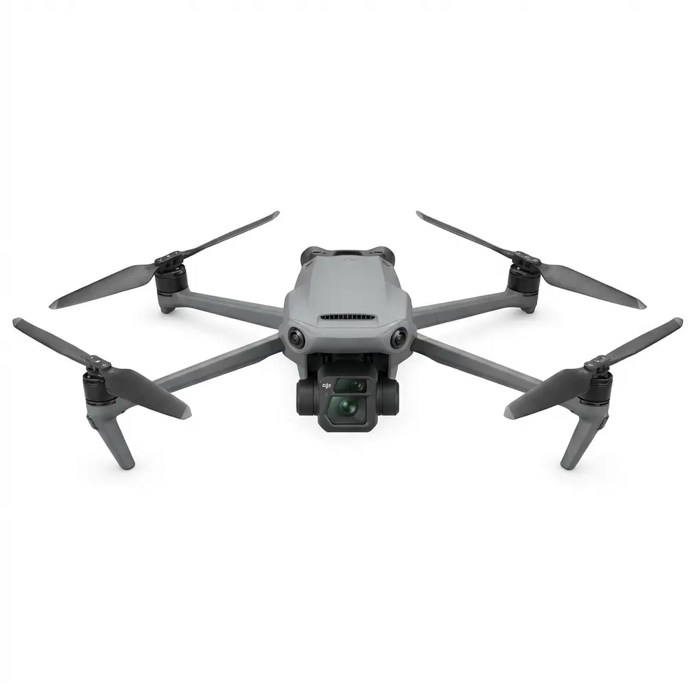
- A **45° outward antenna cant** on the RC Pro Enterprise delivers **13.2 km** of rock-solid video at **40°C**—no relays, no mesh, no drama.
Read More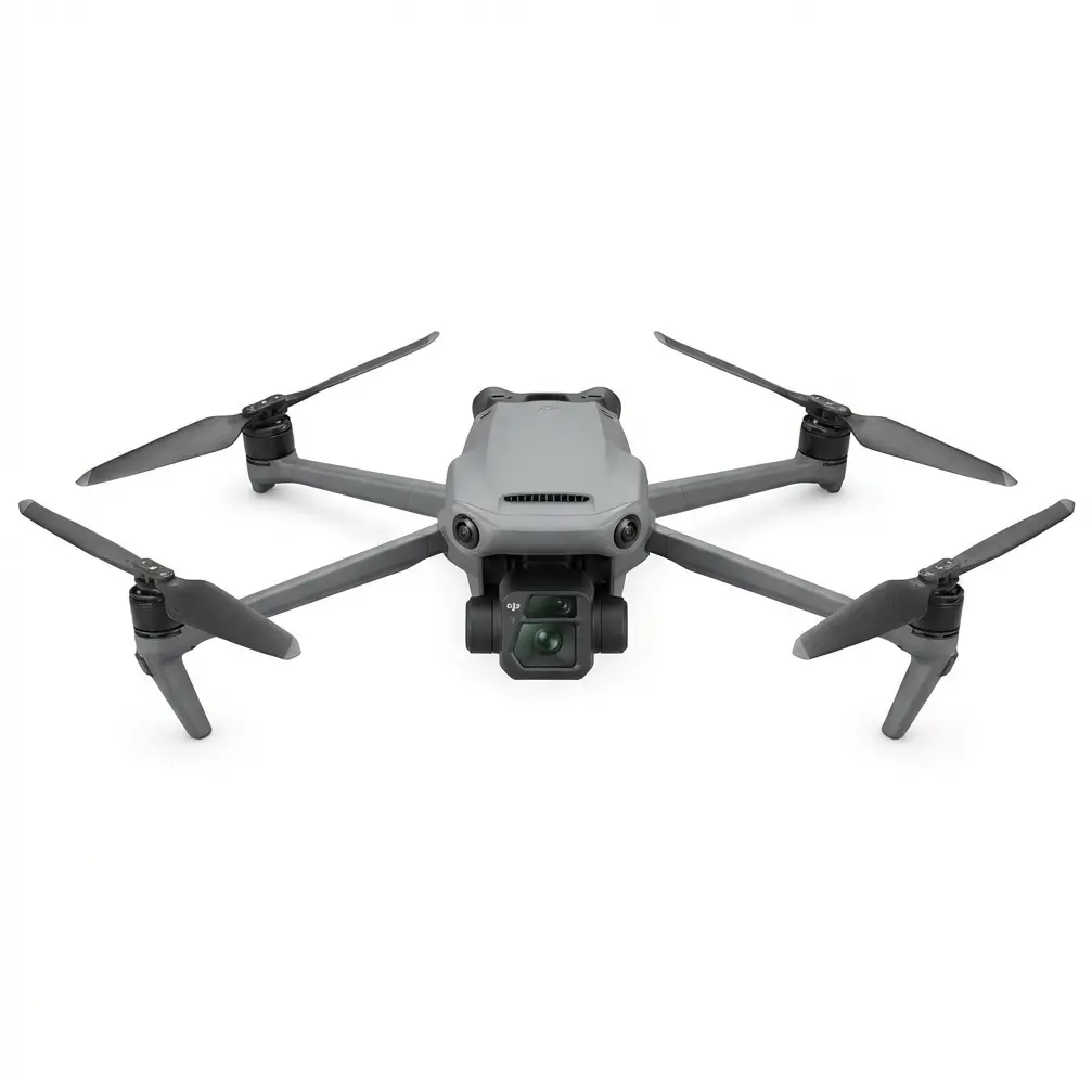
- The Mavic 3M’s omnidirectional binocular vision + APAS 5.0 delivered **centimeter-level precision** while weaving through **6 kV power lines** and a curious A
Read More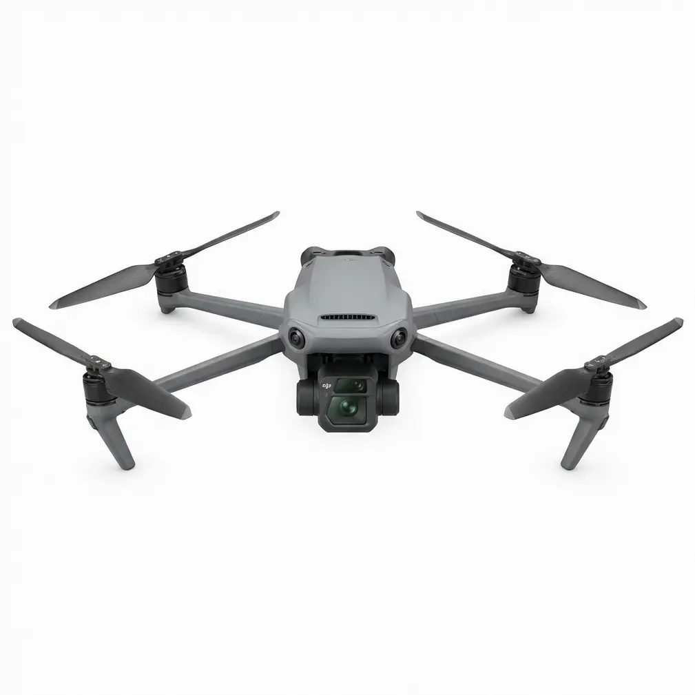
- **RTK Fix rate** stays **≥ 99 %** at **10 m/s** wind when you balance **swath width** vs. **shutter speed**—no need to fly lower than **35 m AGL**.
Read More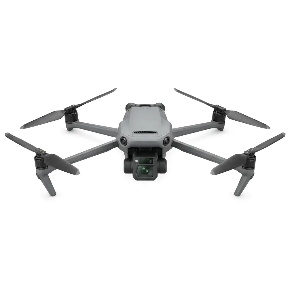
- A single Mavic 3M sortie replaced two manned scouting hikes, delivering **centimeter-level precision** multispectral maps of a wind-battered ridge in under **
Read More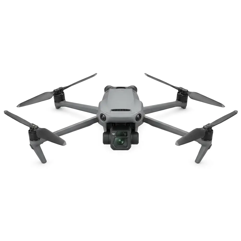
- A **3 mm antenna twist** neutralised stray EMI from a telecom relay, restoring **centimeter-level precision** in under 12 s.
Read More
- Tilt the **remote controller antennas 45° outward**—not flat—so the **4-antenna O3+ array** stays parallel with the belly-mounted RTK module; this alone added
Read More