Mavic 3M: Essential Wildlife Scouting in Remote Areas
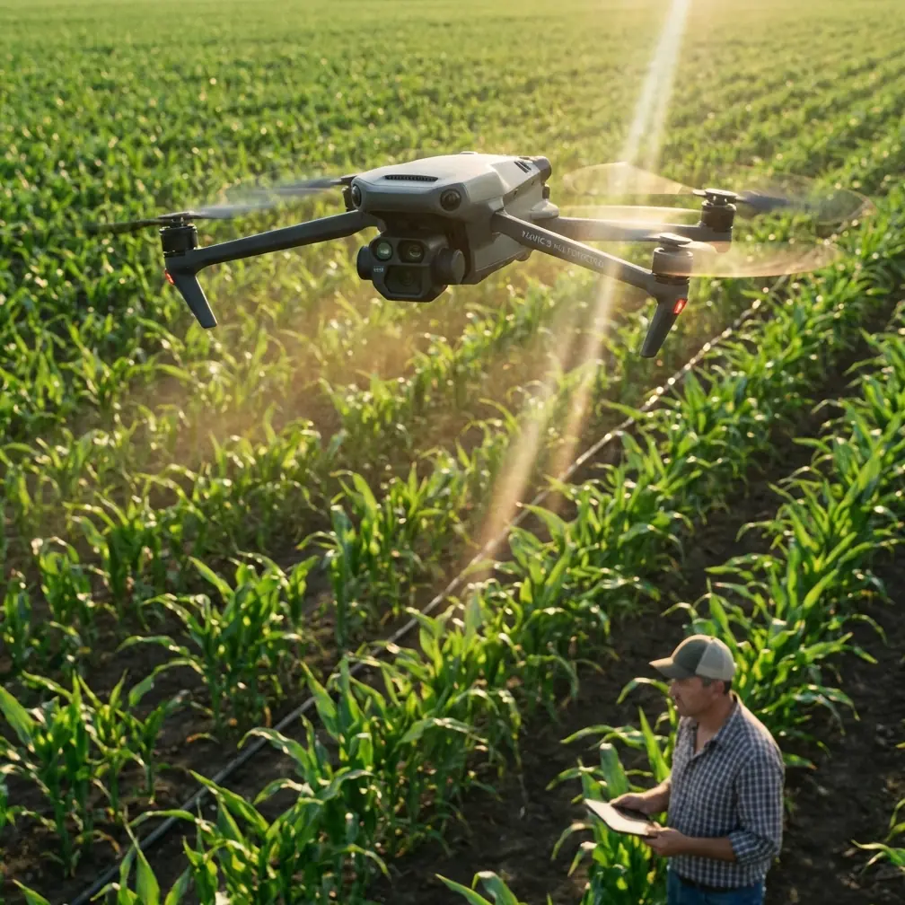
Mavic 3M: Essential Wildlife Scouting in Remote Areas
META: Discover how the Mavic 3M transforms remote wildlife scouting with multispectral imaging and centimeter precision. Expert guide for conservation professionals.
TL;DR
- Multispectral sensors detect wildlife heat signatures and vegetation disturbances invisible to standard cameras
- 46-minute flight time covers vast remote territories without frequent battery swaps
- RTK Fix rate delivers centimeter precision for accurate animal population mapping
- IPX6K weather resistance enables reliable operation in challenging field conditions
Wildlife researchers face an impossible choice: cover enough ground to gather meaningful data or maintain the precision needed for accurate population counts. Traditional aerial surveys using manned aircraft cost thousands per hour and disturb the very animals you're trying to study. Ground-based methods limit coverage to a fraction of the habitat. The Mavic 3M eliminates this compromise entirely, combining agricultural-grade multispectral imaging with expedition-ready durability for remote wildlife scouting operations.
Pre-Flight Cleaning: The Safety Step Most Operators Skip
Before discussing capabilities, let's address a critical pre-flight procedure that directly impacts both flight safety and data quality. Remote wildlife scouting often means operating in dusty savannas, humid rainforests, or salt-laden coastal environments. Debris accumulation on sensor surfaces doesn't just degrade your multispectral data—it compromises the obstacle avoidance systems keeping your aircraft airborne.
The 60-Second Sensor Protocol
Start every field day with this sequence:
- Gimbal lens surfaces: Use a microfiber cloth with gentle circular motions—never dry-wipe multispectral sensors
- Obstacle avoidance sensors: Check all six directions for dust, water spots, or insect residue
- Propeller attachment points: Clear debris that could cause vibration-induced image blur
- Cooling vents: Ensure airflow paths remain unobstructed for thermal management
- RTK antenna surface: Wipe clean to maintain optimal satellite signal reception
Pro Tip: Carry lens cleaning solution in a small dropper bottle rather than pre-moistened wipes. Wipes dry out rapidly in arid environments and freeze in cold conditions. A dropper bottle with microfiber cloths works reliably from -10°C to 40°C.
This routine takes 60 seconds and prevents the two most common remote operation failures: degraded obstacle detection and unusable spectral data.
Why Multispectral Imaging Transforms Wildlife Detection
Standard RGB cameras capture what human eyes see. The Mavic 3M's four multispectral bands reveal what remains invisible—stressed vegetation from animal trails, thermal signatures through light canopy cover, and subtle ground disturbances indicating denning sites.
The Five-Band Advantage
The imaging system captures:
- Green (560nm ± 16nm): Vegetation health assessment around water sources
- Red (650nm ± 16nm): Soil disturbance detection from animal activity
- Red Edge (730nm ± 16nm): Canopy stress patterns from browsing pressure
- Near-Infrared (860nm ± 26nm): Biomass density and hidden trail networks
- RGB (1/2-inch CMOS): High-resolution visual confirmation at 20MP
This combination allows researchers to identify wildlife corridors, feeding zones, and population concentration areas without direct visual contact. A herd of elephants moving through dense bush leaves spectral signatures in vegetation stress patterns visible for days after passage.
Swath Width Calculations for Survey Planning
Effective coverage depends on understanding the relationship between altitude, swath width, and ground sampling distance. At 100 meters AGL, the Mavic 3M delivers:
- Multispectral swath width: Approximately 160 meters
- Ground sampling distance: 5.3 cm/pixel for multispectral bands
- RGB ground sampling distance: 2.7 cm/pixel
For large mammal surveys, this resolution identifies individual animals while the swath width enables efficient transect coverage.
Technical Specifications for Remote Operations
| Feature | Mavic 3M Specification | Field Relevance |
|---|---|---|
| Max Flight Time | 43 minutes | Extended transects without battery changes |
| Transmission Range | 15 km (O3 Enterprise) | Beyond-visual-line-of-sight capability |
| Operating Temperature | -10°C to 40°C | Arctic to tropical deployment |
| Wind Resistance | 12 m/s | Stable imaging in exposed terrain |
| Hover Accuracy (RTK) | 1 cm horizontal, 1.5 cm vertical | Precise repeat surveys |
| IP Rating | IPX6K | Rain and dust protection |
| Takeoff Weight | 951 grams | Backpack-portable for remote access |
The centimeter precision enabled by RTK positioning proves essential for population studies requiring repeat surveys. When you return to the same transect six months later, the aircraft follows identical flight paths within 1-2 centimeters, ensuring comparable data collection.
Expert Insight: RTK Fix rate stability depends heavily on satellite constellation visibility. In dense forest environments, plan flights during periods of maximum satellite availability—typically mid-morning in the Northern Hemisphere. Use mission planning software to predict RTK Fix rate probability before committing to a remote deployment.
Solving the Remote Power Challenge
Wildlife scouting locations rarely offer convenient charging infrastructure. The Mavic 3M's power management approach addresses this reality through several design decisions.
Battery Strategy for Multi-Day Expeditions
Each intelligent flight battery delivers approximately 40 minutes of practical flight time under typical conditions. For a five-day remote survey, consider:
- Minimum battery count: 6 batteries for 4 hours daily flight time
- Charging solution: 100W portable solar panel with battery station
- Backup power: Vehicle-based inverter system for cloudy conditions
- Temperature management: Insulated battery cases for cold environments
The batteries feature integrated heating elements activating automatically below 10°C, maintaining chemistry performance in alpine or early-morning conditions.
Nozzle Calibration Principles Applied to Sensor Alignment
While the Mavic 3M lacks spray capabilities, the precision principles behind nozzle calibration in agricultural drones translate directly to multispectral sensor alignment. Just as spray drift affects application accuracy, sensor misalignment creates data artifacts that compromise wildlife detection.
Sensor Alignment Verification
Before each survey campaign:
- Capture calibration panel images at mission altitude
- Verify band-to-band registration within 1 pixel tolerance
- Check radiometric calibration against known reflectance targets
- Document sun angle and atmospheric conditions
This discipline ensures spectral indices remain comparable across survey dates and locations.
Common Mistakes to Avoid
Ignoring wind patterns at altitude: Ground-level conditions rarely reflect conditions at 100+ meters AGL. Check aviation weather forecasts for winds aloft, not just surface observations.
Underestimating battery consumption in cold: Expect 15-20% reduced flight time when operating below 5°C, even with battery pre-heating enabled.
Flying identical altitudes regardless of target species: Small mammals require lower altitudes and higher resolution; large ungulates allow higher, more efficient survey altitudes.
Neglecting RTK base station placement: Position the base station on stable ground with clear sky view. Unstable mounting or obstructed horizons degrade RTK Fix rate throughout your survey.
Skipping pre-flight sensor cleaning: As detailed earlier, this single oversight causes more failed surveys than equipment malfunction.
Processing multispectral data without radiometric correction: Raw band values shift with sun angle and atmospheric conditions. Always apply radiometric correction before generating vegetation indices.
Frequently Asked Questions
Can the Mavic 3M detect animals through forest canopy?
The near-infrared band penetrates light canopy more effectively than visible wavelengths, revealing ground-level activity invisible to RGB cameras. Dense tropical canopy remains challenging, but the system excels in savanna, woodland, and mixed forest environments where canopy gaps exist.
How does RTK positioning improve wildlife population estimates?
Centimeter precision enables exact transect replication across survey periods. When flight paths match within 1-2 centimeters, population density calculations become statistically comparable. Without RTK, GPS drift of 2-5 meters introduces sampling bias that compounds across large study areas.
What maintenance does the Mavic 3M require in remote field conditions?
Daily sensor cleaning, propeller inspection, and firmware verification form the core maintenance routine. Carry spare propellers, a complete cleaning kit, and backup memory cards. The IPX6K rating handles rain exposure, but salt spray environments require freshwater rinsing of external surfaces after each flight day.
Remote wildlife scouting demands equipment that matches the challenge—reliable, precise, and capable of operating far from support infrastructure. The Mavic 3M delivers multispectral intelligence previously requiring dedicated research aircraft, packaged in a system that fits in a field backpack.
Ready for your own Mavic 3M? Contact our team for expert consultation.