
Mavic 3M May 22, 2026
Mavic 3M Guide for Highway Inspection in Low Light
Highway inspection at dusk exposes two weak habits at once: trusting auto exposure too much, and trusting aircraft autonomy more than the mission deserves.
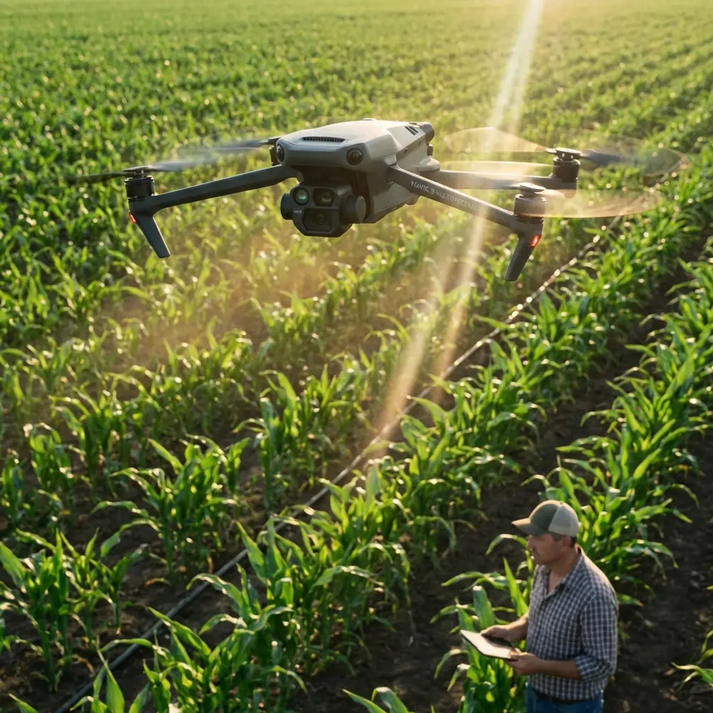
See the Unseen, Precision Agriculture Redefined
Advanced sensors and intelligent features for professional agriculture.
Built-in multispectral imaging system for crop health monitoring and analysis.
High-precision positioning for accurate mapping and autonomous flight.
15km ultra-long transmission range with stable and clear video feed.
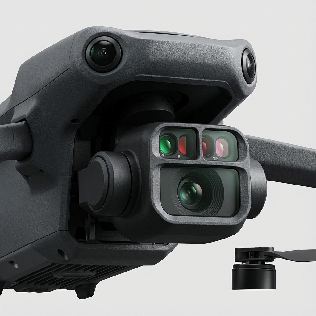
Equipped with a 20MP RGB camera and four 5MP multispectral cameras, the Mavic 3M enables high-precision aerial surveying and crop growth monitoring.
Mechanical shutter prevents motion blur during high-speed flight.
Green, Red, Red Edge, and Near Infrared bands for NDVI analysis.
Built-in sensor records solar irradiance for data normalization.
Stay informed with the latest updates on drone technology, industry trends, and precision agriculture insights.
Highway inspection at dusk exposes two weak habits at once: trusting auto exposure too much, and trusting aircraft autonomy more than the mission deserves.

Wind changes everything in aerial field scouting. Not just aircraft handling. Data quality, repeatability, takeoff choices, image overlap, and the confidence yo
Salt haze flattens contrast. Wet sand throws glare back into the lens. Wind shifts just enough to complicate overlap, and battery estimates that looked comforta