Mavic 3M on the Coast: A Field Report on What Actually
Mavic 3M on the Coast: A Field Report on What Actually Matters
META: A field report on using the DJI Mavic 3M for coastline inspection, with practical notes on multispectral workflow, RTK precision, visual contrast, maze-style route logic, and battery management in marine conditions.
Coastline work punishes vague planning.
Salt haze flattens contrast. Wet sand throws glare back into the lens. Wind shifts just enough to complicate overlap, and battery estimates that looked comfortable onshore start shrinking once the aircraft spends ten straight minutes fighting sea air and crossflow. If you are evaluating the Mavic 3M for coastal inspection, those details matter more than brochure-level specs.
What follows is not a generic overview. It is a field-style interpretation of a few seemingly unrelated technical references and why they are surprisingly useful when the job is shoreline assessment, erosion monitoring, vegetation stress review, and coastal asset mapping.
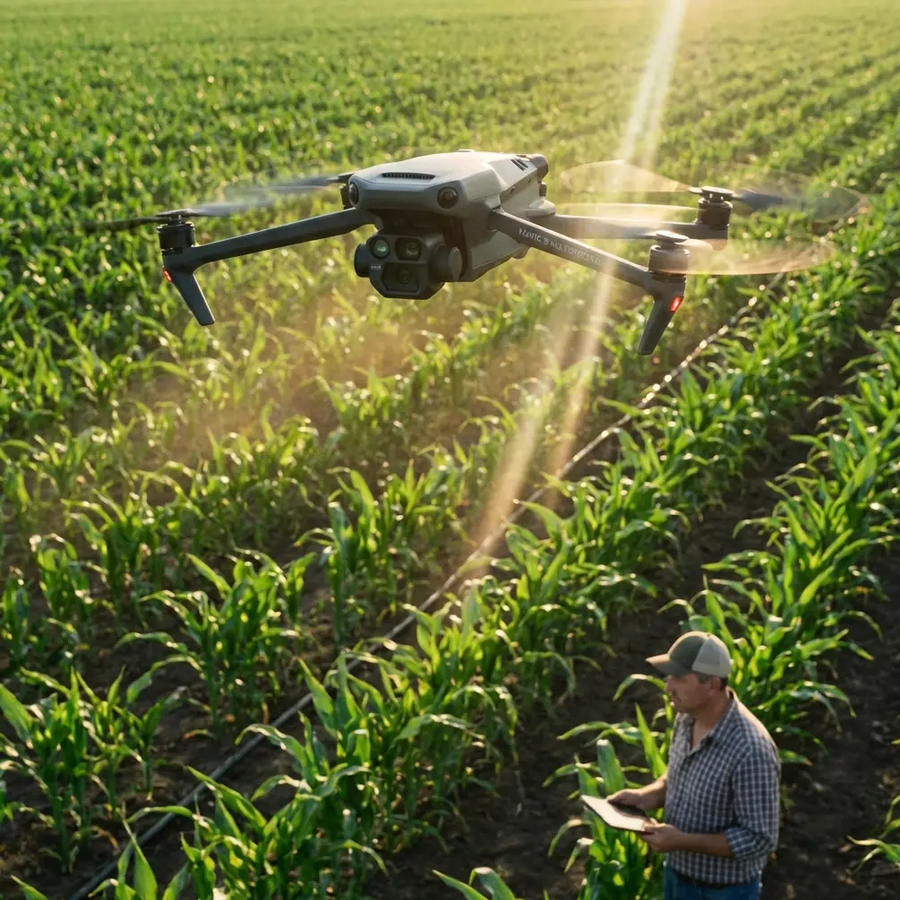
The Mavic 3M is usually discussed through its multispectral value. Fair enough. Multispectral data is the reason many teams buy it in the first place. On the coast, though, sensor value is only half the story. The other half is whether you can create repeatable, interpretable datasets in an environment that is visually messy and operationally unforgiving.
The coastal problem is contrast before it is data
One of the source references is not even about drones. It is a short note on photographing flowers with a phone against a dark background. At first glance that looks irrelevant. It is not.
The key idea is simple: you do not need a perfectly black background. Any darker surface can work, and the operator should change angles so the subject is bright while the background stays dark. The examples given were shaded soil, dark woods, and darker walls or ground. That principle is directly useful in coastal Mavic 3M operations because shoreline inspections often fail at the image-interpretation stage, not the flight stage.
When you inspect dune vegetation, tidal edges, marsh transition zones, or rock revetments, separation is everything. If the foreground subject and the surrounding environment share the same brightness level, both visual and multispectral review become harder. That is especially true when you are trying to distinguish:
- stressed vegetation from shadowed but healthy vegetation
- shallow water boundary from saturated shoreline
- wet rock from marine growth
- sand disturbance from simple tonal variation caused by cloud cover
Changing the aircraft angle to make the subject brighter and the background darker is not just a photography trick. It is an inspection method. In practical terms, I often advise coastal teams to run a quick visual recon pass before committing to the full grid. The purpose is to study glare direction, dark backdrop opportunities, and whether the target feature reads more cleanly from seaward-in or landward-out.
That can affect whether your Mavic 3M mission produces a useful interpretation layer or a folder full of technically captured but visually ambiguous images.
On one shoreline vegetation job, the most readable set was not the nadir-first pass everyone expected. It was an oblique visual pass completed early, while the sun angle gave the dune face a brighter foreground and pushed the inland tree line into a darker tonal band. The principle from that phone-photography reference held up perfectly: the target popped because the background receded.
For operators using the Mavic 3M in coastal zones, that translates into one practical rule: do not choose flight direction based only on map geometry. Choose it based on scene separation.
Why a student drone maze has something to teach a professional coastline team
Another reference came from an educational drone maze competition. Again, it sounds distant from the Mavic 3M and from coastal inspection. It is not.
The competition requires the drone to begin at a start point, explore the maze, visually identify hidden task points, then calculate the shortest route through the space. The advanced course is built as a 5x5 maze with 25 cells, with the start and finish at the middle cells of the first and last rows. That is a compact but useful model for how professionals should think about constrained coastal flight planning.
Many coastline jobs are not really “open area” mapping tasks. They are corridor missions disguised as open scenes. Jetties, seawalls, levees, breakwaters, mangrove edges, tidal creeks, and cliff lines all force aircraft movement into semi-structured paths. If you fly them like a broad agricultural block, you waste battery, increase turns, and often gather redundant data over low-value water.
The maze reference matters because it frames two habits that separate experienced field teams from casual users:
- Exploration first
- Fastest useful path second
That sequence is gold for the Mavic 3M in coastal inspection.
A short exploration segment identifies obstacles, reflective zones, bird activity, signal shadows, and any sections where overlap will fail because of terrain shape or shoreline geometry. Only after that should the final route be fixed. In a perfect world, every mission is preplanned at the desk. On the coast, field reality edits the plan.
The 5x5, 25-cell maze concept is also a helpful mental model for segmenting a shoreline into decision blocks. Instead of thinking of a 2-kilometer coast as one continuous strip, break it into operational cells: dune face, access track, saltmarsh edge, revetment toe, drainage outlet, and so on. Each cell gets a purpose, required sensor emphasis, and a battery allocation. That keeps the Mavic 3M focused on inspection priorities rather than just covering space.
There is another operational point hidden in that maze reference: the drone identifies hidden task points through vision. In real coastal work, your “hidden task points” are not contest markers. They are the easy-to-miss anomalies that usually trigger follow-up action: a drainage breach, a patch of vegetation stress, isolated sediment displacement, or a section where wave undercutting has advanced farther than expected. If your route logic is sloppy, you fly past those without noticing them in time to adjust.
So yes, a student maze has relevance here. It teaches disciplined route architecture. And on a marine edge, route discipline saves battery, improves overlap, and catches more anomalies.
Multispectral is only valuable when your geometry is stable
The Mavic 3M earns its place in coastal inspection when users stop treating multispectral data as magic and start treating it as measurement.
Everyone likes to talk about multispectral outputs, vegetation layers, and stress detection. But coastal environments magnify small inconsistencies. Changing reflectance from wetness, shifting cloud, moving water, and wind-driven vegetation can produce misleading variation if geometry and timing are not under control.
That is where centimeter precision and RTK fix rate become operational, not promotional, terms.
If you are monitoring repeat shoreline conditions over time, especially vegetation change in dune systems or marsh boundaries, your outputs need to line up with minimal drift between missions. The value is not simply seeing “a map.” The value is being able to compare one mission to another with confidence that the change is environmental, not navigational.
This is why I tell teams not to obsess over single-flight image quality while ignoring fix stability. A beautiful dataset with inconsistent positional discipline is hard to defend in trend analysis. A clean RTK workflow gives the Mavic 3M a more serious role in repeat coastal documentation.
The phrase “swath width” also deserves more respect in this context. On the coast, swath width is not just a productivity measure. It affects interpretation consistency. A pass that is too wide relative to terrain complexity may blend visually distinct shoreline elements into one reading zone. Narrower and more intentional coverage often produces better results along irregular edges, even if that means more lines and more planning.
This matters particularly when reviewing plant health near the ocean, where salt exposure, periodic inundation, and sand movement create patchy signatures. If your swath is too ambitious, the Mavic 3M can gather plenty of data without giving you clean decision-quality separation.
A battery tip that becomes obvious only after a few salty mornings
Here is the field lesson I wish more coastal operators learned early: do not use battery percentage as your main planning language.
Use mission segments per battery, and leave one segment unclaimed.
That sounds conservative, but coastal wind profiles are inconsistent in exactly the wrong way. You may launch with stable conditions, run a smooth outbound leg, then spend the return segment fighting a crosswind that was not obvious at takeoff altitude. Add low-level repositioning for oblique checks and battery draw climbs quickly.
With the Mavic 3M, I prefer to define battery use by tasks, not minutes. For example:
- Battery 1: recon and visual contrast test
- Battery 2: primary multispectral block for sector A
- Battery 3: sector B plus one verification pass
- Battery 4: reserve for re-fly, anomaly review, or light change correction
That reserve battery is where good data often comes from. Not because something went wrong, but because the coast changes while you are working. Sun breaks through, haze shifts, tide exposes a new boundary, or glare vanishes for ten minutes and suddenly the feature you wanted all morning becomes readable.
The field mistake is squeezing every battery into a full planned mission and leaving no capacity for intelligent adaptation.
Salt environments also encourage rushed handling because crews want to get the aircraft packed quickly. Resist that instinct. Swap methodically. Keep batteries shaded. Let warm packs cool before charging cycles if you are running a mobile power setup. It sounds basic, but battery confidence is part of data confidence. If you are mentally bargaining with the remaining percentage, you are more likely to shorten a pass, cut overlap, or skip a verification line.
The calibration reference is dry, but the lesson is not
The parameter document in the source pack lists things most people skip over: magnetometer scaling, board rotation offsets, and a differential pressure sensor offset listed at 80.850. It also notes disabled rangefinder options like Lidar-Lite and a Lightware unit in that particular configuration.
No, those exact fixed-wing parameters are not a setup manual for the Mavic 3M. That is not the point. The point is what they remind us about professional flight operations: precision work depends on calibration discipline, and small offsets can quietly contaminate mission confidence.
For coastal Mavic 3M users, this has two implications.
First, heading integrity matters more than many teams realize. Along curved shorelines, subtle heading inconsistencies can influence overlap quality and line tracking, especially when the aircraft is working in wind and the coastline encourages repeated direction changes. If the platform’s orientation logic is not trusted, your carefully planned corridor may show the symptoms later in stitching quality and revisit mismatch.
Second, sensor assumptions are dangerous. In that parameter sheet, some auxiliary sensors are simply disabled. The broader lesson is to know what your aircraft is actually relying on in the field, not what you vaguely assume is helping it. On the coast, where reflective surfaces, low-texture sand, and moving water can reduce the usefulness of some navigation cues, crews should not be casual about preflight checks.
This is where trained habits beat gadget optimism every time.
Reading the coast with the Mavic 3M means combining human judgment with structured capture
The best coastal Mavic 3M operators are not the ones who trust automation blindly. They are the ones who know when to let automation do the repetitive work and when to intervene because the scene is lying.
A marsh edge can look stable until a lower-angle pass shows drainage scarring. A dune face can look uniform until multispectral review flags a stress patch. A rock armor line can appear intact until shadow control reveals displacement. A dark background behind a bright target can clarify what a flat overhead pass obscures.
That is why I still recommend building a two-layer mission style for serious shoreline inspection:
- a structured mapping layer for repeatability
- a selective visual interpretation layer for context and anomaly confirmation
This method respects what the Mavic 3M does best without pretending every problem is solved by one flight mode.
If your team is building a coastal inspection workflow and wants to compare mission logic, overlap settings, or multispectral review habits, you can message our field desk here and talk through the scenario directly.
What the Mavic 3M is really good at on the shoreline
Not everything on the coast requires this aircraft. If the task is pure broad-area visual capture with no analytical follow-up, the Mavic 3M may be more tool than you need. But if the job involves repeatable observation of vegetation condition, erosion-adjacent patterns, or shoreline infrastructure interaction with plant and surface change, it starts making a lot of sense.
Its real strength is not “having multispectral.” Its strength is letting a field team build a disciplined, repeatable inspection record across areas that are visually inconsistent and operationally awkward.
The references behind this article were eclectic: dark-background composition advice, a 25-cell educational maze, and a sheet of calibration parameters. Odd mix. Yet together they point to a mature operating mindset:
- use contrast intentionally
- explore before committing to the shortest path
- trust calibration only when you have checked the foundations
- preserve battery flexibility for the pass that actually answers the question
That is the kind of thinking that gets the most from a Mavic 3M on the coast. Not hype. Not feature recitation. Just clean field decisions made before the sea air starts taking options away.
Ready for your own Mavic 3M? Contact our team for expert consultation.