Mavic 3M Field Report: Scouting High-Altitude Vineyards
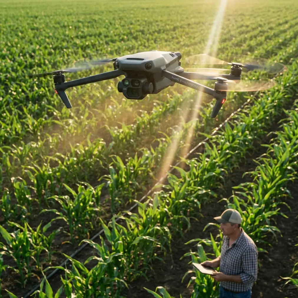
Mavic 3M Field Report: Scouting High-Altitude Vineyards with a City-Service Mindset
META: A field-based Mavic 3M article for high-altitude vineyard scouting, covering multispectral workflow, RTK precision, pre-flight cleaning, spray drift awareness, and why practical low-altitude drone use matters.
High-altitude vineyards punish assumptions.
Light changes fast. Wind moves through rows unevenly. A block that looks uniform from the edge of a slope can break into several microclimates once you actually measure vine vigor, moisture stress, and canopy consistency. That is where the Mavic 3M becomes useful—not as a generic drone story, but as a practical tool for turning aerial data into day-to-day decisions in terrain where walking every row is slow and often misleading.
What makes this conversation timely is not only the aircraft itself, but the broader shift in how drones are being absorbed into real civilian life. Recent reporting from Shenzhen described drones being pushed beyond abstract “low-altitude economy” talking points and into direct public service, even appearing in “airborne first responder” roles tied to everyday convenience and urban support. That matters for vineyard operators more than it may seem at first glance. It signals a maturing operational culture: drones are no longer being framed as novelty hardware or future concepts. They are being judged by whether they solve a real problem on the ground, or in this case, above the canopy.
For vineyard scouting, that same standard applies. The Mavic 3M earns its place only if it makes field decisions clearer, faster, and more defensible.
Why high-altitude vineyards are a different job
Vineyards at elevation create a messy sensing environment. Temperature swings are sharper. Wind corridors are more unpredictable. Block edges may include terraces, drainage breaks, rock exposure, and aspect-driven variations in vine development. A grower can easily mistake topographic stress for disease pressure, or irrigation irregularity for nutrient imbalance, if the scouting method is too coarse.
This is where a multispectral workflow starts to separate itself from visual-only observation. A normal RGB image can show obvious gaps, damaged trellis sections, or severe canopy thinning. But vineyards rarely fail in such obvious ways first. Most management value comes earlier, when the row still looks “acceptable” to the naked eye.
The Mavic 3M’s relevance in that setting is tied to one core idea: it helps convert subtle canopy differences into mapable patterns before they become expensive operational surprises.
The pre-flight step too many crews skip
Before discussing sensors, I want to start with a safety and data-quality habit that sounds minor but has outsized importance in mountain vineyards: pre-flight cleaning.
Not a casual wipe. A disciplined one.
On steep vineyard roads, vehicles throw dust constantly. Add dried spray residue, pollen, fine soil particles, and occasional moisture condensation from cold mornings, and you have the perfect recipe for compromised sensors and degraded situational awareness. If your aircraft is expected to support precise agricultural scouting, every lens and vision-related surface needs inspection before takeoff.
This matters for safety first. Obstructed or contaminated sensing surfaces can reduce reliability in terrain where slope, trunks, wires, and row-end structures already demand attention. It also matters for data integrity. A dirty optical path can subtly affect image consistency, especially when you are comparing flight outputs over time rather than judging a single mission in isolation.
For vineyards that also run spray operations nearby, this cleaning routine connects directly to spray drift awareness. Drift is not only an application problem for the sprayer. Residue suspended in the working environment can end up on aircraft surfaces, affecting subsequent scouting flights if maintenance discipline is weak. In practical terms: if a block was treated recently, I want crews to consider both air conditions and contamination risk before launching the Mavic 3M.
A useful field sequence is simple:
- inspect camera windows and sensor surfaces under angled light,
- check for dried residue around the airframe,
- confirm propeller cleanliness and condition,
- verify no moisture film remains after cleaning,
- then proceed to calibration and mission setup.
That five-minute discipline reduces both preventable error and unnecessary risk.
Why centimeter-level positioning changes vineyard decisions
In terraced or sloped vineyards, location accuracy is not just a nice feature. It determines whether your map supports action.
The reason RTK matters is straightforward. If your scouting data shifts from one mission to the next, you can misread vine change where no real agronomic change exists. A high RTK fix rate stabilizes repeatability. When operators talk about centimeter precision, the operational significance is not abstract. It means the same weak section of canopy can be revisited, confirmed, and compared over time with confidence rather than guesswork.
That becomes especially valuable when blocks are narrow, elevation changes are abrupt, or row spacing limits margin for positional drift. A few centimeters can be the difference between confidently tagging a recurring issue zone and spending extra field labor trying to reconcile map artifacts with physical rows.
For high-altitude vineyards, I view RTK performance as part of crop interpretation, not merely flight engineering. If the positional backbone is strong, you can align multispectral patterns with irrigation infrastructure, trellis repairs, erosion zones, and historical treatment records much more cleanly. If it is weak, your maps become interesting pictures that still require too much manual verification.
Multispectral is useful only when tied to real scouting questions
The industry sometimes talks about multispectral imaging as if the sensor itself creates agronomic insight. It does not. Good questions create useful maps.
In high-altitude vineyard work, the Mavic 3M is strongest when the mission plan is tied to specific operational uncertainties:
- Which rows are lagging due to water stress versus shallow soil?
- Are upper-slope vines showing uniform reduced vigor or patchy anomalies?
- Is a suspected issue following irrigation layout, exposure, or varietal change?
- Did last week’s wind event leave a measurable canopy effect in exposed sections?
When you ask those questions first, the multispectral output becomes actionable. Without that framing, crews often collect data that looks sophisticated but leads nowhere.
One of the best uses I have seen is separating “looks bad from the pickup road” from “actually requires intervention.” In steep vineyards, visual impressions are biased by angle, shadow, and row direction. Multispectral scouting helps normalize that view. It gives managers a more stable reference for deciding where to send people on foot, where to sample tissue, and where to leave a block alone because the apparent issue is simply terrain-driven variation.
Swath width, overlap, and the temptation to rush
There is always pressure to cover acreage quickly, especially when weather windows are short. But in vineyards, swath width and overlap should be chosen for row-level interpretation, not just area coverage.
A wider swath can speed the mission, but if terrain variation causes inconsistent image geometry or reduced interpretability across steep transitions, the saved minutes can be lost later in rechecks. The right answer depends on block shape, row orientation, and elevation change. In mountain vineyards, I generally favor a more conservative mapping setup because data quality degrades quietly before operators notice.
That same caution applies if the scouting mission is meant to inform spray planning. While the Mavic 3M is not a spraying platform, its maps often influence how a treatment team approaches a block. If drift risk is already elevated by local wind behavior, then poor scouting resolution can compound the problem by encouraging overly broad treatment assumptions. Accurate scouting helps narrow intervention zones. Narrower zones can support more disciplined spray decisions, which in turn improves drift management.
This is why nozzle calibration still belongs in the conversation even when discussing a scouting aircraft. The drone map may identify where action is needed, but the effectiveness and environmental discipline of that action still depend on ground or aerial application quality. If the treatment system is poorly calibrated, precise scouting data will not deliver its full value.
The Shenzhen lesson: drones prove themselves in routine service
The Shenzhen report is worth dwelling on because it reflects a larger operational truth. The article emphasized that local drone deployment is being shaped around public service and daily convenience, not just industrial ambition. It described a push to turn technical innovation into something citizens can actually experience in ordinary life. That framing is surprisingly relevant to vineyard management.
In agriculture, drone programs also fail when they stay at the level of concept. They succeed when they become ordinary and useful.
For a vineyard manager, that means the Mavic 3M should fit into routine decision cycles:
- weekly scouting before labor allocation,
- post-weather checks after wind or temperature stress,
- pre-harvest canopy review,
- targeted follow-up after irrigation adjustments,
- documentation of recurring weak zones over the season.
The urban-service example from Shenzhen underscores a standard worth adopting in the field: practical deployment beats theoretical capability. If a drone can become part of city life because it makes a real task easier, the same logic should guide vineyard operations. The aircraft should reduce uncertainty, compress response time, and improve consistency. If it does not, the workflow needs to be redesigned.
A sample field workflow for mountain vineyards
Here is the workflow I usually recommend for high-altitude scouting teams using a Mavic 3M:
1. Weather and residue check
Do not just assess wind speed. Assess wind pattern. Ridge-top vineyards often produce intermittent cross-row gusts that are more disruptive than steady airflow. Also check whether nearby spray work has left airborne residue or fresh deposits that justify extra cleaning.
2. Pre-flight cleaning and visual inspection
As mentioned earlier, this is not optional. Clean camera and sensing surfaces carefully. Look for dust, dried chemistry, condensation, and propeller damage. In cold mornings, verify there is no lingering moisture before launch.
3. RTK confirmation
Do not rush past this stage. A strong RTK fix rate is foundational for repeat missions and row-level analysis. Centimeter precision becomes especially valuable when comparing seasonal shifts in small, irregular vineyard blocks.
4. Mission design based on the scouting question
Set overlap, altitude, and swath width according to the decision you need to make. If the question concerns subtle variability in a stressed slope, design for higher confidence, not maximum acreage.
5. Ground truthing after map review
Use the multispectral results to choose where human inspection should go next. The map is a filter for field labor, not a substitute for every boot-on-ground observation.
6. Link scouting to treatment discipline
If the map will inform spraying, review drift risk and nozzle calibration before operational follow-through. Good imagery should narrow action zones, not encourage indiscriminate application.
Human factors still decide whether the aircraft delivers value
Technology conversations often ignore crew discipline. That is a mistake.
In vineyards, the best results come from operators who understand crop context, not only flight controls. The Mavic 3M is especially powerful when the pilot, agronomist, and farm manager share a common question set. If one person flies, another interprets maps in isolation, and a third decides treatment without context, the workflow fragments quickly.
That is another reason the Shenzhen story resonates. Civilian drone use becomes durable when it is integrated into a service system. The aircraft alone is not the service. The people, procedures, and response loop around it create the value.
For vineyard teams that want to tighten that loop, it often helps to compare notes with operators who work in similar terrain and crop conditions. If you need a practical discussion about configuring Mavic 3M missions for steep vineyard blocks, this field coordination channel can be a useful starting point.
What the Mavic 3M does best in this setting
For high-altitude vineyards, I would summarize the aircraft’s strength this way: it brings repeatable, spatially trustworthy crop observation into environments where variability is the rule, not the exception.
That advantage comes from several connected pieces:
- multispectral sensing that can surface subtle canopy differences,
- RTK-supported centimeter precision for repeatable comparison,
- mission flexibility for irregular vineyard geometry,
- and a workflow that can inform targeted field checks rather than broad assumptions.
But none of those features operate in isolation. If pre-flight cleaning is sloppy, if RTK is treated casually, if swath width is chosen only for speed, or if spray follow-through ignores drift and nozzle calibration, the whole chain weakens.
The good news is that mountain vineyards are exactly where disciplined drone scouting can have outsized value. Terrain creates complexity. Complexity rewards better measurement.
And that is the larger takeaway. Whether in a city using drones to make public services tangible or in a vineyard using aerial sensing to sharpen crop decisions, the standard is the same: the aircraft must translate innovation into something operationally real.
Ready for your own Mavic 3M? Contact our team for expert consultation.