Mavic 3M for High-Altitude Field Capture
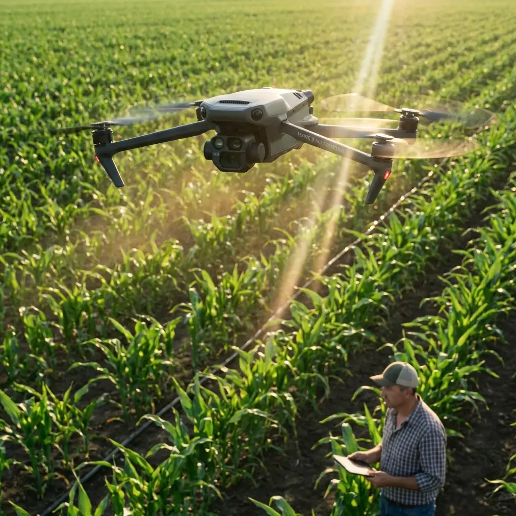
Mavic 3M for High-Altitude Field Capture: A Practical Method That Starts Before Takeoff
META: A field-focused tutorial on using Mavic 3M for high-altitude agricultural capture, with workflow insights drawn from live-view training logic, timing discipline, and real aerial display lessons.
By Dr. Sarah Chen
High-altitude field capture with the Mavic 3M is often treated as a simple altitude setting problem. Go higher, cover more hectares, finish faster. That logic is only half right.
The real constraint is not altitude by itself. It is how altitude interacts with live visibility, timing, image consistency, and the pilot’s ability to make clean corrections without disturbing the mission. When growers or agronomy teams ask why one data set produces reliable vegetation insight while another creates patchy, hard-to-interpret results, the answer usually lives in the workflow rather than the aircraft spec sheet.
That is where a few unlikely reference points become useful. A recent aviation carnival in Qingyuan staged formation and aerobatic performances above the Beijiang, using the river and urban skyline as a dramatic visual backdrop. At first glance, that sounds far removed from crop mapping. It is not. The lesson is that aerial work is always shaped by background, geometry, and the pilot’s relationship to the scene. Over a river, the contrast comes from water, buildings, and moving perspective. Over fields at higher altitude, the background is flatter and more repetitive, which makes orientation, overlap discipline, and correction timing more demanding than many operators expect.
A second reference comes from an education drone manual. In that TT training setup, the aircraft connects to a tablet over WiFi, the operator sees the flight image in real time, and the expansion module displays status data including TOF ranging and battery level. On paper, it is an entry-level teaching example. In practice, it captures a principle that matters deeply for Mavic 3M missions: your screen is not a passive monitor. It is the control surface for decision quality. Real-time viewing changes how well you detect missed swaths, edge distortion, glare issues, and route drift before those errors spread across an entire block.
And a third reference, from aerobatic instruction, may be the most relevant of all. It teaches a simple rhythm for a 45° climb sequence: pull, center, pause, roll, pause. The key idea is not the maneuver itself. It is the pause. Small intentional gaps between actions create time to observe, verify wing level, and correct. In agricultural imaging, especially at higher altitude, that same discipline is the difference between a mission that merely flies and one that produces defensible data.
Why high-altitude capture changes the way you should fly the Mavic 3M
The attraction of flying higher is obvious. A larger swath width can reduce the number of lines required to map a field. For broad-acre crops, that can be efficient. It can also be risky if the operator treats the mission as a one-click automation exercise.
At higher altitude, three things happen at once.
First, individual crop features occupy fewer pixels. That means the value of the Mavic 3M’s multispectral output depends more heavily on consistent overlap and stable geometry. Small deviations that look harmless on the flight screen can become real interpretation problems later, particularly along field edges, terraces, irrigation structures, or mixed-canopy zones.
Second, visual sameness increases. Many fields look almost identical from above once you reach a certain height. The cinematic effect can be beautiful, much like the Beijiang air show using landscape as stage scenery, but the operational consequence is less glamorous: pilots can lose intuitive orientation. That matters when checking whether the aircraft is tracking the intended corridor cleanly, whether wind is pushing line spacing, or whether a terrain break is creating an unexpected shift in apparent ground speed.
Third, your correction window gets narrower psychologically, even when it is still available physically. Operators often feel rushed at altitude because the aircraft appears to be moving across the field more abstractly. This is exactly where the aerobatic training concept of “slight pause between steps” becomes useful. The mission may be automated, but your review points should not be.
A better tutorial mindset: build planned pauses into the mission
One of the worst habits in agricultural drone work is constant intervention. Newer operators see a tiny deviation, jab at the controls, then overcorrect, then compensate again. In image missions, that creates more instability than the original issue.
The aerobatic training text warns against mixing corrections into every moment of the sequence until the whole maneuver turns messy. The same applies here. For Mavic 3M field capture, define deliberate checkpoints instead.
For example:
- before takeoff
- after climb to mapping altitude
- after the first two or three lines
- at the first turn sequence
- mid-mission battery review
- before entering a new field section with different elevation or planting pattern
At each checkpoint, pause your thinking even if the aircraft does not physically hover. Look at the live view, mission progress, and telemetry together. Ask a short set of questions:
- Is the line spacing visually clean?
- Are field edges being covered as planned?
- Is wind causing sideways bias?
- Does the light angle create glare or inconsistent reflectance?
- Is the route still appropriate for the crop geometry below?
This sounds basic, but it directly improves multispectral usability. High-altitude agricultural capture is not just about getting the aircraft over the field. It is about preserving interpretability.
What the tablet training example teaches Mavic 3M operators
The TT education document includes a straightforward setup flow: install a charged battery, attach the top expansion module, connect by Micro USB on the left side, power on, check the indicator lights, and confirm status data on the dot-matrix display. It also emphasizes that the operator can view the flight image on the tablet in real time and capture photos or video when a target scene appears.
That level of procedural clarity is exactly what many professional pilots skip once they become comfortable. They trust routine. Routine is useful, but it can dull observation.
For a Mavic 3M mission, the equivalent lesson is to verify every data path before launch, not just whether the props spin and the route loads. If you are capturing fields at higher altitude, your preflight should confirm:
- display readability in current sunlight
- reliable live image feed
- RTK status and fix stability if your workflow depends on centimeter precision
- mission grid orientation relative to the field, not just the map default
- battery health for expected wind load
- intended overlap and practical swath width for the crop and terrain
The educational drone’s TOF and battery readout are simple examples of visible, immediate status cues. In professional work, the principle expands: put critical mission awareness where you will actually notice it during the flight. If your screen layout hides useful indicators behind menus, fix that before takeoff.
This is especially true in high-altitude field work because the aircraft can seem “fine” while subtle data quality issues are already developing.
Multispectral capture is only as good as your route discipline
The Mavic 3M’s appeal in agriculture is tied to multispectral collection. But many operators think in sensor terms when they should be thinking in path terms.
A stable path matters because plant analysis depends on consistent acquisition conditions. If adjacent lines are unevenly spaced, if turn behavior clips field margins, or if altitude fluctuates over rolling ground, post-processing has to work harder to reconcile mismatched inputs. In some cases, the software can compensate enough. In others, your maps may look clean while hiding weak comparability between sections.
That is why the “45° line pause” idea from aerobatic training is so useful conceptually. On the page, it is about leaving enough time to observe whether the wings are level before the next pull. In field capture, the equivalent is leaving enough mental room to verify that the mission remains geometrically honest before the next section begins.
Do not rush from launch to completion simply because the route is automatic.
A practical rule I teach is this: the first segment validates the mission, not the final export. If the first few lines reveal a wind mismatch, an awkward grid angle, or problematic glare, change course early. That saves far more time than finishing an elegant but compromised mission.
The operational significance of landscape background
The Qingyuan aviation event over the Beijiang is useful for another reason. Air displays over water and cityscape highlight aircraft motion clearly because the background contains strong visual references. Agricultural fields often do the opposite. Large uniform blocks reduce your visual sense of drift and attitude.
This has two consequences for Mavic 3M operators flying high over crops.
First, do not rely on intuition alone for directional correctness. Use your map view and telemetry actively. Field patterns can trick the eye, especially in repetitive crops.
Second, edge planning matters more than most pilots think. The background monotony of broad fields can make line endpoints feel visually interchangeable. That is where missed borders happen. In crop analysis, border gaps are not trivial. They often coincide with drainage features, compaction zones, road-adjacent stress, or spray drift patterns that agronomists specifically want to inspect.
If your reader scenario includes spray drift or nozzle calibration follow-up, this becomes even more valuable. A high-altitude Mavic 3M capture can reveal broad treatment patterns, but only if margins and transition areas are covered intentionally. Drift rarely respects the neat interior of a field. It expresses itself at edges, along neighboring blocks, and near obstacles.
A useful third-party accessory for high-altitude field work
One third-party addition I often recommend is a high-brightness monitor hood or sun-shield system for the controller or tablet. It is not glamorous. It does not change the aircraft. It changes your error rate.
Remember the TT training example where the operator relies on the tablet’s real-time image to capture and assess what the drone sees. In strong daylight over reflective crops or pale soil, screen washout can quietly degrade your judgment. At higher altitudes, where details are already reduced, poor screen visibility can make you miss route issues, glare bands, or weak edge coverage.
A simple shade accessory improves live-view readability enough to matter. For serious field teams, that can be more operationally useful than chasing another software tweak. If you are comparing controller setups or practical field accessories for this kind of work, this direct WhatsApp line is a sensible starting point: ask about proven monitor-shade and field-kit options.
High-altitude capture workflow I recommend for Mavic 3M
Here is the field method I use when the goal is broad coverage without sacrificing agronomic usefulness.
1. Build the mission around the field, not the app default
Set the grid to reflect crop orientation, irrigation direction, and terrain breaks. Generic north-south lines are often lazy planning disguised as standardization.
2. Validate RTK before the field becomes a dataset
If your workflow depends on centimeter precision, confirm the RTK fix rate is stable before launch and again after ascent. A precise route is not the same as a precise result if the fix condition is unstable.
3. Use the first lines as a diagnostic window
Treat the opening segment as a quality test. Check image consistency, overlap behavior, and whether your chosen swath width makes sense for the field’s actual texture and boundaries.
4. Pause mentally at transitions
Borrow the aerobatic rhythm. Action, center, pause. In mission terms: climb, verify, start, review. At turns or new blocks, do not stack decisions too fast. Small review moments reduce cumulative error.
5. Watch edges for agronomic value
If the job relates to spray drift, irrigation variability, nozzle calibration review, or establishment issues, prioritize margins and transition strips. Those areas often tell the more useful story.
6. Keep the live view central
The TT training material may describe a simple WiFi-linked tablet setup, but the principle scales perfectly: real-time image awareness changes outcomes. Do not let the mission map distract you from what the camera is actually seeing.
7. Adjust altitude for meaning, not just speed
Higher is not automatically better. If the field has variability you need to resolve clearly, lower slightly and accept the extra passes. Coverage efficiency means little if interpretive value drops.
The main mistake to avoid
The most common mistake in high-altitude Mavic 3M field capture is assuming automation removes the need for piloting judgment.
It does not.
Automation removes repetitive stick work. That is a gift. It should free your attention for better observation, cleaner corrections, and stronger mission validation. The aerobatic text makes this point in a different language: leaving a little time between steps gives you room to see and fix what matters. The TT education manual makes it in beginner form: watch the live image and understand what the aircraft is doing. The Qingyuan aerial show reminds us that flight is always contextual, always shaped by the relationship between aircraft and background.
Put together, those references point to a more mature way of flying the Mavic 3M over fields at altitude. Not faster for the sake of faster. Smarter, cleaner, more intentional.
That is what produces multispectral datasets agronomists can trust.
Ready for your own Mavic 3M? Contact our team for expert consultation.