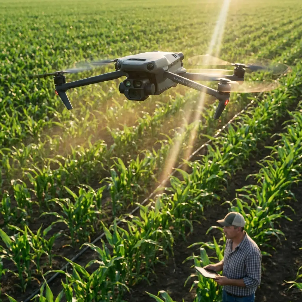
Mavic 3M in Mountain Operations: A Practical Workflow
Mavic 3M in Mountain Operations: A Practical Workflow for Teams Who Need Usable Data, Not More Files
META: A field-driven tutorial on using Mavic 3M in mountain environments, with lessons from RAW image overload, multispectral workflow choices, storage discipline, and RTK-aware planning.
Mountain work has a way of exposing bad assumptions.
On flat ground, you can get away with sloppy overlap, inconsistent lighting plans, and oversized files that nobody processes on time. In the hills, those habits catch up fast. Terrain changes your angle to the crop, shadows move earlier than expected, and the window for a clean flight can be surprisingly short. If the aircraft is collecting more data than your team can realistically turn into decisions, you are not building a precision workflow. You are building backlog.
That is one reason the Mavic 3M deserves a more serious discussion than the usual “multispectral drone for agriculture” summary. In mountain delivery venues, upland orchards, stepped plots, and remote trial sites, the value of this platform is not just that it captures multispectral data. It is that it can help a team stop drowning in files they do not use.
I was reminded of this by an apparently unrelated photography story. A photographer reviewing old phone images found 27 RAW photos from the previous year still sitting untouched in the gallery. Each file was about 42MB. Phone storage had dropped to 11%, and the files were deleted. That detail matters because it describes a familiar operational failure: collecting “high-value” data without a practical plan to process it. The same account also noted that phone RAW often requires third-party software, and the writer had to test Lightroom, Snapseed, and Darkroom just to begin editing. A veteran photographer with 20 years of experience offered a simpler rule: keep only the RAW files you need to edit that day, then convert the rest to JPG to save both storage and mental effort.
That advice has real relevance for Mavic 3M teams working in mountain terrain.
The mountain problem is rarely flight alone
When operators first move a multispectral workflow into mountainous areas, they tend to focus on the aircraft’s flight performance. That matters, but it is only half the problem. The harder question is what happens after landing.
In mountain venues, you may be flying repeated blocks across elevation changes, variable cloud cover, and narrow access windows. If your workflow depends on dragging every image into multiple software packages, tuning settings manually, and storing everything indefinitely “just in case,” your cycle time breaks down. Agronomy decisions slow down. Site managers stop trusting the schedule. The aircraft did its job, but the operation did not.
The Mavic 3M makes sense here when it is used as part of a disciplined capture-to-decision pipeline. The lesson from the phone RAW example is not “avoid rich image data.” It is “be selective about what deserves heavy processing.”
With Mavic 3M, that means planning before launch which outputs are operationally necessary for the terrain and crop stage. In mountain environments, that often comes down to a short list:
- a reliable multispectral map for crop variability
- geospatial consistency across repeat flights
- enough visible imagery to verify anomalies on the ground
- an archive policy that does not cripple storage
That is a better mindset than hoarding every dataset at maximum burden and hoping someone eventually interprets it.
Why multispectral matters more in the hills
Mountain fields are visually deceptive. A slope can look healthy from one access road and stressed from the opposite side. Shadowing and uneven moisture distribution can make ordinary RGB review misleading, especially in the morning or late afternoon.
This is where the Mavic 3M earns its place. Multispectral data gives you a more stable way to detect variation than casual visual review alone. In practical terms, it helps separate “this area looks darker because of angle and light” from “this area is actually performing differently.”
That distinction becomes operationally significant when you are managing fertilizer zones, scouting disease pressure, checking drainage patterns, or verifying whether an intervention on a difficult hillside actually worked. In mountain venues, walking every terrace or ridge line is slow and often inconsistent. A multispectral pass lets the team prioritize where to send people.
But the technology only helps if the data remains manageable. The phone RAW story is useful because it captures the trap of file-rich workflows. A single image at 42MB may not sound alarming until multiplied across repeated missions, teams, and seasons. Drone programs can make the same mistake at a much larger scale. A mountain operation with repeat monitoring should define what gets processed immediately, what gets compressed or converted for routine review, and what gets archived in full resolution for traceable agronomic records.
A practical tutorial for using Mavic 3M in mountain delivery venues
I use “delivery venues” here in the broad field sense: places where teams must deliver actionable outputs under access constraints, changing terrain, and tight timing. That could be a mountain orchard cooperative, a remote trial site, or a ridge-based planting area where inputs and decisions must reach the right block fast.
1. Start with the decision, not the mission
Do not launch because the weather is acceptable and the battery is full. Launch because there is a clear question to answer.
Examples:
- Which hillside blocks show the earliest stress signature?
- Did yesterday’s irrigation reach the upper terraces evenly?
- Which sections require a closer scouting walk this afternoon?
- Is there enough geospatial consistency to compare this week against the last flight?
When the question is clear, your Mavic 3M mission design becomes simpler. You are not chasing every possible layer. You are collecting what supports the decision window.
2. Build around RTK consistency
In mountain terrain, repeatability matters as much as image quality. A strong RTK fix rate is not just a technical vanity metric. It determines whether your maps line up cleanly enough over time to trust change detection at the block level.
That becomes especially valuable where slope and terrace geometry create visual complexity. Centimeter precision reduces the chance that apparent crop variation is really a positioning mismatch between flights. If you are comparing stress signatures across dates, poor alignment can waste the whole exercise.
So before talking about indexes, get your geospatial discipline right:
- verify your RTK setup before reaching the remote site
- confirm signal conditions in the valley or ridge environment
- avoid treating “close enough” positioning as acceptable for time-series analysis
The Mavic 3M is most useful in mountains when it gives you confidence that a difference in the map reflects a difference in the field.
3. Match swath width to terrain reality
Broad-area efficiency sounds attractive, but swath width in mountain work is never just about covering ground quickly. On slopes, wide assumptions can hide poor data capture at the edges, especially where elevation changes alter effective geometry across a pass.
A narrower, more deliberate pattern often produces better decisions than a superficially efficient mission that leaves inconsistent quality across terraces or ridge shoulders. The correct swath width is the one that preserves useful overlap and stable interpretation, not the one that looks fastest on paper.
This matters when teams are tempted to compensate for difficult access by flying fewer lines. In a mountain venue, cutting corners in coverage usually costs more time later in re-flights, rescouting, and internal argument over whether the map can be trusted.
4. Keep your storage policy brutally practical
The photography anecdote should be pinned on the wall of every drone office.
A set of 27 untouched RAW images, each around 42MB, is a small-scale version of what happens when drone teams collect first and think later. Then software complexity appears. In the phone example, the user needed third-party tools like Lightroom, Snapseed, or Darkroom, then got stuck on basic editing controls. Drone teams can do the same thing with multispectral stacks, orthomosaic exports, alternate index renders, and duplicate archives.
Your Mavic 3M program needs a file policy:
- What gets processed same day?
- What gets exported into a lightweight review format for field managers?
- What remains in full detail for compliance, agronomy comparison, or long-term study?
- Who decides a dataset has ongoing value?
That veteran photographer’s rule is surprisingly good operational doctrine: keep the heavy material you actually need to work on now. Convert or compress what is only needed for routine review. Archive selectively, not emotionally.
5. Use multispectral to reduce unnecessary mountain foot traffic
In remote terrain, every field visit has a cost in time and fatigue. The purpose of Mavic 3M is not to replace agronomists or crop consultants. It is to make their on-foot time more selective.
If a multispectral map highlights a specific upper-slope block with an unusual pattern, your team can send a scout there first instead of walking a full mountain section. That is a real operational gain. It improves response time and reduces wasted movement in difficult terrain.
The same logic applies to spray follow-up. If you are assessing possible spray drift, application consistency, or the effect of nozzle calibration on coverage outcomes, terrain-aware multispectral review gives you a faster first filter. It does not replace proper agronomic interpretation, but it narrows the search area. In mountainous settings where wind behavior can vary sharply across ridges and sheltered sections, that focus is valuable.
The hidden benefit: less software friction
One of the most revealing facts in the source material was not about file size. It was about software dependence. Even when a flagship phone advertises ProRAW, the fine print may still say third-party software is required. That gap between marketing and workflow is where many teams get burned.
The same principle applies in drone operations. The aircraft may capture excellent data, but if your team lacks a practical post-processing path, technical capability becomes an administrative burden.
So when deploying Mavic 3M, ask three blunt questions:
- Can the field team move from capture to a readable output quickly?
- Can non-specialists understand the output without a long software learning curve?
- Can the organization sustain storage and comparison over a season?
If the answer to any of those is no, simplify. Better a clean repeatable workflow than an advanced workflow nobody finishes.
A field example: what changed for one mountain workflow
Years ago, one recurring problem in upland projects was the handoff between flight teams and decision-makers. The pilots came back with lots of imagery. The agronomy side wanted clear flags, not folders. Site supervisors needed to know which block to inspect before weather turned. Instead, everyone got more data than they could absorb.
What improved with the Mavic 3M was not just sensor capability. It was the ability to structure missions around a practical question and repeat them with geospatial consistency. Once RTK-backed mapping and a disciplined archive policy were in place, the conversation changed. Instead of “here are the files,” it became “here are the zones that changed, here is where to walk, and here is what can wait.”
That is the difference between owning a capable aircraft and running a usable mountain operation.
When to ask for help
If your team is moving into mountain multispectral workflows and wants to avoid the usual storage and processing mistakes, it helps to compare mission design, RTK setup, and output strategy before the season gets busy. If that would be useful, you can message our field team here.
The real lesson from the RAW story
The source story was about phone photography, but the core issue is universal. High-fidelity capture is only worthwhile when it serves a real editing or decision need. Otherwise, it becomes clutter.
For Mavic 3M users in mountain environments, that lesson is sharp and practical. Do not confuse richer files with better operations. Use multispectral where it clarifies terrain-driven variability. Protect RTK consistency so comparisons mean something. Be realistic about swath width on slopes. Keep storage under control. And design every mission around a field decision someone actually needs to make.
That is how Mavic 3M becomes genuinely useful in the mountains: not as a collector of impressive data, but as a disciplined tool for turning difficult terrain into clearer, faster action.
Ready for your own Mavic 3M? Contact our team for expert consultation.