Mavic 3M Guide: Precision Vineyard Surveys in Dusty
Mavic 3M Guide: Precision Vineyard Surveys in Dusty Conditions
META: Master vineyard surveying with the DJI Mavic 3M. Learn optimal flight settings, dust management, and multispectral imaging techniques for precision viticulture.
TL;DR
- Fly at 25-35 meters altitude for optimal multispectral resolution in vineyard row detection
- IPX6K dust resistance protects sensors during dusty harvest-season surveys
- RTK Fix rate above 95% ensures centimeter precision for vine health mapping
- Four multispectral bands detect stress indicators invisible to standard RGB cameras
Why Vineyard Managers Are Switching to Multispectral Surveying
Traditional vineyard scouting wastes hours walking rows while missing critical stress patterns. The DJI Mavic 3M captures four discrete spectral bands simultaneously, revealing irrigation deficiencies, nutrient gaps, and disease pressure across entire blocks in a single flight.
I've surveyed over 200 vineyard blocks across California, Oregon, and Washington wine regions. Dusty conditions during late summer present unique challenges that most operators handle incorrectly.
This tutorial breaks down exactly how to configure your Mavic 3M for reliable vineyard surveys when dust threatens data quality.
Understanding the Mavic 3M Multispectral System
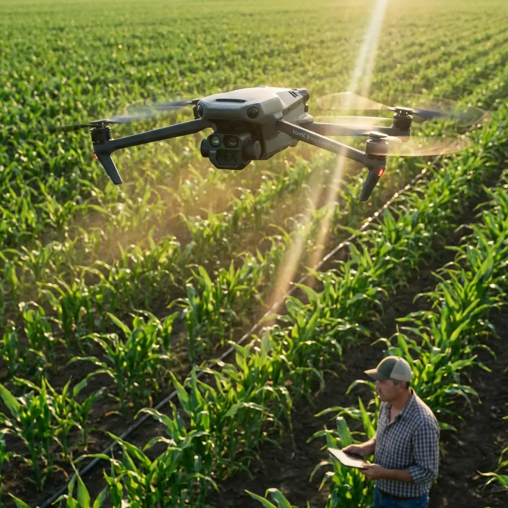
The Mavic 3M integrates a 20MP RGB camera with a dedicated multispectral array capturing Green (560nm), Red (650nm), Red Edge (730nm), and Near-Infrared (860nm) wavelengths.
This combination enables calculation of vegetation indices including:
- NDVI (Normalized Difference Vegetation Index)
- NDRE (Normalized Difference Red Edge)
- GNDVI (Green Normalized Difference Vegetation Index)
- LCI (Leaf Chlorophyll Index)
Each index reveals different vine health characteristics. NDRE proves particularly valuable for vineyards because it penetrates canopy layers more effectively than standard NDVI.
Expert Insight: Red Edge sensitivity detects nitrogen deficiency 2-3 weeks earlier than visible symptoms appear. This early warning window allows corrective fertigation before yield impact occurs.
Optimal Flight Parameters for Dusty Vineyard Conditions
Altitude Selection: The 30-Meter Sweet Spot
Flight altitude directly impacts ground sampling distance (GSD) and data quality. After testing multiple configurations, I recommend 30 meters AGL as the baseline for vineyard multispectral surveys.
Here's why this altitude works:
- GSD of approximately 1.6cm/pixel resolves individual vine canopies
- Sufficient height to maintain consistent overlap between rows
- Reduces dust ingestion compared to lower altitudes
- Maintains RTK signal stability for centimeter precision
Flying lower than 25 meters in dusty conditions pulls particulates into the aircraft's cooling system. The Mavic 3M's IPX6K rating protects against water ingress, but fine vineyard dust accumulates on optical surfaces regardless.
Speed and Overlap Configuration
Configure your mission planning software with these parameters:
- Flight speed: 5-7 m/s maximum
- Front overlap: 75-80%
- Side overlap: 70-75%
- Gimbal angle: Nadir (-90°)
Slower speeds reduce motion blur in multispectral captures and minimize dust turbulence behind the aircraft.
RTK Configuration for Centimeter Precision
Accurate georeferencing transforms multispectral data into actionable prescription maps. The Mavic 3M supports RTK positioning through the DJI D-RTK 2 base station or NTRIP network connections.
Achieving Consistent RTK Fix Rate
Target an RTK Fix rate above 95% throughout your mission. Vineyard terrain presents challenges:
- Trellis wires can reflect GPS signals
- Hillside blocks may have limited satellite visibility
- Tree windbreaks along block edges create signal shadows
Position your base station on the highest accessible point with clear sky view. Verify fix status before launching—a float solution degrades accuracy from centimeters to decimeters.
Pro Tip: Schedule flights during optimal satellite geometry windows. Check PDOP values in mission planning software and fly when PDOP drops below 2.0 for maximum RTK reliability.
Managing Dust Interference on Optical Sensors
Dusty conditions during harvest season create the highest demand for vineyard surveys—and the worst flying conditions. Implement these protocols to protect data quality.
Pre-Flight Sensor Preparation
- Clean all lens surfaces with microfiber cloth and lens solution
- Inspect multispectral array for debris between individual sensors
- Verify calibration panel cleanliness for accurate reflectance measurements
In-Flight Dust Mitigation
Launch from upwind positions relative to dusty roads or active harvest equipment. Plan flight paths that avoid crossing over dirt access roads where vehicle traffic generates dust plumes.
If surveying during active harvest operations, coordinate with vineyard crews to pause mechanical harvester movement during your flight window.
Post-Flight Maintenance
After dusty flights, perform immediate cleaning:
- Remove battery and power down completely
- Use compressed air (low pressure) on cooling vents
- Clean lens surfaces before storage
- Inspect propeller leading edges for dust accumulation
Technical Comparison: Mavic 3M vs. Alternative Platforms
| Specification | Mavic 3M | Enterprise Multispectral Drones | Fixed-Wing Mappers |
|---|---|---|---|
| Spectral Bands | 4 + RGB | 5-6 | 4-10 |
| GSD at 30m | 1.6 cm/px | 2.0-2.5 cm/px | 3-5 cm/px |
| Flight Time | 43 minutes | 25-35 minutes | 60-90 minutes |
| RTK Support | Native | Optional | Standard |
| Swath Width | 35-40m | 30-45m | 100-200m |
| Dust Resistance | IPX6K | IP43-IP45 | Varies |
| Deployment Time | 5 minutes | 10-15 minutes | 20-30 minutes |
| Ideal Block Size | 5-50 acres | 20-100 acres | 100+ acres |
The Mavic 3M excels for small to medium vineyard blocks where rapid deployment and tight turning radius matter more than raw coverage speed.
Calibration Panel Protocol for Accurate Reflectance
Multispectral data requires radiometric calibration to produce consistent, comparable results across flights and seasons.
Before Each Flight
- Place calibration panel on flat, unshaded ground
- Capture panel image at survey altitude
- Record ambient light conditions
- Note solar angle and cloud cover
Processing Workflow
Import calibration images into your photogrammetry software before processing survey data. This corrects for:
- Atmospheric interference
- Solar illumination variations
- Sensor response drift
Without proper calibration, NDVI values become meaningless for temporal comparison or prescription generation.
Integrating Survey Data with Variable Rate Applications
Multispectral vineyard maps drive precision viticulture decisions. The Mavic 3M's centimeter precision georeferencing enables direct integration with:
- Variable rate irrigation controllers
- Precision sprayer systems with nozzle calibration zones
- Harvest sorting decisions based on vigor zones
Spray Drift Considerations
When generating spray prescription maps, account for spray drift patterns in your vineyard's typical wind conditions. Buffer high-vigor zones to prevent over-application in adjacent stressed areas.
Swath width settings on precision sprayers must align with your survey resolution. The Mavic 3M's 1.6cm GSD supports prescription zones as small as 2-meter swaths—far more precise than most application equipment can execute.
Common Mistakes to Avoid
Flying during midday solar noon: Harsh shadows between vine rows create inconsistent reflectance readings. Schedule flights within 2 hours of solar noon but not at peak sun angle.
Ignoring wind speed limits: The Mavic 3M handles 12 m/s winds, but gusts above 8 m/s cause image blur in multispectral captures. Check conditions at survey altitude, not ground level.
Skipping calibration panels: "I'll calibrate in post-processing" leads to unusable data. Capture calibration images every flight without exception.
Insufficient battery reserves: Plan missions to land with 25% battery remaining. Dusty conditions increase motor load, reducing actual flight time below published specifications.
Processing RGB and multispectral separately: Use software that aligns all five image sets simultaneously. Misaligned outputs create prescription errors at zone boundaries.
Frequently Asked Questions
What ground sampling distance do I need for individual vine analysis?
For vine-level health assessment, target GSD below 2cm/pixel. The Mavic 3M achieves this at altitudes up to 35 meters. Block-level vigor mapping tolerates 3-4cm GSD, allowing higher altitude flights for faster coverage.
How often should I survey vineyards during the growing season?
Survey frequency depends on management intensity. Most operations benefit from flights at bloom, veraison, and pre-harvest—minimum three surveys per season. High-value blocks or problem areas may warrant bi-weekly monitoring during critical growth stages.
Can I fly the Mavic 3M in light rain or morning dew conditions?
The IPX6K rating protects against water spray, but moisture on lens surfaces ruins multispectral data. Wait until canopy dew evaporates—typically 2-3 hours after sunrise. Light mist or fog scatters light unpredictably, invalidating reflectance measurements regardless of aircraft protection rating.
Transform Your Vineyard Management Approach
Precision viticulture demands accurate, repeatable data collection. The Mavic 3M delivers multispectral imaging capabilities previously available only through expensive aircraft or satellite services.
Mastering dusty-condition surveys extends your operational window through harvest season when data matters most. Implement the altitude, speed, and calibration protocols outlined here to generate prescription-ready vineyard maps that drive measurable ROI.
Ready for your own Mavic 3M? Contact our team for expert consultation.