Expert Surveying With Mavic 3M: What China’s 2026 Low
Expert Surveying With Mavic 3M: What China’s 2026 Low-Altitude Shift Means for Coastal Vineyard Operations
META: A practical expert analysis of how 2026 low-altitude policy, drone liability insurance, and disciplined capture workflow affect Mavic 3M vineyard surveying in coastal conditions.
If you operate a Mavic 3M over coastal vineyards, the latest Chinese drone news points to something larger than a few isolated headlines. The pieces fit together. Better airspace management, formal insurance mechanisms, and sharper thinking about image-capture sequence all push the same message: drone work is becoming less experimental and more accountable.
That matters for multispectral surveying.
For years, many farm drone discussions centered on hardware specs alone. Useful, but incomplete. In a vineyard near the coast, your bottleneck is rarely just the aircraft. It is the entire chain: whether the drone launches cleanly, whether the optics stay reliable in salt-laden air, whether the RTK fix rate stabilizes before takeoff, whether your operator follows the right sequence when framing and capturing data, and whether the mission sits inside a regulatory and risk framework that can support repeat operations.
The recent policy signals out of China suggest that 2026 may be remembered as a turning point. One report describes the low-altitude economy moving from “trial flights” to “scenario validation” in 2026 as airspace management becomes more refined, infrastructure networks take shape, and core equipment keeps improving. That phrase, scenario validation, deserves attention. It means operations are no longer judged mainly on whether a drone can fly. They are judged on whether a drone can solve a real field problem, consistently, under practical constraints.
For a coastal vineyard team using a Mavic 3M, that distinction is everything.
Why this matters specifically to Mavic 3M users
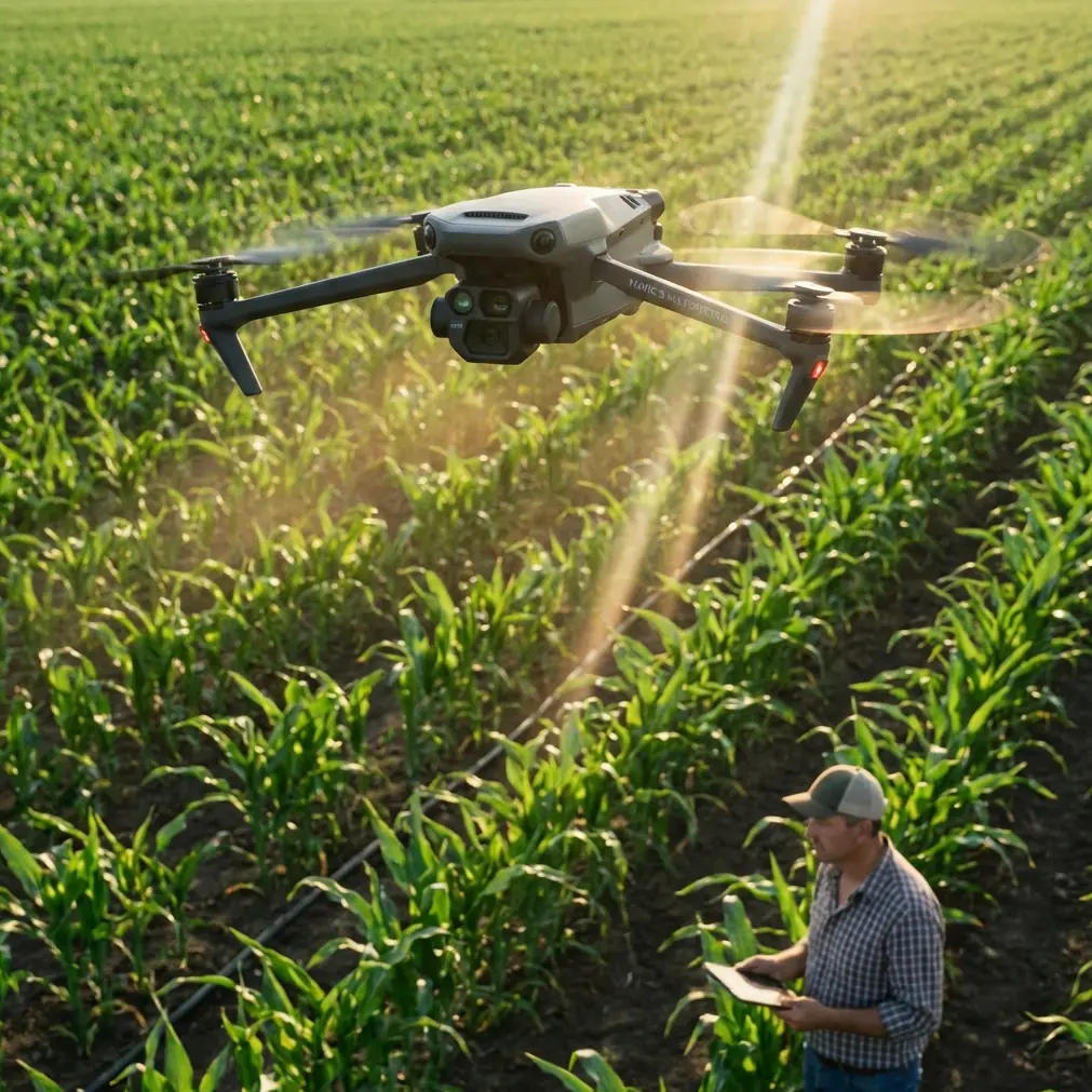
The Mavic 3M sits in an interesting lane of the UAV market. It is not a heavy spray platform, and it is not a cinematic toy. Its operational value comes from turning flight into agronomic evidence. Multispectral data can reveal row variability, canopy vigor differences, drainage patterns, disease stress signals, and gaps that broad visual inspection often misses. In coastal vineyards, where salt exposure, wind, shifting humidity, and uneven terrain can all influence vine performance, that kind of insight becomes actionable fast.
But here is the uncomfortable truth: good multispectral output depends on boring discipline.
One of the referenced photography pieces raises a deceptively simple question that many operators still get wrong: what comes first in capture workflow—metering, composition, or focus? The original discussion is aimed at imaging practice more broadly, yet the operational lesson carries directly into Mavic 3M fieldwork. When people rush the order of image decisions, they lose efficiency and may miss decisive moments. In vineyard surveying, the “decisive moment” is not artistic. It is the narrow environmental window when light, wind, and aircraft status line up well enough to produce comparable data across blocks.
Sequence matters because consistency matters.
A Mavic 3M mission is not just “fly and map.” It is inspect, clean, verify, stabilize, plan, then launch. In coastal conditions, I would push one pre-flight cleaning step higher on the checklist than many teams currently do: clean and inspect the vision sensors, airframe seams, and camera glass before every survey day, not just after obvious contamination. Salt haze and fine residue can degrade obstacle sensing confidence, interfere with safety behavior, and compromise the optical clarity your multispectral workflow depends on. Even if the aircraft maintains an environmental protection rating such as IPX6K on related field-oriented equipment categories, no rating replaces a wiped sensor surface and a confirmed clean lens.
That is not housekeeping for its own sake. It is risk control. It also preserves data quality.
The insurance headline changes the operational conversation
Another recent development is even more concrete. In Chongqing, a consortium led by PICC Property and Casualty and involving 18 insurance institutions reportedly issued the first policy under a compulsory unmanned aircraft liability insurance pilot, covering 194 drones for a low-altitude technology company tied to China Aerospace Science and Technology Corporation.
Those numbers matter.
Not because vineyard operators suddenly need to think like a fleet manager of 194 aircraft, but because the market is moving toward a world where drone accountability is formalized at scale. When the first compulsory-style liability pilot reaches real issuance, the discussion shifts. Drone missions are no longer framed purely as technical tasks. They become insurable operational activities with defined responsibilities.
For Mavic 3M operators in vineyards, especially near populated roads, wineries, tourist footpaths, utility corridors, or coastal service areas, that shift is significant. It means clients, cooperatives, and site managers will increasingly ask a harder set of questions:
- Is the aircraft registered correctly?
- Is the mission documented?
- Is operator workflow standardized?
- Is liability coverage in place?
- Are pre-flight checks auditable?
- Is the captured data defensible if a crop-management decision depends on it?
This is where many small operations still lag. They focus on the map output, not the operational record behind it. Yet the insurance signal suggests that record-keeping and procedural consistency will only gain importance.
In other words, the Mavic 3M is becoming part of a professional system, not just a clever tool.
A practical coastal vineyard workflow that fits the moment
Let’s translate the news into field practice.
If you are surveying vineyards near the coast, begin by treating each mission as both a sensing task and a compliance event. The low-altitude economy’s move toward scenario validation means your stakeholders care about reliability in context. The insurance pilot means accountability is becoming institutional. The imaging workflow story means the order of actions affects whether data is usable.
Here is the workflow I recommend.
First, inspect and clean before power-up. Wipe the camera glass, multispectral sensor windows if accessible by approved method, downward and forward vision surfaces, landing gear contact points, and battery terminals. In coastal air, invisible residue accumulates faster than crews think. This single step supports both safety features and image integrity.
Second, confirm environmental suitability before route loading. Coastal sites are deceptive. Wind can feel manageable at standing height but behave very differently over vine rows and ridge lines. If your mission is intended to compare canopy vigor over time, unstable conditions introduce noise that no post-processing can fully remove.
Third, wait for RTK stability. Do not shortcut the RTK fix rate check because you are pressed for time. A survey intended for row-level analysis benefits from centimeter precision only if the positioning solution is actually locked and stable before the mission starts. In practice, that determines whether repeated surveys align cleanly enough to support temporal comparison.
Fourth, set the mission around agronomy, not around battery convenience. Your swath width should fit row spacing, terrain complexity, and the level of canopy detail required. Wider is not always better. The point is not maximum acreage per flight. The point is interpretable data.
Fifth, separate survey logic from spray logic, but understand both. A Mavic 3M does not perform spraying, yet vineyard managers often use its outputs to inform treatment decisions. That means your maps may influence choices around spray drift risk, nozzle calibration on application platforms, and block-by-block intervention timing. If the survey overstates stress in a wind-exposed corner, you may trigger unnecessary treatment. If it misses a weak pattern along a coastal edge, the next spray pass may be poorly targeted. Survey quality has downstream consequences.
Sixth, log anomalies immediately after landing. Reflection off irrigation surfaces, unexpected canopy gaps, weak GNSS behavior near infrastructure, and lens contamination events should be written down while they are fresh. This habit is one of the easiest ways to make future maps more trustworthy.
The bigger Chinese low-altitude story is not abstract
The People’s Daily summary highlights several examples of how drones are already being woven into practical work: tethered aircraft for disaster lighting, transport drones helping move harvests, and swarm displays drawing attention in urban skies. It also notes that in agricultural provinces such as Shandong, Henan, and Sichuan, plant-protection drones have already reached scaled use in major pest-control work, while high-altitude and cold-region power-grid operations have expanded in places like Yunnan and Tibet.
For Mavic 3M users, the significance is not that every vineyard survey resembles those missions. It is that drones are being normalized across very different operating environments. Agriculture, emergency response, logistics, utility inspection: these sectors create institutional pressure for better infrastructure, more predictable airspace rules, stronger training expectations, and more mature risk transfer tools.
That broader ecosystem benefits precision survey aircraft too.
A vineyard manager in a coastal region might think national low-altitude policy has little to do with a morning multispectral mission over grape rows. I would argue the opposite. When airspace management becomes more refined and infrastructure grows, smaller professional missions become easier to schedule, justify, and scale. When insurance pilots move from concept to real policies, site access negotiations become simpler. When operators internalize the order of image capture rather than improvising in the field, data quality rises.
That is how an industry matures: not through one dramatic leap, but through a stack of practical improvements that reinforce each other.
What expert operators should change now
If I were advising a coastal vineyard team deploying Mavic 3M this season, I would make four immediate changes.
The first is procedural: standardize the pre-flight cleaning and sensor inspection routine. Salt contamination is a slow thief. It reduces confidence gradually, which is why teams underestimate it.
The second is documentary: create a one-page mission record that includes wind notes, RTK status, sensor condition, battery IDs, and any environmental oddities. If insurance and compliance scrutiny increase, this will save time later.
The third is analytical: train crews to understand that image sequence is operational, not artistic trivia. The question of whether to meter, compose, or focus first is really a question about whether you control the variables that shape usable data. Sloppy sequence creates false confidence.
The fourth is strategic: connect Mavic 3M outputs directly to field actions, but only with clear thresholds. If a map suggests stress, define what follow-up inspection is required before treatment decisions are made. This reduces the chance that multispectral data gets over-interpreted.
If your team is building that kind of workflow and wants to compare notes with practitioners working through similar field conditions, this field-ops chat link is a practical place to start: https://wa.me/example
Mavic 3M’s role is getting sharper, not broader
There is a temptation in the drone market to make every aircraft sound universal. That is not how good operations work. The Mavic 3M earns its place by doing one class of job very well: producing field intelligence that supports agronomy, survey repeatability, and operational decision-making.
The current news cycle reinforces that role. One story focuses on the order of image-making decisions and the cost of getting the sequence wrong. Another points to a national environment where 2026 may mark the shift from pilot-stage experimentation to validated use cases. A third introduces a compulsory-liability pilot with 18 participating insurers and coverage issued for 194 aircraft, signaling that institutional responsibility is catching up with technical adoption.
Put together, these are not random headlines. They are a roadmap.
For coastal vineyard surveying, the message is clear. Fly cleaner. Log better. Wait for positioning certainty. Respect capture order. Treat multispectral output as evidence, not decoration. And operate as if every mission now sits inside a more mature low-altitude ecosystem—because increasingly, it does.
That is where the Mavic 3M makes the most sense: not as a novelty, but as a disciplined survey instrument working inside an industry that is finally building the surrounding structure it always needed.
Ready for your own Mavic 3M? Contact our team for expert consultation.