Capturing Vineyard Health with Mavic 3M | Expert Tips
Capturing Vineyard Health with Mavic 3M | Expert Tips
META: Learn how the DJI Mavic 3M transforms vineyard monitoring with multispectral imaging. Expert tips for optimal flight settings and actionable crop health data.
TL;DR
- Optimal flight altitude of 30-50 meters delivers the best balance between coverage and multispectral resolution for vineyard canopy analysis
- RTK Fix rate above 95% ensures centimeter precision for repeatable flight paths across growing seasons
- Multispectral bands detect vine stress 2-3 weeks before visible symptoms appear
- Proper nozzle calibration and swath width planning prevent data gaps in row-by-row coverage
The Remote Vineyard Challenge
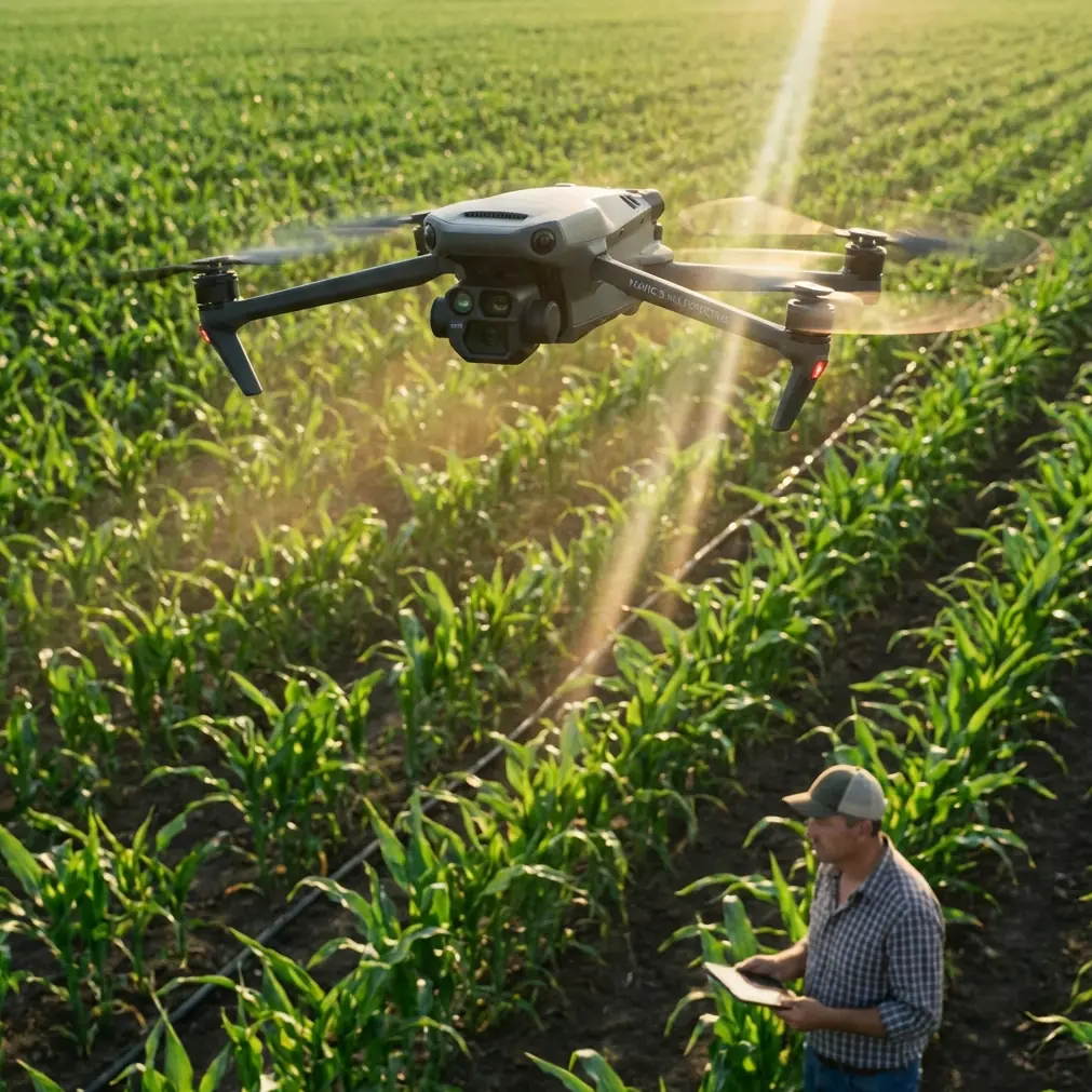
Vineyard managers in remote regions face a critical monitoring problem. Traditional scouting methods miss early-stage vine stress, and by the time symptoms become visible, yield damage is already occurring. The DJI Mavic 3M solves this with four multispectral bands plus RGB imaging in a compact, field-deployable package.
This guide covers the exact flight parameters, sensor settings, and data workflows that transform raw multispectral captures into actionable vineyard intelligence. You'll learn altitude optimization, RTK configuration for centimeter precision, and common calibration mistakes that compromise data quality.
Why Multispectral Imaging Changes Vineyard Management
Standard RGB cameras capture what human eyes see. Multispectral sensors reveal what they cannot—chlorophyll absorption patterns, water stress indicators, and nutrient deficiencies hiding beneath green canopy surfaces.
The Mavic 3M integrates a 20MP RGB camera alongside a dedicated multispectral array featuring:
- Green band (560nm ± 16nm) for chlorophyll content assessment
- Red band (650nm ± 16nm) for vegetation stress detection
- Red Edge band (730nm ± 16nm) for early stress identification
- Near-Infrared band (860nm ± 26nm) for biomass and vigor mapping
This combination generates NDVI, NDRE, and custom vegetation indices without post-processing band alignment—each frame captures all five channels simultaneously with sub-pixel alignment accuracy.
Expert Insight: The Red Edge band is your secret weapon for vineyard work. It penetrates canopy layers more effectively than standard red, detecting stress in lower leaf zones that red-only sensors miss entirely.
Optimal Flight Parameters for Vineyard Capture
Altitude Selection: The 30-50 Meter Sweet Spot
Flight altitude directly impacts ground sampling distance (GSD), coverage efficiency, and data quality. For vineyard multispectral work, 30-50 meters AGL delivers optimal results.
At 30 meters, the multispectral sensor achieves approximately 2.5cm/pixel GSD. This resolution distinguishes individual vine health variations within rows. At 50 meters, GSD increases to roughly 4.2cm/pixel—still sufficient for block-level analysis while covering 40% more area per battery.
| Altitude (m) | GSD (cm/px) | Coverage/Battery | Best Use Case |
|---|---|---|---|
| 25 | 2.1 | ~15 hectares | Individual vine analysis |
| 30 | 2.5 | ~18 hectares | Row-level stress mapping |
| 40 | 3.3 | ~24 hectares | Block comparison studies |
| 50 | 4.2 | ~30 hectares | Whole-vineyard surveys |
For remote vineyard operations where battery logistics matter, 40 meters often represents the practical optimum—sufficient resolution for actionable stress detection with extended coverage per flight.
Speed and Overlap Configuration
Flight speed affects image sharpness and overlap consistency. The Mavic 3M performs optimally at 5-7 m/s for multispectral capture, allowing the sensor adequate exposure time while maintaining mission efficiency.
Configure overlap settings based on terrain complexity:
- Flat terrain: 70% frontal, 70% side overlap
- Moderate slopes (5-15°): 75% frontal, 75% side overlap
- Steep hillside vineyards (>15°): 80% frontal, 80% side overlap
Higher overlap compensates for altitude variations in terrain-following mode and ensures complete coverage despite GPS drift between passes.
RTK Configuration for Centimeter Precision
Remote vineyard locations often lack cellular connectivity for NTRIP corrections. The Mavic 3M supports RTK positioning through the DJI D-RTK 2 base station, achieving 1cm horizontal and 1.5cm vertical accuracy independent of network infrastructure.
Achieving 95%+ RTK Fix Rate
RTK Fix rate measures the percentage of captured images with full centimeter-precision positioning. Target 95% or higher for professional vineyard mapping.
Factors affecting Fix rate in remote locations:
- Base station placement: Position on stable ground with clear sky view above 15° elevation
- Satellite constellation: Enable GPS, GLONASS, Galileo, and BeiDou for maximum satellite availability
- Initialization time: Allow 3-5 minutes for RTK convergence before launching missions
- Multipath avoidance: Keep base station away from buildings, vehicles, and metal structures
Pro Tip: In remote valleys with limited sky visibility, schedule flights during optimal satellite geometry windows. Use GNSS planning apps to identify periods with PDOP values below 2.0 for your specific location.
Why Centimeter Precision Matters for Vineyards
Repeatable flight paths across growing seasons enable change detection analysis. When each image geotags to within 1-2 centimeters, you can overlay May stress maps directly onto August harvest predictions and track individual vine performance longitudinally.
This precision also supports variable-rate application mapping. Spray drift management requires exact zone boundaries—RTK positioning ensures treatment maps align precisely with physical vine rows.
Swath Width Planning for Complete Coverage
Swath width determines how much ground each flight line covers. Incorrect planning creates data gaps between passes or wastes time with excessive overlap.
The Mavic 3M multispectral sensor has a 73.9° field of view. At 40 meters altitude, this produces approximately 61 meters swath width. With 75% side overlap, effective line spacing becomes roughly 15 meters.
Calculating Flight Lines for Vineyard Blocks
For a rectangular 10-hectare block (approximately 316m × 316m):
- Determine swath width at planned altitude: 61m at 40m AGL
- Apply overlap factor: 61m × 0.25 = 15.25m effective spacing
- Calculate required lines: 316m ÷ 15.25m = 21 flight lines
- Add buffer lines at edges: 23 total lines
This systematic approach prevents the coverage gaps that compromise vegetation index accuracy at block boundaries.
Sensor Calibration and Data Quality
Pre-Flight Calibration Panel Protocol
Multispectral sensors require radiometric calibration for consistent data across flights and seasons. The Mavic 3M supports calibration panel capture before and after each mission.
Calibration procedure:
- Position calibration panel on flat, shadow-free ground
- Capture panel image at mission altitude before takeoff
- Repeat panel capture immediately after landing
- Process both captures to correct for changing light conditions
Skipping calibration introduces 15-25% reflectance variation between flights, making temporal comparisons unreliable.
Sunlight Angle Considerations
Solar angle affects canopy reflectance patterns. For vineyard multispectral work, fly during 10:00-14:00 local solar time when sun angle exceeds 30° elevation. Lower angles create excessive shadow between rows and inconsistent illumination across east-west oriented blocks.
The Mavic 3M's integrated sunlight sensor helps compensate for illumination changes, but cannot fully correct for shadow contamination in low-angle conditions.
Common Mistakes to Avoid
Flying too fast for sensor exposure Speeds above 8 m/s cause motion blur in multispectral bands, particularly the narrow-bandwidth Red Edge channel. Reduce speed to 5-6 m/s for sharp imagery.
Ignoring wind effects on spray drift analysis When using multispectral data to assess spray coverage, capture baseline imagery before application. Wind conditions during spraying affect drift patterns—your drone data reveals where product actually landed versus planned zones.
Single-flight seasonal analysis One flight provides a snapshot, not a trend. Schedule monthly captures minimum during growing season to track stress development and intervention effectiveness.
Neglecting nozzle calibration parallels If using multispectral data to guide variable-rate applications, ensure sprayer nozzle calibration matches your prescription map resolution. A 2-meter prescription grid means nothing if nozzles deliver 5-meter swath variations.
Overlooking IPX6K weather limitations The Mavic 3M's IPX6K rating protects against rain and dust, but wet canopy surfaces alter spectral reflectance. Capture data when foliage is dry—typically 2+ hours after rain or heavy dew.
Frequently Asked Questions
What vegetation indices work best for vineyard stress detection?
NDRE (Normalized Difference Red Edge Index) outperforms NDVI for vineyard applications. The Red Edge band penetrates canopy layers more effectively, detecting stress in lower leaf zones before it manifests in upper canopy. Use NDVI for overall vigor assessment and NDRE for early stress identification.
How many batteries do I need for a 50-hectare vineyard survey?
At 40 meters altitude with 75% overlap and 6 m/s flight speed, expect approximately 25-30 hectares per battery in ideal conditions. A 50-hectare property requires 2-3 batteries including safety margins. Carry at least one additional battery for re-flights if data quality issues arise.
Can I fly multispectral missions in cloudy conditions?
Overcast conditions actually benefit multispectral capture by eliminating harsh shadows between vine rows. However, rapidly changing cloud cover creates illumination inconsistencies between flight lines. Fly during stable overcast or clear conditions—avoid partially cloudy skies where shadows move across the vineyard during capture.
Transforming Data into Vineyard Decisions
Raw multispectral captures become actionable intelligence through proper processing workflows. The Mavic 3M outputs standard TIFF files compatible with DJI Terra, Pix4D, and Agisoft Metashape for orthomosaic generation and index calculation.
Focus analysis on:
- Block-level vigor variation for harvest timing decisions
- Row-by-row stress patterns indicating irrigation or drainage issues
- Individual vine anomalies requiring ground-truthing
- Temporal change maps showing intervention effectiveness
The combination of centimeter precision positioning, calibrated multispectral data, and systematic flight planning transforms the Mavic 3M from an imaging tool into a vineyard management system.
Ready for your own Mavic 3M? Contact our team for expert consultation.