What a Tibet Reforestation Story Reveals About Wildlife Moni
What a Tibet Reforestation Story Reveals About Wildlife Monitoring with the Mavic 3M
META: A field-grounded analysis of how lessons from drone-assisted forestry in Shannan, Tibet translate into smarter wildlife monitoring in complex terrain with the DJI Mavic 3M.
By Dr. Sarah Chen
On March 28, officials in Shannan, Tibet announced progress in the Sangri County afforestation project tied to the broader South-North Mountain Greening effort. The work, in the Dona Village area, is part of a 2026 “plant first, subsidize later” forestry program. One detail stands out: local people were using drones to improve the efficiency of tree planting and transport.
That is not a wildlife story on its face. It is a forestry and livelihoods story. But for anyone evaluating the Mavic 3M for wildlife monitoring in difficult landscapes, it is exactly the kind of real-world signal that matters.
Why? Because high-elevation, broken terrain exposes the truth about drone systems very quickly. Marketing claims disappear. What remains are the operational fundamentals: can the aircraft cover uneven ground efficiently, can it produce repeatable data, can local teams actually use it, and does it reduce labor in places where every extra trip costs time, energy, and safety margin?
The Tibet afforestation case points to all four.
The real lesson from Shannan: terrain punishes inefficiency
The reported use case in Sangri County was practical. Drones were helping local residents with planting operations and transport steps, raising efficiency in the field. That matters because mountain work is never just one task. A crew may need to move materials, inspect progress, verify coverage, and decide what needs attention next. In fragmented topography, those steps can consume more effort than the core mission itself.
Wildlife monitoring in similar terrain has the same structure. The problem is rarely “take a few aerial photos.” The problem is building a reliable observation workflow across ridgelines, slopes, shadowed valleys, and access-limited habitat without over-disturbing animals or exhausting staff.
That is where the Mavic 3M becomes relevant.
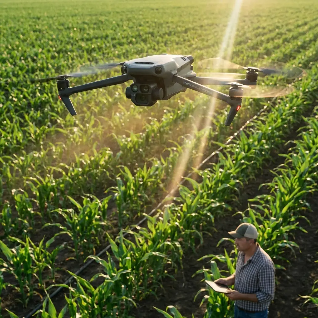
The Mavic 3M is not a transport platform, so it does not mirror the forestry mission directly. Its value is different. It turns inaccessible ground into measurable information. In rugged monitoring programs, that distinction is crucial. If a local forestry project can already benefit from drones simply by improving planting and transport efficiency, then a sensor-focused aircraft with multispectral capability has an even stronger case where the goal is habitat assessment, vegetation stress detection, corridor mapping, and repeatable ecological observation.
Why multispectral matters more in wildlife work than many teams realize
A wildlife monitoring mission in complex terrain often fails before the first flight line if the team confuses animal monitoring with habitat monitoring. You usually cannot manage wildlife well if you only look for the animals themselves. In mountain environments, direct sightings are intermittent, weather windows are narrow, and line-of-sight can break down in seconds. Habitat condition becomes the more stable layer of truth.
This is where the Mavic 3M earns its place. Its multispectral workflow gives field teams a way to see vegetation variation that standard RGB imagery can miss. That can support habitat-use studies, feeding-area assessments, edge analysis, seasonal vegetation change review, and post-disturbance recovery tracking. In other words, instead of asking only, “Where were animals today?” you can ask the more useful management question: “What changed in the landscape that may shift animal presence over the next month?”
The Shannan afforestation report gives us a strong operational anchor here. The project is part of a larger ecological construction effort while also supporting local income. That dual objective—ecology plus livelihoods—is common in wildlife landscapes too. Protected areas, buffer zones, grazing interfaces, and restoration corridors often involve both ecological targets and community outcomes. A drone program that can document vegetation establishment, track restoration progress, and reduce unnecessary foot travel helps both sides of that equation.
The significance of one date and one place
A lot of drone content stays abstract. This case does not.
We have a specific date: March 28.
We have a specific place: Sangri County in Shannan, within the Dona Village area.
We have a specific activity: drone-assisted afforestation operations improving planting and transport efficiency.
And we have a specific policy frame: a 2026 forestry project under the Tibet South-North Mountain Greening initiative, designed to deliver ecological gains alongside increased local income.
Those details matter because they tell us this is not a staged demonstration. It is a field deployment in a demanding environment, tied to a real public-interest land management program. For Mavic 3M users, that is the useful signal. Mountain drone operations are not theoretical. Communities are already integrating UAVs into environmental work where terrain, labor, and logistics are serious constraints.
If your wildlife team works in similarly broken landscapes, the question is not whether drones belong there. The question is which drone workflow gives the cleanest, most repeatable environmental intelligence.
Mavic 3M as the “decision layer” in mountain wildlife programs
In rugged habitat monitoring, teams often make a costly mistake: they deploy people first, then use drone data to validate what the field crew already suspected. That reverses the logic. The Mavic 3M is most valuable when it becomes the decision layer that tells you where field effort should go.
A practical sequence looks like this:
- Fly repeated multispectral missions over habitat zones, migration corridors, restoration plots, or forage areas.
- Compare vegetation response patterns across slope aspect, elevation, and moisture gradients.
- Identify anomalies or trend shifts worth ground verification.
- Send field teams only where direct inspection is necessary.
This is exactly where the Tibet afforestation example resonates. If drones are already increasing efficiency in labor-heavy environmental work, then using the Mavic 3M to reduce unnecessary wildlife survey miles is not just convenient. It is operationally smarter.
Complex terrain changes the economics of every footstep.
Centimeter precision is not a buzzword in steep country
The context notes around RTK fix rate and centimeter precision are especially relevant for mountain wildlife work. In flatter agricultural operations, small positional errors can sometimes be tolerated depending on the task. In steep and heterogeneous habitat, those same errors can weaken longitudinal studies.
If you are comparing vegetation vigor along a ridge shoulder versus a shaded gully, or tracking the recovery of a wildlife corridor after erosion control and reseeding, positional repeatability becomes essential. Centimeter-level consistency lets you revisit the same zones with far more confidence. It sharpens before-and-after analysis and reduces ambiguity when trying to determine whether a change in plant response is real or simply a mapping mismatch.
That has direct operational significance. Better RTK fix reliability means less time arguing over data alignment and more time interpreting ecological patterns that matter. For research teams, NGOs, reserve managers, and restoration contractors, that can materially improve the quality of reporting.
What the reader scenario gets right: wildlife monitoring is usually a vegetation problem first
Monitoring wildlife in complex terrain is often framed as a detection challenge. In reality, it is frequently a landscape interpretation challenge.
Animals move according to cover, forage, disturbance, water access, thermal refuge, and seasonal plant response. The Mavic 3M’s multispectral output helps teams analyze the conditions that shape those movements. That is particularly useful in transition zones where visual interpretation alone can be misleading—for example, where healthy-looking canopy hides understory stress, or where patch edges appear uniform in RGB but diverge in vigor and moisture dynamics.
The Tibet case reinforces this wider point. The afforestation project is about ecological construction, not just moving materials from one place to another. Drone efficiency in planting and transport is the visible benefit. The larger value is that UAVs are now embedded in how landscape change gets executed and measured.
For wildlife monitoring, this means the drone is not merely a camera in the air. It is part of the ecological management system.
A third-party accessory that actually helps in mountain operations
Accessories are often discussed badly. Too much hype, not enough relevance.
For Mavic 3M work in wildlife landscapes, one genuinely useful third-party add-on is a high-visibility landing pad with weighted edge stakes designed for uneven alpine or semi-arid ground. It sounds modest, but in real field conditions it can improve launch reliability, reduce dust contamination at takeoff, and create a more controlled routine when crews are operating on rocky surfaces or sparse vegetation.
That matters more than people expect. In mountain environments, launch and recovery are often the most disorderly part of the mission. A stable, visible landing zone lowers the chance of rushed handling and helps standardize field practice across teams. If the operation includes repeated seasonal flights, that kind of procedural consistency pays off.
Not every enhancement needs to be electronic to be valuable.
Ignore the irrelevant specs
The context seed includes terms like spray drift, nozzle calibration, swath width, and IPX6K. Those belong more naturally to agricultural spraying platforms than to the Mavic 3M’s role in habitat intelligence. They are useful reminders of a broader point: choose your metrics according to mission, not according to what the industry happens to talk about.
For wildlife monitoring with the Mavic 3M, the specs that matter most are data consistency, geospatial repeatability, terrain-adapted mission planning, and field deployability. If your workflow is sound, the aircraft becomes a compact ecological survey instrument. If your workflow is weak, even excellent hardware produces attractive but shallow maps.
Why local adoption matters as much as sensor quality
Another underappreciated detail in the Shannan report is that local people were participating in the drone-enabled forestry work. That is operationally significant.
A drone program becomes durable when it can be absorbed by the people doing the land management, not just by visiting specialists. In ecology and wildlife work, this affects everything: continuity of seasonal data, frequency of missions, maintenance of flight records, and responsiveness after storms, grazing pressure shifts, or restoration setbacks.
The Tibet project is framed around both ecological improvement and increased local income. That combination should catch the attention of wildlife managers. The most resilient monitoring systems are not detached from local livelihood realities. They support them. A platform like the Mavic 3M can fit that model when it is used to document restoration outcomes, guide fieldwork efficiently, and reduce wasted effort in difficult terrain.
If you are building such a workflow and need a practical conversation about field setup rather than a generic brochure, this direct project chat is one sensible place to start.
The Mavic 3M is strongest when paired with a narrow question
The best use of the Mavic 3M in complex wildlife landscapes is not “monitor everything.” It is to define a narrow ecological question and measure it well.
Examples include:
- Is forage quality changing along a seasonal movement route?
- Which restored patches are establishing evenly, and which are failing?
- Are slope-facing differences altering vegetation recovery after intervention?
- Where should ground teams verify habitat degradation without covering unnecessary distance?
That is the real bridge from the Shannan afforestation news to the reader’s wildlife-monitoring scenario. Drone value becomes clear when terrain is difficult, labor is precious, and landscape outcomes matter more than flashy footage.
The forestry teams in Sangri County were not using drones because UAVs are fashionable. They were using them because efficiency in planting and transport made the work more practical. Wildlife teams should apply the same discipline. Use the Mavic 3M where it removes friction from ecological decision-making.
A grounded view of what success looks like
Success with the Mavic 3M in mountain wildlife programs does not mean replacing biologists, trackers, or local ecological knowledge. It means giving them a better first layer of evidence.
You map habitat condition before sending people uphill.
You revisit the same area with centimeter precision instead of relying on memory and rough visual comparison.
You detect vegetation shifts that influence wildlife behavior before those shifts become obvious from the ground.
And you build a monitoring rhythm that can survive rough access, limited labor, and the practical realities of field management.
That is why the Tibet afforestation report matters. One short news item from Shannan contains a bigger truth about drones in environmental work: in hard landscapes, useful UAVs are not defined by spectacle. They are defined by whether they help local teams do meaningful land stewardship more efficiently.
For the Mavic 3M, that is the right frame. Not hype. Not generic capability lists. A field tool for seeing habitat clearly enough to make fewer wasted moves and better ecological decisions.
Ready for your own Mavic 3M? Contact our team for expert consultation.