Mapping Forests With the Mavic 3M: Why “Negative Space”
Mapping Forests With the Mavic 3M: Why “Negative Space” Matters More Than Another Sensor Setting
META: A technical review for Mavic 3M forest mapping teams on using negative space in drone imagery to improve visual interpretation, multispectral mission planning, and decision-making in complex terrain.
Forest mapping with the Mavic 3M usually gets framed as a sensor problem. Teams talk about multispectral bands, RTK fix rate, swath width, overlap, terrain following, and centimeter precision. Those are real variables. They are not the whole story.
The more overlooked variable is visual composition.
A recent Chinese photography piece published on March 27, 2026 argued that “negative space” is not decorative minimalism but a core compositional tool that determines breathing room, subject tension, and the emotional register of an image. Read through the language carefully and there is a practical lesson here for Mavic 3M operators working in forests: a cleaner frame often carries more usable information than a crowded one.
That may sound counterintuitive in a workflow built on data density. Yet anyone who has mapped steep woodland, mixed canopy, riparian corridors, or fragmented stands knows the problem. In complex terrain, images become visually noisy fast. Branch structures overlap. Sky gaps compete with canopy signatures. Slopes distort scale perception. Shadows mimic stress signatures. Water edges confuse interpretation. If every frame is packed edge to edge with detail, the operator and the end user both work harder to see what actually matters.
This is where the photography concept of “留白,” often translated as negative space or intentional blank space, becomes operationally relevant for Mavic 3M missions.
Negative space is not art-school fluff
The source article makes two points that deserve attention from UAV mapping professionals.
First, it describes blank or simplified areas in a frame—open sky, water surfaces, plain backgrounds, or intentionally soft empty zones—as a way to make the subject clearer and give the image “breathing space.” In practical drone work, that translates into a stronger visual hierarchy. When a target area is surrounded by less clutter, anomalies become easier to recognize. Forest edge encroachment, storm damage corridors, invasive patches, drainage lines, and stand boundary irregularities all become more legible.
Second, the article notes that different placements of empty space shape different kinds of visual meaning. Left-side negative space can support a subject moving to the right. Space above a subject can amplify openness. Large minimalist areas can create stillness and precision. That sounds poetic, but it maps surprisingly well onto technical flight imagery review.
When your mission objective is forest mapping, especially with the Mavic 3M, composition affects interpretation in at least three distinct layers: field acquisition, stakeholder communication, and post-processing confidence.
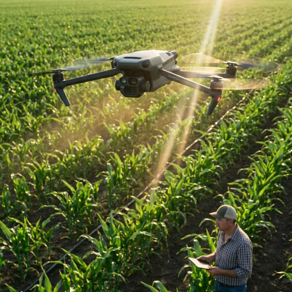
Why this matters specifically for the Mavic 3M
The Mavic 3M is not just a camera drone that happens to carry multispectral hardware. It is often deployed by teams that need to convert flight outputs into land management decisions. In forestry, those decisions may involve regeneration assessment, disease scouting, canopy gap analysis, species boundary review, erosion monitoring, or corridor planning across difficult slopes.
In these contexts, the raw dataset may be spatially rigorous, but the individual frames still influence human judgment. That is especially true during pre-processing QA, anomaly spot checks, and report generation.
A forest-mapping team typically wants two things at once:
- quantitative reliability from multispectral and RTK-enabled workflows
- qualitative clarity in the images humans actually inspect
The recent photography discussion is relevant because it challenges the “fill the frame with everything” instinct. The article explicitly pushes back against the misconception that a full frame is automatically a better frame. For Mavic 3M forestry work, that is a useful corrective.
A frame overloaded with canopy texture can reduce interpretive speed. A frame that preserves intentional open regions—sky margin, river margin, trail corridor, landslide scar, clearing boundary—often makes the subject stand out with less ambiguity.
That becomes even more valuable in mixed-elevation forests where terrain complexity already burdens the operator. If the image itself also fights for attention, small but significant patterns get missed.
Forest mapping in complex terrain: where composition meets data discipline
Let’s ground this in actual operations.
In dense or mountainous forests, pilots often focus heavily on swath width and overlap because coverage gaps are expensive. Rightly so. But if every pass is planned only for maximum area capture, image usefulness can degrade in specific edge zones. This is not a sensor failure; it is a framing failure.
Suppose you are mapping a valley forest where the mission includes canopy stress around a stream corridor. A conventional instinct is to center the densest vegetation throughout the frame. The result is often visual congestion: dark shadows, layered canopy, reflective water, and steep terrain compression all competing together.
A more disciplined approach uses negative space intentionally. You may allow the stream itself, an open gravel bar, or an adjacent sky band to occupy meaningful frame area in sample stills and inspection passes. That “unused” portion is not wasted. It creates contrast. It isolates the tree line. It improves readability of canopy boundaries and disturbance transitions.
The original source specifically highlights blank sky or water as effective forms of negative space. In forest mapping, those are not just aesthetic devices. They are separation tools.
For field teams reviewing mission outputs on a tablet or monitor, that separation reduces cognitive load. And in forestry, lower cognitive load often means better decisions.
Multispectral teams still need human-readable imagery
There is a temptation to assume that because the Mavic 3M captures multispectral data, compositional thinking belongs only to RGB photographers. That is a mistake.
Multispectral workflows are powerful, but interpretation still depends on context. A stressed patch in one band response is easier to validate when the corresponding visual frame clearly isolates the stand, the topographic break, or the moisture boundary. If the scene is visually cluttered, teams can overread spectral anomalies that are really shadow artifacts, slope effects, or adjacency contamination.
This is where a disciplined image-selection mindset pays off. During sorties, pilots and observers should identify moments where the target feature is supported by visual “breathing room.” The source article’s emphasis on giving a scene space rather than packing it with elements applies neatly here. It reduces the oppressive effect of too many competing forms, which is exactly what forest imagery often suffers from.
In practical terms, that means saving and using review frames where the target stand, skid trail, water margin, or canopy break is clearly separated by simplified surrounding space. Those images become better references for analysts, forest managers, and non-technical stakeholders.
Directional space helps explain movement and terrain processes
Another specific detail from the source is the idea that left-side blank space works well when a subject extends or moves to the right. Translate that into forestry and you get a useful reporting principle: directional empty space can help communicate processes.
If windthrow runs downslope toward the east, if disease spread follows a drainage path, or if regrowth advances from a cut edge into an older stand, the frame should leave room in the direction of change. This improves narrative clarity in technical reports.
A good forest image does not merely document where something is. It hints at what it is doing.
That matters for erosion channels, stream sediment movement, road washout progression, insect damage fronts, and canopy opening along slope transitions. For these cases, compositional room in the direction of spread or flow helps a reader understand process, not just pattern.
This is especially helpful when presenting Mavic 3M findings to mixed audiences. Analysts may trust vegetation indices. Operations managers, landowners, or environmental reviewers often trust what they can visually parse in seconds.
The quiet value of space above the canopy
The source also states that space above a subject can create a broader, more open mood. In a forest mapping context, that has a technical use beyond mood.
A small but deliberate upper-frame margin can help define canopy height transitions against the sky, making ridgeline structure, emergent crowns, snag presence, and shelterbelt breaks easier to identify in selected stills. On steep terrain, this can clarify vertical structure that gets visually compressed when every frame is jammed with tree cover from edge to edge.
No, this does not replace LiDAR or advanced structural analysis. But in the real world, teams often need fast field interpretation and report-ready visuals before a larger analytical chain is complete. In those moments, a frame with space above the canopy can carry structural cues more cleanly than a tightly cropped one.
A third-party accessory changed the workflow
One practical improvement I have seen in Mavic 3M forestry work came from a third-party tablet sun hood mounted to the remote display. It is not glamorous equipment, and it does not alter the aircraft’s multispectral payload. Yet in bright, broken light—common at forest edges and on ridges—it materially improves on-site frame evaluation.
That matters because negative space decisions are easiest to make when the operator can actually see subtle tonal separation on the screen. Open sky, water glare, soft empty margins, and low-contrast canopy boundaries are all harder to judge under harsh daylight. A sun hood reduces misreads during live composition checks and quick QA review between passes.
This is one of those small field upgrades that quietly sharpens the usefulness of an advanced aircraft. If your team is discussing setup options for forest missions, I would rather see better display readability than another accessory with no effect on interpretation. If you want to compare practical field setups, this quick chat link is the easiest way to continue the discussion: message our UAV mapping desk.
Don’t confuse emptiness with inefficiency
There is a habit in technical UAV work of treating anything outside the core target as excess. That mindset can be costly.
The source article argues that empty or simplified visual zones do more than strip away distraction. They also create room for imagination and subtlety. For a technical audience, “imagination” may sound imprecise, but the underlying point is valid: when the frame is not overcrowded, the viewer can infer relationships more easily.
In forest mapping, those inferred relationships include:
- the distance between a stressed stand and a water source
- the spread direction of a disturbance front
- the separation between canopy openings and intact cover
- the spatial tension between ridge, slope, and drainage line
A frame with no visual breathing room can bury those relationships.
The result is a paradox. Teams collect more detail but understand less.
What this means for mission planning
If you fly the Mavic 3M in forests, here is the operational takeaway from this photography discussion.
Do not reserve compositional thinking for marketing shots or final report covers. Use it inside your technical workflow.
That means planning not only for overlap, swath width, and RTK-supported positional consistency, but also for moments of visual separation. During acquisition and review, look for frames where open sky, water surfaces, trail corridors, clearings, or softened background zones help define the subject.
For steep or crowded woodland sites, I recommend three habits:
First, identify natural separators before takeoff. Stream channels, meadow edges, roads, landslide scars, logging decks, and canopy gaps can all function as negative space anchors.
Second, during manual still capture or review sampling, avoid the urge to center dense canopy every time. Let the subject breathe when the operational story benefits from it.
Third, use those cleaner frames in your technical communication. They often explain a multispectral finding faster than a denser image with more raw detail.
Final assessment
The March 27, 2026 photography article is not about forestry drones. On the surface, it is about composition. Yet its central claim—that blank space is a decisive part of meaning, not a missing part of the frame—is directly useful for Mavic 3M teams mapping forests in difficult terrain.
Two details from that piece stand out operationally. One is the idea that open regions such as sky or water give a subject breathing room and sharpen visual focus. The other is that the placement of that space changes how a viewer reads direction, openness, and calm. Both matter in real drone mapping. They help analysts isolate target features, reduce clutter-driven misinterpretation, and produce report imagery that explains forest conditions more clearly.
The Mavic 3M gives you rich data. That does not remove the need for visual judgment. In many cases, it raises the stakes for it.
When the terrain is complicated, the best frame is often the one that leaves something out.
Ready for your own Mavic 3M? Contact our team for expert consultation.