Mavic 3M Best Practices for Windy Coastline Missions
Mavic 3M Best Practices for Windy Coastline Missions: What Recent Drone News Actually Changes
META: Expert how-to for flying the Mavic 3M on windy coastlines, with practical guidance on video capture discipline, school-based drone education, and why strict airspace compliance matters.
I’ve spent enough time around shorelines to know that coastal flying punishes sloppy habits fast. Salt haze softens contrast. Gusts arrive sideways. Light changes by the minute. And if your workflow is casual, the aircraft exposes it.
That is why three recent drone news items, while seemingly unrelated, say something useful for anyone planning a Mavic 3M mission near the coast. One piece focused on simple smartphone video settings for beginners. Another covered a school drone science event in Guoyang County, where theory and live demonstrations were deliberately paired. The third came from Kunming police, who reported a pilot being detained for 5 days and fined 1000 yuan for unauthorized flying in controlled airspace and exceeding altitude limits without approval.
If you operate a Mavic 3M, those stories connect more tightly than they first appear.
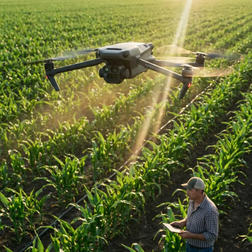
The Mavic 3M is not a casual toy aircraft. It is a multispectral platform built for data capture, repeatability, and operational reliability. Yet most mission failures still come from basic human decisions: wrong settings, weak planning, or a loose attitude toward compliance. For coastline work in windy conditions, that gap between hardware capability and pilot discipline becomes the whole story.
Why this matters specifically for Mavic 3M users
Many people hear “Mavic 3M” and think first about multispectral agriculture, vegetation analysis, or centimeter-level mapping workflows. Fair enough. The aircraft earns that reputation. But the discipline required for clean crop intelligence is exactly the discipline that helps on a windy shoreline: clear mission intent, correct resolution settings, stable capture procedures, and strict control over the operating environment.
I learned this the hard way on a coastal documentation job years ago. The aircraft was fine. The pilot workflow was the weak link. A phone call interrupted ground recording during a short weather window, and the backup footage was recorded at settings that looked acceptable on a phone but fell apart once we reviewed detail on a larger monitor. The flight itself was recoverable. The mission output wasn’t.
That is why the smartphone video advice from the recent Chinese article is more relevant than it sounds. One of its core recommendations was straightforward: choose resolution based on purpose. Use 1080P for short-form sharing, and use 4K 30fps for high-quality archive footage. It also advised prioritizing 1080P 30fps in low light because it admits more light and reduces visible noise, and it recommended enabling airplane mode while keeping Wi-Fi active to avoid incoming calls interrupting recording.
Those are simple ideas. They are also operationally smart.
A Mavic 3M coastline mission usually involves more than the aircraft alone. You may be capturing ground reference video, documenting launch conditions, recording shoreline erosion markers, or gathering visual notes for later interpretation alongside multispectral outputs. If your phone-based documentation pipeline is weak, your mission record becomes fragmented. That matters when you need to compare wind conditions, tidal context, or the timing of image capture against the final stitched dataset.
Start with the mission outcome, not the aircraft
The first question is not, “What can the Mavic 3M do?” It is, “What do I need from this sortie?”
On a coastline, that answer tends to fall into three buckets:
- visual documentation of shoreline condition
- multispectral data capture for vegetation or surface analysis
- repeatable mapping under changing wind and light
Each one places different pressure on your settings and flight style.
If your mission is mainly interpretive and report-driven, you need consistent, reviewable imagery. If your output is scientific or operational, repeatability matters more than cinematic flair. If you are assessing exposed vegetation, marsh edges, or salt-affected surfaces, the multispectral payload becomes far more than a bonus. It becomes your reason for flying.
This is where the school outreach story from Guoyang County is surprisingly instructive. The event did not stop at lecture content. It deliberately combined a drone science talk with live operational demonstrations. That “theory plus practice” structure is exactly how competent Mavic 3M operators should prepare for fieldwork. Coastal flying punishes people who know only the manual or only the sticks. You need both.
In practical terms, that means every shoreline mission should have two layers:
- a conceptual plan for what you are measuring or documenting
- a field execution plan for how you will actually capture it in wind
Without the first, you collect images without meaning. Without the second, you fail before the data becomes usable.
Resolution discipline is not just for creators
Let’s come back to that first news item, because the resolution advice maps well to real Mavic 3M fieldwork.
If you are using a phone or secondary device to record field notes, launch footage, or reference clips, reserve 4K 30fps for material you may need to inspect later in detail. That includes wave line position, vegetation movement, surface texture, and any evidence of wind severity that helps explain anomalies in your dataset. For quick stakeholder updates or internal messaging, 1080P is usually enough.
The low-light recommendation matters even more at the coast. Early morning and late afternoon are common windows for reducing harsh glare, but they also bring softer light and sometimes haze. In those conditions, favoring 1080P 30fps on support footage can indeed produce cleaner results than pushing resolution at the expense of noise. This is not a creative shortcut. It is a documentation decision.
And the airplane-mode tip is the kind of thing professionals stop laughing at after one bad day. If you are using a phone for ground recording, hotspot support, or mission notes, preventing a call from interrupting your process is basic risk control. I now treat it as part of preflight, right alongside checking battery condition and wind direction.
Wind changes how you should think about swath and repeatability
The Mavic 3M’s strength is structured capture. On exposed coastlines, that only works if you respect how wind distorts your assumptions.
Crosswinds affect more than aircraft feel. They can alter ground speed consistency, change effective overlap, and introduce subtle variability across a planned swath. If you are building repeatable datasets, especially where vegetation edges or salt-marsh transition zones matter, a stable flight profile is more valuable than squeezing maximum coverage from every battery.
That is where experienced operators start thinking less like hobby pilots and more like survey managers. Swath width is not just a software number on a map. In wind, it becomes a question of how much useful coverage you can hold while preserving overlap quality and minimizing correction headaches later. A slightly tighter plan often produces a better dataset than a broad aggressive grid flown at the edge of controllability.
If your operation depends on RTK-supported accuracy, coastline conditions add another wrinkle. Maintaining a strong RTK fix rate is not simply about turning the feature on. You need a takeoff area with clean signal conditions, proper setup time, and the judgment to abort if the environment undermines the reliability you need. Centimeter precision sounds impressive in a spec discussion. In the field, it is a chain of conditions that can be weakened by impatience.
Compliance is not the boring part of the mission
The Kunming enforcement report should get every professional’s attention. The case involved unqualified flying, unauthorized operation in controlled airspace, and over-altitude flight. The result was not a warning. It was administrative detention for 5 days and a 1000 yuan fine.
For coastal operators, this matters because shorelines often sit near ports, urban edges, protected zones, infrastructure corridors, or other sensitive airspace environments. Beautiful scenery does not mean simple airspace. In many regions, coastline missions create a false sense of openness because pilots visually perceive “empty water” and assume lower risk. Regulators do not see it that way.
For a Mavic 3M user, compliance is also tied directly to data value. A flight that generates good imagery but violates airspace rules is not professionally useful. It exposes the operator, compromises the client, and undermines the legitimacy of drone-based data collection more broadly.
My rule is blunt: if the authorization picture is unclear, the mission is not ready.
That mindset is especially important for consultants and in-house teams trying to normalize multispectral operations. Every legal, well-documented mission builds trust in advanced UAV work. Every reckless one makes the next approval harder for everyone.
A field workflow that actually holds up
For windy coastline work with the Mavic 3M, I recommend a workflow built around restraint rather than bravado.
First, define the mission product. Are you mapping vegetation stress, documenting erosion, comparing seasonal shoreline change, or collecting supporting visuals for a report? That determines whether your priority is spectral consistency, visual detail, or repeatability over time.
Second, structure your capture stack. The aircraft handles the main task, but your supporting devices matter. If you are recording contextual footage on a phone, use the same discipline highlighted in the recent video settings article: 4K 30fps for archival review, 1080P for quick distribution, and 1080P 30fps in darker conditions where cleaner capture matters more than pixel count. Switch the phone to airplane mode with Wi-Fi enabled before launch. It is a tiny step that protects continuity.
Third, assess the coast as a moving environment, not a static backdrop. Wind over dunes, seawalls, rocky outcrops, and open surf lines behaves differently within surprisingly short distances. Do a short stability check before committing to the full pattern. If the aircraft is working too hard just to hold your planned lines, your mission design needs adjustment.
Fourth, think about overlap and swath width conservatively. A clean dataset with stronger consistency beats a wider but compromised one. This is where the Mavic 3M rewards professional patience.
Fifth, treat compliance as part of your data quality standard. Controlled airspace, altitude limits, and local approvals are not separate from mission planning. They are mission planning.
Why education stories matter to operators
The Guoyang County school event might seem far removed from professional drone operations, but I read it differently. The organizers built the activity around two elements: a science lecture and practical demonstration. Even the early interactive Q&A mattered, because it got students actively thinking rather than passively watching.
That is the right model for this industry.
Good Mavic 3M teams are built the same way. They do not just train people to press the right buttons. They teach why multispectral capture works, how environmental conditions affect results, and what practical behaviors reduce error. When that understanding is present, field decisions get better. Pilots choose safer launch points. They notice when wind is corrupting consistency. They stop treating compliance as someone else’s problem.
If you are building an internal drone program, that story is a useful reminder: technical competence grows faster when explanation and hands-on execution stay connected.
The real lesson from these three news items
Taken together, the news points to a single truth. Advanced UAV work still depends on basic discipline.
The smartphone article reminds us that capture settings and interruption control matter. The school science event shows that theory and practice need to move together. The Kunming enforcement case proves that noncompliant flying carries real consequences, not theoretical ones.
For Mavic 3M operators on windy coastlines, that combination is almost a checklist for professional maturity.
Use the right settings for the output you actually need.
Train in a way that connects concepts to field behavior.
Never separate flight quality from legal airspace discipline.
That is not glamorous advice. It is the kind that keeps your missions useful.
If you are planning a coastal Mavic 3M workflow and want a second set of eyes on mission design, overlap strategy, or compliance checks, you can message me here. I prefer reviewing plans before the field day gets expensive.
The Mavic 3M makes difficult work easier, but it does not make careless work safe. On a windy shoreline, that distinction shows up in every battery cycle, every line flown, and every dataset you bring home.
Ready for your own Mavic 3M? Contact our team for expert consultation.