Surveying Dusty Solar Farms with the Mavic 3M
Surveying Dusty Solar Farms with the Mavic 3M: What Actually Matters in the Field
META: A field-driven case study on using the DJI Mavic 3M for dusty solar farm surveys, with practical insight on multispectral workflows, RTK precision, aperture discipline, and why data quality depends on more than sensor specs.
Dust changes everything on a solar site.
It settles on modules, softens contrast, confuses visual interpretation, and turns a clean mapping plan into a data-quality problem. On paper, the Mavic 3M looks like an easy fit for solar asset work because it combines RTK-enabled mapping with multispectral capture in a portable platform. In practice, that combination only delivers value if the operator understands a more basic truth: better data is not created by chasing a single spec.
That point shows up in an unexpected place. A photography blogger posting on April 26, 2026 argued that roughly 90% of people use the wrong aperture when shooting flowers. The takeaway was not about flowers at all. It was about image-making habits. People cling to fixed formulas such as “single flower at F1.8” or “flower field at F11,” then wonder why the result lacks clarity, subject separation, or mood. The blogger’s real point was that background blur is not just a function of a large aperture. It depends on depth of field control, subject emphasis, and the visual outcome you actually need.
That same mistake appears all the time in drone operations. On solar sites, teams often obsess over one headline feature—multispectral, RTK, resolution, AI processing, whatever is fashionable—and ignore the operational chain that makes those features useful. With the Mavic 3M, the strongest results come from treating the aircraft as a system rather than a spec sheet.
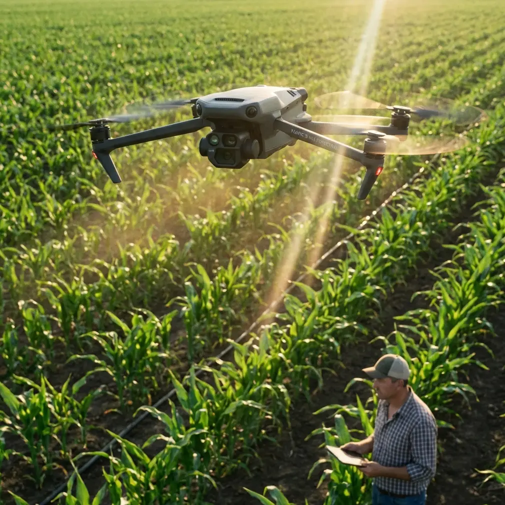
A solar farm case: dust, repetition, and false confidence
Consider a utility-scale solar farm in a dry region. Rows are repetitive. Surfaces are reflective. Dust loading is uneven across blocks. Some strings show obvious buildup, while others only reveal subtle consistency shifts when you compare plant sections over time. In this environment, visual flights alone can miss patterns, but raw multispectral collection without strong geospatial discipline can create a different problem: you get lots of images, but limited confidence in the change map.
This is where the Mavic 3M stands apart from general-purpose prosumer drones. Its value is not simply that it can capture multispectral data. It is that it can tie that data to repeatable mapping outputs with centimeter-level positioning when RTK conditions are properly managed. For solar operators, that matters because the job is rarely “take nice pictures.” The job is to revisit the same blocks, compare cleaning cycles, inspect soiling trends, prioritize maintenance, and produce records that stand up to engineering review.
A weak RTK fix rate can quietly undermine that process. Even if image quality looks acceptable on screen, inconsistent positioning makes temporal comparison harder, especially across long panel corridors where edge matching and repeatability matter. In a dusty solar scenario, the operational significance of RTK is simple: you are not just documenting what the site looks like today, you are building a traceable layer for comparison against future surveys. That is the difference between pretty imagery and actionable asset intelligence.
Why multispectral earns its place here
Dust on panels is not only a cleanliness issue. It is a performance and maintenance scheduling issue. Standard RGB imagery can identify obvious accumulation, access-road encroachment, wash runoff patterns, or damaged surfaces. But multispectral capture adds another layer by making subtle reflectance differences easier to track across sections of the site.
For agriculture, multispectral tools are usually discussed in relation to crop vigor. One 2016 paper on UAV plant protection in China described how unmanned aircraft, combined with GPS and GIS, support modern agricultural operations by improving aerial efficiency and enabling precision information gathering. The same logic carries directly into solar farm surveying. Replace crop health with panel-condition pattern analysis, and the principle remains: when aerial data is georeferenced well, repeated flights become a management system instead of a one-off inspection.
That matters more than many teams expect. On dusty sites, soiling is rarely uniform. Wind direction, perimeter traffic, grading, nearby construction, and drainage all create patchiness. The Mavic 3M’s multispectral workflow helps reveal those block-level differences faster than a purely manual visual review, particularly when the operator is trying to distinguish between random surface variation and recurring environmental drivers. A competitor drone with a stronger marketing emphasis on high-resolution visual output may still lag here if it cannot deliver the same integrated, repeatable multispectral mapping workflow in a compact field package.
The aperture lesson nobody should ignore
Now back to that flower-photography example, because it has direct operational value.
Drone users also fall into formula thinking. Fly at this height. Use that shutter. Pick this overlap. Trust this default. The result is often “good enough” imagery that does not quite answer the inspection question. In dusty solar mapping, image settings should be chosen for consistency, panel detail retention, and minimized interpretation errors—not based on generic rules borrowed from another mission type.
The blogger’s critique of the “F1.8 for one flower, F11 for a flower field” mindset is useful because it exposes a bad habit: believing one variable explains the entire image. On a solar farm, one variable never explains the whole dataset. Not multispectral. Not RTK. Not flight speed. Not altitude.
Operationally, that means:
- A clean RTK solution without disciplined overlap planning can still leave weak reconstruction areas.
- Strong multispectral capture without repeatable mission timing can reduce comparability between survey dates.
- Sharp visual images without proper interpretation methodology can still misclassify dust effects versus reflection artifacts.
The Mavic 3M rewards operators who understand that mapping quality comes from controlling the chain.
Dusty environments punish weak workflow design
Solar farms are unforgiving for another reason: they expose corners cut in mission planning.
Dust affects takeoff and landing zones, lens surfaces, folding-arm handling, and turnaround speed between flights. A larger enterprise aircraft can absolutely perform well, but there is a reason compact systems like the Mavic 3M are attractive to consultants and O&M teams. You can move quickly across sections, redeploy without a heavy support footprint, and run repeatable surveys with less logistical drag.
This is also where competitors sometimes lose ground. Some alternative platforms offer modular payload flexibility, but that flexibility can add setup complexity, calibration overhead, or workflow fragmentation. The Mavic 3M excels when the mission demands fast movement between blocks, consistent geospatial output, and multispectral capture from one integrated aircraft. For consultants working under site access limits or narrow weather windows, that integration is not a convenience feature. It is time recovered in the field.
And on dusty sites, time matters. Longer setup means more contamination risk, more interruptions, and greater chance that changing light conditions will affect comparability. A platform that gets airborne quickly and repeats accurately often beats a theoretically more configurable system that slows the crew down.
A note on “spray drift” thinking in a solar context
Spray drift and nozzle calibration belong to agricultural UAV discussions, not solar inspection. Still, the underlying concept is surprisingly relevant.
The 2016 cotton-field UAV paper emphasized that aerial application performance depends on more than the aircraft itself. Supporting technologies, standards, and trained service teams all matter. In crop work, poor nozzle calibration or drift control compromises the mission. In solar surveying, the equivalent failure is poor mission calibration and environmental discipline. If your reflectance workflow, RTK process, or site repeatability is loose, the aircraft may perform perfectly while the data outcome still disappoints.
That is why experienced operators build standard operating procedures around the Mavic 3M instead of relying on default settings. On a dusty solar site, those SOPs typically cover panel row orientation, time-of-day consistency, control of takeoff contamination, lens inspection intervals, and RTK verification before each block. None of that sounds glamorous. All of it affects whether the final map can support maintenance decisions.
Why logistics history matters when evaluating drone platforms
There is another reference point worth paying attention to. A technical project document on EHang described a 2016 agreement with Lung Biotechnology involving the purchase of 1,000 drones for rapid artificial-organ transport. Strip away the financial framing and one operational idea stands out: serious buyers in high-consequence logistics care about reliability, throughput, and repeatability at scale.
That principle applies to solar surveying too.
A drone chosen for commercial asset work should not just be capable of flying a demo mission. It should fit into repeat operations where every sortie contributes to a stable workflow. The Mavic 3M’s appeal in solar is similar in spirit. The aircraft is useful not because it produces a dramatic one-time result, but because it can be integrated into a repeat inspection cadence across large sites. Dust trends, cleaning validation, construction-stage comparisons, and vegetation encroachment monitoring all benefit from that operational regularity.
This is one of the clearest distinctions between enterprise-oriented workflows and hobby-style drone use. The flight is only the visible part. The real product is a repeatable decision pipeline.
Where the Mavic 3M genuinely outperforms many alternatives
The Mavic 3M is especially strong when all of the following are true:
You need multispectral and standard mapping in one field-ready platform.
This reduces switching delays and simplifies deployment across multiple solar blocks.You care about centimeter precision over repeated surveys.
RTK-backed mapping is not just a nice-to-have when comparing soiling patterns or maintenance outcomes over time.The site is dusty and operational simplicity matters.
Compact deployment lowers friction. Less friction usually means better consistency.Your team is small.
Large aircraft can be powerful, but they often demand more support, more planning overhead, and more downtime between zones.
Where some competitors may edge ahead is in highly specialized workflows that require heavier payload combinations or unique sensing stacks. But for a consultant or asset team focused on efficient solar surveys, the Mavic 3M often lands in the sweet spot between portability, precision, and data utility.
What a disciplined Mavic 3M solar workflow looks like
A solid field routine usually looks less cinematic than people expect.
You establish a dust-aware launch area. Confirm lens cleanliness repeatedly, not just once. Check RTK status before lifting into each mission block. Keep survey timing consistent enough to preserve comparability. Watch for repetitive-row geometry that can mask stitching issues. Review sample outputs on site before leaving. Then repeat that process block by block.
That repetition is exactly why integrated aircraft tend to win in the real world. The less time your crew spends adapting hardware and troubleshooting handoffs, the more likely they are to preserve methodological consistency. And consistency is what gives multispectral survey data its value.
If you are comparing the Mavic 3M with other platforms for dusty solar work, this is the question I would ask first: which system helps your team make fewer small operational mistakes over 50 flights, not just one? That is usually where the best answer reveals itself.
If you want to discuss a field workflow for your site conditions, including RTK setup and repeat-survey planning, you can message Marcus directly here.
The bigger lesson
The most useful insight from the source material is not hidden in a product brochure.
One source challenged the lazy habit of treating aperture like a magic answer, even though image quality depends on a broader visual system. Another highlighted how UAV value in agriculture comes from coordinated technologies, standards, and practical deployment. A third showed that serious commercial drone programs are built around repeatable operational outcomes, not novelty.
That combination tells us exactly how to think about the Mavic 3M on dusty solar farms.
Do not reduce it to “the drone with multispectral.” Do not reduce mission quality to RTK alone. Do not reduce survey success to one setting, one sensor, or one flight.
Used well, the Mavic 3M excels because it brings multispectral insight, centimeter-level mapping discipline, and field mobility into one practical system. That blend is what makes it so effective for solar survey work where dust, repetition, and comparison over time are the real challenges.
Ready for your own Mavic 3M? Contact our team for expert consultation.