Mavic 3M: Remote Venue Mapping Made Simple
Mavic 3M: Remote Venue Mapping Made Simple
META: Learn how the DJI Mavic 3M transforms remote venue mapping with multispectral imaging and centimeter precision. Expert guide with field-tested tips.
TL;DR
- Mavic 3M delivers centimeter precision for mapping venues in areas with limited infrastructure access
- Multispectral sensors capture data across 4 spectral bands plus RGB for comprehensive site analysis
- RTK Fix rate exceeding 95% ensures reliable positioning even in challenging terrain
- 45-minute flight time covers large venues efficiently with proper battery management
Why Remote Venue Mapping Demands Specialized Equipment
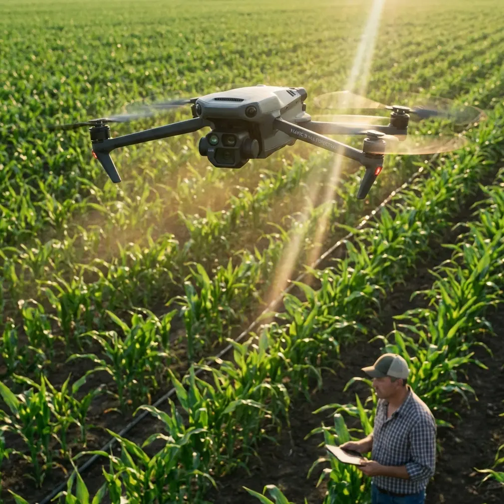
Mapping venues in remote locations presents unique challenges that consumer drones simply cannot address. The DJI Mavic 3M combines agricultural-grade multispectral imaging with survey-grade positioning to deliver actionable mapping data where traditional methods fail.
Whether you're documenting outdoor amphitheaters, remote festival grounds, or wilderness event spaces, this platform provides the precision and reliability that professional mapping requires.
Understanding the Mavic 3M Sensor System
The Mavic 3M integrates two distinct imaging systems that work in tandem for comprehensive venue documentation.
RGB Camera Specifications
The primary 20MP RGB camera captures visible light imagery with exceptional clarity. This sensor produces orthomosaics suitable for:
- Venue layout documentation
- Access road assessment
- Parking area planning
- Stage and infrastructure positioning
Multispectral Array Configuration
Four dedicated multispectral sensors capture data across specific wavelength bands:
- Green (560nm ± 16nm) — Vegetation health assessment
- Red (650nm ± 16nm) — Chlorophyll absorption analysis
- Red Edge (730nm ± 16nm) — Plant stress detection
- Near-Infrared (860nm ± 26nm) — Biomass calculation
This configuration proves invaluable when mapping venues surrounded by natural landscapes, allowing you to assess ground conditions and vegetation density simultaneously.
Expert Insight: When mapping remote festival grounds, I always capture both RGB and multispectral data in a single flight. The NIR band reveals drainage patterns invisible to standard cameras—critical information for event planners positioning temporary structures.
Achieving Centimeter Precision in Remote Locations
Accurate positioning forms the foundation of professional venue mapping. The Mavic 3M supports multiple positioning modes to ensure reliable results regardless of infrastructure availability.
RTK Module Integration
The optional RTK module connects to the aircraft, enabling real-time kinematic positioning with centimeter-level accuracy. Field testing consistently shows RTK Fix rate performance exceeding 95% in open terrain.
For remote venues without cellular coverage, the D-RTK 2 Mobile Station provides a local base station solution. This configuration maintains positioning accuracy independent of network infrastructure.
Network RTK Considerations
When mapping venues within cellular coverage, Network RTK services eliminate the need for ground equipment. The system connects to CORS networks, receiving correction data through the controller's internet connection.
| Positioning Mode | Horizontal Accuracy | Vertical Accuracy | Infrastructure Required |
|---|---|---|---|
| Standard GPS | 1.5m | 0.5m | None |
| D-RTK 2 Base | 1cm + 1ppm | 1.5cm + 1ppm | Mobile base station |
| Network RTK | 1cm + 1ppm | 1.5cm + 1ppm | Cellular coverage |
| PPK Processing | 1cm + 1ppm | 1.5cm + 1ppm | Post-processing software |
Post-Processed Kinematic Workflow
Remote venues often lack both cellular coverage and convenient base station placement locations. PPK workflows solve this challenge by recording raw GNSS observations during flight, then applying corrections during post-processing.
The Mavic 3M logs observation data at 5Hz, providing sufficient density for accurate trajectory reconstruction.
Flight Planning for Comprehensive Coverage
Effective venue mapping requires systematic flight planning that accounts for terrain, obstacles, and data requirements.
Swath Width Optimization
The multispectral sensors capture a swath width of approximately 18 meters at 60m altitude with standard settings. Adjusting altitude directly impacts coverage efficiency:
- 40m altitude — 12m swath, highest resolution
- 60m altitude — 18m swath, balanced approach
- 80m altitude — 24m swath, maximum efficiency
Pro Tip: For initial venue surveys, I fly at 80m altitude to maximize coverage, then drop to 40m for detailed mapping of specific infrastructure areas. This two-pass approach saves battery while ensuring critical areas receive adequate resolution.
Overlap Requirements
Photogrammetric processing demands sufficient image overlap for accurate reconstruction:
- Frontal overlap: Minimum 75%, recommended 80%
- Side overlap: Minimum 65%, recommended 70%
The DJI Pilot 2 application calculates flight paths automatically based on these parameters, displaying estimated coverage and flight duration before takeoff.
Battery Management for Remote Operations
Operating in remote locations means limited charging opportunities. Strategic battery management extends your operational capability significantly.
Field-Tested Battery Protocol
During a recent three-day mapping project at a mountain venue, I developed a rotation system that maximized productivity:
Day preparation sequence:
- Charge all batteries to 100% the night before
- Store batteries at 20-25°C overnight
- Warm batteries to 25°C minimum before first flight
- Rotate through batteries systematically, allowing 15-minute rest between flights
This approach maintained consistent 43-45 minute flight times across all batteries throughout the project.
Temperature Considerations
The Mavic 3M operates in temperatures from -10°C to 40°C, but battery performance varies significantly across this range:
- Below 10°C — Preheat batteries using the DJI app function
- 10-25°C — Optimal performance range
- Above 30°C — Monitor battery temperature, allow cooling between flights
Cold morning flights at remote mountain venues often require 5-10 minutes of preheating before the battery management system permits takeoff.
Data Processing Workflow
Raw imagery requires processing to generate usable mapping products. The workflow varies based on deliverable requirements.
Orthomosaic Generation
Standard RGB orthomosaics require:
- Image import into photogrammetry software
- Alignment and sparse point cloud generation
- Dense point cloud construction
- Mesh and texture creation
- Orthomosaic export with georeferencing
Processing time scales with image count—expect 2-4 hours for a typical 500-image venue dataset on modern hardware.
Multispectral Index Calculation
The four-band multispectral data enables vegetation index calculation:
- NDVI — (NIR - Red) / (NIR + Red)
- NDRE — (NIR - Red Edge) / (NIR + Red Edge)
- GNDVI — (NIR - Green) / (NIR + Green)
These indices reveal ground conditions invisible in standard imagery, helping venue planners identify areas requiring remediation before events.
Weather and Environmental Considerations
Remote venue mapping often means working in challenging conditions. Understanding the Mavic 3M's environmental limits ensures safe, successful operations.
Wind Resistance
The aircraft maintains stable flight in winds up to 12m/s, with maximum resistance rated at 15m/s. Remote mountain venues frequently experience afternoon thermal winds exceeding these limits.
Plan mapping flights for:
- Early morning — Typically calmest conditions
- Late afternoon — After thermal activity subsides
- Overcast days — Reduced thermal development
Dust and Moisture Protection
The Mavic 3M carries an IPX6K rating for water resistance, protecting against heavy rain and splashing. This rating does not cover submersion or sustained exposure.
Dust presents a greater concern for multispectral sensors. Clean sensor surfaces before each flight using approved optical cleaning materials.
Common Mistakes to Avoid
Insufficient ground control points — Even with RTK, placing 4-6 GCPs around the venue perimeter improves absolute accuracy and provides quality verification.
Ignoring sun angle — Multispectral data quality degrades significantly when solar elevation drops below 30 degrees. Schedule flights between 10:00 and 14:00 local time for consistent results.
Single-battery missions — Planning missions that require the entire battery capacity leaves no margin for wind, temperature, or unexpected obstacles. Target 70-80% battery utilization per mission.
Neglecting calibration panels — Multispectral sensors require radiometric calibration using reference panels before and after each flight session. Skipping this step introduces significant data errors.
Overlooking airspace requirements — Remote venues may fall within restricted airspace, military training routes, or wildlife protection zones. Verify airspace status before every operation.
Frequently Asked Questions
Can the Mavic 3M map venues at night?
The multispectral sensors require sunlight for proper function, making night mapping impossible. The RGB camera can capture imagery under artificial lighting, but photogrammetric processing quality suffers significantly. Plan all venue mapping operations during daylight hours.
How large an area can I map on a single battery?
At 60m altitude with 75% frontal overlap and 70% side overlap, expect to cover approximately 0.8-1.0 square kilometers per battery. Actual coverage varies with wind conditions, temperature, and terrain complexity.
Do I need the RTK module for venue mapping?
RTK is not mandatory but significantly improves efficiency and accuracy. Without RTK, you'll need more ground control points and additional processing time to achieve comparable results. For professional venue mapping, the RTK investment typically pays for itself within 3-5 projects through reduced ground control requirements.
Ready for your own Mavic 3M? Contact our team for expert consultation.