Monitoring Highways in Windy Conditions With the Mavic 3M
Monitoring Highways in Windy Conditions With the Mavic 3M: Exposure Control, Antenna Setup, and Stable Data Capture
META: A practical tutorial on using the Mavic 3M for windy highway monitoring, with expert guidance on metering, exposure compensation, RTK stability, antenna positioning, and multispectral data quality.
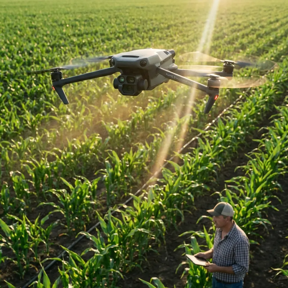
Highway monitoring sounds straightforward until the wind starts pushing the aircraft sideways, sun glare bounces off guardrails, and the road surface alternates between dark asphalt and bright lane markings. That is where many otherwise capable drone workflows begin to unravel. The Mavic 3M is often discussed for its multispectral payload and mapping value, but in exposed roadside corridors, image consistency depends just as much on camera discipline and field technique as on the aircraft itself.
For operators working long transport corridors, windy conditions create three simultaneous problems. First, the aircraft has to hold a clean and repeatable path. Second, the imaging system must keep exposure stable as the drone crosses patches of very different reflectance. Third, the data has to remain geographically reliable enough for inspection, vegetation encroachment review, drainage assessment, and repeatable change detection.
This is where a seemingly basic photography concept becomes highly relevant. A recent article published on 2026-04-10 by 御空逐影 broke down metering for beginners in unusually plain language, and one point deserves attention in the highway context: the metering mode determines how much of the frame the camera evaluates for light, and which part of the scene it treats as the basis for exposure. That sounds elementary. In field operations, it is anything but.
Why exposure discipline matters more on highways than many operators expect
A highway scene is visually deceptive. The frame can contain low-reflectance pavement, bright concrete barriers, retroreflective signs, metal roofs, pale shoulders, moving vehicles, and sometimes water. In wind, the aircraft may yaw or crab slightly while maintaining track, so the composition changes from one image to the next even if the route line remains correct. If exposure shifts with every variation in the frame, the result is uneven imagery and weaker comparison value across the corridor.
For Mavic 3M users, that inconsistency matters beyond aesthetics. Multispectral interpretation, roadside vegetation analysis, maintenance trend review, and orthomosaic generation all benefit from visual stability. Even in workflows that prioritize map products over standalone photos, poor exposure decisions can increase processing friction and reduce confidence during review.
The beginner photography article used a simple example: if the subject is a flower bud near the center of the frame and does not occupy much of the total image, center-weighted average metering can be the right choice. The operational significance for highway work is easy to translate. If the primary target is a specific central feature such as a damaged barrier section, expansion joint, culvert opening, signpost foundation, or lane-surface defect, a metering approach that gives more weight to the central region helps prevent the camera from being overly influenced by bright sky or dark roadside margins.
That one detail can make the difference between documenting a feature clearly and losing it in exposure compromise.
The Mavic 3M in a windy corridor: what the aircraft is actually doing for you
The Mavic 3M is built for precise aerial data collection, and in corridor work that precision matters most when conditions are less than ideal. Highways are open environments. Crosswinds can be sustained for long stretches, and turbulence is common near overpasses, cuttings, embankments, trucks, and sound walls. A drone that can hold line well and maintain positional quality gives the operator room to focus on data quality rather than constant correction.
That is where centimeter precision and RTK fix rate become practical concerns rather than specification-sheet decoration. In windy monitoring missions, a strong RTK solution supports more reliable geotagging and cleaner repeat surveys. If your objective is to compare shoulder erosion, drainage ponding, median vegetation growth, or crack progression over time, positional repeatability is what turns aerial collection into useful evidence.
Wind also affects swath width in practice. Planned corridor coverage may look fine in software, but drift and attitude changes can subtly reshape the actual imaging footprint. The answer is not simply to fly faster and hope the overlap absorbs the problem. It is better to build a route that respects the wind direction, validates fix stability before the mission begins, and uses exposure settings that do not fluctuate as the aircraft angle changes.
The metering lesson most Mavic 3M operators overlook
Many drone pilots leave metering on the default and only intervene when a scene looks obviously wrong. That habit is understandable for casual flights, but it is weak fieldcraft for infrastructure monitoring.
The article from chinahpsy made the core principle very clear: metering mode is the rule that tells the camera how large an area to evaluate and which part of the frame counts most. On a windy highway mission, that means the camera is constantly making judgment calls based on whatever enters the frame at that instant.
Consider three common situations:
1. Asphalt with a bright sky band
If a portion of the horizon or sky remains visible, the camera may reduce exposure to protect highlights, leaving the roadway too dark for easy defect interpretation.
2. Concrete structures in a mostly dark scene
An overpass pier or bright barrier can pull the exposure upward or downward depending on framing, creating inconsistent image series.
3. A small target in the middle of a wider corridor
A damaged expansion joint or drainage feature may be the actual subject, yet it occupies only a small portion of the frame. If metering favors the entire scene too strongly, the subject can lose clarity.
This is exactly why the flower-bud example matters. If your subject is centered and comparatively small, center-weighted logic can be useful because it aligns the exposure decision with the operational target rather than the brightest distraction in the frame.
For Mavic 3M highway monitoring, the practical takeaway is simple: choose metering intentionally based on the task, not by habit.
A field-ready exposure workflow for windy highway missions
When I train corridor operators, I recommend treating exposure as part of mission planning, not as an afterthought.
Step 1: Define the true subject
Ask what the imagery is meant to support. Are you mapping the full corridor, reviewing pavement conditions, monitoring encroaching vegetation, or documenting structures at intervals? If the subject is broad and uniform, a wider scene evaluation may work. If the priority is a smaller central asset, weighting exposure toward the center can be more reliable.
Step 2: Check the light before takeoff
Midday glare on road surfaces can produce harsh contrast. Low-angle sun can create long shadows from poles, barriers, and vehicles. Windy conditions often come with broken cloud, which means illumination can shift from minute to minute. If light is unstable, lock down as much consistency as the mission allows.
Step 3: Use exposure compensation deliberately
The reference article did not just discuss metering; it also centered on exposure compensation for beginners. That pairing is critical. Metering tells the camera what to look at. Exposure compensation tells it to bias the result. If your road deck is routinely coming out too dark because bright reflective elements keep entering the frame, a modest compensation adjustment can stabilize the output without forcing a full manual workflow.
Step 4: Review the first image set before committing the corridor
Do not assume the first pass is acceptable because the live view looks fine. Zoom into actual captures. Look at lane markings, cracks, shoulder edges, and drainage inlets. If those details are inconsistent, fix the exposure logic before proceeding.
Step 5: Keep the frame predictable
Wind is easier to manage when your flight direction and camera angle are predictable. If the route permits, align legs to reduce abrupt changes in the relative sun angle and frame composition.
Antenna positioning advice for maximum range and more stable control
The brief for this piece asked for antenna positioning advice, and that is especially relevant on highway jobs. Range is not only about flying farther. It is also about maintaining a clean, robust link in a corridor full of reflective surfaces, moving vehicles, and occasional visual obstructions.
A few rules matter:
- Keep the controller antennas oriented so the broadside faces the aircraft rather than pointing the antenna tips directly at it.
- As the drone moves down a long highway segment, rotate your body and controller with the aircraft instead of holding one static posture.
- Avoid standing low beside metal guardrails, vehicles, or sign structures that can interfere with clean signal geometry.
- Gain elevation where safe and legal. Even a small increase in operator vantage can improve line-of-sight quality.
- Do not let your own body shield the controller from the aircraft during a tracking leg.
In windy conditions, stable control link quality is more than convenience. When the aircraft is making continuous micro-corrections against gusts, a healthier communications path supports smoother command and monitoring. That translates into more consistent track adherence and fewer surprises in the image set.
If your team needs a quick field checklist for controller setup and corridor planning, you can send ops questions here: https://wa.me/85255379740
RTK fix rate, crosswind behavior, and why repeatability wins
The Mavic 3M is often chosen because repeatable geospatial work matters. That makes RTK fix rate one of the most useful indicators to watch before and during a windy mission. If the fix is unstable, crosswind-induced deviations become harder to interpret after the fact. Did the aircraft drift, or are you looking at weaker positional confidence? Good operators do not leave that ambiguous.
For highway monitoring, repeatability usually matters more than raw speed. A corridor flown today and reflown next month needs to align tightly enough for practical comparison. That is where centimeter precision becomes operationally valuable. It supports:
- side-by-side condition review
- vegetation growth tracking near carriageways
- embankment and drainage monitoring
- construction progress verification
- shoulder and barrier change documentation
This also intersects with swath width planning. In wind, apparent coverage margins can become deceptive. If overlap is too lean, any drift or yaw variation can leave gaps or reduce confidence in edge features. Build your corridor with enough margin to tolerate real conditions rather than idealized ones.
What about multispectral data on highways?
The Mavic 3M’s multispectral capability is often associated with agriculture, but it has useful civilian value along transport corridors as well. Highways are not just pavement systems. They are linear environments with vegetation, slopes, drainage channels, medians, retention areas, and rights-of-way that need regular observation.
In windy conditions, multispectral collection benefits from the same discipline as RGB imaging: stable path, consistent exposure logic where applicable, and strong geospatial quality. For roadside vegetation health, encroachment assessment, or drainage-zone monitoring, consistent data collection matters more than collecting large volumes of inconsistent imagery.
That is also why some of the adjacent industry buzzwords should be handled carefully. Terms like spray drift and nozzle calibration belong more naturally to agricultural application workflows than to highway inspection. They may appear around Mavic 3M conversations because of the platform’s broader ecosystem, but for road-corridor monitoring the relevant lesson is different: know which capabilities actually support the mission in front of you, and do not import settings or assumptions from another discipline.
Weather hardening, field realism, and IPX6K thinking
Windy highway operations are rarely tidy. Dust, roadside moisture, and sudden weather changes are common. If your team routinely works in exposed corridors, environmental resilience should shape your procedures even when the aircraft is capable enough on paper. References to IPX6K-level protection often appear in professional drone discussions because ingress resistance affects whether a mission can be completed reliably in harsh field conditions. The larger point is procedural: treat weather readiness as a workflow issue, not just a hardware issue.
That means lens checks before each leg, clean sensor windows, careful launch and recovery location choice, and a bias toward shorter, controlled sorties when gust behavior is escalating.
The real lesson: beginners’ camera theory becomes expert fieldcraft
The most useful part of the 2026-04-10 beginner article is not that it simplifies metering. It is that it reminds experienced operators of a truth they often bury under automation: the camera only knows what you tell it to value.
When the source explained that metering mode determines how much of the image is evaluated and which area becomes the exposure reference, it described the exact decision point that affects roadway documentation in mixed lighting. When it gave the example of using center-weighted average metering for a small central flower bud, it quietly outlined a strategy that also fits targeted infrastructure capture.
That is the kind of crossover experienced Mavic 3M users should appreciate. Sophisticated platforms still reward basic photographic competence. In windy highway monitoring, the best results come from combining aircraft stability, RTK confidence, thoughtful route design, disciplined antenna orientation, and exposure choices matched to the real subject.
Do that well, and the Mavic 3M stops being just a capable drone. It becomes a reliable corridor observation tool that holds up when the environment is trying to make your data inconsistent.
Ready for your own Mavic 3M? Contact our team for expert consultation.