How to Scout Vineyards Remotely with Mavic 3M
How to Scout Vineyards Remotely with Mavic 3M
META: Learn how the DJI Mavic 3M transforms vineyard scouting with multispectral imaging. Expert guide covers RTK setup, NDVI mapping, and disease detection techniques.
TL;DR
- Mavic 3M's four multispectral bands detect vine stress 7-14 days before visible symptoms appear
- RTK positioning delivers centimeter precision for repeatable flight paths and accurate data comparison
- IPX6K rating enables scouting in morning dew conditions when thermal contrast peaks
- Proper nozzle calibration on follow-up spray operations reduces chemical use by up to 30%
Why Traditional Vineyard Scouting Falls Short
Walking vineyard rows takes time you don't have. A 40-hectare estate requires 8-12 hours of manual inspection—and you'll still miss early-stage nutrient deficiencies hidden beneath the canopy.
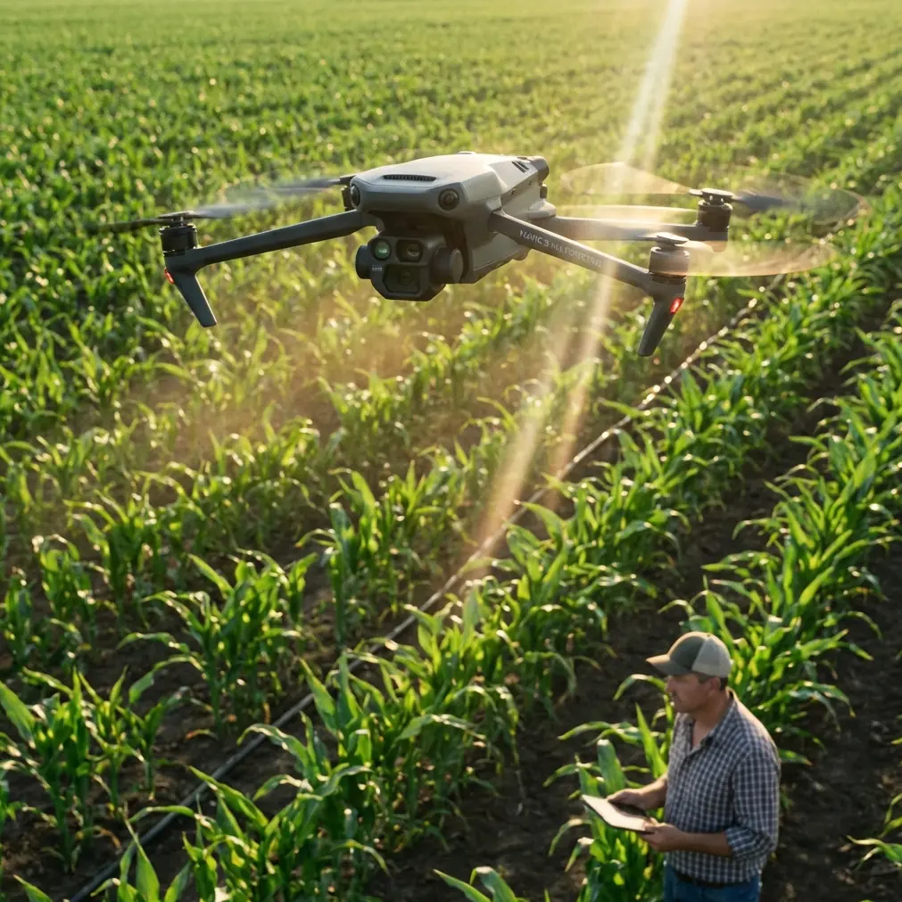
The Mavic 3M changes this equation entirely. While competitors like the senseFly eBee X offer multispectral capabilities, they lack the portability and rapid deployment that remote vineyard operations demand. The Mavic 3M weighs just 951 grams and launches in under 3 minutes, making it practical for daily scouting missions that larger fixed-wing platforms simply can't match.
Understanding the Mavic 3M's Multispectral Advantage
The Four-Band Sensor Array
The Mavic 3M integrates a dedicated multispectral camera alongside its 20MP RGB sensor. This isn't a compromise—it's a purpose-built system capturing:
- Green band (560nm ± 16nm): Chlorophyll absorption analysis
- Red band (650nm ± 16nm): Vegetation stress indicators
- Red Edge band (730nm ± 16nm): Early stress detection before visible symptoms
- Near-Infrared band (860nm ± 26nm): Biomass and water content assessment
The Red Edge band deserves special attention. This wavelength sits precisely where healthy vegetation transitions from absorbing to reflecting light. Subtle shifts here reveal problems days before they manifest in the visible spectrum.
Expert Insight: The Red Edge band is your early warning system. When I'm scouting Napa Valley vineyards in July, Red Edge anomalies consistently predict powdery mildew outbreaks 10-12 days before white patches appear on leaves. That window transforms reactive treatment into preventive management.
RTK Fix Rate: The Foundation of Precision
Raw multispectral data means nothing without spatial accuracy. The Mavic 3M supports RTK positioning through the DJI D-RTK 2 Mobile Station, achieving:
- Horizontal accuracy: ±1cm + 1ppm
- Vertical accuracy: ±1.5cm + 1ppm
- RTK Fix rate: Typically >95% in open vineyard environments
This centimeter precision enables something critical: temporal comparison. When you fly the same mission weekly, RTK ensures each pixel represents the identical vine position. Without it, you're comparing apples to oranges.
Step-by-Step: Planning Your Vineyard Scouting Mission
Pre-Flight Checklist
Before launching, verify these parameters:
- Weather window: Wind below 10 m/s, no precipitation
- Sun angle: Between 10:00-14:00 for consistent illumination
- RTK base station: Positioned with clear sky view, >15 satellites tracked
- Calibration panel: Clean, positioned in open area for reflectance calibration
- Battery status: Minimum 2 batteries for 40-hectare coverage
Optimal Flight Parameters
| Parameter | Recommended Setting | Rationale |
|---|---|---|
| Altitude | 60-80 meters AGL | Balances resolution with coverage efficiency |
| Speed | 8-10 m/s | Prevents motion blur in multispectral capture |
| Overlap (Front) | 75% | Ensures seamless orthomosaic generation |
| Overlap (Side) | 70% | Accounts for terrain variation |
| Swath width | ~85 meters at 70m altitude | Plan flight lines accordingly |
| GSD | ~3.5 cm/pixel | Sufficient for individual vine analysis |
Mission Execution Protocol
Launch from a consistent home point each session. The Mavic 3M's 43-minute flight time covers approximately 200 hectares per battery under optimal conditions—though vineyard terrain typically reduces this to 35-45 hectares with safety margins.
Pro Tip: Fly your calibration panel at mission start AND end. Atmospheric conditions shift throughout the flight, and bracketing your data with calibration images dramatically improves radiometric accuracy. I've seen NDVI values drift by 0.08-0.12 over a 30-minute flight without proper calibration correction.
Processing Multispectral Data for Actionable Insights
Generating Vegetation Indices
Raw band data transforms into decision-ready maps through vegetation indices. The most valuable for viticulture:
NDVI (Normalized Difference Vegetation Index)
- Formula: (NIR - Red) / (NIR + Red)
- Range: -1 to +1 (healthy vines typically 0.6-0.85)
- Use: Overall vigor assessment, irrigation management
NDRE (Normalized Difference Red Edge)
- Formula: (NIR - Red Edge) / (NIR + Red Edge)
- Range: -1 to +1 (healthy vines typically 0.3-0.5)
- Use: Early stress detection, nitrogen status
GNDVI (Green Normalized Difference Vegetation Index)
- Formula: (NIR - Green) / (NIR + Green)
- Range: -1 to +1
- Use: Chlorophyll content, water stress indicators
Software Workflow
DJI Terra processes Mavic 3M multispectral data natively, but third-party options offer advanced analytics:
- Pix4Dfields: Purpose-built for agriculture, excellent zone management
- Agisoft Metashape: Maximum processing control, steeper learning curve
- DroneDeploy: Cloud-based simplicity, subscription model
Translating Data into Spray Operations
Variable Rate Application Zones
Your multispectral maps directly inform precision spraying. When stress zones appear, the Mavic 3M data integrates with agricultural spray drones like the DJI Agras series.
Critical considerations for spray operations:
- Spray drift: Wind speeds above 3 m/s require adjusted nozzle angles
- Nozzle calibration: Verify output matches prescription map requirements
- Buffer zones: Maintain 10-meter margins from sensitive areas
- Swath width: Typically 4-7 meters depending on spray drone model
The precision here matters. Blanket applications waste chemistry and stress healthy vines. Zone-based treatment guided by multispectral data reduces inputs while improving outcomes.
Technical Comparison: Mavic 3M vs. Competing Platforms
| Feature | DJI Mavic 3M | senseFly eBee X | Parrot Sequoia+ |
|---|---|---|---|
| Weight | 951g | 1.3kg (airframe only) | 135g (sensor only) |
| Deployment Time | <3 minutes | 10-15 minutes | Varies by carrier |
| Multispectral Bands | 4 + RGB | Depends on payload | 4 + RGB |
| RTK Support | Native | Native | Requires carrier |
| Flight Time | 43 minutes | 59 minutes | Carrier dependent |
| Weather Rating | IPX6K | IP54 | Not rated |
| Integrated RGB | 20MP, 4/3 CMOS | Separate payload | No |
The Mavic 3M's IPX6K rating deserves emphasis. Vineyard scouting often demands early morning flights when dew still clings to leaves and thermal differentials peak. Competitors without robust weather sealing force you to wait—losing the optimal imaging window.
Common Mistakes to Avoid
Flying too high for meaningful data Altitude above 100 meters reduces ground sampling distance beyond useful thresholds. You'll generate pretty maps that lack actionable detail.
Ignoring calibration panels Skipping reflectance calibration introduces systematic errors. Your NDVI values become relative rather than absolute, preventing meaningful comparison across dates.
Single-date analysis One flight captures a moment. Vineyard management requires trend analysis. Establish weekly or bi-weekly flight schedules during growing season.
Overlooking RTK initialization Launching before achieving RTK Fix produces meter-level positioning errors. Wait for the solid green indicator—those extra 60-90 seconds save hours of data alignment headaches.
Processing with default settings Software defaults optimize for speed, not accuracy. Invest time learning radiometric correction workflows specific to your processing platform.
Frequently Asked Questions
What time of day produces the best multispectral vineyard data?
Fly between 10:00 and 14:00 local solar time when sun angle exceeds 30 degrees. This minimizes shadow interference and ensures consistent illumination across your vineyard blocks. Early morning flights work for thermal analysis but compromise multispectral radiometric quality.
How often should I scout vineyards with the Mavic 3M during growing season?
Weekly flights from bud break through veraison provide optimal monitoring frequency. During critical periods—bloom, fruit set, and pre-harvest—consider twice-weekly missions. Post-veraison, bi-weekly flights typically suffice unless specific stress events require investigation.
Can the Mavic 3M detect specific vineyard diseases?
The Mavic 3M detects stress signatures rather than diagnosing specific pathogens. However, stress patterns combined with location data strongly indicate likely causes. Powdery mildew creates distinctive Red Edge anomalies in canopy interiors, while water stress manifests as uniform NDVI depression along row segments. Ground-truth suspicious areas to confirm diagnosis.
Taking Your Vineyard Operations Further
The Mavic 3M transforms vineyard management from reactive to predictive. Centimeter precision, robust weather resistance, and rapid deployment create a scouting platform that fits real-world operational demands.
Success requires consistent methodology. Establish your flight protocols, maintain calibration discipline, and build temporal datasets that reveal trends invisible to single-point observations.
Ready for your own Mavic 3M? Contact our team for expert consultation.