Mavic 3M in Complex Terrain: What a High
Mavic 3M in Complex Terrain: What a High-Altitude Drone Trial Really Means for Field Imaging
META: A practical case study on filming and mapping fields with Mavic 3M in complex terrain, using lessons from a 2,524.8-meter high-altitude drone test and real operational planning insights.
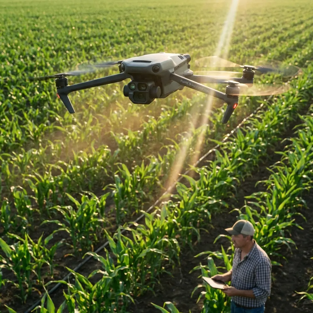
When people ask me whether the Mavic 3M is suitable for rugged agricultural terrain, they usually expect a checklist: RTK, multispectral payload, route planning, terrain follow. Useful, yes. But that is not where the real answer starts.
It starts before takeoff.
If you are filming or mapping fields in broken terrain—terraces, highland valleys, uneven ridgelines, wind funnels, irrigation cuts—the aircraft’s sensor quality is only part of the story. The rest is operational discipline. And one recent news item from China makes that point more clearly than any spec sheet could.
A recent high-altitude drone flight activity in Lanping, Yunnan, brought multiple unmanned aircraft into a genuinely demanding environment. The venue was Fenghua General Airport, identified as Yunnan’s first A1-class high-altitude general aviation airport, sitting at 2,524.8 meters above sea level. That number matters. At that elevation, thinner air changes rotor efficiency, climb behavior, payload margin, thermal patterns, and the reliability envelope of any aircraft operating near performance limits. The event reportedly included successful first flights of several large, medium, and small highland drones, with tests covering data link displays, detection and positioning, maximum takeoff weight operations, speed envelopes, hover ceiling, practical ceiling, and endurance.
On the surface, that story is not about the Mavic 3M. Operationally, it absolutely is.
For anyone using the Mavic 3M to film fields in complex terrain, the Lanping trial highlights a truth that experienced crews already know: harsh geography punishes lazy preparation. It also rewards aircraft operators who think like directors instead of button-pushers.
That second lesson comes from a different recent piece, one about mobile photography rather than UAVs. Its central idea was simple: average people record what they see; skilled shooters direct the frame by arranging the elements before capture. For drone field work, that mindset is gold. In difficult landscapes, the best Mavic 3M results come from directing the mission, not merely launching into it.
Case Study: Planning an M3M Mission Above Broken Fields
Let’s put this into a field scenario.
Imagine a grower wants imagery of hillside plots with irregular elevation changes, mixed crop vigor, narrow access paths, and unstable wind coming through a valley. The goal is not just pretty footage. The job is to collect actionable multispectral data while also capturing visual material that explains crop stress patterns to a farm manager or agronomist.
This is where many operators make a bad assumption. They believe the aircraft will smooth out the terrain problem for them. It won’t.
The Mavic 3M is an efficient platform because it combines compact deployment with multispectral capability, which is exactly why it is attractive in the first place. But compact does not mean casual. In rough agricultural ground, your mission quality depends on what happens during the first five minutes on site.
My standard routine starts with a pre-flight cleaning step that too many crews skip because it feels minor. It is not minor. Before powering up, I clean the vision sensors, camera windows, and airframe surfaces that can affect obstacle sensing or imaging clarity. Dust, dried spray residue, pollen, and fine mud splash are common in farm work. On a platform used around chemical applications or nearby spray operations, residue buildup can be subtle. It can also degrade safety features and image consistency.
This matters even more when the mission area includes drift-prone zones or fields recently exposed to spray drift. If a mist event or airborne residue has settled on the aircraft, you are not just risking softer imagery. You may be compromising the reliability of obstacle sensing, terrain awareness, or return behavior in a place where tree lines, poles, and slope transitions leave very little room for error.
In short: clean first, then calibrate, then launch.
Why the Lanping Test Changes the Way We Read Terrain
The Lanping high-altitude trial matters because it validates something larger than a one-day demonstration. According to the report, the participating systems went through 11 days of prior closed testing and then demonstrated stability and reliability in an extreme environment. That is operationally significant because severe environments reveal weaknesses that mild conditions hide.
For an Mavic 3M crew, the takeaway is not that your aircraft suddenly becomes a high-altitude logistics platform. The takeaway is that environment must be treated as an active variable in mission design.
At 2,524.8 meters, density altitude effects are not theoretical. Even if your own field sits much lower, complex terrain can create similar decision pressure in different ways: rising ground, unstable gusts, changing line-of-sight, and abrupt temperature variation across valley and ridge. If your route plan ignores these factors, your RTK fix rate may look fine on the pad yet become less useful if your geometry, signal environment, or flight behavior deteriorates over the mission.
That is why I treat terrain as both a mapping challenge and a flight mechanics problem.
For imaging, complex terrain affects overlap consistency, swath width, and data uniformity. For flight safety, it affects climb demand, power reserve, and link quality. The Lanping event specifically referenced testing around maximum takeoff weight, practical ceiling, hover ceiling, and endurance. Those are not abstract engineering metrics. They are exactly the areas where field operators get caught out when they load extra accessories, launch with a partially contaminated aircraft, or build an overlong route in a wind-exposed valley.
Direct the Mission, Don’t Just Fly It
The smartphone photography article had one useful phrase: skilled shooters act like directors. I would apply that directly to Mavic 3M work.
A weak operator sees a field and flies whatever grid the app suggests.
A strong operator stages the mission.
That means waiting for wind to settle if your data consistency depends on stable crop posture. It means choosing launch points that preserve line-of-sight through slope changes. It means separating a multispectral run from a visual storytelling run when the sun angle favors one but not the other. It means checking whether irrigation haze, dust, or chemical vapor could affect lens cleanliness and image repeatability.
Sometimes the smartest move is a three-second pause before takeoff.
That sounds trivial. It isn’t. The same “wait 3 seconds” photography principle translates surprisingly well to UAV work. A short pause helps you catch details crews miss when they rush: a prop blade with debris at the root, a smudge over a sensor window, uneven satellite lock, a low-confidence RTK Fix rate, a shifting breeze up the row, or a vehicle parked where your return path should be clear.
Good missions are often saved by small hesitations.
Multispectral Work in Uneven Fields: Where Precision Actually Breaks Down
The Mavic 3M earns its place when the job demands multispectral insight, not just aerial visuals. But uneven ground is where operators discover the difference between nominal precision and usable precision.
Centimeter precision sounds reassuring, and RTK-backed workflows can absolutely deliver serious value. Still, the field result depends on more than the label. In terraced or rolling farmland, your effective swath width may vary if terrain separation changes more than expected. Your overlap can suffer at slope transitions. Shadow behavior can complicate interpretation. And if you are comparing blocks across different elevations, environmental inconsistency can creep in faster than many teams realize.
That is why route setup, altitude behavior, and timing deserve as much attention as the payload itself.
If the mission supports adjacent spray planning, the operational chain gets even tighter. You are no longer just identifying stress. You are generating information that may influence downstream application decisions, including nozzle calibration strategy, treatment zoning, and drift management around sensitive edges. Bad imagery leads to bad assumptions. Bad assumptions become expensive field actions.
So when I hear about a successful trial involving detection and positioning, data transmission demonstrations, and endurance testing in a demanding highland environment, I do not file it under general UAV news. I file it under operational mindset. It reinforces the standard that field imaging crews should already be holding themselves to.
A Practical M3M Workflow for Complex Terrain
Here is the workflow I recommend when filming or mapping fields with the Mavic 3M in rugged ground:
Start with airframe hygiene. Clean lenses, sensor covers, landing surfaces, and body seams where dust or spray residue collects. If the aircraft has been near agrochemical activity, be extra strict. Safety systems only help when they can see.
Then verify positioning quality. Do not settle for a casual glance at satellites. Watch RTK behavior long enough to trust the fix state in the actual launch area, not just in an open patch nearby. Sloped fields, tree lines, and infrastructure can change conditions quickly.
Next, inspect the route against terrain rather than against the map alone. A beautiful rectangle on screen may cross ridge shoulders, sink lines, or wind corridors that alter aircraft behavior. Adjust for consistent ground sampling and overlap, not just convenient geometry.
After that, split mission intent. One flight for clean multispectral acquisition. Another, if needed, for narrative visuals that explain conditions to stakeholders. Mixing priorities often compromises both.
Finally, leave margin. Always. The Lanping report’s emphasis on endurance and performance limits is a reminder that reserve is part of professionalism. In field operations, margin is what turns a tight mission into a routine one.
If you are refining that workflow for your own acreage and terrain profile, this is a good point to message a field imaging specialist and compare route logic before the next deployment.
What This Means for Mavic 3M Owners Right Now
The broader market is full of new UAV announcements, including fresh FPV kits and specialized platforms entering the industry. That is healthy. It also creates noise. A lot of operators end up chasing novelty when they should be sharpening method.
For Mavic 3M users, the recent high-altitude success in Yunnan is a useful signal. It underscores that reliability is not a marketing mood; it is proven under stress. And it reminds us that the value of any drone in agriculture depends on how well the operator translates platform capability into disciplined field execution.
The aircraft can give you multispectral layers, precise positioning support, and a compact footprint suitable for difficult access points. But in complex terrain, the winning edge usually comes from less glamorous habits: clean sensors, realistic route design, awareness of wind and slope interaction, and enough patience to direct the scene instead of merely documenting it.
That is also why I do not separate filming from field intelligence as sharply as many teams do. The best agricultural drone crews understand both. They know how to frame a problem visually, and they know how to collect data that survives scrutiny. One informs the other. A well-shot visual pass can explain where terrain funnels runoff or why a block is underperforming. A solid multispectral pass can verify whether that visual impression reflects actual plant stress.
That is the real opportunity with the Mavic 3M in broken terrain. Not just flying. Interpreting.
And interpretation starts on the ground, with a clean aircraft, a deliberate pause, and a route built for the field you actually have—not the flat one in your head.
Ready for your own Mavic 3M? Contact our team for expert consultation.