Mavic 3M for Low-Light Coastline Monitoring
Mavic 3M for Low-Light Coastline Monitoring: What Arctic Glacier Missions and Autonomous Drone Logistics Reveal
META: A practical expert guide to using the Mavic 3M for low-light coastline monitoring, with lessons drawn from Arctic glacier mapping, automated drone hubs, multispectral workflows, RTK precision, and interference control.
Coastal monitoring rarely fails because the drone cannot fly. It fails because the environment lies.
Shorelines at dusk flatten into low-contrast bands. Wet rock reflects just enough light to confuse visual interpretation. Salt haze softens edges. Tidal movement changes the scene faster than a survey plan can keep up. If you are flying a DJI Mavic 3M for coastline work in low light, the challenge is not simply image capture. It is whether the data still means something after the aircraft lands.
That is why recent UAV news matters more than it may first appear. One report describes an international research team preparing to deploy Windracers’ heavy-lift drone technology to map Greenland’s Petermann Glacier this summer, focusing on the interaction between ice and ocean water in the far northwest Arctic. Another points to an urban drone delivery network in Jiangxinzhou that is expanding beyond a drone hub airport into a modular forward warehouse system supported by robots, robot dogs, and unmanned ground vehicles for fully automated sorting, inventory checks, loading, and unloading.
At first glance, neither story is about the Mavic 3M. But both point to the same operational truth: the future of drone work belongs to teams that can trust data and workflow under difficult conditions. For a Mavic 3M operator tasked with monitoring coastlines in low light, that lesson is immediate.
Why the Greenland glacier story matters to Mavic 3M users
The Petermann Glacier mission is not just a dramatic Arctic headline. It highlights a problem coastal observers know well: the boundary between land, water, and ice is dynamic, unstable, and often visually ambiguous. Researchers are heading into a frigid marine environment specifically to study how ice and ocean water interact. That is operationally significant because coastlines are also interaction zones. Freshwater outflow, sediment plumes, wave action, erosion fronts, marsh stress, and storm debris all collect where surfaces meet and shift.
The Greenland project also underscores something else. If a drone mission is important enough to send a heavy-lift platform into the Arctic, then environmental monitoring has moved beyond basic aerial photography. The question is no longer “can a drone see it?” but “can the system document change with enough consistency to support real decisions?”
For Mavic 3M crews, especially those working in estuaries, tidal wetlands, harbors, and rocky shorelines, that means building a flight method that values repeatability above spectacle. Low-light operations make that harder. Visual cues weaken. Auto-exposure can drift. Water texture changes minute by minute. The answer is not to improvise harder. It is to fly a disciplined multispectral and RTK-based workflow.
The Mavic 3M advantage in dim coastal conditions
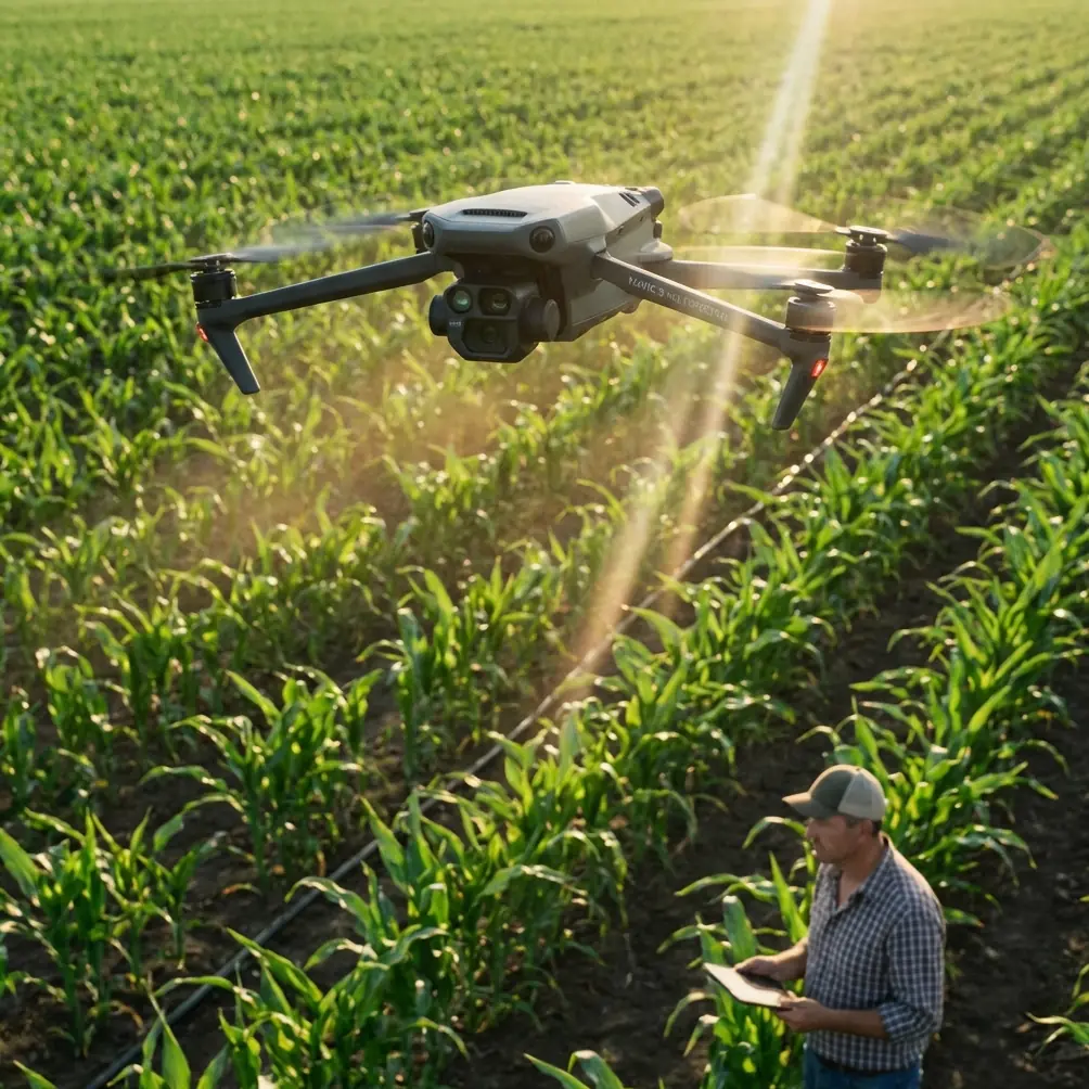
The Mavic 3M sits in a useful middle ground. It is not a heavy-lift Arctic platform, and it does not need to be. Its value comes from portability, multispectral data collection, and the ability to maintain centimeter precision when RTK conditions are healthy. In low-light coastal monitoring, that combination matters more than raw aircraft size.
Multispectral capture can reveal stress patterns and moisture-related differences that standard RGB imagery may hide at dusk. Along shorelines, this helps when you are trying to separate saturated vegetation from shallow standing water, identify distressed saltmarsh zones, or monitor subtle changes in coastal plant health that precede visible erosion. In bright daylight, RGB may be enough for broad interpretation. In low light, spectral information often carries the survey.
Centimeter precision also changes the quality of the mission. If you are revisiting the same seawall, dune edge, mangrove fringe, or outfall channel every week, positional repeatability is not a luxury. It is the only way to distinguish genuine environmental change from operator inconsistency. A strong RTK fix rate reduces that ambiguity.
But low light introduces a trap. Operators often focus so heavily on the camera that they overlook signal integrity. Along coastlines, electromagnetic interference can come from communications infrastructure, power equipment, vessels, industrial waterfront assets, and even poorly positioned ground hardware. If your RTK solution becomes unstable, your entire comparison set loses value.
A practical low-light coastline workflow for the Mavic 3M
Here is the method I recommend when the mission goal is actionable shoreline monitoring rather than casual inspection.
1. Define the coastline feature before launch
Do not launch with a vague goal such as “document the beach.” Decide what you are measuring.
Is it vegetation stress near salt intrusion? A retreating dune toe? Sediment migration around a breakwater? Waterline encroachment near infrastructure? Once the target is defined, you can choose a flight altitude and swath width that preserve the detail you actually need.
A broad swath width may seem efficient, but in low light it often creates interpretation problems at the edges of each pass, especially over reflective water. Narrower, more deliberate lanes usually produce cleaner mosaics and more stable analysis.
2. Prioritize RTK health before image ambition
Centimeter precision only helps when the fix is stable. Before takeoff, verify your RTK environment and watch for degraded performance near coastal communications equipment or metallic structures. If the fix rate is inconsistent, reposition the base or adjust the mission start point.
This is where electromagnetic interference becomes a very practical issue. I have seen shoreline teams lose good positional consistency simply because the antenna was placed too close to a metal railing, site hut, or active communications box. A small antenna adjustment can materially improve the RTK fix rate. Raise it, move it clear of reflective surfaces, and create cleaner sky visibility. If interference persists, shift the ground setup laterally rather than accepting a compromised solution.
That one decision can determine whether a seasonal shoreline change map is defensible or doubtful.
3. Work earlier in the evening than your eyes prefer
Pilots often wait too long because the scene still looks visible to the human eye. The sensor is less forgiving. In low-angle and fading light, water absorbs detail fast, and coastal shadows lengthen unevenly. Start while you still have enough illumination for stable multispectral capture, not when the coastline looks dramatic.
This is also the point at which many operators should stop pretending that “night capability” means “anytime capability.” The Mavic 3M performs best when it has just enough environmental light to separate surfaces cleanly. The goal is not darkness. The goal is controlled low-light contrast.
4. Use multispectral data for interpretation, not decoration
Many teams collect multispectral imagery and then fall back to RGB for the actual decisions. That wastes the payload.
In a coastal setting, the multispectral stack can help isolate vegetation stress, reveal wetness transitions, and identify pattern changes in marsh or dune plant communities before obvious structural failure appears. For shoreline managers, that creates an earlier warning window. In practical terms, it means you can flag a vulnerable section of coast before a storm turns a small weakness into expensive damage.
5. Keep overlap conservative
Low-light work rewards caution. Increase image overlap beyond what you might accept in bright conditions. This improves reconstruction quality when water surfaces, dark sediment, and reflective patches produce inconsistent visual texture.
The tradeoff is flight time, but for shoreline monitoring the cost of underlapping is usually higher than the cost of an extra battery cycle.
What drone tea delivery teaches shoreline monitoring teams
The Jiangxinzhou report may sound unrelated, but it contains a sharper lesson than most monitoring articles. The future system there is not only about drones dropping off goods. It includes modular warehouse infrastructure plus automated sorting, inventory, loading, and unloading with robots, robot dogs, and unmanned vehicles. In other words, the value is in the chain, not the aircraft alone.
That same logic applies to Mavic 3M coastline work. The aircraft is only one node in the operational system. If your handoff from flight planning to data management to repeat-survey comparison is weak, then even excellent imagery will be underused.
This is where many field teams underperform. They invest in a capable platform, then handle the rest with ad hoc folders, inconsistent naming, and undocumented environmental conditions. A better model is to think like an automated logistics network. Standardize intake. Standardize processing. Standardize comparison. Build a repeatable route from raw capture to interpreted result.
A simple example: after every low-light coastal mission, record tide state, wind direction, cloud cover, RTK status, antenna placement notes, and any observed interference sources. If a future data anomaly appears, you have the operational context to explain it. That is exactly how high-value drone programs mature.
If your team is building that kind of repeatable field protocol, this quick coastal operations chat link can fit naturally into a field support workflow.
Handling electromagnetic interference without turning the mission into guesswork
The prompt for this article specifically raises antenna adjustment, and rightly so. In coastal environments, interference is often subtle. The symptoms may look like routine positioning fluctuation rather than a site-specific signal problem.
What you should watch for:
- RTK lock that takes longer than expected
- Position quality that drifts between sorties at the same site
- Uneven accuracy near port equipment, towers, industrial shoreline assets, or vessel traffic zones
- Good imagery paired with poor alignment between repeated missions
When this happens, do not immediately blame the drone. Start with geometry and placement. Move the antenna away from metallic surfaces. Increase separation from powered site infrastructure. Check whether the antenna is partially shielded by nearby equipment or structures. Small relocations often have outsized effects.
This sounds basic, but it is where field discipline beats technical bravado. Operators sometimes chase software settings when the real fix is physical placement.
What about spray drift, nozzle calibration, and IPX6K?
Those terms belong more naturally to agricultural and spray platforms than to the Mavic 3M, but they still offer a useful mental model.
Spray drift teaches environmental humility. In agriculture, tiny atmospheric changes can move material farther than expected. On the coast, the equivalent lesson is that wind, mist, and salt aerosol quietly alter data quality and aircraft behavior. If you would not ignore drift during an application mission, do not ignore marine air movement during a low-light survey.
Nozzle calibration is a reminder that precision comes from setup, not intention. For a Mavic 3M operator, the parallel is sensor workflow calibration, mission consistency, and geospatial discipline. You do not get reliable trend data because you wanted a clean result. You get it because every setup choice supported one.
IPX6K-type thinking also matters even when a specific rating is not the center of the story. Coastal work is punishing. Moisture, salt, and wind-driven spray test equipment and procedures. Aircraft selection, launch handling, battery protection, and post-flight maintenance all become part of data quality. A shoreline mission can be technically successful in the air and still degrade your long-term program if your maintenance culture is weak.
The real takeaway for Mavic 3M coastal operators
The Petermann Glacier story tells us that the most demanding environmental missions are moving toward drones because surface interaction zones are too important, too remote, or too dynamic to monitor casually. The Jiangxinzhou automation story shows that drone success increasingly depends on workflow architecture, not just aircraft capability.
Put those together, and the lesson for Mavic 3M users becomes clear.
If you are monitoring coastlines in low light, your competitive edge is not flashy flying. It is repeatable, interference-aware, multispectral fieldwork tied to reliable RTK positioning and clean post-flight process. The operator who can revisit the same shoreline corridor with stable geometry, document spectral change, and explain every anomaly will produce more valuable results than the operator who simply captures attractive imagery.
That matters for erosion studies. It matters for habitat management. It matters for storm preparedness and infrastructure protection. And it absolutely matters when conditions are dim, the tide is moving, and the visual scene is trying to fool you.
The Mavic 3M is not the Arctic heavy-lift drone in the Greenland headline. It is not part of the automated tea-delivery warehouse chain in Jiangxinzhou either. But the lessons from both stories sharpen how we should use it. Think like a researcher. Operate like a systems engineer. Fly like every centimeter has to stand up to scrutiny later.
That is how low-light coastline monitoring becomes credible instead of merely impressive.
Ready for your own Mavic 3M? Contact our team for expert consultation.