Mavic 3M in Extreme-Temperature Forest Inspection
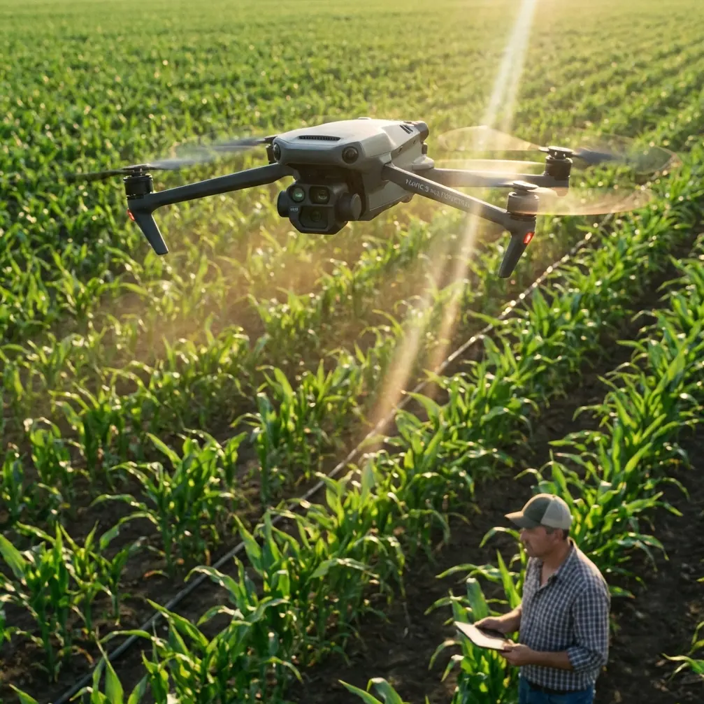
Mavic 3M in Extreme-Temperature Forest Inspection: What Actually Matters in the Field
META: A field-driven technical review of the DJI Mavic 3M for forest inspection in extreme temperatures, with practical insight on multispectral workflow, RTK precision, flight discipline, and how changing weather affects usable data.
When people talk about the Mavic 3M, the conversation usually drifts straight to sensor specs and map outputs. That misses the real point.
In forest inspection, especially when temperatures are pushing high or dropping hard, data quality is rarely decided by the aircraft alone. It comes from the relationship between light, platform stability, and the way the imaging system interprets the scene. That may sound obvious to experienced operators, but it is still where many missions quietly fail. The pattern is familiar: highlights blow out in sun breaks above the canopy, shaded understory loses separation, and a flight that looked clean in the app delivers weak analysis back at the desk.
That is why the Mavic 3M deserves a more grounded review. Not as a magic solution, but as a disciplined tool for operators who understand when automation works and when a changing environment needs to be pulled back under control.
The lesson forest inspectors often learn too late
A recent photography discussion outside the drone sector made a point that applies almost perfectly here: image quality is not about memorizing settings. It comes from understanding how light, hand stability, and algorithmic processing interact. In drone work, replace hand stability with aircraft stability and add GNSS discipline, and the same rule holds.
That matters with the Mavic 3M because forest inspection is one of the hardest places to ask an aerial imaging system to stay honest. You are dealing with broken light through branches, mixed temperatures at different canopy levels, reflective water patches, moving leaves, and terrain that can change the aircraft’s relationship to the target in seconds. Automatic capture routines do a lot of heavy lifting, but they do not eliminate environmental complexity. They simply hide it until the data review stage.
The same source also argued that “pro” controls matter most when auto mode stops coping with the scene. For Mavic 3M operators, that translates into a simple field principle: when weather or lighting begins to drift, do not just keep flying because the aircraft is still airborne. Pause. Reassess the light source, the target position, and whether the platform is being disturbed. That single habit often separates a usable forest health map from an expensive reflight.
Why the Mavic 3M fits forest inspection better than many general-purpose drones
The Mavic 3M is especially relevant for forestry because it gives inspectors more than standard visible imagery. Its multispectral capability changes the mission from “taking pictures of trees” to measuring pattern, stress, vigor, and variation across a living environment that rarely shows its problems clearly in RGB alone.
In practical terms, that means you are not just documenting canopy loss or obvious discoloration. You are looking for weaker signatures that can indicate early stress, uneven growth behavior, moisture imbalance, pest pressure, or recovery lag after temperature shock. In an extreme-heat or extreme-cold inspection window, that distinction matters. By the time visual symptoms are obvious in a large forest block, the operational response is often already late.
This is also where centimeter precision and RTK fix rate become more than brochure language. In forestry, repeated missions only become useful if the alignment from one survey to the next is tight enough to support comparison. If your goal is to observe change after frost, wind stress, drought conditions, or edge damage, sloppy georeferencing turns trend analysis into guesswork. With strong RTK performance, the Mavic 3M can support repeatable datasets that make temporal analysis far more defensible.
And yes, that can overlap with concerns people normally associate with agriculture, such as spray drift, nozzle calibration, and swath width. Forest managers running adjacent treatment operations or mixed land programs often need to understand whether stress patterns are environmental, biological, or linked to application behavior. The Mavic 3M is not a spraying platform, but it can be part of the evidence chain that helps teams assess whether treatment coverage and drift assumptions match reality on the ground.
Mid-flight weather changes are where the review gets real
On one extreme-temperature forest inspection scenario, the day started clean enough. Cold morning air, fairly stable conditions, decent contrast on the target zone. The plan was straightforward: build a repeatable multispectral pass over a stand with known variability, verify a strong RTK lock, and maintain a conservative swath width to preserve image consistency over uneven terrain.
Then the weather shifted mid-flight.
A moving band of cloud cut direct illumination, wind began to push laterally across a ridge line, and temperature behavior near the canopy changed just enough to alter how parts of the scene read. This is exactly the kind of moment when operators either trust the system blindly or start acting like inspectors.
The Mavic 3M handled the transition well from an airframe and mission-continuity standpoint. Stability remained good, positioning discipline stayed reliable, and the aircraft did not turn into a workload burden when the environment became less cooperative. That is worth saying clearly. In a forest mission, you do not want the pilot consumed by platform management while also trying to protect data quality.
But the more meaningful point is what happened operationally. The shift in weather did not make the drone fail. It changed the scene. And that meant the mission needed interpretation, not just completion.
This mirrors a useful observation from the smartphone photography reference: professional control is not about showing off technical knowledge. It exists for the moments when automation is no longer reading the situation well enough. In forest inspection with the Mavic 3M, that can mean tightening the mission area, adjusting the flight sequence, changing the timing of the second pass, or postponing a section so the dataset stays internally consistent.
That kind of judgment is not glamorous, but it is what experienced operators are paid for.
Multispectral only helps if the capture conditions are respected
The Mavic 3M’s multispectral workflow is powerful, but not forgiving of sloppy field habits. Forest operators sometimes assume that once they are collecting non-RGB data, the analytics will somehow “see through” bad capture choices. They will not.
If intense sun breaks are clipping bright sections while shadows deepen under denser canopy, the resulting map may still process, but interpretation gets weaker. If wind is driving crown movement, subtle vegetative distinctions can become less reliable. If terrain forces inconsistent height above target, your effective sampling quality shifts across the block.
This circles back to another detail from the reference material: image problems such as unnatural portrait blur or night highlights turning into a bright smear are often caused by poor parameter control. In drone forestry, the equivalent is less cosmetic but more costly. The signs show up as unstable reflectance quality, patchy seam behavior, inconsistent plant signatures, or weak comparability across flights.
A disciplined Mavic 3M operator should be checking four things before and during mission execution:
- Where the light is coming from.
- How the target is positioned relative to that light.
- Whether the aircraft is remaining stable enough for the intended data output.
- Whether the environmental change is large enough to compromise comparability.
That checklist sounds simple because it is. It is also the foundation of reliable aerial inspection.
Extreme temperatures expose weak workflows faster than weak hardware
A lot of product discussions obsess over ruggedness shorthand, including terms like IPX6K, even when that does not directly define the actual aircraft being reviewed or the mission profile being flown. In my view, extreme-temperature forest work is less about chasing labels and more about understanding where the workflow breaks first.
Usually, it is not at the shell. It is at the planning and decision layer.
Cold conditions can alter battery behavior, compress your comfortable flight window, and create a false sense of stable atmosphere before winds build. Heat creates its own problems: thermal stress on electronics, unstable air over varied terrain, and wider swings between open-canopy and shaded imaging conditions. The Mavic 3M is capable in these environments, but it rewards crews who think ahead.
That includes preserving RTK reliability before takeoff, watching fix rate quality instead of assuming it, and planning overlaps and swath width with the forest structure in mind rather than simply maximizing area per battery. If your route design is too aggressive for the canopy variation and the weather starts to turn, the mission may remain technically complete while becoming analytically weaker.
That difference is where experienced forestry consultants earn their keep.
A practical note on repeatability
Forest inspection is rarely a one-time event. Most teams want comparison over time: before and after a heat event, before and after treatment, across seasonal transitions, or as part of a broader health-monitoring program. The Mavic 3M’s real value shows up when those repeat missions line up well enough to let you trust the delta.
That is why centimeter precision matters. Not because it sounds impressive, but because it supports confidence in temporal comparison. If a stressed zone appears to expand between two missions, you need to know whether the stand changed or your positioning drifted. Strong RTK discipline reduces that ambiguity.
For mixed land managers, this can also inform neighboring operational questions. If a forest edge borders treated acreage, visible stress signatures might raise questions about spray drift or application consistency. That does not mean the drone provides a legal verdict. It means it gives you a spatially consistent view that can direct ground checks, nozzle calibration reviews, and follow-up sampling where they actually belong.
What I would tell a forestry team considering the Mavic 3M
The Mavic 3M is not just useful because it flies well or because it carries multispectral sensors. It is useful because it gives disciplined operators a practical bridge between field observation and repeatable aerial evidence.
For extreme-temperature forest inspection, that bridge holds up when the crew treats image capture as a controlled measurement exercise rather than a routine drone flight. The aircraft supports that mindset well. It is agile enough for difficult terrain, precise enough for repeat work, and capable of producing data that goes beyond surface-level visual inspection.
Still, the most valuable lesson is almost annoyingly old-school: stop before you fly and read the scene. Look at the light source. Look at the stand. Look at the wind behavior. Look at whether the aircraft will be stable over the actual target, not just over the launch area.
That advice may sound borrowed from a camera operator, and in a way it is. But it fits the Mavic 3M perfectly. The smartest drone crews I know are not the ones reciting settings from memory. They are the ones who know when automated systems are doing fine and when the scene has started to get away from them.
If you are building a forest inspection workflow around the Mavic 3M and want to compare route design, RTK practices, or multispectral mission planning, you can message our field team here.
The short version: in harsh forest conditions, the Mavic 3M is at its best when the operator thinks like both a pilot and an imaging technician. That is the difference between collecting files and producing answers.
Ready for your own Mavic 3M? Contact our team for expert consultation.