Mavic 3M Vineyard Mapping: Mountain Terrain Guide
Mavic 3M Vineyard Mapping: Mountain Terrain Guide
META: Master Mavic 3M multispectral mapping in mountain vineyards. Expert techniques for RTK precision, interference handling, and optimal data capture.
TL;DR
- RTK Fix rate above 95% is achievable in mountain vineyards with proper antenna positioning and base station placement
- Electromagnetic interference from rocky terrain requires specific antenna adjustments to maintain centimeter precision
- Optimal swath width settings of 7-9 meters balance coverage efficiency with multispectral data quality on slopes
- Morning flights between 6:00-9:00 AM minimize thermal updrafts and maximize spectral consistency
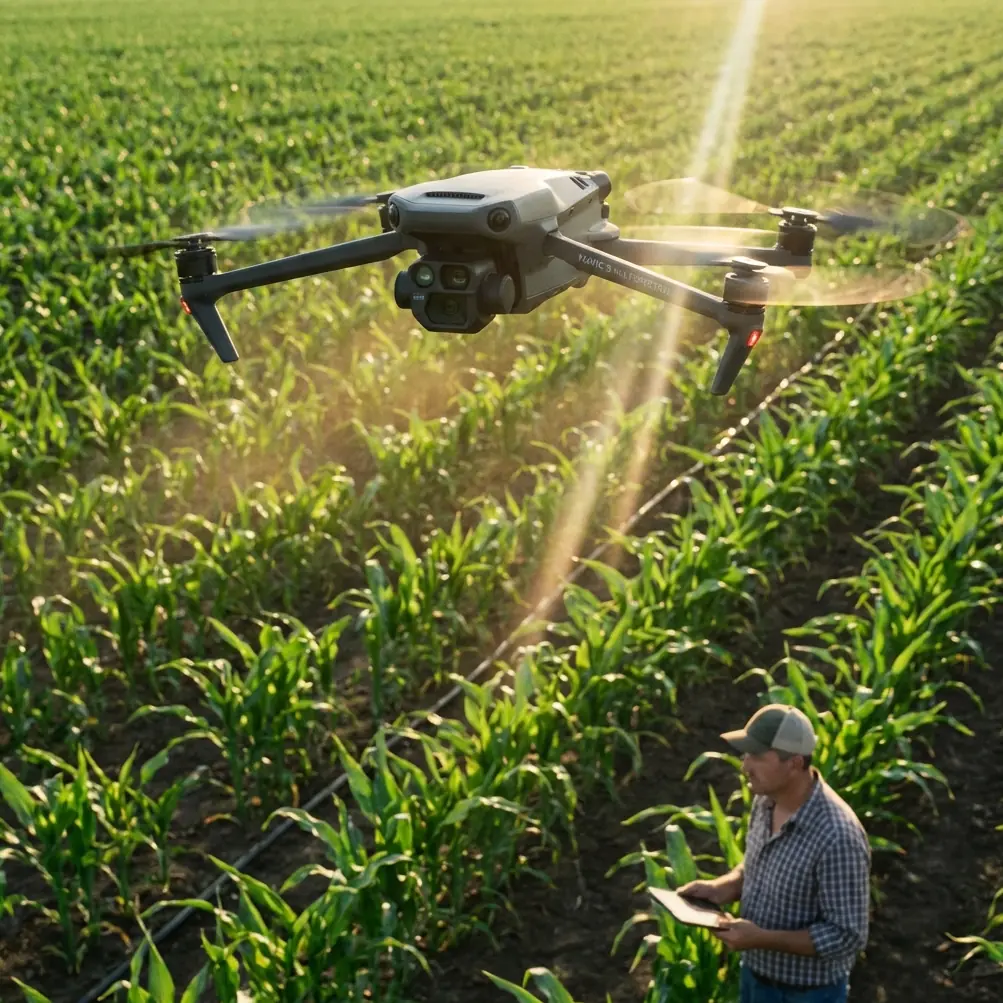
Mountain vineyard mapping presents unique challenges that flat-terrain operations never encounter. The Mavic 3M's multispectral imaging system combined with RTK positioning creates opportunities for precision viticulture—but only when operators understand how terrain affects signal integrity and data quality.
This guide walks you through proven techniques for capturing reliable vineyard data in mountainous regions, from antenna configuration to flight planning strategies that account for elevation changes exceeding 500 meters within a single mission.
Understanding the Mavic 3M's Multispectral Advantage for Viticulture
The Mavic 3M integrates a 4/3 CMOS RGB camera alongside a dedicated multispectral imaging system featuring four narrow-band sensors. These sensors capture data at specific wavelengths critical for vegetation analysis:
- Green band (560nm ±16nm): Chlorophyll reflection assessment
- Red band (650nm ±16nm): Stress detection in canopy
- Red Edge (730nm ±16nm): Early disease identification
- Near-Infrared (860nm ±26nm): Biomass and water content evaluation
For vineyard applications, the Red Edge band proves particularly valuable. Grapevines under water stress or experiencing nutrient deficiencies show spectral shifts in this band 3-5 days before visible symptoms appear in RGB imagery.
The synchronized capture system ensures all five sensors record simultaneously, eliminating registration errors that plague multi-pass systems. This matters significantly when tracking row-by-row variability across terraced mountain vineyards.
Handling Electromagnetic Interference Through Antenna Adjustment
Rocky mountain terrain creates electromagnetic challenges that coastal or plains operations rarely encounter. Mineral deposits, particularly those containing iron oxide and magnetite, generate localized magnetic anomalies that affect compass calibration and RTK signal reception.
During a recent mapping project in a 1,200-meter elevation vineyard, persistent compass errors forced mission aborts until we identified the interference source: a granite outcropping 40 meters from the launch point containing significant magnetite deposits.
Expert Insight: Before launching in mountain vineyards, perform compass calibration at your planned takeoff location, then walk 50 meters in each cardinal direction while monitoring the DJI Pilot 2 compass status. Inconsistent readings indicate localized interference requiring a launch point relocation.
The Mavic 3M's dual-antenna RTK system provides heading accuracy of 0.2 degrees under normal conditions. Mountain operations frequently degrade this to 0.5-0.8 degrees without proper mitigation. The solution involves three adjustments:
Antenna Orientation Protocol:
- Position the aircraft so the primary antenna faces the RTK base station directly
- Maintain line-of-sight between aircraft and base station throughout the mission
- Plan flight paths that keep the aircraft's rear antenna oriented toward open sky rather than cliff faces
Base Station Placement Strategy:
- Establish the base station at the highest accessible point within 2 kilometers of the survey area
- Avoid placement near metal structures, vehicles, or power lines
- Confirm IPX6K-rated protection if morning dew or fog is expected
These adjustments consistently restore RTK Fix rates to 95%+ even in challenging electromagnetic environments.
Flight Planning for Terraced Mountain Vineyards
Terrain-following missions in mountain vineyards require different parameters than flat-field agriculture. The Mavic 3M's terrain-follow system uses downward-facing sensors to maintain consistent altitude above ground level (AGL), but steep slopes introduce complications.
Optimal Flight Parameters
| Parameter | Flat Terrain | Mountain Vineyard (15-30° slope) | Steep Terrain (>30° slope) |
|---|---|---|---|
| Flight Speed | 10-12 m/s | 7-8 m/s | 4-5 m/s |
| AGL Altitude | 30-40m | 40-50m | 50-60m |
| Front Overlap | 75% | 80% | 85% |
| Side Overlap | 65% | 70% | 75% |
| Swath Width | 12-15m | 7-9m | 5-7m |
| GSD Achieved | 1.5 cm/px | 2.0 cm/px | 2.5 cm/px |
The reduced swath width on slopes compensates for perspective distortion in multispectral imagery. Wider swaths on steep terrain create inconsistent ground sampling distances (GSD) between the uphill and downhill edges of each image, complicating NDVI calculations.
Pro Tip: For vineyards with mixed slope angles, divide the property into zones based on terrain steepness. Create separate flight plans for each zone rather than attempting a single mission with averaged parameters. This approach adds 15-20 minutes to total flight time but dramatically improves data consistency.
Accounting for Elevation Changes
The Mavic 3M maintains stable flight up to 6,000 meters above sea level, but battery performance decreases at altitude. At 1,500 meters elevation, expect approximately 12% reduction in flight time compared to sea-level specifications.
Plan missions with these adjusted expectations:
- Maximum flight time at sea level: 43 minutes
- Practical flight time at 1,000m: 38-40 minutes
- Practical flight time at 1,500m: 35-37 minutes
- Practical flight time at 2,000m: 32-34 minutes
Always land with 25% battery remaining in mountain operations. Unexpected updrafts or the need to climb rapidly over terrain features can drain reserves quickly.
Multispectral Calibration for Consistent Data
Spectral data quality depends entirely on proper radiometric calibration. The Mavic 3M includes a calibration panel designed for pre-flight and post-flight reference captures, but mountain conditions introduce variables that affect calibration accuracy.
Lighting Consistency Challenges
Mountain vineyards experience rapid lighting changes as clouds pass over peaks or morning fog burns off unevenly. A 15-minute mission might encounter three distinct lighting conditions, each requiring different radiometric corrections.
The solution involves strategic timing and redundant calibration:
Pre-Flight Calibration Sequence:
- Place the calibration panel on level ground in full sunlight
- Capture reference images at 2 meters AGL with all sensors
- Record ambient light readings using a handheld spectrometer if available
- Note cloud cover percentage and sun angle
Mid-Mission Calibration (for missions exceeding 20 minutes):
- Program a waypoint return to the calibration panel location
- Capture fresh reference images before continuing
- This creates calibration bookends for post-processing software
Post-Flight Calibration:
- Immediately upon landing, capture final calibration images
- Compare pre and post lighting conditions
- If lighting changed significantly, flag the dataset for enhanced radiometric correction
Nozzle Calibration Considerations for Variable Rate Applications
When multispectral data feeds into variable rate application systems for spray operations, nozzle calibration becomes critical. The Mavic 3M's NDVI outputs must translate accurately into prescription maps that spray drones can execute.
Spray drift in mountain vineyards behaves unpredictably due to thermal currents and channeled winds between rows. Prescription maps generated from Mavic 3M data should account for:
- Wind speed thresholds: Pause spray operations when sustained winds exceed 3 m/s on slopes
- Thermal timing: Complete spray applications before 10:00 AM when thermal updrafts intensify
- Buffer zones: Increase spray buffers by 20% on downslope edges to prevent drift into adjacent areas
Common Mistakes to Avoid
Launching from unstable surfaces: Mountain takeoff points often include loose gravel or sloped terrain. The Mavic 3M's downward sensors can misread distance on uneven surfaces, causing unstable hover at launch. Always carry a portable landing pad measuring at least 50cm x 50cm.
Ignoring magnetic declination updates: Mountain regions frequently have significant magnetic declination that changes over relatively short distances. Update the aircraft's magnetic model before each mission rather than relying on cached data from previous flights.
Underestimating terrain data age: The terrain-following system relies on elevation data that may be outdated in actively managed vineyards. Recent terracing, road construction, or erosion can create 5-10 meter discrepancies between mapped and actual elevation. Conduct a manual reconnaissance flight before automated missions in unfamiliar areas.
Single-battery mission planning: Mountain operations consume batteries faster and present fewer emergency landing options. Always plan missions that complete with 30% battery rather than the 20% acceptable in flat terrain. Carry at least three fully charged batteries per hour of planned flight time.
Neglecting temperature effects on sensors: Multispectral sensors perform optimally between 10-35°C. Early morning mountain flights may begin below this range, affecting spectral accuracy for the first 10-15 minutes until sensors warm. Allow the aircraft to hover for 3-5 minutes after power-on before beginning data collection.
Frequently Asked Questions
What RTK Fix rate should I expect in mountain vineyard operations?
With proper base station placement and antenna orientation, RTK Fix rates of 95-98% are achievable in most mountain vineyard environments. Rates below 90% indicate interference issues requiring launch point relocation or base station repositioning. The Mavic 3M's dual-antenna system provides redundancy, but both antennas must maintain clear sky view for optimal performance. Rocky overhangs, dense tree canopy at vineyard edges, or nearby cliff faces can degrade fix rates significantly.
How does slope angle affect multispectral data quality?
Slopes exceeding 15 degrees introduce perspective distortion that affects ground sampling distance consistency across each image frame. The uphill portion of each capture has smaller GSD than the downhill portion, creating NDVI calculation inconsistencies. Compensate by reducing swath width, increasing overlap, and flying slower. Slopes beyond 35 degrees may require manual flight modes rather than automated terrain-following, as the system's 30-degree maximum pitch limitation affects sensor orientation relative to the ground surface.
Can I use the Mavic 3M's multispectral data for irrigation scheduling in mountain vineyards?
The Near-Infrared band provides reliable water stress indicators when properly calibrated. Combine NDVI data with soil moisture sensors for accurate irrigation scheduling. Mountain vineyards often have significant water availability variation across elevation zones—the Mavic 3M can map these differences at centimeter precision when RTK positioning is maintained. Generate prescription maps weekly during the growing season, focusing flights on the 2-hour window after sunrise when plant water status most accurately reflects soil moisture conditions.
Ready for your own Mavic 3M? Contact our team for expert consultation.