Mavic 3M in a Harder Airspace: What Swarm Warfare
Mavic 3M in a Harder Airspace: What Swarm Warfare and Layered Drone Detection Mean for Vineyard Mapping
META: A field-focused analysis of how new swarm-drone tactics and layered radar detection reshape real-world Mavic 3M operations for remote vineyard mapping.
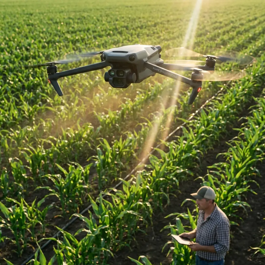
When people discuss the Mavic 3M, the conversation usually stays inside the farm gate: NDVI layers, plant vigor maps, RTK workflows, and flight planning over uneven rows. That is useful, but incomplete. Remote vineyard mapping now sits inside a wider drone environment that is becoming more crowded, more intelligent, and more heavily monitored.
Two recent developments sharpen that reality.
First, a reported live-fire swarm test by Turkey’s STM described a single operator directing 20 Kargu loitering munitions in a coordinated mission. Second, DroneShield announced a partnership with Robin Radar Systems to integrate radar into a layered drone-detection architecture. One story is about autonomy at scale. The other is about airspace visibility and counter-UAS detection becoming more sophisticated. Neither story is about agriculture on its face. Both matter to anyone flying a Mavic 3M in remote vineyards.
I say that as someone who has spent more time than I care to admit trying to map difficult blocks where the technical challenge was not just image capture. It was operational certainty. Can the aircraft hold a stable positioning solution at the far end of a valley? Can the pilot maintain clean flight discipline around patchy communications? Can the team distinguish normal low-altitude operations from activity that security systems may flag as suspicious? In the past, these problems were often treated as separate. They are no longer separate.
The Mavic 3M becomes more valuable when you understand it in that broader context.
The old vineyard problem was never just about crops
A remote vineyard creates an odd mix of precision and isolation. The agronomy demands centimeter-level repeatability, especially when you are comparing canopy development over time or trying to isolate irrigation stress from disease pressure. Yet the operating environment often works against you. Terrain breaks line of sight. Wind channels through rows. Launch points are compromised by dust, slope, or restricted access. Connectivity drops when you need it most.
A few seasons ago, one of the recurring frustrations in multispectral mapping was not image quality itself. It was operational friction. You could plan the mission carefully, set overlap conservatively, and still lose efficiency because the team had to re-fly sections after inconsistent positioning or poor flight geometry in challenging conditions. If you were also trying to align imagery with downstream ground truth, every gap in the chain became expensive in time.
That is where the Mavic 3M changed the equation for many field teams. Not because it eliminated complexity, but because it reduced the number of weak links in a real agricultural workflow. Its appeal in vineyards is not abstract. It is practical: multispectral capture, repeatable route execution, and the ability to build health maps that actually support decisions in irrigation, nutrition, and targeted intervention.
But the external environment is changing around that workflow.
Swarm autonomy changes how all drones are perceived
The Turkish swarm test stands out because of one specific operational detail: one operator reportedly directed 20 loitering munitions in a coordinated attack. That number matters. Twenty aircraft under one human controller signals a clear shift away from the older one-pilot-one-drone mental model. Even if agricultural users are flying a single Mavic 3M over vines, the broader drone ecosystem is moving toward higher autonomy, distributed control, and more complex machine behavior.
Why should a vineyard manager care?
Because public and institutional perceptions of drones are shaped less by vineyard mapping than by the most sensitive uses of the technology. As swarm concepts mature, regulators, infrastructure operators, and private security teams have stronger incentives to treat unidentified low-altitude aircraft with greater scrutiny. A drone over a remote agricultural property may still be legitimate. But the threshold for asking questions about intent, identity, and flight profile is likely to get lower, not higher.
For Mavic 3M operators, that has a direct operational significance. Flight planning can no longer focus only on agronomic efficiency. It also has to account for airspace interpretation. The cleaner your mission design, the better. Predictable track lines. Consistent altitude. Clear documentation of purpose. Tight geofencing discipline. Good records of launch point and route. These were once best practices. Increasingly, they are part of being legible in an airspace where detection systems and human observers are primed to notice patterns.
That is not paranoia. It is professionalism.
Layered detection means “remote” no longer means unseen
The DroneShield-Robin Radar integration is the other side of the same coin. The key fact here is not merely that a partnership was announced. It is that Robin’s radar is being integrated into a layered drone-detection solution. Layered detection matters because no single sensor sees everything well. Radar broadens awareness. Other sensors refine identification and response. Together, they make low-altitude drone activity easier to detect, classify, and track.
For a vineyard operator, especially in a remote area, that has two implications.
First, do not assume rural geography equals low visibility. Agricultural estates near sensitive infrastructure, logistics corridors, private industrial sites, or protected facilities may fall closer to monitored airspace than operators realize. A Mavic 3M flying a perfectly lawful mapping mission may still be seen by systems designed for security rather than agronomy.
Second, the quality of your operational conduct starts to matter more than ever. If a flight is detected, can its behavior be recognized as routine and controlled? A mapping mission with disciplined swath width, uniform speed, stable altitude, and orderly turns looks very different from erratic maneuvering. The Mavic 3M is well suited to that kind of structured flight, which is one reason it remains strong for vineyard mapping: it helps teams behave like survey operators, not hobby pilots improvising in the field.
What this means specifically for Mavic 3M vineyard workflows
This broader airspace story does not reduce the usefulness of the Mavic 3M. It actually clarifies where it fits best.
In vineyards, the Mavic 3M earns its keep through repeatable multispectral capture. That matters when you are trying to identify stress patterns before they are obvious from ground level. Multispectral data is not magic, but it can be decisive when the goal is to isolate underperforming rows, compare vigor zones, and prioritize field visits in large or fragmented estates.
The remote vineyard scenario makes those strengths more meaningful. When crews cannot easily drive every block, a high-quality aerial pass becomes a force multiplier. You can map, identify anomalies, then send boots only where they are needed. That shortens response time and reduces wasted inspection labor.
The practical challenge is keeping the data reliable in field conditions. This is where the often-overlooked details matter.
A strong RTK fix rate is not just a specification to admire in marketing copy. In vineyard work, it underpins repeatability. If you are revisiting the same block to compare canopy development across time, positioning consistency reduces alignment headaches later. Centimeter precision supports more defensible temporal analysis, especially when rows are tight and terrain is irregular. The difference between a stable solution and a marginal one shows up downstream in confidence, not just in logs.
Swath width also deserves more respect than it usually gets. Wider is not automatically better in vineyards. A swath that looks efficient on paper can become problematic if row geometry, edge effects, or elevation changes degrade coverage quality. The Mavic 3M works best when operators treat swath width as a quality-control variable rather than simply a productivity lever. In remote terrain, a slightly more conservative pattern often saves time because it prevents partial re-flights.
And although the Mavic 3M is not a sprayer, readers planning integrated drone programs should not separate mapping from spray execution too sharply. Spray drift and nozzle calibration still belong in the conversation because multispectral maps often guide where spray resources go next. If the imagery says one thing but the application hardware performs inconsistently, the vineyard loses the benefit of precision. Mapping only pays off when it improves action.
A more disciplined field method now wins twice
There is a quiet operational lesson in these two news items. The drone sector is becoming more capable and more observable at the same time. Better autonomy on one side. Better detection on the other. For agricultural professionals, the response is not to fly less intelligently. It is to fly more deliberately.
That starts before takeoff.
In remote vineyard missions, I recommend building every Mavic 3M deployment around four questions:
- Is the route optimized for repeatability rather than just speed?
- Is the expected positioning performance good enough for time-series comparison?
- Is the flight profile orderly enough to be readily understood if observed or detected?
- Is the output tied to a concrete field decision, not just map generation for its own sake?
When teams get these right, the Mavic 3M becomes much easier to justify operationally. It is no longer just a sensor platform collecting attractive maps. It becomes part of a documented agronomic process with a clear purpose and disciplined execution.
That shift also helps when coordinating among stakeholders. Vineyard owners want actionable insight. Farm managers want practical tasking. Compliance-minded teams want predictable procedures. Pilots want fewer surprises. A well-run Mavic 3M mission serves all four.
The past challenge: too many avoidable re-flights
If I compare current practice with the pain points many teams used to accept, the biggest improvement is not flashy. It is fewer avoidable re-flights.
That was the old tax on remote mapping. You would discover after landing that one block needed another pass because overlap was compromised by terrain, or positioning degraded, or mission geometry was too aggressive for the site. Then the light changed, wind picked up, and your “efficient” survey became a day-long nuisance.
The Mavic 3M made that easier by supporting a more controlled, survey-grade mindset in a compact platform. That is the real operational win. Not convenience for its own sake, but a narrower gap between planned mission and usable agronomic output.
Now place that against a world where swarm operations are demonstrating high levels of coordinated autonomy and airspace security firms are adding stronger radar-based awareness. Suddenly, disciplined agricultural mapping is not only about getting better plant data. It is also about operating in a way that remains credible, explainable, and professional in a more sensitive low-altitude environment.
That may sound like a subtle distinction. In practice, it is not subtle at all.
Why this moment matters for remote vineyard operators
Remote vineyards often adopt technology for practical reasons first. Labor scarcity. Terrain difficulty. Uneven crop performance. Long travel times between blocks. Those reasons remain valid. But the timing now matters because the external drone landscape is shifting faster than many agricultural users realize.
A single operator controlling 20 aircraft in a military swarm test is one signal. Radar being folded into a layered detection stack is another. Together, they indicate that the low-altitude airspace around us is being redefined by scale, automation, and surveillance.
For Mavic 3M operators, the opportunity is to stay ahead of that curve by treating vineyard mapping as a precision operation in every sense: data precision, route precision, and behavioral precision.
That means tighter SOPs. Better mission logs. More careful launch-site selection. Stronger awareness of nearby sensitive zones. Cleaner communication with landowners and neighboring facilities when appropriate. And above all, a commitment to extracting field value from each flight rather than flying because the aircraft is available.
If your team is refining that workflow and wants a practical discussion around mission design, RTK discipline, multispectral deliverables, or how mapping links to downstream application planning, you can start the conversation here: message our field team.
The Mavic 3M remains a strong tool for vineyard mapping in remote terrain. The difference now is that success depends on seeing the aircraft not just as a farm sensor, but as part of a drone ecosystem that has become more intelligent and more visible. Operators who adapt to that reality will get better maps, fewer wasted flights, and far fewer surprises.
Ready for your own Mavic 3M? Contact our team for expert consultation.