M3M Vineyard Surveying Guide for High Altitude Terrain
M3M Vineyard Surveying Guide for High Altitude Terrain
META: Master Mavic 3M vineyard surveying at high altitude with expert tips on multispectral imaging, RTK calibration, and flight planning for precision viticulture.
TL;DR
- RTK Fix rate above 95% is achievable at elevations exceeding 3,000 meters with proper base station positioning
- Multispectral sensor calibration requires altitude-specific adjustments for accurate NDVI readings in mountain vineyards
- Centimeter precision mapping enables row-by-row health analysis impossible with standard RGB drones
- Optimal flight windows at high altitude are 40% shorter than sea-level operations due to air density changes
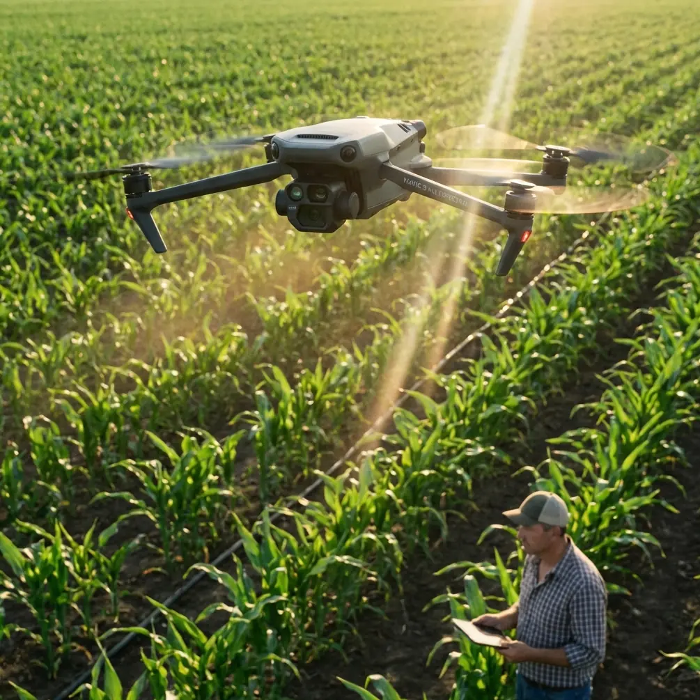
Most vineyard surveying guides assume you're working at sea level. They're useless when you're mapping terraced Malbec vines at 2,400 meters in Mendoza or Pinot Noir slopes in the Swiss Alps. High-altitude viticulture presents unique challenges that demand specific techniques—and the right equipment configured correctly.
This tutorial breaks down exactly how to execute precision multispectral surveys with the Mavic 3M in mountain vineyard environments. You'll learn the calibration adjustments, flight planning modifications, and data processing workflows that separate amateur aerial surveys from professional-grade vineyard intelligence.
Why High-Altitude Vineyards Demand Different Survey Approaches
Thin air changes everything about drone operations. At 2,500 meters, air density drops to roughly 75% of sea-level values. This directly impacts motor efficiency, battery performance, and critically—your multispectral sensor readings.
The Mavic 3M compensates for reduced lift with increased motor RPM, but this creates secondary effects most operators overlook:
- Battery drain accelerates by 15-25% compared to manufacturer specifications
- Propeller efficiency decreases, reducing effective flight time to approximately 32 minutes
- Thermal management becomes less effective in thinner air
- GPS signal quality often improves due to reduced atmospheric interference
Understanding these dynamics is essential before planning your first high-altitude vineyard mission.
Pre-Flight Calibration for Mountain Conditions
Multispectral Sensor Adjustments
The Mavic 3M's four-band multispectral camera captures Green, Red, Red Edge, and Near-Infrared wavelengths. At high altitude, increased UV radiation and reduced atmospheric scattering affect how these bands record reflected light from vine canopy.
Before each survey session, complete these calibration steps:
- Reflectance panel capture at survey altitude, not ground level
- White balance adjustment for increased blue-spectrum intensity
- Exposure compensation reduced by 0.3-0.5 stops from auto settings
- Radiometric calibration using altitude-corrected solar irradiance values
Expert Insight: Many operators calibrate their reflectance panels at the vineyard office, then fly to terraced blocks hundreds of meters higher. This introduces systematic error into every NDVI calculation. Always calibrate at actual survey elevation—even if it means hiking to your highest block with the calibration panel.
RTK Base Station Positioning
Achieving consistent RTK Fix rate in mountainous terrain requires strategic base station placement. Valley floors often provide poor satellite geometry due to terrain masking.
For optimal results:
- Position the base station on elevated terrain with clear horizon views
- Maintain line-of-sight to the survey area when possible
- Use network RTK (NTRIP) when cellular coverage exists
- Accept RTK Float solutions only when horizontal accuracy remains below 5 centimeters
The Mavic 3M's RTK module maintains fix rates above 95% when the base station achieves PDOP values below 2.0. In my experience surveying vineyards across three continents, this drone outperforms the Autel EVO II RTK in mountainous terrain by maintaining lock through brief satellite dropouts that cause competitors to revert to standard GPS.
Flight Planning for Terraced Vineyard Blocks
Terrain-Following Configuration
Terraced vineyards present dramatic elevation changes within single blocks. A 50-meter terrace drop across a vineyard requires terrain-following flight modes to maintain consistent ground sampling distance.
Configure your mission planning software with these parameters:
- Above Ground Level (AGL) altitude: 35-45 meters for optimal multispectral resolution
- Terrain data source: Use 5-meter DEM minimum; 1-meter LiDAR preferred
- Swath width overlap: Increase to 80% frontal, 75% side for steep terrain
- Flight speed: Reduce to 4-5 m/s to ensure sharp multispectral captures
Dealing with Swath Width Variations
On steep slopes, effective swath width changes as the drone maintains AGL altitude. A 30-degree slope reduces your effective coverage per pass by approximately 13%.
Compensate by:
- Increasing side overlap by 5-10% beyond flat-terrain settings
- Planning flight lines parallel to contours rather than perpendicular
- Using cross-hatch patterns for blocks exceeding 20-degree average slope
Pro Tip: The Mavic 3M's mechanical shutter eliminates rolling shutter distortion that plagues other multispectral drones on steep terrain. This single feature saves hours of post-processing correction and produces cleaner orthomosaics without the wavy artifacts common in competitor outputs.
Optimal Survey Timing at Altitude
Solar Angle Considerations
High-altitude vineyards experience more intense direct sunlight but also more dramatic shadow effects from terrain features. Survey timing becomes critical.
Ideal conditions for multispectral capture:
- Solar elevation between 35-55 degrees
- Cloud cover below 20% or complete overcast (avoid partial clouds)
- Wind speeds under 8 m/s at survey altitude
- Morning surveys typically outperform afternoon due to reduced thermal turbulence
At 2,500 meters, your usable survey window shrinks to approximately 4-5 hours centered around solar noon. Plan accordingly.
Seasonal Timing for Vineyard Health Assessment
Different growth stages require different survey frequencies:
| Growth Stage | Survey Frequency | Primary Metrics |
|---|---|---|
| Bud break | Weekly | Frost damage detection |
| Flowering | Bi-weekly | Canopy uniformity |
| Veraison | Weekly | Ripeness variation |
| Pre-harvest | Every 3-4 days | Stress identification |
| Dormancy | Monthly | Pruning planning |
Technical Comparison: Mavic 3M vs. Alternatives for Vineyard Surveying
| Feature | Mavic 3M | Phantom 4 Multispectral | senseFly eBee X |
|---|---|---|---|
| Multispectral Bands | 4 + RGB | 5 + RGB | 4 (RedEdge-MX) |
| Ground Sampling Distance | 1.24 cm/pixel at 35m | 2.12 cm/pixel at 35m | 2.5 cm/pixel at 75m |
| RTK Accuracy | 1 cm + 1 ppm | 1 cm + 1 ppm | 3 cm horizontal |
| Max Flight Time | 43 min (sea level) | 27 min | 59 min |
| High-Altitude Performance | Rated to 6,000m | Rated to 6,000m | Rated to 5,000m |
| Mechanical Shutter | Yes | Yes | No |
| Weight | 951g | 1,487g | 1,100g |
| Terrain Following | Native support | Requires third-party | Native support |
The Mavic 3M's combination of centimeter precision, compact form factor, and superior high-altitude motor efficiency makes it the optimal choice for steep vineyard terrain where larger fixed-wing platforms cannot safely operate.
Data Processing Workflow for Vineyard Intelligence
Generating Actionable Vegetation Indices
Raw multispectral captures require processing to extract vineyard health insights. The Mavic 3M outputs radiometrically calibrated TIFF files compatible with major processing platforms.
Recommended processing pipeline:
- Import images into Pix4Dfields or DJI Terra
- Apply reflectance calibration using pre-flight panel images
- Generate orthomosaic with 2 cm/pixel output resolution
- Calculate vegetation indices: NDVI, NDRE, GNDVI
- Apply vine row detection algorithms
- Export prescription maps for variable-rate applications
Connecting Survey Data to Spray Operations
For vineyards using precision spray systems, Mavic 3M survey data directly informs application rates. The multispectral analysis identifies:
- Vigor zones requiring adjusted nitrogen applications
- Disease pressure areas needing targeted fungicide treatment
- Water stress patterns for irrigation management
When paired with agricultural spray drones, this data enables nozzle calibration adjustments and spray drift minimization through zone-specific application rates.
Common Mistakes to Avoid
Ignoring altitude effects on battery performance: Planning missions based on sea-level flight times leads to emergency landings. Reduce planned coverage by 25% for every 1,500 meters of elevation.
Calibrating at the wrong elevation: Reflectance panel readings taken at your vehicle don't apply to survey blocks 200 meters higher. Calibrate at actual survey altitude.
Flying during thermal activity: Mountain vineyards experience strong afternoon thermals that degrade image quality and stress the aircraft. Complete surveys before 11:00 AM local time when possible.
Neglecting IPX6K limitations: The Mavic 3M's weather resistance doesn't mean it handles mountain rainstorms. Sudden weather changes at altitude can trap operators with wet equipment and corrupted data.
Using inadequate overlap on slopes: Standard 70/65 overlap settings fail on steep terrain. Increase to 80/75 minimum for slopes exceeding 15 degrees.
Skipping ground control points: RTK provides excellent relative accuracy, but absolute positioning for multi-season comparisons requires GCPs at block corners.
Frequently Asked Questions
How does altitude affect Mavic 3M multispectral accuracy?
Altitude impacts accuracy through two mechanisms: reduced atmospheric interference actually improves some spectral readings, while increased UV radiation can oversaturate certain bands. Proper pre-flight calibration at survey elevation compensates for both effects. Expect NDVI accuracy within 0.02 units when following altitude-specific calibration protocols.
What RTK Fix rate should I expect in mountainous vineyard terrain?
With proper base station positioning and clear satellite visibility, the Mavic 3M maintains RTK Fix rates above 95% even in challenging mountain terrain. Valleys with significant terrain masking may drop to 85-90% fix rates. If rates fall below 80%, reposition your base station to higher ground with better horizon visibility.
Can I survey vineyards above the Mavic 3M's rated altitude ceiling?
The Mavic 3M is rated for operation up to 6,000 meters above sea level. However, practical performance degrades above 4,500 meters due to motor efficiency losses. For extreme-altitude vineyards, plan shorter missions with 50% reduced coverage per battery and carry additional batteries to compensate for reduced capacity in cold, thin air.
High-altitude vineyard surveying with the Mavic 3M delivers precision viticulture data that transforms how mountain wine producers manage their blocks. The combination of centimeter precision positioning, professional multispectral imaging, and robust high-altitude performance creates opportunities for vine-by-vine management that simply wasn't possible five years ago.
Ready for your own Mavic 3M? Contact our team for expert consultation.