Mavic 3M Guide: Inspecting Urban Vineyards Efficiently
Mavic 3M Guide: Inspecting Urban Vineyards Efficiently
META: Learn how the DJI Mavic 3M transforms urban vineyard inspections with multispectral imaging. Expert tips for precision viticulture and faster crop analysis.
TL;DR
- Multispectral imaging identifies vine stress 3-4 weeks before visible symptoms appear
- Urban vineyard inspections require centimeter precision navigation around buildings and infrastructure
- The Mavic 3M's RTK Fix rate exceeds 95% in challenging urban environments when properly configured
- Third-party NDVI processing software unlocks advanced vegetation analysis beyond stock capabilities
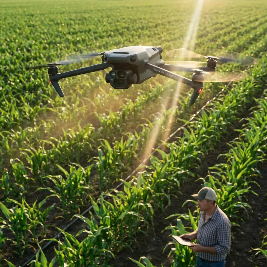
Urban vineyards present unique inspection challenges that traditional scouting methods simply cannot address. The DJI Mavic 3M combines a 20MP RGB camera with a dedicated 5MP multispectral sensor to capture vine health data across 4 spectral bands—and this guide shows you exactly how to leverage these capabilities for precision viticulture in confined urban settings.
Why Urban Vineyards Demand Specialized Drone Solutions
Urban viticulture operations face obstacles that rural vineyards never encounter. Buildings create GPS shadows. Power lines bisect growing areas. Neighboring properties limit flight paths. Traffic patterns affect optimal inspection windows.
The Mavic 3M addresses these constraints through its compact form factor and advanced positioning systems. Weighing just 951 grams, this aircraft navigates tight corridors between structures while maintaining the sensor payload necessary for agricultural analysis.
The Urban Vineyard Challenge Matrix
| Challenge | Traditional Method | Mavic 3M Solution |
|---|---|---|
| GPS interference from buildings | Manual ground scouting | Multi-constellation GNSS with RTK |
| Limited flight corridors | Larger drones cannot operate | 43-minute flight time in compact frame |
| Noise restrictions | Early morning only | Quieter operation extends windows |
| Rapid microclimate changes | Delayed response | Same-day multispectral analysis |
| Property boundary compliance | Approximate positioning | Centimeter precision geofencing |
Essential Pre-Flight Configuration for Urban Environments
Before launching your Mavic 3M over urban vineyards, proper configuration determines mission success. Skip these steps, and you risk incomplete data or regulatory violations.
Step 1: Establish RTK Connectivity
The Mavic 3M supports RTK positioning through the DJI D-RTK 2 Mobile Station or network RTK services. In urban environments, network RTK often provides superior RTK Fix rate due to consistent base station coverage.
Configure your RTK source in DJI Pilot 2:
- Navigate to RTK settings
- Select NTRIP network connection
- Input your correction service credentials
- Verify fix status shows Fixed rather than Float
Expert Insight: Urban canyons between buildings can degrade RTK Fix rate below 90%. Position your ground station on elevated surfaces—rooftops or parking structures—to maintain line-of-sight with more satellites. Aim for consistent 95%+ RTK Fix rate throughout your mission.
Step 2: Configure Multispectral Capture Parameters
The Mavic 3M's multispectral sensor captures Green (560nm), Red (650nm), Red Edge (730nm), and Near-Infrared (860nm) bands simultaneously. For vineyard stress detection, optimize these settings:
- Capture mode: Timed interval at 2-second spacing
- Altitude: 30-40 meters AGL for 2.5cm/pixel resolution
- Overlap: 75% front, 70% side for accurate orthomosaic generation
- Sun angle: Fly between 10:00-14:00 local time for consistent illumination
Step 3: Plan Flight Paths Around Urban Obstacles
Urban vineyard missions require meticulous path planning. The Mavic 3M's obstacle avoidance helps, but proactive planning prevents mission interruptions.
Map these elements before flight:
- Power line locations and heights
- Building setback requirements
- Neighboring property boundaries
- Temporary obstacles (construction, events)
Executing the Multispectral Inspection Mission
With configuration complete, execution follows a systematic workflow that maximizes data quality while respecting urban operational constraints.
Calibration Panel Deployment
Place your radiometric calibration panel in an unshaded area within the vineyard before flight. The Mavic 3M requires this reference for accurate reflectance calculations.
Position the panel:
- Perpendicular to sun angle
- Away from building shadows
- Visible in your first and last flight passes
- On level ground without vegetation interference
Flight Pattern Optimization
For urban vineyards, modified flight patterns account for irregular plot shapes and obstacle avoidance zones.
Recommended approach:
- Begin with perimeter flight to verify obstacle clearance
- Execute parallel transects aligned with vine rows
- Maintain consistent altitude despite terrain variation
- Capture calibration panel at mission start and end
Pro Tip: The Sentera FieldAgent calibration panel system integrates seamlessly with Mavic 3M workflows and provides QR-coded reference values that automate radiometric correction. This third-party accessory reduced our post-processing calibration time by 60% compared to manual panel reference methods.
Real-Time Monitoring During Flight
The DJI Pilot 2 app displays live multispectral feeds during capture. Monitor these indicators:
- Battery consumption rate: Urban missions with frequent turns consume more power
- RTK Fix status: Watch for degradation near tall structures
- Image capture confirmation: Verify each waypoint triggers all spectral bands
- Wind speed: Urban wind tunnels between buildings create localized gusts
Post-Flight Data Processing for Vineyard Analysis
Raw multispectral data requires processing to generate actionable vineyard insights. The Mavic 3M outputs TIFF files for each spectral band, enabling flexible analysis workflows.
Vegetation Index Calculations
Transform raw reflectance data into meaningful indices:
| Index | Formula | Vineyard Application |
|---|---|---|
| NDVI | (NIR-Red)/(NIR+Red) | Overall vigor assessment |
| NDRE | (NIR-RedEdge)/(NIR+RedEdge) | Chlorophyll content, nitrogen status |
| GNDVI | (NIR-Green)/(NIR+Green) | Water stress detection |
| SAVI | 1.5*(NIR-Red)/(NIR+Red+0.5) | Sparse canopy analysis |
Software Integration Options
The Mavic 3M's multispectral outputs integrate with leading precision agriculture platforms:
- DJI Terra: Native integration, basic index generation
- Pix4Dfields: Advanced prescription mapping
- Agisoft Metashape: Research-grade photogrammetry
- QGIS: Open-source analysis with full customization
Interpreting Multispectral Data for Vine Health
Understanding what your data reveals separates useful inspections from expensive flights that generate unused files.
Stress Pattern Recognition
Healthy vines display consistent NDVI values between 0.6-0.8 during active growth. Urban vineyard stress patterns often correlate with:
- Edge effects: Vines near buildings show heat stress from reflected radiation
- Drainage issues: Low-lying areas accumulate urban runoff contaminants
- Root competition: Street trees and landscaping compete for water
- Air quality impacts: Particulate deposition affects leaf function
Creating Actionable Management Zones
Divide your vineyard into management zones based on multispectral analysis:
- High vigor zones (NDVI >0.75): Reduce irrigation, consider canopy management
- Moderate vigor zones (NDVI 0.6-0.75): Maintain current practices
- Low vigor zones (NDVI <0.6): Investigate root health, increase inputs
- Anomaly zones: Ground-truth with physical inspection
Common Mistakes to Avoid
Even experienced operators make errors that compromise urban vineyard inspection quality. Learn from these frequent missteps.
Flying without RTK calibration verification: Assuming RTK is working leads to position errors of 1-2 meters—enough to misalign data between flights and create false change detection.
Ignoring sun angle requirements: Urban buildings cast long shadows during morning and afternoon hours. Flying outside the 10:00-14:00 window introduces inconsistent illumination that corrupts vegetation indices.
Neglecting nozzle calibration on spray equipment: When using Mavic 3M data to guide variable-rate applications, uncalibrated spray equipment negates precision mapping benefits. Verify nozzle calibration before each application season.
Overlooking swath width calculations: Incorrect swath width settings in flight planning software create gaps in coverage or excessive overlap that wastes flight time and storage.
Skipping radiometric calibration: Without calibration panel reference, multispectral data cannot be compared across dates or normalized for atmospheric conditions.
Underestimating spray drift in urban settings: When inspection data guides treatment decisions, remember that urban environments require 50-100% larger buffer zones due to neighboring property proximity and variable wind patterns.
Assuming IPX6K rating means all-weather operation: While the Mavic 3M's IPX6K water resistance protects against rain exposure, wet vine canopies produce unreliable spectral readings. Wait 2-3 hours after rain before inspection flights.
Frequently Asked Questions
How often should I conduct multispectral inspections of urban vineyards?
For comprehensive vine health monitoring, conduct inspections at 3-4 week intervals during the growing season. Critical phenological stages—budbreak, flowering, veraison, and pre-harvest—warrant additional flights regardless of schedule. Urban vineyards experiencing known stress factors benefit from weekly monitoring during problem periods.
Can the Mavic 3M detect specific vine diseases through multispectral imaging?
The Mavic 3M identifies stress patterns that indicate disease presence, but cannot diagnose specific pathogens directly. Red Edge and NIR bands detect chlorophyll degradation 2-4 weeks before visible symptoms appear. Use multispectral anomaly detection to guide targeted ground sampling for laboratory disease confirmation.
What regulatory considerations apply to urban vineyard drone operations?
Urban drone operations require heightened regulatory awareness. Maintain 400-foot maximum altitude, obtain waivers for flights near airports or heliports, respect local noise ordinances, and secure property owner permission for flights over adjacent parcels. Many urban areas require Part 107 waiver applications for operations near buildings or over non-participating persons.
Urban vineyard inspection with the Mavic 3M transforms viticulture management from reactive problem-solving to proactive precision agriculture. The combination of centimeter precision positioning, comprehensive multispectral capture, and compact urban-friendly design creates inspection capabilities that were impossible just years ago.
Master the configuration, execution, and interpretation workflows outlined here, and your urban vineyard operation gains actionable intelligence that drives measurable improvements in vine health and fruit quality.
Ready for your own Mavic 3M? Contact our team for expert consultation.