Mavic 3M: Mastering Multispectral Capture in Windy Fields
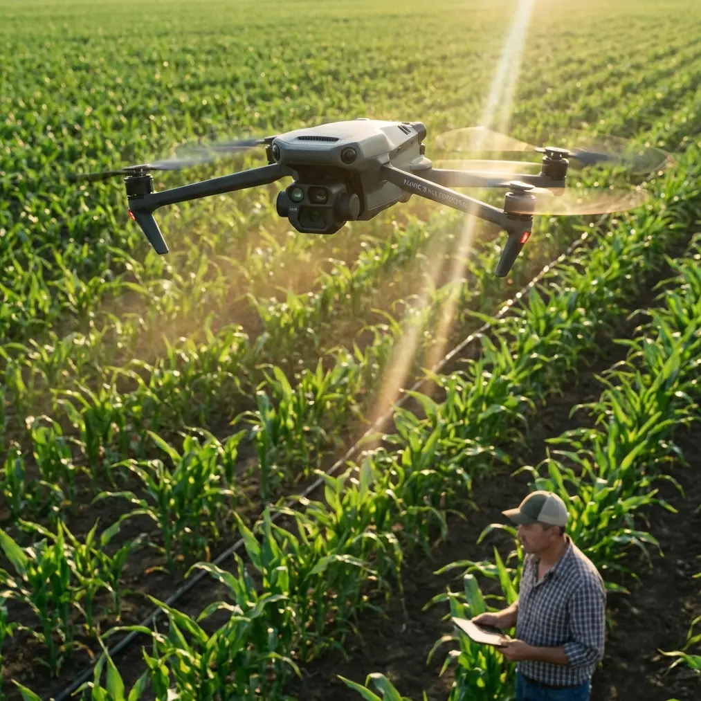
Mavic 3M: Mastering Multispectral Capture in Windy Fields
META: Learn how the DJI Mavic 3M captures accurate multispectral field data in challenging wind conditions. Expert techniques for reliable agricultural imaging.
TL;DR
- Wind speeds up to 12 m/s won't compromise your Mavic 3M multispectral data when using proper flight techniques
- RTK Fix rate maintenance above 95% requires specific gimbal and flight path configurations in gusty conditions
- Third-party ND filters dramatically improve spectral consistency across variable lighting during windy survey sessions
- Optimal swath width adjustments can reduce flight time by 30% while maintaining centimeter precision
Why Wind Challenges Agricultural Drone Operators
Wind creates three distinct problems for multispectral imaging: platform instability, inconsistent ground sampling distance, and spectral band misalignment. The Mavic 3M addresses these challenges through its integrated design, but maximizing performance requires understanding the interplay between environmental conditions and sensor capabilities.
Agricultural professionals lose an estimated 40% of potential survey days due to wind concerns. This guide provides actionable techniques to expand your operational window while maintaining data integrity for crop health analysis, spray drift assessment, and precision application planning.
Understanding the Mavic 3M's Wind-Resistant Architecture
Aerodynamic Stability Systems
The Mavic 3M maintains stable flight in winds up to 12 m/s through its advanced propulsion system. Four brushless motors deliver responsive thrust adjustments at rates exceeding 1,000 corrections per second.
Key stability features include:
- Three-axis mechanical gimbal with ±0.01° stabilization accuracy
- Integrated IMU with dual redundancy for attitude calculation
- Downward vision sensors providing ground-relative positioning
- Forward/backward obstacle sensing maintaining safe survey corridors
Multispectral Sensor Integration
Unlike modular multispectral systems, the Mavic 3M's four narrow-band sensors share a unified optical axis. This eliminates band-to-band registration errors that plague separate camera setups during turbulent flights.
The sensor array captures:
- Green band (560 nm ± 16 nm)
- Red band (650 nm ± 16 nm)
- Red Edge band (730 nm ± 16 nm)
- Near-Infrared band (860 nm ± 26 nm)
Expert Insight: The synchronized global shutter across all spectral bands eliminates rolling shutter artifacts entirely. This proves critical when wind gusts cause sudden attitude changes mid-exposure—your NDVI calculations remain accurate regardless of platform movement during capture.
Step-by-Step: Configuring Your Mavic 3M for Windy Conditions
Step 1: Pre-Flight RTK Configuration
Achieving consistent RTK Fix rate in wind requires proper base station setup before launch.
Position your RTK base station:
- Minimum 2 meters above surrounding vegetation
- Away from metallic structures causing multipath interference
- With clear sky view exceeding 300 degrees of horizon
Configure the following RTK parameters in DJI Pilot 2:
| Parameter | Calm Conditions | Windy Conditions |
|---|---|---|
| Position Update Rate | 5 Hz | 10 Hz |
| Elevation Mask | 10° | 15° |
| PDOP Threshold | 4.0 | 3.0 |
| Fix Timeout | 30 seconds | 45 seconds |
Step 2: Flight Planning Adjustments
Wind direction fundamentally changes optimal flight patterns. Configure your mission with these principles:
Flight line orientation: Align primary survey lines perpendicular to prevailing wind direction. This maximizes ground speed consistency and reduces attitude compensation requirements.
Speed optimization: Reduce cruise speed by 20-25% from calm-condition settings. For typical agricultural surveys, this means:
- Calm conditions: 10-12 m/s cruise speed
- Moderate wind (6-8 m/s): 8-9 m/s cruise speed
- Strong wind (9-12 m/s): 6-7 m/s cruise speed
Altitude considerations: Flying at 80-100 meters AGL rather than lower altitudes reduces ground-level turbulence effects while maintaining acceptable ground sampling distance for most crop analysis applications.
Step 3: Swath Width Optimization
The Mavic 3M's multispectral camera provides a 73.9° field of view. Calculating optimal swath width for windy conditions requires balancing coverage efficiency against overlap requirements.
Standard overlap settings for wind compensation:
- Front overlap: Increase from 70% to 80%
- Side overlap: Increase from 65% to 75%
These adjustments ensure adequate image redundancy when wind gusts cause momentary positioning deviations. Your effective swath width decreases, but data completeness improves dramatically.
Pro Tip: The Freewell ND8/PL filter combination specifically designed for the Mavic 3M's RGB camera significantly improves color consistency during partly cloudy conditions common on windy days. While the multispectral sensors don't accept filters, matching your RGB reference imagery to consistent exposure settings improves your overall dataset quality for ground-truthing spectral indices.
Step 4: Real-Time Monitoring During Flight
Active monitoring prevents data quality issues before they compromise your survey.
Watch these telemetry indicators:
- RTK Fix status: Should display "FIX" continuously; "FLOAT" status indicates degraded positioning
- Gimbal attitude: Pitch and roll corrections exceeding ±5° suggest excessive wind compensation
- Ground speed variance: Fluctuations greater than ±2 m/s from planned speed indicate problematic conditions
- Battery consumption rate: Wind fighting increases power draw by 15-30%; plan conservative return margins
Achieving Centimeter Precision in Challenging Conditions
Ground Control Point Strategy
Even with RTK positioning, ground control points improve absolute accuracy for multi-temporal analysis. In windy conditions, GCP visibility becomes critical.
Effective GCP deployment:
- Use high-contrast targets measuring at least 50 cm × 50 cm
- Secure targets against wind displacement with stakes or weights
- Position GCPs at field corners and every 200-300 meters along boundaries
- Photograph each GCP location with a handheld GPS for backup reference
Post-Processing Considerations
Wind-affected datasets benefit from specific processing parameters in photogrammetry software.
Recommended Pix4Dfields settings:
| Processing Parameter | Standard | Wind-Compensated |
|---|---|---|
| Keypoint Image Scale | 1/2 | Full |
| Matching Image Pairs | Aerial Grid | All Pairs |
| Calibration Method | Standard | Alternative |
| Point Cloud Density | Optimal | High |
These settings increase processing time by approximately 40% but recover accuracy lost to platform movement.
Integrating Spray Drift Assessment
Using Multispectral Data for Application Verification
The Mavic 3M excels at post-application spray drift assessment. Wind conditions during spraying directly correlate with off-target deposition patterns visible in multispectral imagery.
Capture timing for spray verification:
- Pre-application baseline: 24-48 hours before treatment
- Initial response: 3-5 days post-application for herbicides
- Full expression: 7-14 days for complete effect visualization
Nozzle Calibration Correlation
Correlating aerial imagery with ground-based nozzle calibration data reveals application uniformity issues. The Mavic 3M's centimeter-level positioning enables precise mapping of coverage gaps to specific sprayer sections.
Create calibration correlation by:
- Recording exact sprayer path with RTK logging
- Capturing multispectral imagery at consistent intervals
- Overlaying spray swath boundaries on vegetation index maps
- Identifying systematic patterns indicating nozzle malfunction
IPX6K Rating: Understanding Weather Limitations
The Mavic 3M's IPX6K ingress protection rating provides resistance against water jets and heavy rain. However, this rating doesn't address all weather-related operational concerns.
What IPX6K covers:
- Protection against rain during flight
- Resistance to agricultural chemical spray contact
- Dust and debris protection in field environments
What IPX6K doesn't cover:
- Lens contamination affecting image quality
- Moisture on sensor surfaces causing spectral distortion
- Extended submersion or pressure washing
Always inspect optical surfaces before and after flights in precipitation conditions.
Common Mistakes to Avoid
Ignoring wind gradient effects: Surface wind measurements don't reflect conditions at survey altitude. Use weather apps providing wind data at multiple elevations, or conduct test flights to assess actual conditions.
Maintaining calm-weather overlap settings: Insufficient overlap in windy conditions creates data gaps that only become apparent during processing. Always increase overlap percentages as described above.
Flying immediately after wind direction changes: Turbulence peaks during wind shifts. Wait 15-20 minutes after significant direction changes for conditions to stabilize.
Neglecting battery temperature: Cold, windy conditions accelerate battery cooling. Pre-warm batteries to 25-30°C before launch and monitor temperature throughout flight.
Skipping pre-flight calibration: IMU and compass calibration drift affects stabilization accuracy. Calibrate before each windy-condition session, not just when prompted.
Frequently Asked Questions
What is the maximum safe wind speed for Mavic 3M multispectral surveys?
The Mavic 3M maintains stable flight up to 12 m/s sustained wind with gusts to 15 m/s. However, optimal multispectral data quality requires limiting operations to 10 m/s or below. Above this threshold, gimbal compensation approaches its limits, and attitude corrections begin affecting spectral band alignment despite the integrated sensor design.
How does wind affect RTK Fix rate, and what's the minimum acceptable rate?
Wind causes subtle antenna movement that can degrade RTK signal quality. Maintain RTK Fix rate above 95% for survey-grade results. If Fix rate drops below 90%, consider aborting the mission and waiting for calmer conditions. The position update rate increase to 10 Hz recommended earlier helps maintain Fix status during brief gusts.
Can I use the Mavic 3M for spray application monitoring on the same day as treatment?
Yes, but timing matters. Capture imagery at least 4 hours after application to allow spray droplets to dry and avoid lens contamination from airborne drift. For wind-affected applications, same-day imaging can document drift patterns before rainfall or irrigation redistributes residues. The multispectral sensors detect chlorophyll fluorescence changes within hours of contact with many herbicides.
Ready for your own Mavic 3M? Contact our team for expert consultation.