Mavic 3M in Windy Solar Farm Inspections
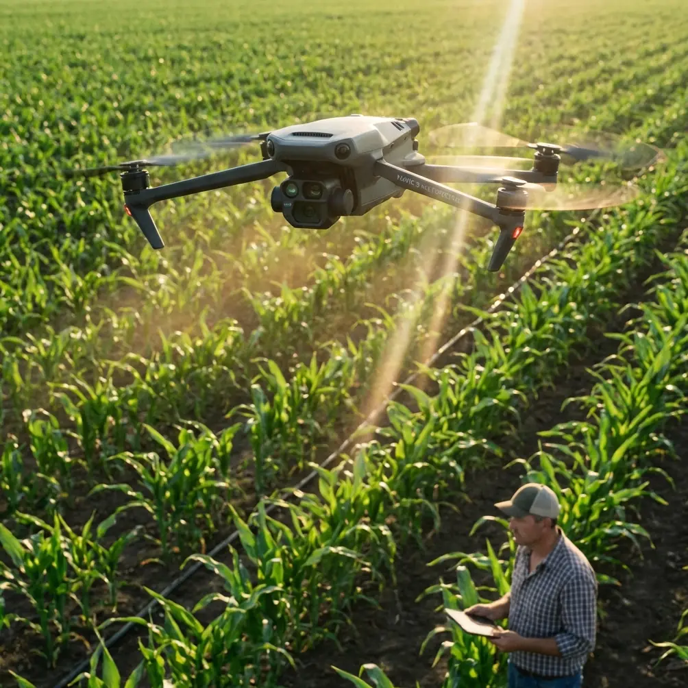
Mavic 3M in Windy Solar Farm Inspections: A Field Report on What Actually Makes the Difference
META: A field report on using the Mavic 3M for windy solar farm inspections, with practical insight on flight discipline, image composition, battery workflow, and why stable repeatable data matters more than spec-sheet hype.
Wind changes everything at a solar site.
On paper, a panel inspection mission looks clean: launch, run the lines, collect the imagery, identify thermal or multispectral anomalies, and move on. In practice, wind pushes the aircraft off track, shakes operator confidence, and punishes sloppy preflight habits. That is where the Mavic 3M starts to separate itself—not because it erases difficulty, but because it rewards disciplined workflows.
I learned that the hard way on a large utility-scale inspection where the weather was good enough to fly, but bad enough to expose every weak link in the operation. The site was open, the gusts were inconsistent, and reflections off endless glass rows made image review more demanding than usual. The aircraft mattered, yes. But the real breakthrough came from treating the mission less like a casual drone flight and more like a repeatable imaging system.
That distinction is worth exploring, especially for teams looking at the Mavic 3M for solar work.
The Mavic 3M Is Not Just About Sensors
Most discussions around the Mavic 3M go straight to multispectral capability, mapping efficiency, RTK fix rate, or centimeter precision. Those matter. On solar farms, however, the bottleneck is often operational consistency rather than sensor availability.
A windy inspection amplifies three things:
- Flight stability under variable loading and air movement
- Battery discipline across repeated sorties
- Image composition that supports analysis instead of fighting it
Those sound basic. They are. Basic is where missions are won.
One of the most useful reminders came from an unlikely source: a beginner photography article published on 2026-05-18 by 御空逐影. It was not written for industrial drone operators. It was aimed at novices trying to make photos look better. Yet one tip in particular translates directly into better solar inspection output: the rule of thirds, using on-screen grid lines to divide the frame into a tic-tac-toe pattern.
That sounds almost too simple for a technical workflow. It isn’t.
Why Composition Still Matters in Industrial Data Capture
When people hear “inspection drone,” they often assume composition is irrelevant because software does the heavy lifting. That is only partly true. In a windy environment, image framing still influences the usefulness of your data, especially during manual review, spot verification, and anomaly confirmation.
On solar sites, not every finding comes from one automated pass. There are moments when you pause mapping, reposition, and capture targeted imagery of a suspect string, inverter area, combiner box corridor, or edge-of-array section where environmental effects are creating unusual readings. In those moments, grid discipline matters.
Using screen grid lines and placing the point of interest off dead center often produces a more readable frame. The panel defect, hotspot cluster, or vegetation intrusion doesn’t get lost in a flat symmetrical shot. More importantly, you retain surrounding context—row spacing, neighboring modules, maintenance access paths, and directional shadows—that helps the analyst interpret what they’re seeing.
That small photography principle becomes operationally significant because solar inspections are not just about collecting pixels. They are about collecting interpretable evidence.
The article’s larger message was that photography is not difficult and even complete beginners can improve quickly. That applies nicely to inspection teams scaling Mavic 3M operations. You do not need every pilot to be a veteran cinematographer. You do need them to understand that image quality is a habit, not an accident.
Wind Exposes Poor Energy Planning Faster Than Almost Anything Else
The second lesson comes from the reference material on the DJI TT educational drone. It is obviously a different platform from the Mavic 3M, but the operational logic carries over cleanly: power systems, propeller behavior, and battery rotation dictate whether your day feels controlled or chaotic.
The TT material explains the propulsion system in plain terms: motors, propellers, and battery work together to generate flight. It also gives several concrete numbers that are surprisingly useful as training anchors. In that document, an unloaded aircraft can fly for about 13 minutes on a full battery. A charging hub can charge 3 batteries in sequence, and charging one battery takes about 30 minutes using a standard 5-volt charger.
No, those are not Mavic 3M performance figures. That’s not the point. The point is that even a basic training platform teaches the same operational truth seen in commercial fieldwork: battery scheduling is not a side issue. It is the structure of the mission.
On a windy solar farm, your effective sortie plan shrinks. Hover time is more expensive. Repositioning costs more. Go-arounds become more common. If the team is careless with battery rotation, launch timing, or cool-down management, the day breaks apart quickly. You start rushing. Rushing leads to skipped verification passes. Skipped verification passes lead to return visits.
The TT guide even notes that after using one battery, the drone should be powered down and allowed to rest for a while. Again, this is basic instruction, but the principle remains valuable in the field: managing thermal load and power cycles is part of protecting consistency. On large inspection days, that mindset beats heroics.
Propellers, Counter-Rotation, and Why the Aircraft Feels “Settled”
Another detail from the TT training document deserves attention because it explains something many operators feel without articulating. The document states that the drone uses 4 propellers, with opposite rotational directions arranged so that diagonal propellers spin the same way while adjacent propellers spin opposite ways. The reason is to cancel the reaction torque generated by each motor-propeller set.
That is not an academic footnote. It is the foundation of controllable multirotor flight.
In windy solar inspections, the aircraft is constantly making tiny corrections. Stable response depends on a propulsion system that balances torque cleanly and predictably. If your team trains only on app workflows and neglects flight fundamentals, they tend to interpret drift, yaw corrections, or attitude changes as mysterious “wind issues” rather than normal control responses being managed well—or poorly.
For Mavic 3M operators, understanding this matters for two reasons.
First, it improves preflight awareness. If a propeller is compromised, installed incorrectly, or worn beyond what the crew should tolerate, control quality in gusts degrades faster than many realize. Second, it improves pilot behavior. Operators who understand reaction torque and stabilization tend to fly smoother lines, make less abrupt stick input, and preserve image quality.
In solar work, that means cleaner overlap, steadier verification passes, and fewer unusable captures.
Mapping Precision Is Only Valuable If the Workflow Around It Is Mature
The context around this assignment mentions RTK fix rate and centimeter precision, and those are valid priorities for solar asset documentation. But precise georeferencing doesn’t rescue a weak field process.
This is where the aviation testing document, while not directly about the Mavic 3M, offers a useful professional parallel. It describes acceptance testing as a process built around defined requirements, operating procedures, detailed design documents, interface controls, and expected results. In other words, performance is not assumed. It is verified against a structured checklist.
That mindset is exactly what separates casual drone usage from dependable solar inspection operations.
For a windy site, your Mavic 3M workflow should function like a field acceptance test every time:
- Are the mission parameters set for present wind, not yesterday’s template?
- Is the RTK environment stable enough for the accuracy you intend to claim?
- Are your capture settings producing analyzable images in reflective conditions?
- Are your battery swaps and launch intervals planned, or improvised?
- Do you have a defined reflight threshold when gusts start compromising overlap or image sharpness?
The testing manual also emphasizes initialization parameters before executing test procedures. That sounds abstract until you remember what happens on a solar farm. “Initialization parameters” in practical drone terms include your coordinate settings, flight speed, altitude, overlap values, camera mode, and environmental assumptions. If those are wrong at launch, the rest of the mission merely fails in an orderly way.
The Mavic 3M helps because it gives operators a compact, efficient platform for multispectral and mapping work. But what makes that platform productive is the discipline wrapped around it.
A Real Shift in How the Mavic 3M Simplified Windy Site Work
The first time I felt the Mavic 3M genuinely reduce friction on a windy solar inspection, it wasn’t during the flashy part of the job. It happened during the boring middle.
We had already completed the broad coverage and were moving into targeted review. Historically, this phase was where teams lost time. Gusts would push the aircraft enough to make close verification shots messy. Pilots would overcorrect. Analysts later got images with weak framing, uneven context, and just enough ambiguity to trigger another pass.
With the Mavic 3M, the improvement came from combining better platform confidence with better operator behavior. We flew slower where it mattered. We used disciplined framing rather than centering everything by reflex. We treated each battery cycle as a planned segment, not a scramble. And we defined in advance what constituted an acceptable recapture.
That changed the work from “cover the site and hope review goes well” to “collect evidence in a way that survives review.”
If your team is trying to standardize that kind of field process, it helps to compare notes with people who’ve already built one. A direct way to do that is through this Mavic 3M field workflow chat, especially if your challenge is windy utility-scale inspection rather than basic introductory flying.
What Solar Teams Often Get Wrong
The most common mistake I see is assuming that a capable drone automatically produces decision-ready inspection data.
It doesn’t.
Teams obsess over multispectral payloads, swath width, or centimeter precision, then ignore simple practices that determine whether those advantages show up in the final deliverable. A few examples:
They underrate visual composition
Even in technical capture, framing affects interpretation. The rule of thirds is not an art-school relic; it is a practical way to keep anomalies readable within their environment.
They treat batteries as logistics, not mission design
The TT training material’s plain numbers—13 minutes of flight on a full battery, 3 batteries charged in sequence, 30 minutes per battery—underline a universal lesson: endurance planning shapes output quality. Wind makes that even more true.
They don’t teach propulsion fundamentals
Understanding why opposing propeller directions cancel torque improves pilot smoothness and preflight seriousness. Better handling leads to better data.
They launch without a verification mindset
The avionics testing reference pushes a powerful idea: define expected results before execution. For solar inspections, that means clarity about what acceptable imagery, overlap, and positional reliability look like before the first takeoff.
The Mavic 3M Works Best When the Operator Thinks Like an Inspector
That may be the central point.
The Mavic 3M is not just a drone you fly over panels. It is a measurement and evidence-collection platform. In windy conditions, the gap between those two mindsets becomes obvious. A pilot mindset alone focuses on staying airborne and finishing the route. An inspector mindset asks whether the resulting data will support maintenance decisions, warranty claims, vegetation management, performance troubleshooting, or comparative trend analysis later.
That is why small details from outside the usual spec sheet matter.
A beginner photography article reminding you to use grid lines.
A training drone manual explaining why battery rotation and propeller arrangement matter.
A systems testing manual insisting on defined procedures and expected outputs.
Taken together, they point toward a more mature way to run Mavic 3M inspections.
And on a solar farm, maturity beats improvisation.
When the wind is pushing across open rows and the site is large enough that every wasted pass has a cost, the operators who do best are rarely the ones chasing the most dramatic flight profile. They are the ones who keep the aircraft, the batteries, the framing, and the mission logic under control from the first lift to the final review shot.
That’s where the Mavic 3M earns its place—not by making fieldwork effortless, but by giving a disciplined team the kind of platform that turns discipline into usable results.
Ready for your own Mavic 3M? Contact our team for expert consultation.