Capturing Coastal Detail with the Mavic 3M
Capturing Coastal Detail with the Mavic 3M: A Practical Field Method for Reliable Multispectral Results
META: Learn a field-tested coastal workflow for the DJI Mavic 3M, including RTK stability, multispectral capture, interference mitigation, and obstacle-response thinking drawn from real UAV reference cases.
Coastal work exposes the Mavic 3M to a strange mix of advantages and headaches. Open sightlines are excellent. Lighting can be beautiful. Coverage can be efficient. Then the environment starts pushing back: reflective water, salt haze, gust fronts, signal noise near infrastructure, and terrain that changes character every few hundred meters. If you are using the Mavic 3M to document shoreline vegetation, salt-marsh transitions, dune stress, or erosion patterns, the aircraft is capable of delivering exceptional data. But capability is not the same as repeatability.
What separates a clean coastal dataset from an expensive reshoot usually comes down to small operational decisions made before takeoff and in the first minutes of flight.
This article is built around that reality. Not a generic overview of the Mavic 3M, but a practical method for using it well in coastal environments, with a focus on multispectral capture, RTK consistency, and one under-discussed issue: electromagnetic interference and antenna adjustment. I’ll also borrow a useful lesson from an unrelated UAV training document and an urban drone-response case, because both reveal something important about how professionals should think about autonomous sensing and fast exception handling.
Why the coast is a hard place to get “clean” data
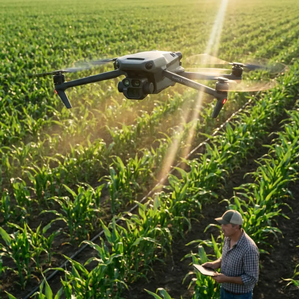
The Mavic 3M is often discussed in agricultural terms, and fairly so. Its multispectral payload is built for analytical work. But along the coast, that same strength becomes valuable for mapping vegetation health gradients, monitoring wetland edge retreat, and distinguishing stressed plant zones from normal seasonal variation. The problem is that the coast is not a neat farm block.
You may launch near seawalls, metal guardrails, communication masts, utility lines, concrete roofs, parked vehicles, or harbor equipment. Those objects can disturb compass behavior, affect signal quality, and create uneven confidence in positioning during RTK-dependent missions. Add wind shear and reflective surfaces, and the margin for sloppy procedure disappears.
If your aim is centimeter-grade repeatability over time, RTK fix rate matters more than many operators admit. A dataset can look visually acceptable and still be weaker than it should be for temporal comparison. That is especially true when tracking narrow shoreline change or vegetation striping across tidal edges.
Start with the mission design, not the aircraft menu
Before touching the flight app, define the actual coastal question.
Are you trying to:
- compare dune vegetation vigor over time,
- map invasive spread in marsh edges,
- detect drainage stress after salt intrusion,
- or build a baseline orthomosaic for later change detection?
The answer changes altitude, overlap, timing, and acceptable swath width. Coastal operators sometimes copy inland mapping settings and assume the mission is “close enough.” It rarely is.
For multispectral work near the shoreline, I recommend planning around consistency first and coverage second. Fly when light conditions are stable, tidal state is intentional rather than incidental, and wind is within a range that preserves image geometry. If the site includes both vegetated shoreline and adjacent built infrastructure, decide in advance whether the mission prioritizes biological analysis or edge-detail mapping. Trying to maximize both in one pass usually compromises one of them.
The hidden coastal issue: electromagnetic interference
This is where field crews lose time. The Mavic 3M may be airborne and apparently stable, but if you launched too close to interference sources, your confidence in downstream outputs should drop.
Harbor perimeters, coastal highways, flood-control stations, container yards, desalination facilities, and telecom-heavy rooftops all deserve suspicion. Even when the aircraft is functioning normally, interference can degrade the smoothness of RTK acquisition or create unnecessary warnings that force conservative mission choices.
A simple mitigation step is often enough: move the takeoff point farther from metal masses and active electrical infrastructure, then reassess antenna orientation before reattempting the mission. Many crews think of antenna positioning as a basic radio hygiene issue. In coastal work, it becomes a data-quality issue. A slight repositioning of the pilot station can improve line-of-sight geometry and reduce near-field clutter around the controller.
The practical method I use is this:
Survey the launch zone for hidden interference sources.
Look beyond obvious towers. Fences, parked maintenance trucks, roof-mounted equipment, and power cabinets matter.Check RTK behavior before committing to the route.
Do not judge by satellite count alone. Watch how quickly the solution stabilizes and whether it holds cleanly.Adjust controller antenna orientation deliberately.
Don’t leave the antennas in a default position out of habit. Match orientation to the aircraft’s planned track and your standing position.If warnings persist, relocate rather than rationalize.
Ten extra meters can matter. Fifty can transform the mission.Only then lock the mapping workflow.
Once the signal environment is behaving, the rest of the mission becomes far more predictable.
This sounds elementary, but it directly affects centimeter precision. And for coastal repeat surveys, repeatability is everything.
A useful lesson from an “air traffic police” deployment
One of the reference items describes a Chinese urban drone platform validated by a joint innovation lab between local traffic authorities and a regional big-data group. The core AI was verified for all-weather automatic recognition of issues such as illegal parking, lane obstruction, slow-moving traffic, and congestion anomalies. The operational headline is striking: minor traffic accidents could reportedly be handled in 3 minutes.
That is not a coastal mapping story. Still, it contains a lesson worth carrying into Mavic 3M field practice.
The real value of a professional drone system is not just what it sees. It is how quickly the operation converts detection into action. In the Yancheng case, the system’s advantage was rapid recognition plus rapid response, which improved traffic flow during a peak holiday period. For a coastal survey crew, the equivalent is not incident enforcement; it is field exception handling.
When the Mavic 3M encounters poor positioning confidence, changing wind, glare-heavy water margins, or an interference-prone launch site, the crew needs an equally disciplined response loop:
- detect the anomaly early,
- interpret whether it threatens mission validity,
- modify the plan immediately,
- and resume with confidence.
That mindset is more valuable than blind adherence to a prewritten route. Good operators do not just fly the plan. They run a response system.
What a training document teaches about obstacle logic
Another reference document, though educational rather than commercial, offers a remarkably practical insight for UAV operators. In a wall-approach experiment, a training drone flying backward at a control value of -30 maintained a pitch angle close to 0° during normal motion. When it reached a vertical wall, the pitch angle increased noticeably to about 12°. The exercise then proposed a simple protection logic: when the pitch angle exceeded 6°, the system treated that as contact and commanded the aircraft to move forward for 0.5 seconds before hovering and landing.
No, the Mavic 3M is not flown like a classroom drone. But the operational principle is deeply relevant: attitude changes can reveal contact or abnormal aerodynamic behavior before the pilot fully processes what happened visually.
In coastal environments, especially around seawalls, revetments, embankments, and vegetation edges, this matters. Why?
Because the pilot may be distracted by:
- glare from tidal surfaces,
- side winds near hard structures,
- changing altitude references over uneven ground,
- or the temptation to “just finish one more line.”
The takeaway is not to build crude collision logic into a mission. The takeaway is to respect aircraft attitude data as part of situational awareness. If the platform begins showing unexpected behavior near vertical features or while transitioning between open beach and built shoreline, stop treating it as a cosmetic anomaly. Investigate it.
This is one reason experienced teams review more than image count and battery state. They watch the aircraft’s behavior as a system.
Building a coastal Mavic 3M workflow that actually holds up
Here is the method I recommend when the mission goal is high-trust coastal capture.
1) Choose the launch position for signal integrity, not convenience
The nearest car park is not automatically the best launch point. If it sits beside metal fencing, utility cabinets, or a floodgate control room, you may be starting the mission in the worst RF environment available. Walk the site. Test alternatives. Your RTK fix rate and signal consistency will often improve before the aircraft even leaves the ground.
2) Normalize your capture conditions
Coastal vegetation analysis with multispectral data becomes much more useful when collection conditions are controlled. Similar tidal phase, similar sun angle, and similar wind conditions make temporal comparisons meaningful. This matters more than shaving a few minutes off field time.
3) Treat water edges as interpretation hazards
The Mavic 3M’s multispectral capability is powerful, but shoreline transitions can complicate readings. Wet soil, shallow water, algae, foam, and salt residue may create boundaries that look crisp in one band and ambiguous in another. Build overlap generously enough that you have room to validate edge behavior during processing.
4) Watch for mission drift caused by interference, not just wind
If the aircraft is fighting two problems at once—gusts and weak signal confidence—you may misdiagnose the source of the issue. That is why preflight interference control matters. Remove one variable early.
5) Use swath width strategically
Bigger swath width sounds efficient, but wide-area efficiency is not the same as analytical reliability. Along irregular coastlines, narrower and cleaner mission blocks often produce better outputs than oversized passes that mix too many surface conditions at once.
6) Build a stop rule before launch
Define what conditions trigger a pause or abort:
- unstable RTK behavior,
- persistent compass anomalies,
- excessive crosswind over exposed segments,
- or unacceptable glare over key capture zones.
That stop rule protects the quality of the final dataset and reduces the temptation to salvage weak flights.
Where multispectral really earns its place on the coast
The Mavic 3M becomes most valuable when visual imagery alone cannot answer the question. Along a coast, that usually means detecting subtle biological or moisture-related variation before it becomes obvious to the eye.
Examples include:
- vegetation stress at dune margins,
- saltwater intrusion effects in low marsh plants,
- uneven recovery after storm wash-over,
- and linear stress patterns near drainage outlets or foot traffic corridors.
This is not spray drift or nozzle calibration territory in the classic crop-management sense, but the discipline is similar: collect data in a way that supports action, not just imagery. If your workflow cannot deliver repeatable surface comparisons, the multispectral payload is being underused.
One practical note for teams working around infrastructure
If your shoreline project runs near ports, treatment plants, sea defenses, or industrial utility corridors, establish a communication routine before field day. The biggest delays in these environments are often not aviation-related. They come from access gates, moving equipment, and changing work zones that force you into poor launch positions.
For teams that need to coordinate site access or compare deployment options before a mission, I often suggest using a direct field-ops channel like this WhatsApp contact for pre-mission coordination so launch-site decisions are made before batteries are on the table.
The broader point: precision comes from operational discipline
There is a tendency to treat the Mavic 3M as if the payload itself guarantees professional results. It does not. The aircraft gives you the tools: multispectral sensing, mapping efficiency, and the potential for centimeter precision when RTK conditions are right. Coastal work then tests whether the operator can protect that potential.
The most useful insight from the reference material is not the surface detail. It is the operational logic underneath it.
From the Yancheng traffic drone case, we learn the value of fast, validated response systems. A platform that can identify anomalies all day and support action within 3 minutes shows what mature drone operations look like: sensing tied tightly to decision-making.
From the UAV wall-contact training exercise, we learn that aircraft attitude changes are not background telemetry. A shift from near 0° pitch in normal backward flight to roughly 12° at wall contact, with a 6° threshold used for protective action, is a reminder that flight-state data can support practical safety logic.
Applied to coastal Mavic 3M work, those lessons become clear:
- detect environmental trouble early,
- trust data, not assumption,
- and respond before small issues become corrupted deliverables.
That is how you capture coastlines with confidence. Not by chasing perfect conditions, but by running a field method that stays stable when conditions are only partly cooperative.
Ready for your own Mavic 3M? Contact our team for expert consultation.