Mapping Windy Fields with the Mavic 3M: A Practical
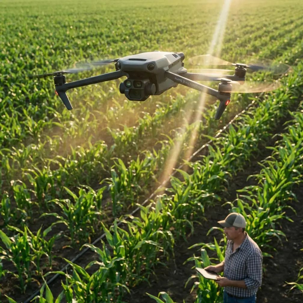
Mapping Windy Fields with the Mavic 3M: A Practical Workflow That Starts Before Takeoff
META: A field-tested guide to mapping windy farmland with the Mavic 3M, including pre-flight cleaning, flight geometry, multispectral consistency, and why tight route logic matters.
Wind changes everything in field mapping.
Not just the obvious parts, like ground speed or battery planning. Wind reaches deeper into the job. It affects image consistency, aircraft attitude, overlap stability, and the quality of the agronomic decisions that come later. When you are flying a Mavic 3M over crops, that matters because the mission is not simply to get airborne. The mission is to return with usable multispectral data that can support action in the field.
I’ve seen many operators focus on route settings and forget the simple habits that keep data quality from drifting. One of the most useful disciplines is a pre-flight cleaning step. It sounds mundane, but on a windy day it becomes one of the most important safety and accuracy checks you can do.
Before launch, clean the vision surfaces, inspect the camera window, and remove any residue around exposed seams and landing areas. In farming environments, sticky dust, pollen, and fertilizer particles accumulate fast. If your previous operation involved crop inputs, organic material, or low-level work near disturbed soil, that contamination can interfere with sensor behavior and visual confidence during takeoff and landing. For operators who also work around spreading operations, this is not theoretical. A recent Britain case showed drones being used to spread seaweed as fertilizer on land as growers respond to rising fertilizer costs. Seaweed may be useful agronomically, but it also highlights the reality of modern field environments: aircraft are increasingly working around unconventional organic inputs, and residue management before a mapping sortie is no longer optional.
That is the first lesson for windy field mapping with the Mavic 3M. Data quality starts on the ground.
The real problem with mapping in wind
Most pilots describe windy mapping as a flight stability problem. That is only partly true.
The harder problem is geometric consistency. The aircraft can often still fly safely, but safety alone does not guarantee a clean dataset. In wind, the platform continuously corrects its position. Small speed changes, yaw corrections, and attitude shifts can affect how evenly the field is captured. That can show up later as uneven overlap, harder stitching, or variable multispectral confidence across the map.
This is where route design matters more than many people realize.
One useful mental model comes from a training exercise found in DJI educational material. The exercise is simple: the drone rises to 80 centimeters, climbs another 40 centimeters to reach 120 centimeters, waits 1 second, then flies a square path with 100-centimeter sides. At the end of the route, a blue indicator marks the end of the track, the aircraft pauses, then lands. On paper, this sounds like a beginner routine. In practice, it teaches something professionals should never ignore: controlled flight patterns reveal how an aircraft behaves when geometry is the priority.
That same material goes further. It points out that the square track can be parallel to the ground, vertical to the ground, or set at another angle in three-dimensional space. Operationally, that matters because mapping is never just movement from waypoint to waypoint. It is orientation, repeatability, and how the aircraft carries its sensors through space. In windy conditions, the Mavic 3M is not simply covering acreage. It is preserving a measurement geometry.
Why that square-flight lesson matters to Mavic 3M operators
The Mavic 3M is built for agricultural mapping, but good hardware does not remove the need for disciplined route logic. A windy mission is where sloppy planning becomes expensive.
Take the 100-centimeter square exercise as a concept, not a scale. The point is not the size of the box. The point is that every side of the route introduces a directional change, and every directional change gives you a chance to observe aircraft behavior. In the training example, one version keeps the aircraft from turning while it flies the square. Another version has it rotate 90 degrees counterclockwise after each side so that the nose keeps facing the direction of travel.
That distinction has real significance for the Mavic 3M in field mapping.
When wind is pushing across a field, you want to think carefully about whether your route logic is asking the aircraft to fight sideways drift, yaw repeatedly, or maintain a consistent sensor-forward orientation. The goal is smooth, predictable capture. If the aircraft is constantly correcting through turns and crosswind transitions, you can still finish the mission, but your dataset may carry the consequences.
So, on windy days, route planning should prioritize three things:
- stable line tracking across the dominant wind component
- minimized abrupt heading changes where possible
- consistent image acquisition geometry across each swath
This is where terms like swath width and centimeter precision stop being brochure language and start becoming operational constraints. A wide area covered badly is still bad data.
Pre-flight cleaning is not housekeeping. It is part of mission assurance
Let’s return to that cleaning step, because it deserves more attention than it gets.
The Mavic 3M is often deployed in dusty fields, near plant residue, on farm roads, and around operations where material can become airborne. If your workday includes nearby fertilizing, spreading, or low-altitude scouting over dry rows, fine particles can settle where they should not. In Britain, drone-based seaweed spreading is one example of how aerial operations are expanding into new agricultural tasks. For mapping crews, the takeaway is practical: if drones are working around organic fertilizer workflows, contamination control needs to be built into the flight sequence.
A smart pre-flight cleaning routine for windy field mapping includes:
- wiping camera and sensor windows with approved materials
- checking landing gear and body seams for compacted dirt or sticky residue
- inspecting propellers for edge contamination
- making sure venting areas are clear
- confirming no moisture, salt film, or fertilizer dust remains from prior work
Why mention salt film? Because seaweed-derived material and coastal environments can leave residues that are not always obvious at a glance. Even when the aircraft is not being used for spreading, cross-use environments matter. If one team is mapping and another is applying, contamination migrates.
For operators working in rough agricultural weather, environmental sealing matters too. The term IPX6K comes up often in professional drone conversations because washdown resistance and contamination tolerance influence uptime. The Mavic 3M is not a replacement for a dedicated spraying platform, but the mindset carries over: if you want reliable field performance, treat cleanliness and inspection like part of the payload workflow, not an afterthought.
Wind, multispectral capture, and the hidden cost of inconsistency
The Mavic 3M earns its place in agriculture because multispectral data helps growers see variation that standard visual imagery can miss. But multispectral only helps if the capture is consistent enough to trust.
Wind creates two kinds of trouble here.
First, it changes the aircraft’s movement profile. Second, it can change what the crop canopy is doing during capture. Leaves flutter. Taller plants lean. Reflectance conditions are not static. That does not mean you should avoid flying every breezy day. It means you should be deliberate about what level of wind you are willing to accept for the agronomic question at hand.
If your objective is broad field variability screening, you may tolerate more environmental movement than if you are trying to compare subtle vigor changes across narrow zones. The Mavic 3M can handle professional mapping work, but the operator has to choose settings and timing that fit the decision being made downstream.
This is also why RTK fix rate matters. In windy fields, position confidence is not a luxury. It is part of maintaining repeatability and preserving confidence in your map alignment. Centimeter precision has operational value only when the rest of the mission design supports it. A stable RTK solution, disciplined overlap choices, and route directions that respect the wind together produce the result. None of those elements works well in isolation.
Flight pattern discipline beats improvisation
Some pilots try to “feel out” windy conditions after takeoff and adapt on the fly. That may work for casual imaging. It is weak practice for agricultural mapping.
The educational square-path example gives us a better model: launch, climb in a controlled sequence, stabilize, wait, then begin the route. That 1-second wait at 120 centimeters in the training scenario may seem trivial, but the principle is sound. Let the aircraft settle before beginning structured movement.
Translate that to the Mavic 3M and the lesson becomes straightforward:
- don’t rush from takeoff straight into aggressive line work
- confirm aircraft stability before the mapping run begins
- watch how the aircraft holds position in the wind
- use the first few moments to verify that the platform is not compensating abnormally
On a windy day, those few seconds can save an entire mission from becoming a compromised dataset.
And while mapping is very different from choreographed training flight, another line from that educational material is worth borrowing. It suggests designing routines that make full use of movement modules and extensions, even to the point of having the drone “dance” to music. Strip away the novelty and there is a serious idea underneath: the best drone operations are programmed, intentional, and repeatable. In agriculture, repeatability wins. Not creativity for its own sake.
What to adjust when the field is exposed
When fields are wide open, wind has room to build and stay consistent over long distances. That can be easier than turbulent orchard edges, but it also means the aircraft may spend much of the mission under continuous load. The Mavic 3M operator should plan for that from the start.
A few practical adjustments matter:
1. Fly the cleanest geometry, not the most ambitious acreage
If conditions are pushing the platform hard, reduce the mission size and keep the data clean. Better one reliable block than a large stitched map with uneven quality.
2. Watch crosswind lines carefully
Crosswind segments often reveal whether overlap and line discipline are being preserved. If the aircraft is working too hard to hold the route, the map may suffer even when the flight remains safe.
3. Re-check exposed surfaces after landing
Windy farm launches kick up abrasive dust. A quick post-flight inspection makes the next sortie safer and more accurate.
4. Keep application and mapping logic separate
Words like spray drift and nozzle calibration belong to application operations, not mapping settings, but they still matter around the mission environment. If another aircraft or crew is applying material nearby, drift can contaminate surfaces, reduce visibility, and alter launch-site cleanliness. Mapping teams need separation from active spreading zones.
That point loops us back to the seaweed story. As drones take on more roles in agriculture, shared workspaces become more complicated. A field may be mapped one hour and receive an aerial fertilizer treatment the next. Operators who understand those interactions will produce better results than those who treat mapping as a sealed-off task.
Mavic 3M success in wind is mostly about discipline
People often ask for a single trick that makes the Mavic 3M perform better in windy fields. There isn’t one.
There is a chain of decisions.
Clean the aircraft before launch. Verify sensor surfaces. Respect route geometry. Use the wind rather than arguing with it. Think about heading changes the way a flight-training exercise thinks about a square route: every side and every turn changes what the aircraft has to do. Preserve RTK integrity. Keep the multispectral mission tied to the agronomic question you actually need answered.
That is how you protect data quality.
If you are building a field workflow and want a second set of eyes on route logic, environmental prep, or mapping consistency, you can message a Mavic 3M field consultant here.
The Mavic 3M is a serious tool. In calm weather, it can make good operators look great. In wind, it exposes every shortcut. That is not a flaw. It is a reminder that precision agriculture still depends on precise habits.
Ready for your own Mavic 3M? Contact our team for expert consultation.