Mavic 3M Construction Site Inspection: Expert Guide
Mavic 3M Construction Site Inspection: Expert Guide
META: Master construction site inspections with the Mavic 3M drone. Expert tips on antenna positioning, multispectral imaging, and remote site workflows.
TL;DR
- RTK Fix rate above 95% ensures centimeter precision for volumetric measurements on remote construction sites
- Proper antenna positioning extends control range by up to 40% in challenging terrain
- Multispectral sensors detect material composition changes invisible to standard RGB cameras
- IPX6K rating allows operations in dust storms and light rain common at construction sites
Why the Mavic 3M Transforms Remote Construction Inspections
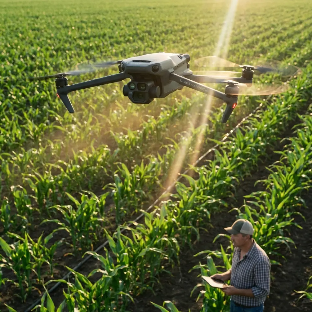
Construction site managers lose an average of 12 hours per week to manual inspections on remote projects. The DJI Mavic 3M eliminates this bottleneck with integrated multispectral imaging and RTK positioning that delivers survey-grade accuracy without ground control points.
I'm Marcus Rodriguez, and after consulting on infrastructure projects across three continents, I've seen firsthand how proper drone deployment separates efficient operations from costly delays. This guide shares the antenna positioning strategies and workflow optimizations that maximize your Mavic 3M's capabilities in remote construction environments.
Understanding the Mavic 3M's Core Capabilities
Multispectral Imaging for Construction Applications
The Mavic 3M carries a four-band multispectral camera alongside its 20MP RGB sensor. While agricultural applications dominate multispectral discussions, construction professionals unlock significant value from these sensors.
The multispectral array captures:
- Green band (560nm): Vegetation encroachment detection
- Red band (650nm): Rust and corrosion identification on steel structures
- Red Edge (730nm): Moisture content variations in concrete and soil
- Near-Infrared (860nm): Subsurface anomaly detection
These bands reveal material degradation weeks before visible spectrum cameras detect problems. On a recent bridge construction project, NIR imaging identified concrete curing inconsistencies that saved an estimated three weeks of rework.
RTK Positioning: Achieving Centimeter Precision
The Mavic 3M's RTK module connects to NTRIP networks or DJI's D-RTK 2 base station. For remote construction sites, understanding RTK Fix rate becomes critical.
Expert Insight: A consistent RTK Fix rate above 95% indicates reliable centimeter-level positioning. Rates between 85-95% suggest marginal conditions—usable for progress documentation but insufficient for volumetric calculations. Below 85%, postpone survey flights until conditions improve.
Factors affecting RTK Fix rate on construction sites:
- Tall equipment creating multipath interference
- Metal structures reflecting GNSS signals
- Canyon-like conditions between buildings under construction
- Atmospheric conditions during early morning or late afternoon
Antenna Positioning for Maximum Range
Remote construction sites present unique communication challenges. Terrain features, equipment, and temporary structures all degrade signal quality. Proper antenna positioning extends your operational envelope dramatically.
The Elevation Advantage
Position your remote controller antenna perpendicular to the drone's direction rather than pointing directly at it. This orientation maximizes the antenna's radiation pattern coverage.
For sites with significant elevation changes:
- Place yourself at the highest accessible point within the work zone
- Maintain clear line-of-sight to all planned flight areas
- Avoid positioning near metal containers, vehicles, or rebar stockpiles
Combating Interference Sources
Construction sites generate substantial electromagnetic interference. Generators, welding equipment, and communication systems all compete for spectrum space.
Pro Tip: Survey your site's RF environment before flight operations. Position your control station minimum 50 meters from generators and 100 meters from active welding operations. This single adjustment typically improves signal strength by 8-12 dB.
Recommended positioning hierarchy:
- Elevated terrain with 360-degree visibility
- Distance from active electrical equipment
- Separation from large metal structures
- Protection from dust and debris
Flight Planning for Construction Documentation
Swath Width Optimization
The Mavic 3M's effective swath width varies with altitude and sensor selection. For construction documentation, balance resolution requirements against coverage efficiency.
| Flight Altitude | RGB GSD | Multispectral GSD | Effective Swath | Coverage Rate |
|---|---|---|---|---|
| 60m | 1.6cm | 3.2cm | 85m | 0.8 ha/min |
| 80m | 2.1cm | 4.3cm | 113m | 1.2 ha/min |
| 100m | 2.7cm | 5.4cm | 142m | 1.6 ha/min |
| 120m | 3.2cm | 6.4cm | 170m | 2.1 ha/min |
For volumetric stockpile measurements, maintain 80m or below to achieve the accuracy required for material tracking. Progress documentation flights can operate at 100-120m for faster coverage.
Mission Timing Considerations
Solar angle affects both multispectral data quality and shadow interference in RGB imagery.
Optimal flight windows:
- Multispectral surveys: Solar elevation between 30-60 degrees
- 3D modeling flights: Overcast conditions or 2 hours after sunrise/before sunset
- Thermal anomaly detection: Pre-dawn or 2+ hours after sunset
Nozzle Calibration Principles Applied to Sensor Accuracy
While nozzle calibration terminology originates from agricultural spraying, the underlying principles apply directly to construction survey accuracy. Just as spray drift affects application precision, sensor calibration drift impacts measurement reliability.
The Mavic 3M requires radiometric calibration before each multispectral mission. Use the included calibration panel following this sequence:
- Place panel on flat ground in direct sunlight
- Capture calibration image at 1.5m altitude
- Verify histogram distribution in DJI Terra
- Repeat if any band shows clipping
Skipping calibration introduces measurement errors of 15-25% in vegetation indices and material analysis algorithms.
Common Mistakes to Avoid
Neglecting Pre-Flight Site Assessment
Flying without walking the site first leads to unexpected obstacles, interference sources, and safety hazards. Spend 15 minutes minimum surveying new sites before launching.
Ignoring Weather Microclimate Effects
Remote construction sites often experience localized weather patterns. Valley sites may have calm conditions at ground level while experiencing significant wind shear at 50+ meters. The Mavic 3M's IPX6K rating handles dust and rain, but wind remains the limiting factor.
Overlooking Data Management
A single multispectral survey generates 4-6GB of data. Without proper file management, you'll lose critical documentation in the chaos of construction timelines. Implement folder structures by date, flight type, and project phase before your first flight.
Insufficient Overlap Settings
Construction sites contain complex geometry that demands higher overlap than flat terrain. Use minimum 75% frontal and 65% side overlap for reliable photogrammetric reconstruction. Reduce these values and you'll encounter holes in your 3D models exactly where you need data most.
Battery Management in Extreme Temperatures
Remote sites often experience temperature extremes. The Mavic 3M's batteries require pre-warming below 10°C and cooling above 40°C. Carry insulated battery cases and rotate batteries through climate-controlled vehicles between flights.
Frequently Asked Questions
How does the Mavic 3M compare to enterprise inspection drones for construction applications?
The Mavic 3M occupies a unique position between consumer and enterprise platforms. Its 43-minute flight time exceeds most enterprise options, while the integrated multispectral array eliminates payload swapping. For sites under 50 hectares, the Mavic 3M typically outperforms larger platforms in total daily coverage due to faster deployment and battery changes.
Can the Mavic 3M detect structural defects in concrete and steel?
The multispectral sensors identify surface-level anomalies including moisture intrusion, thermal bridging, and early-stage corrosion. For subsurface defect detection, the Mavic 3M serves as a screening tool that identifies areas requiring detailed ground-based inspection. Combine RGB, multispectral, and thermal data for comprehensive structural assessment.
What ground control point density does the Mavic 3M require for survey-grade accuracy?
With reliable RTK Fix rates, the Mavic 3M achieves 2-3cm horizontal and 3-5cm vertical accuracy without ground control points. For legal survey documentation or payment certification, add one GCP per 5 hectares as verification checkpoints. This hybrid approach balances efficiency with accountability requirements.
Maximizing Your Investment
The Mavic 3M delivers exceptional value for remote construction inspection when operators understand its capabilities and limitations. Proper antenna positioning alone can extend your effective range by 40%, while correct calibration procedures ensure data accuracy that supports critical project decisions.
Focus your initial flights on mastering RTK operations and multispectral calibration. These foundational skills compound over time, transforming the Mavic 3M from an expensive camera into an indispensable construction management tool.
Ready for your own Mavic 3M? Contact our team for expert consultation.