Mavic 3M in Extreme Temperatures: How to Hold Altitude
Mavic 3M in Extreme Temperatures: How to Hold Altitude, Protect Data Quality, and Reduce Spray Drift
META: A field-focused guide to using the Mavic 3M around spraying operations in extreme temperatures, with practical advice on flight altitude, stability, multispectral consistency, and drift-aware mission planning.
Extreme temperatures punish weak workflows long before they punish aircraft.
That matters if you are using the Mavic 3M to support spraying venues, document crop stress, verify treatment coverage, or build multispectral maps that feed operational decisions. In hot midday fields, cold dawn orchards, or large sites with variable microclimates, the real challenge is not simply getting airborne. It is maintaining clean data, stable flight geometry, and repeatable altitude while conditions are trying to pull your mission apart.
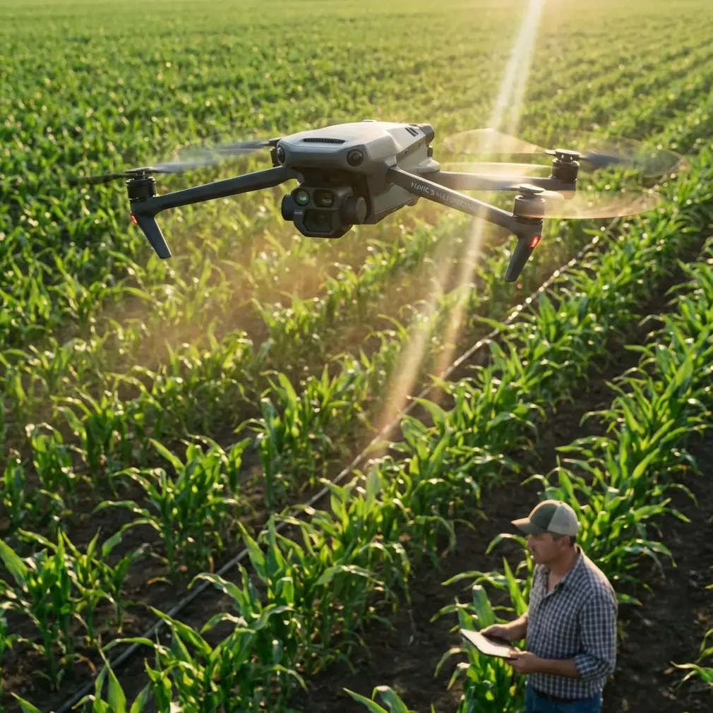
The Mavic 3M is often discussed as a multispectral platform, and rightly so. But when the reader’s real-world concern is spraying in extreme temperatures, the conversation needs to move beyond sensors and into flight discipline. Stable height, controlled turns, predictable swath overlap, and careful timing can make the difference between a useful map and a misleading one.
I want to focus on one operational insight above all:
When supporting spray-related work in extreme temperatures, the best flight altitude is not the highest safe altitude or the lowest possible detail pass. It is the lowest altitude that still preserves a simple, stable, repeatable flight path with consistent coverage and enough thermal margin to avoid rushed corrections.
That may sound obvious. In practice, it is where many missions go wrong.
Why altitude discipline matters more in extreme temperatures
Extreme heat increases instability near the surface. Hot ground creates rising air, uneven density, and local turbulence. Extreme cold can produce battery performance concerns, stiffer airframes at startup, and a temptation to hurry the mission before conditions worsen. In both cases, poor altitude control does more than affect image sharpness.
It changes the operational meaning of your data.
For a spray support mission, altitude directly influences:
- image scale consistency
- overlap quality
- perceived plant vigor variation in multispectral outputs
- confidence in edge-of-field drift observations
- match quality between one mission and the next
- the realism of any swath-width planning derived from the map
If one section of the mission is flown noticeably higher than another, plant rows may appear with different scale and reflectance geometry. If turns are sloppy, the aircraft can lose height and direction at the same time. That creates gaps, duplicate passes, and inconsistent data density precisely where you need the cleanest evidence: field boundaries, treatment transitions, and problem zones.
The old RC flight training literature included a principle that remains surprisingly relevant here: before a maneuver, maintain true level flight rather than allowing the aircraft to “quietly climb.” That source was discussing aerobatic roll preparation, not mapping drones, yet the lesson carries over beautifully. A hidden climb bleeds speed and invites instability. In drone mapping, the equivalent is entering a turn, terrain change, or waypoint transition without first settling the aircraft into a stable track and height. You may still complete the pass, but your data can degrade in ways that are hard to detect until processing.
The hidden enemy: corrective flying
Extreme temperatures encourage overcorrection.
Pilots see the aircraft drift slightly, then compensate too aggressively. They hit a turn late, tighten it, then add pitch or throttle input equivalents through the automation stack by changing speed or route logic. Soon the aircraft is no longer tracing a clean survey line; it is being dragged through a series of small recoveries.
Another training detail from classic model-aircraft instruction is worth borrowing: action consistency depends on separating inputs cleanly. One source stresses that a pilot should feel the control return to center before applying the next axis, because mixing corrections carelessly can cause the aircraft to depart from the intended axis and lose directional control. For Mavic 3M operators, the modern interpretation is this:
Do not stack avoidable variables.
If the mission already has temperature stress, do not also introduce unnecessary speed changes, abrupt turn geometry, or inconsistent altitude targets. Keep the aircraft on one clean task at a time: straight pass, controlled turn, reacquire line, repeat. That is how you preserve centimeter precision where RTK fix rate and overlap discipline matter.
A practical altitude framework for spray-support missions
There is no single magic number for every crop and venue. Canopy structure, obstacle environment, wind profile, and required ground sampling detail all matter. But for extreme-temperature work, altitude should be selected using a more conservative logic than on a mild day.
Here is the framework I recommend.
1. Start from data purpose, not curiosity
Ask what the mission must prove.
If the goal is broad stress mapping before or after spraying, you usually do not need to fly as low as possible. Lower altitude can improve detail, but it also amplifies the impact of turbulence, rotor wash interaction near irregular canopies, and micro-adjustments at every row break. For many spray-related surveys, slightly higher and more stable is better than ultra-low and inconsistent.
If the goal is checking a narrow issue such as localized runoff, edge damage, or treatment variability, then a second targeted pass at lower altitude can be added after the main map. Separating broad mapping from close inspection keeps the core dataset cleaner.
2. Protect overlap before chasing finer detail
In heat, aircraft motion near the surface becomes less predictable. In cold, fast corrective moves can consume battery margin and compress your planning window. Either way, overlap and track repeatability should outrank theoretical maximum detail.
A mission flown a bit higher with uniform overlap often produces more trustworthy agronomic interpretation than a lower mission with irregular geometry. This is especially true for multispectral analysis, where consistency between passes matters as much as raw image sharpness.
3. Avoid the “quiet climb” at line transitions
This is one of the most useful crossovers from the reference material.
RC training warns against the pilot unconsciously allowing a climb before entering a maneuver because the aircraft slows and then drops. In Mavic 3M route execution, a similar error appears when the aircraft enters a turn or terrain-adjusted segment without first settling. The result is a line that begins at one effective altitude and ends at another.
Operationally, that matters because your multispectral layers can become harder to compare across the field. It also affects visual interpretation around spray edges, where a small geometry change may masquerade as a treatment difference.
4. Keep turn angles gentle and consistent
One of the reference documents gives a clear technical number for basic fixed-wing turning: bank should not exceed 30 degrees in a normal turn, with level flight established first and altitude maintained through the maneuver. The Mavic 3M is not a trainer airplane, but the operating logic is still sound. Sharp, aggressive turns are where mapping consistency goes to die.
In automated survey design, give the aircraft room to turn. At field edges, avoid route designs that force abrupt pivots close to trees, poles, or terrain breaks. Extreme temperatures reduce your tolerance for last-second corrections. The cleaner the turn, the cleaner the re-entry to the next line.
5. Build in a safe-height mindset
Another concrete detail from the source material recommends that training turns be practiced at around 50 meters of altitude before maneuvering, precisely because loss of lift in a bank can quickly become a spiral if not corrected. Again, this is fixed-wing instruction, but the operating significance translates well: do not conduct complex route behavior too close to the ground when conditions are already unstable.
For Mavic 3M users, that does not mean every mission should be flown at 50 meters. It means your selected altitude should leave room for the aircraft to remain composed through transitions rather than forcing constant low-level recovery. Around spraying venues, especially where drift assessment is part of the task, composure beats bravado.
How this affects spray drift interpretation
Spray drift is a surface-level phenomenon with many inputs: nozzle selection, droplet size, release height, wind, humidity, and temperature. The Mavic 3M does not spray, but it can support drift-aware decisions by documenting crop response, field-edge patterns, stressed zones, and post-treatment variability.
That only works if your map is trustworthy.
If flight altitude varies too much, the edge signatures you are studying may reflect acquisition inconsistency rather than agronomic reality. If one pass is lower and another higher, the canopy can present differently in both visual and multispectral layers. That can distort the way operators read possible off-target effects.
This is why I advise teams to think of altitude as part of quality control, not just mission setup.
A disciplined altitude plan helps you separate three things that often get confused in extreme-temperature spraying environments:
- actual crop or canopy response
- atmospheric effect during spraying
- data collection inconsistency during drone mapping
When those blur together, decision quality suffers.
The Mavic 3M advantage, if you use it properly
The Mavic 3M’s real value in this scenario is not simply that it carries multispectral capability. It is that it allows fast, repeatable site capture for operational teams who need timely decisions. When paired with strong RTK performance, careful nozzle calibration records from the spraying side, and route designs that preserve swath consistency, it becomes a powerful verification tool.
But centimeter precision on paper means little if the aircraft is flown with casual altitude discipline.
A clean RTK fix rate helps you place data accurately. It does not rescue a mission built on unstable geometry. Likewise, multispectral sensing can reveal plant stress patterns, but it cannot tell you whether a strange edge signature came from real field conditions or from a low, wobbly, heat-disturbed pass flown too aggressively.
That is why flight planning and piloting restraint still matter.
A field workflow that works
If I were advising a team using the Mavic 3M around spray operations in extreme temperatures, I would suggest this order:
Pre-flight
- Define the exact question: drift check, pre-spray vigor map, post-spray comparison, blocked nozzle suspicion, or irregular swath review.
- Confirm RTK status expectations and satellite conditions.
- Review wind and temperature trend, not just the single forecast value.
- Choose an altitude that prioritizes stable overlap and repeatability.
- Check that route turns are not unnecessarily tight.
On-site launch
- Let the aircraft establish stable flight before beginning the core lines.
- Watch for early signs of heat-bounce or cold-related sluggishness in transitions.
- Do not respond to minor deviations with a chain of aggressive changes.
During mission
- Keep speed consistent.
- Avoid ad hoc lowering of altitude in selected zones unless you plan a separate inspection pass.
- Monitor whether field edges, row ends, or terrain shifts are causing the aircraft to climb or sink subtly.
After capture
- Compare line consistency before interpreting stress patterns.
- Review suspicious edge anomalies with the question: is this agronomic, atmospheric, or geometric?
- If necessary, rerun a short control pass at a stable altitude rather than forcing interpretation from weak data.
For operators who want to discuss route setup for hot-weather orchards, cold-morning fields, or mixed terrain near spray blocks, this direct field-planning chat is often the fastest way to sort out mission logic before deployment.
The flower-photography lesson that surprisingly applies
One reference in your source set discusses photographing a single flower and makes a simple point: keep the frame clean and place the subject in the center when you want an unmistakable focal point. The reason is not artistic snobbery. It is clarity. A simple frame makes the subject obvious, and centered composition helps reveal the detail of the flower and even the structure of the pistil.
That same principle belongs in Mavic 3M operations around spraying venues.
Clean inputs create clear outputs.
A cluttered mission profile—variable altitude, uneven speed, fussy route edits, rushed transitions—buries the subject under noise. A simpler flight plan, with the aircraft held on a stable path and the target area treated as the true focal point, gives the multispectral data a better chance to show what is actually happening in the field.
In other words, operational simplicity is not a compromise. It is a method for making the subject stand out.
What “optimal altitude” really means here
For this scenario, optimal flight altitude is the height at which all of the following remain true:
- the aircraft can hold a repeatable path without constant correction
- overlap remains dependable across the entire block
- turn behavior does not force abrupt attitude changes
- near-surface turbulence is manageable
- canopy detail is sufficient for the spray-support question at hand
- battery and temperature margins remain comfortable
That altitude may be higher than your first instinct.
And in extreme temperatures, that is often the smart choice.
A lower pass can always be added later for a specific anomaly. It is much harder to repair a full-field dataset collected with unstable geometry, drifting turns, and inconsistent height. Teams often blame the software, the atmosphere, or the sensor. More often, the problem began with an altitude choice that was too ambitious for the conditions.
The Mavic 3M is a strong platform for commercial agriculture and site documentation, especially where multispectral evidence can guide spraying decisions. But the best results come from disciplined flying, not from pushing the aircraft to the edge of detail at the expense of consistency.
If you remember just two numbers from the reference material, make them these: 30 degrees as a reminder not to let turns become too aggressive, and 50 meters as a reminder that safe maneuvering margin matters when stability is on the line. Those figures come from classic flight training, yet their operational message remains fresh: establish level, stable flight first, then execute the next task cleanly.
That is the real secret to better Mavic 3M data in extreme temperatures.
Ready for your own Mavic 3M? Contact our team for expert consultation.