Mavic 3M in Dusty Solar Farms: Why China’s New Drone
Mavic 3M in Dusty Solar Farms: Why China’s New Drone Liability Insurance Changes the Pre-Flight Playbook
META: A practical expert tutorial on flying the Mavic 3M over dusty solar farms, with insight into China’s first compulsory drone liability insurance pilot, operational risk, cleaning checks, RTK reliability, and multispectral workflow discipline.
Dust changes how professionals should think about the Mavic 3M. Not just because dust softens image contrast, coats optics, and creeps into hinges. It changes the risk equation.
That shift matters more now because China has crossed a regulatory threshold in low-altitude operations. In Chongqing, the country’s first compulsory liability insurance pilot for unmanned aircraft has already issued its first policy. One policy now covers 194 drones with a total risk guarantee of 42.6 million yuan, and that single event marks more than a paperwork milestone. It establishes the first formal mechanism in China’s low-altitude economy for mandatory drone liability coverage.
For Mavic 3M operators working around solar assets, that news is not abstract. It points to a more disciplined operating environment where flight logs, maintenance habits, mission design, and preventable incidents will carry more weight. If you are mapping a dusty solar farm, your pre-flight routine is no longer just about protecting image quality. It is about proving operational maturity.
That is the frame for this tutorial.
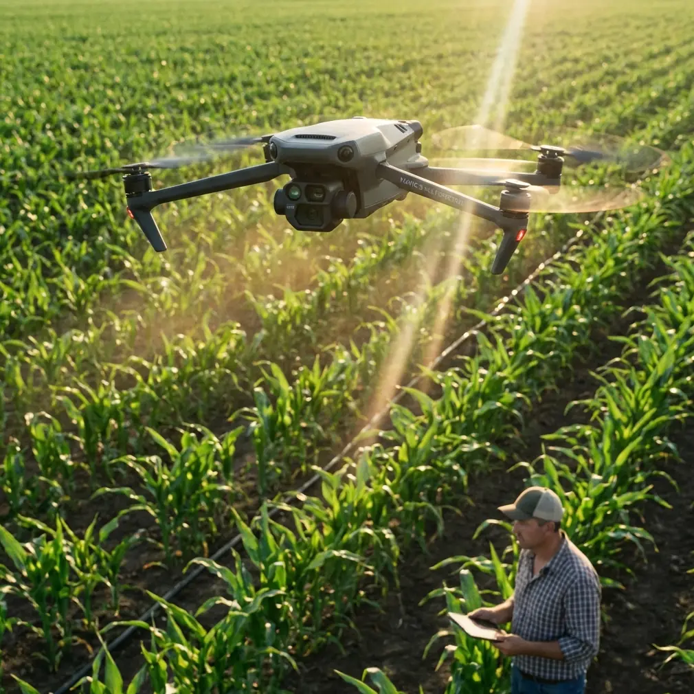
The Mavic 3M is best known for multispectral data collection, plant health workflows, and precision mapping. Yet the same aircraft is increasingly used in broader inspection scenarios where repeatability, route accuracy, and sensor reliability matter more than generic aerial photography. Solar farms are a strong example. They are large, repetitive, often exposed, and unforgiving of sloppy execution. Dust accumulates on panel surfaces, on service roads, and on aircraft bodies. Wind corridors between array rows can introduce unstable low-level air. Bright reflective surfaces can challenge visual interpretation. If your aircraft launches with dirty sensors or weakened positioning confidence, the mission degrades before the first waypoint is completed.
So let’s start where too many crews rush: cleaning.
The pre-flight cleaning step that now matters beyond housekeeping
Before takeoff, clean the aircraft as if the mission record may someday need to explain what happened. That is not paranoia. It is simply the logical response to a market moving toward formalized risk transfer and tighter accountability.
On a dusty solar site, the first pass should focus on the visual navigation sensors, obstacle sensing windows, camera glass, and airframe seams. A dry, clean microfiber cloth and an air-safe blower are preferable to aggressive wiping. If grit is dragged across a lens cover, you may not notice the scratch until reflectance data looks inconsistent across repeated flights. On a multispectral platform, that is not a cosmetic issue. It can corrupt comparison work across dates, especially when operators are trying to identify subtle thermal or spectral anomalies around panel rows, drainage edges, or vegetation encroachment.
The second pass is functional. Check gimbal freedom. Confirm that landing gear contact points are free of packed dust. Inspect propeller roots and motor tops, where fine particles often settle after a previous mission. Dust accumulation there may seem minor, but it can become part of a vibration story later. That matters for image sharpness and for aircraft health monitoring.
Then verify the return-to-home environment and obstacle sensing behavior in the actual launch zone, not the one you imagined in the truck. A solar farm is rarely an empty rectangle. There are fence lines, inverter stations, cable structures, maintenance vehicles, and occasional temporary construction activity. A safety feature only helps if it is seeing clearly.
This is the operational significance of the insurance news: once the industry begins normalizing compulsory liability mechanisms, preventable oversights become harder to excuse. The Chongqing pilot is a signal that the low-altitude economy is becoming legible to institutions. Operators who treat pre-flight cleaning as a casual habit will look increasingly outdated.
Why a solar farm mission stresses the Mavic 3M differently
A dusty solar site is not the same as a crop field, even if both benefit from systematic coverage. In agriculture, operators often think in terms of spray drift, nozzle calibration, swath width, and treatment timing. Those concepts do not directly define a Mavic 3M inspection mission, but they remain useful as mental models.
Take swath width. In spraying, it determines coverage efficiency and overlap quality. In solar mapping, the equivalent question is route spacing and image overlap over long, repetitive geometry. If wind pushes the aircraft slightly off line between panel blocks, your dataset may still look complete at a glance while hiding weak reconstruction zones. That problem tends to show up later, during stitching or anomaly review, when revisiting the site costs time and credibility.
Or consider nozzle calibration as an analogy for sensor discipline. A spraying team calibrates because output consistency matters more than guesswork. A Mavic 3M team should think the same way about multispectral consistency, RTK status, mission altitude, and lighting conditions. If one flight is made with a marginal RTK Fix rate and the next is captured under more stable geometry, change detection becomes harder to trust. Centimeter precision is not a marketing flourish in these environments. It is the difference between “roughly there” and “reliably repeatable.”
That is where the Mavic 3M earns its keep. When flown with stable RTK performance and repeatable routes, it can support tight, comparable datasets across very large sites. On solar infrastructure, repeatability matters because operations teams often care less about one beautiful map than about whether the same string, edge, or maintenance corridor looks different from last month.
RTK discipline in dusty, reflective environments
If your Mavic 3M workflow depends on precise geo-referencing, do not treat RTK as a box that merely turns green. Watch its behavior before launch and during the first segment of the route.
Solar farms can create a deceptively clean visual scene while still challenging reliability. Repetitive metal structures, long open corridors, and heat shimmer later in the day can all complicate data confidence, even when the aircraft remains fully controllable. A weak RTK Fix rate at launch is one of the quietest ways to poison a mission. The aircraft flies. Images save. The map builds. But alignment drift creeps into comparison work.
For that reason, one of the most practical habits is to power up early, allow the system to stabilize, and confirm lock quality before arming. If site procedures permit, walk the launch area first and avoid placing the aircraft near service vehicles, fencing masses, or temporary metallic clutter. Then check the live feed from the navigation and imaging systems after cleaning. If dust remains on a sensor window, now is the cheap moment to solve it.
Centimeter precision is only useful when it is real. The Mavic 3M can support accurate repetition, but only if the operator respects setup conditions.
Multispectral data is only as good as the operator’s restraint
One of the most common mistakes in solar-site capture is trying to force a generic aerial routine onto a specialist aircraft. The Mavic 3M is not at its best when flown like a casual camera drone over reflective infrastructure without mission logic.
Multispectral capability can be extremely valuable around solar farms, especially where vegetation management, drainage patterns, dust movement, or ground disturbance around panel rows affects performance and maintenance planning. It may help teams see patterns that standard RGB review underplays. But this only works when flights are designed for comparable output.
That means fixed altitude, deliberate overlap, repeatable line spacing, and consistent timing relative to sun angle when possible. Dust in the air can change apparent contrast and reduce the clarity of low-level detail. Dust on the optics is worse, because it creates a controlled failure you accidentally carried into the mission yourself.
A disciplined operator also knows when not to fly. High surface glare at the wrong hour, wind gusts through array corridors, or visible airborne dust plumes can undermine even a well-planned mission. The mature decision is sometimes to wait.
Insurance, accountability, and what this means for serious operators
The broader significance of the Chongqing policy is not just that one company’s fleet now has coverage. It is that China’s low-altitude economy is starting to convert operational risk into structured institutional practice. That matters to every serious drone team, including those flying compact enterprise platforms like the Mavic 3M.
Two details from the pilot are especially revealing.
First, the scale: 194 drones under one policy with 42.6 million yuan in risk protection. That is fleet thinking, not hobby thinking. It suggests the market is organizing around managed risk, portfolio exposure, and operational standards.
Second, the institutional design: the policy was jointly issued by PICC Property and Casualty together with 18 insurance organizations. That degree of participation shows this is not a fringe experiment. The insurance sector sees low-altitude operations as material enough to coordinate around. Swiss Re Institute’s projection that the low-altitude insurance market could reach 8 to 10 billion yuan by 2035 adds another layer. Insurance is no longer trailing the drone industry; it is beginning to shape how the sector defines professional practice.
For Mavic 3M operators, the lesson is plain. Your maintenance record, pilot checklists, risk assessments, launch-zone choices, and route discipline are becoming business assets. A well-run dusty-site mission is not only safer and cleaner. It is more insurable, more defensible, and easier to scale.
A practical field workflow for dusty solar farms
Here is the workflow I recommend for Mavic 3M crews operating in dusty solar conditions:
Begin with site walk-through, not immediate setup. Identify the dust source zones first: access roads, active maintenance lanes, bare soil sections, and wind channels between arrays. Choose a launch point upwind when possible.
Next, clean the aircraft before powering into the mission profile. Focus on sensor windows, gimbal glass, and propeller hubs. Confirm obstacle sensing visibility. If your team keeps maintenance documentation, log the cleaning step rather than treating it as invisible routine.
Then establish RTK confidence. Wait for stable fix status. Avoid rushing because the site looks easy. Large solar assets reward precision but hide small setup errors until post-processing.
After that, review route geometry as if you were planning a measurement task rather than a photography task. Define overlap that protects reconstruction. Keep altitude and speed conservative enough to preserve multispectral consistency. Think about effective swath width in terms of data quality, not maximum area per battery.
Once airborne, monitor environmental drift. Dust plumes, thermal shimmer, and changing glare can quietly reduce data value. If conditions change, pause and reassess. A partial high-quality mission is better than a full low-trust dataset.
Finally, clean again after landing. Dust left on the airframe becomes tomorrow’s problem. It also obscures wear patterns that could have been caught early.
If your team is building a repeatable inspection SOP for utility-scale sites, it helps to compare notes with operators facing the same conditions. I’ve found that a quick field exchange often solves more than another generic checklist, which is why some crews keep an open line through a simple site-ops chat channel for launch condition and maintenance feedback.
Where this leaves the Mavic 3M
The Mavic 3M sits in an interesting position. It is compact enough to deploy quickly, but sophisticated enough that careless operation wastes its strengths. In a market where low-altitude regulation, insurance mechanisms, and mission-critical use cases are becoming more formal, that balance becomes even more important.
The real story is not simply that drones now have an equivalent of compulsory traffic liability coverage in one pilot region. The real story is that the industry is being asked to grow up operationally. Solar farm missions in dusty environments are a perfect test case. They look routine from a distance. They are not. They expose whether a crew understands sensor hygiene, route repeatability, RTK reliability, and the difference between collecting images and collecting dependable evidence.
For Mavic 3M operators, this is good news. Professional standards usually reward the teams already doing careful work. A clean sensor window, a stable RTK fix, and a documented pre-flight process are not glamorous. They are exactly the kind of habits that become valuable when the sector starts measuring risk with sharper tools.
Ready for your own Mavic 3M? Contact our team for expert consultation.