Mavic 3M at Altitude: A Field Report on Capturing Solar
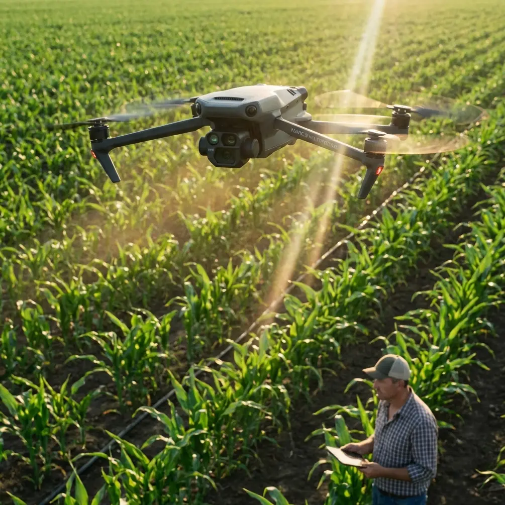
Mavic 3M at Altitude: A Field Report on Capturing Solar Farms Without Blown Highlights or Soft Data
META: Field-tested Mavic 3M best practices for high-altitude solar farm capture, with practical guidance on exposure, multispectral workflow, RTK precision, and avoiding motion blur in bright, reflective conditions.
The first time I surveyed a solar site at elevation, the problem was not access. It was trust.
From the ground, everything looked straightforward: long rows of panels, clean geometry, predictable flight lines, and sunlight so strong it felt like free image quality. In reality, high-altitude solar farms are one of the easiest places to fool yourself. Reflection off the glass pushes exposure in odd directions. Thin mountain air and wind can nudge a platform just enough to soften a dataset. And if you lean too hard on brightness instead of exposure discipline, you come home with images that look usable on a tablet and fall apart once you start inspecting detail.
That is why the Mavic 3M earns its keep on these jobs. Not because it makes difficult sites effortless, but because it gives you a more disciplined imaging workflow when conditions are trying to trick you.
This field report is built around a lesson many camera users learn the hard way. In a recent mobile camera tutorial using a Mate 60 Pro as the example, the author showed what happens when settings are pushed without understanding the tradeoff. Raise ISO to 3200 and the image gets brighter, yes, but noise becomes obvious and subjects can turn soft. Push EV to +1.3 and the preview may look better, but the shutter can fall to 1/4 second, which is an open invitation to blur. The same piece also pointed out that an aperture control was effectively unavailable on that phone because the device lacked a physical aperture.
Those details came from a phone camera context, but the operational lesson carries directly into drone work over solar fields: brightness is not the same thing as usable capture, and a control that appears available in theory may not be the variable that actually saves the mission. On the Mavic 3M, especially when you are working high-altitude solar infrastructure, that difference matters.
What high-altitude solar capture gets wrong if you let automation do all the thinking
The temptation on a bright site is to assume the camera has an easy job. Plenty of sun. Strong contrast. Wide rows. Open sky. But solar panels are reflective surfaces with repetitive structure, and that combination can punish sloppy exposure choices.
If you chase brightness the way a beginner might on a phone camera, you create the drone version of the same failure described in that Mate 60 Pro example. Higher ISO may lift the frame, but it does so by adding noise exactly where you need clean tonal separation. On a solar farm, that means lower confidence when reviewing texture, edge clarity, dust patterns, heat-correlated anomalies that need visual cross-reference, and the general crispness required for mapping-grade deliverables.
The EV example is even more relevant. A compensation value of +1.3 sounds harmless until the shutter stretches to 1/4 second. On a handheld phone, that gives you drag and softness. On a drone, even with stabilization and a capable airframe, a shutter that slow during mission flight can turn geometric consistency into guesswork. The aircraft is moving. The wind is moving it more than you think. Reflective surfaces are changing with the sun angle. If the shutter is lagging, your map may still stitch, but your confidence in panel-level detail drops fast.
That is the first operational significance I stress with the Mavic 3M on elevated solar sites: protect shutter integrity before you chase a brighter-looking preview. Clean data beats flattering data every time.
Why the Mavic 3M fits this work better than improvised aerial imaging
I have seen teams try to document utility-scale and commercial solar sites using general-purpose drones, handheld references, and a patchwork of apps. That can produce pictures. It does not always produce reliable datasets.
The Mavic 3M is built for measured capture, not visual guesswork. Its value on solar work is not just the multispectral payload, though that gets the headlines. The real advantage is that it brings repeatability to jobs where repeatability is easy to lose. You can return to the same swath, the same overlap logic, the same mission geometry, and the same positioning confidence. For high-altitude operations, that consistency is what separates a clean seasonal comparison from a folder full of “close enough.”
The multispectral side matters because solar sites are rarely only about pretty orthos. Operators want actionable site intelligence. They want to understand vegetation encroachment around assets, drainage behavior near access routes, and conditions that can affect maintenance planning. At altitude, where terrain transitions and edge zones can be more complex, multispectral capture helps the drone do more than merely document panel rows. It supports a fuller site-management picture.
And then there is RTK. If your RTK fix rate is unstable, your day gets longer. Centimeter precision is not a vanity metric on large solar facilities. It affects repeat flights, change detection, georeferencing confidence, and how much cleanup the office team has to do later. On a mountain or plateau site where logistics are already less forgiving, every avoidable rework cycle hurts.
The camera lesson from the phone example that every Mavic 3M pilot should internalize
That mobile camera article made three points that are surprisingly useful as a drone checklist.
First, ISO is a trade, not a rescue tool. The cited example of ISO 3200 increasing brightness while introducing obvious noise is exactly why I avoid casual sensitivity jumps over solar arrays. If your data starts getting noisy, you may preserve general visibility while losing the fine clarity that makes inspection and mapping valuable. High altitude can bring brighter conditions, but it can also bring variable haze, sharp reflections, and wind. The answer is not to throw ISO upward and hope.
Second, EV changes are not free. The article’s +1.3 EV example led to a shutter of 1/4 second and visible blur. Operationally, that is the better warning than the brighter screen image. Drone pilots often forget that a nice-looking live view can conceal a bad acquisition decision. On a mapping mission, shutter behavior deserves more attention than the apparent prettiness of the feed.
Third, not every camera parameter is physically available in the way users assume. The Mate 60 Pro’s aperture option being inactive because there was no physical aperture is a useful reminder for drone crews selecting workflows. Do not build your solar capture plan around a control you think should be there. Build it around the controls and sensor behavior you actually have. With the Mavic 3M, that means understanding how its payload performs in your mission profile rather than importing assumptions from another camera category.
That sounds basic, but it saves missions.
My preferred Mavic 3M workflow for solar farms in high-altitude environments
I approach these sites in layers.
The first layer is positioning discipline. I want strong RTK behavior before I care about visual perfection. A healthy RTK fix rate is the quiet hero of repeatable survey work. If the site is remote and the signal environment is less forgiving, I will spend more time validating that positioning confidence before launching the main mission. The reason is simple: if the geometry is wrong, image quality alone will not rescue the dataset.
The second layer is exposure restraint. Reflective panel surfaces can bait pilots into overcompensating. I would rather hold a faster shutter and keep the image clean than brighten the frame at the cost of motion softness. The phone tutorial’s 1/4-second example is a perfect cautionary tale here. A drone in motion has no business pretending that a sluggish shutter is acceptable just because the preview looks bright.
The third layer is swath planning. Swath width sounds like a dry planning term until you are trying to cover a broad site before light shifts or wind builds. At altitude, weather windows can tighten. The Mavic 3M’s ability to execute repeatable routes means you can choose a swath width that respects both overlap needs and battery efficiency, instead of improvising halfway through the mission. If your panels are arranged in long corridors across sloped ground, smart swath decisions reduce wasted passes and keep incidence angles more consistent.
The fourth layer is multispectral purpose. I do not turn on multispectral capture just because the aircraft has it. I do it when the site team can use the result. Around solar fields, that often means identifying vegetation pressure near fence lines, service roads, drainage channels, or undeveloped margins. If there is an agrivoltaic component, the Mavic 3M becomes even more useful because it can support vegetation assessment and facility documentation in the same project cycle.
A practical note on altitude, weather, and image confidence
High-altitude operations add small penalties that stack up.
Batteries drain into thinner air and cooler conditions differently than crews expect. Wind can look mild from staging and behave very differently over the array. Sun angle changes can amplify reflections from one section of panels while another section remains easy to read. All of that argues for a platform and workflow that produce stable, repeatable capture instead of “good enough” snapshots.
This is also where experienced crews stop confusing brightness with information. The mobile camera example of pushing ISO to 3200 until the image gets noisy is a consumer version of a professional mistake: believing visibility equals data quality. On a solar farm, especially one at elevation, the right question is not “Can I see the row?” It is “Can I trust this frame for analysis, comparison, and reporting?”
That difference is why I keep the Mavic 3M in the discussion for these projects.
Where this aircraft helps beyond imagery alone
People usually ask about sensors first. Fair enough. But what often makes or breaks a solar mission is not the headline spec. It is whether the aircraft reduces operational friction.
The Mavic 3M does that by supporting consistent route execution, reliable geospatial outputs, and a workflow that plays well with enterprise decision-making. When a facilities manager wants to compare one campaign to the next, centimeter precision matters. When engineering wants a clean map without extensive office correction, RTK matters. When vegetation around the site starts affecting maintenance or drainage planning, multispectral matters.
Even peripheral concepts from adjacent UAV sectors are instructive here. Think about how agricultural teams obsess over nozzle calibration or spray drift. Those are not glamorous topics. They are discipline topics. In solar surveying, the equivalents are exposure control, flight-line consistency, overlap strategy, and positional confidence. Different task, same principle: operational maturity beats feature-chasing.
And while the Mavic 3M is not a washdown agricultural platform, crews who work in dusty, exposed industrial environments still appreciate rugged field behavior. That is why site operators often ask about environmental durability standards such as IPX6K when comparing drone systems across use cases. The exact requirement depends on the operation, but the underlying concern is valid: remote assets demand equipment choices that respect field reality, not office assumptions.
The human part of the job
One of the reasons I like writing field reports instead of product summaries is that drone work is rarely about the drone alone. It is about what the team can trust when the day is over.
On my earlier mountain solar job, we had enough imagery. What we did not have was confidence. Reflections were inconsistent. Some passes looked sharp until we zoomed in. Positioning was usable, not repeatable. The office team spent too much time trying to decide whether the problem was in the site or in the capture.
With the Mavic 3M, that conversation got shorter. Better mission structure. Better positional repeatability. Smarter use of multispectral data. Fewer avoidable compromises in exposure. The aircraft did not remove the need for judgment. It rewarded judgment.
If you are planning a similar workflow and want to compare notes on flight planning or site setup, I sometimes share quick field recommendations here: message me directly on WhatsApp.
The takeaway for serious solar capture teams
The most useful lesson from that phone camera tutorial was not about phones at all. It was about consequences.
ISO 3200 can brighten a frame while adding noise. EV at +1.3 can brighten a frame while dragging shutter speed down to 1/4 second and causing blur. An aperture control may appear in an interface and still be operationally irrelevant if there is no physical aperture behind it. Those are camera truths, not brand-specific quirks.
Applied to a high-altitude solar farm mission with the Mavic 3M, the lesson is straightforward. Do not chase bright-looking imagery at the expense of clean, stable, geospatially trustworthy capture. Use the aircraft for what it does best: repeatable mission execution, multispectral intelligence, and centimeter-precision workflows that stand up after the flight, not just during it.
That is what made the difference for me in the field. Not a flashy feature. Better decisions, supported by a platform that is built for disciplined work.
Ready for your own Mavic 3M? Contact our team for expert consultation.