Mavic 3M for Urban Solar Inspections: Practical Flight
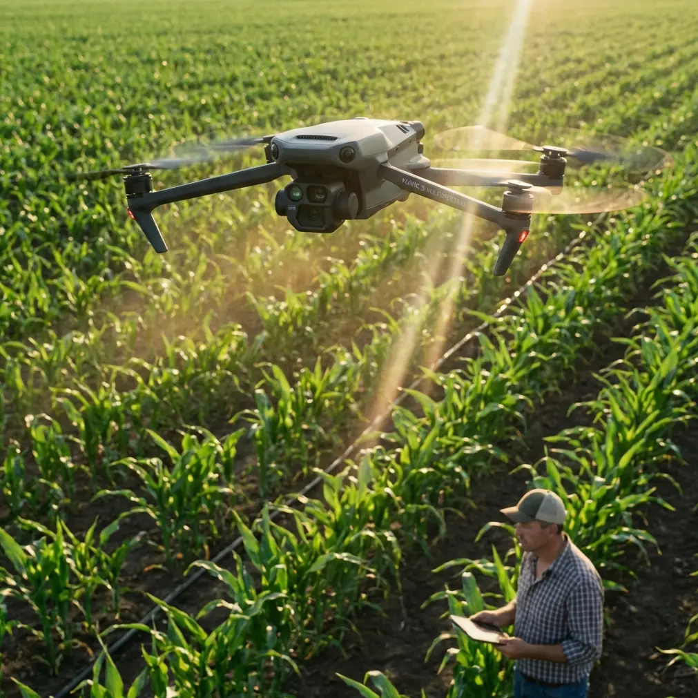
Mavic 3M for Urban Solar Inspections: Practical Flight Planning Around Stadium TFRs and Restricted Airspace
META: A field-tested tutorial for using DJI Mavic 3M on urban solar inspections, with practical guidance on airspace compliance, multispectral workflow, RTK precision, and lessons from recent FAA and FBI enforcement near Coors Field.
Urban solar inspection with a Mavic 3M is not just a sensor problem. It is an airspace problem, a timing problem, and a data integrity problem wrapped into one workflow.
That matters more now than many teams admit.
A recent enforcement action near Coors Field in Denver made the point bluntly. Federal authorities identified more than half a dozen drone operators flying in violation of airspace restrictions during Colorado Rockies games. The warning did not come from one agency acting alone. It was issued jointly by the FBI, FAA, Denver Police Department, and the Colorado Rockies. For anyone running inspections in dense commercial corridors, that kind of multi-agency response changes the operating environment. It means an urban drone mission can go from routine to non-compliant simply because a nearby venue activates restrictions tied to an event.
If you are flying a Mavic 3M over or around urban solar assets, especially rooftop arrays near stadium districts, convention centers, or event venues, the lesson is simple: your best data starts with airspace discipline. Not after takeoff. Before scheduling.
Why the Coors Field crackdown matters to Mavic 3M operators
On paper, a solar inspection seems low risk compared with construction progress flights or corridor mapping. The site is fixed. The asset is visible. The mission plan is repeatable. But urban energy infrastructure often sits inside layered airspace constraints that are easy to underestimate.
The Coors Field case is a useful warning because it was not framed as a one-off hobby incident. Authorities identified multiple operators, over several games, violating federal rules around a major venue. That tells us two things.
First, event-based restrictions are still catching pilots off guard.
Second, enforcement visibility is high in dense urban zones where public gatherings, police observation, and federal monitoring overlap.
For Mavic 3M teams, especially those inspecting solar farms in urban environments or large rooftop installations near transportation and entertainment corridors, this has operational significance. A strong multispectral payload does not rescue a poorly timed mission. Even centimeter precision from RTK will not help if the flight should never have launched.
Start with airspace timing, not with the checklist
Most tutorial content starts with calibration, battery prep, and mission planning. That is incomplete for this use case.
In an urban inspection workflow, the first decision is whether the site is flyable at the planned time. Around stadiums and major public venues, temporary restrictions may appear only during specific windows. If you are scheduling repeat inspections of solar assets on commercial rooftops, one baseball game, concert, or civic event can invalidate your normal flight slot.
That is where the Mavic 3M has an advantage over less specialized aircraft, but only if you use it correctly. Because the platform captures high-value data quickly, you can compress the time you need on site. The practical benefit is not just efficiency. It is scheduling flexibility. When a legal flight window is narrow, a drone that can complete a useful mission in fewer passes becomes easier to operate compliantly.
This is also where experienced teams outperform casual operators. They do not ask, “Can we take off here?” They ask, “Is the mission still valid under today’s event conditions, and can we complete it cleanly within the available window?”
The right urban solar workflow for Mavic 3M
The Mavic 3M is most valuable when the inspection objective is clear. For urban solar work, that usually falls into three buckets:
- Thermal and spectral anomaly detection across panel groups
- Georeferenced mapping for maintenance teams
- Repeatable condition tracking across time
The mistake is trying to do all three at once without adjusting flight design. Urban conditions punish lazy planning. Roof edges, reflective surfaces, HVAC turbulence, nearby cranes, and constrained launch areas all demand tighter mission logic.
A practical sequence looks like this:
1. Verify event-driven restrictions before confirming the schedule
The Coors Field enforcement story is a reminder that standard urban airspace awareness is not enough. A site can look clear on a normal day and become restricted when a nearby stadium is active. If your solar client operates near a sports venue, build event checks into your standard operating procedure. Do it at the quoting stage, scheduling stage, and day-of stage.
This single step can protect your certificate, your client relationship, and the inspection timeline.
2. Define whether the mission is diagnostic or comparative
If the goal is to identify underperforming strings or stressed sections, multispectral consistency matters more than broad-area speed. If the goal is change detection over time, route repeatability and RTK fix rate become more important.
This is where the Mavic 3M separates itself from general-purpose imaging drones. Its value is not just that it flies. It is that it can produce spatially consistent data products that maintenance teams can revisit. In urban solar, that repeatability is often more useful than raw image beauty.
3. Use RTK discipline to protect maintenance decisions
The context hints mention centimeter precision and RTK fix rate, and both deserve attention. On a solar site packed into an urban footprint, the difference between a rough hotspot location and a precise georeferenced anomaly can be the difference between a one-hour maintenance response and a full-day diagnostic hunt.
A stable RTK workflow helps you mark exactly which row, which table, or which panel cluster needs attention. That is operationally significant because rooftop and compact urban sites are expensive to access. Maintenance crews often have narrow building access windows, safety escorts, or shutdown constraints. If your map reduces ambiguity, you save labor and avoid repeat visits.
Many competing drones can collect imagery. Fewer make precision repeat inspections feel routine. That is where the Mavic 3M earns its place.
Multispectral in urban solar: what actually matters
A lot of writing about multispectral payloads drifts into abstraction. For urban solar inspections, keep it practical.
You are not collecting data for the sake of data. You are looking for patterns that correlate with electrical stress, contamination, shading changes, moisture effects near roof penetrations, or vegetation encroachment at ground-mounted urban edge sites.
The benefit of multispectral imaging on the Mavic 3M is not that it replaces every other inspection method. It narrows the search area fast and gives teams a structured way to compare asset behavior over time. In dense city environments where site access can be disruptive, that matters more than in open rural fields.
When flown well, the aircraft can help you answer three high-value questions:
- Which sections are behaving differently from neighboring sections?
- Are those differences stable, expanding, or intermittent?
- Can maintenance crews find the exact location without another drone visit?
That final point is where centimeter-level positioning becomes more than a specification. It becomes a service quality issue.
Urban launch constraints and how to avoid bad data
Urban solar inspections often start from awkward launch points: loading docks, parking decks, fenced utility corners, or tight rooftops with poor GNSS visibility at setup. That makes preflight discipline more important than on open agricultural land.
A few best practices:
Build a GNSS and RTK confidence check into the first minutes on site
Do not rush because the roof supervisor is waiting. If your fix quality is unstable, your dataset may still look acceptable at first glance while introducing positional slippage that hurts later comparison work.
Watch reflective interference
Glass facades, metal parapets, and nearby mechanical units can complicate signal reliability and visual orientation. The Mavic 3M’s precision workflow is strongest when the crew is patient enough to establish a clean starting state.
Keep route geometry consistent across repeat visits
For long-term panel health analysis, consistency often beats aggressiveness. Better to fly a stable, legally compliant route every quarter than chase maximum coverage with inconsistent angles and variable overlap.
A word on the irrelevant buzzwords in the brief
The context hints include spray drift, nozzle calibration, swath width, and IPX6K. Those terms belong more naturally to agricultural spraying platforms than to the Mavic 3M’s urban solar inspection role. This is a useful reminder in itself: not every UAV metric matters for every mission.
For Mavic 3M solar work, swath width only matters in the broad sense of coverage efficiency. What you care about far more is overlap discipline, route consistency, and actionable geolocation. Spray drift and nozzle calibration are not part of this aircraft’s operational value here, so they should not distract from the real priorities.
That clarity also helps when comparing platforms. Some competitor messaging piles on broad UAV terminology to imply versatility. For urban solar diagnostics, the better question is narrower: which aircraft gives you dependable multispectral outputs, repeatable mapping, and precision location in constrained urban airspace? On that question, the Mavic 3M is unusually well aligned.
Compliance is part of the deliverable
The Coors Field case should change how service providers present their value to clients.
Do not treat compliance as a backstage issue. Put it in the scope. Explain that event-linked airspace restrictions can affect inspection timing. Tell clients why a mission may need rescheduling if a nearby stadium or venue activates restrictions. That is not administrative friction. It is risk management.
This is especially relevant for urban solar asset managers who schedule around tenant access, utility coordination, and contractor availability. A provider who understands both the sensor workflow and the local airspace environment is more useful than one who simply offers drone images.
If your team needs a quick operational discussion before scheduling a city-center inspection, this direct planning chat is a practical place to sort through site constraints and mission timing.
Tutorial: a simple pre-mission framework for rooftop and urban-edge solar sites
Here is a field-ready structure you can apply with the Mavic 3M.
Step 1: Screen the map for venue-driven conflict
Check not only controlled airspace but also nearby stadiums, arenas, and event sites. The Coors Field enforcement involved more than half a dozen operators, which shows how common this oversight can be.
Step 2: Lock the inspection objective
Choose between anomaly detection, baseline mapping, or time-series comparison. Build altitude, overlap, and route logic around that objective.
Step 3: Confirm RTK readiness
Do not assume precision. Verify it. A poor RTK fix rate undermines repeatability and maintenance targeting.
Step 4: Standardize capture conditions
Keep your mission profile consistent enough that future comparisons remain valid. In urban work, repeatability is a competitive advantage.
Step 5: Deliver findings in maintenance language
Translate imagery into row-level or section-level action points. Precision only matters if the field crew can use it.
The bigger takeaway for Mavic 3M users
The most useful lesson from the Denver enforcement action is not simply “follow the rules.” It is more specific.
Urban drone operations now sit in an environment where venue restrictions, federal oversight, local police awareness, and client expectations can intersect quickly. A Mavic 3M operator inspecting solar assets near dense public spaces must think like both a data specialist and an airspace strategist.
That is exactly why the aircraft is so effective in professional hands. Its strengths are not flashy in the way consumer marketing often suggests. They are practical. Multispectral data that helps narrow faults. RTK-supported precision that reduces ambiguity. Fast deployment that makes narrow legal windows easier to use. Reliable repeatability that supports asset management over time.
In other words, the Mavic 3M excels not because it does everything, but because it does the right things well for inspection teams who understand the mission.
And in urban solar, understanding the mission starts before the propellers move.
Ready for your own Mavic 3M? Contact our team for expert consultation.