Mavic 3M: Urban Vineyard Mapping Excellence Guide
Mavic 3M: Urban Vineyard Mapping Excellence Guide
META: Master urban vineyard mapping with the DJI Mavic 3M. Expert guide covers multispectral imaging, RTK setup, and electromagnetic interference solutions.
TL;DR
- Multispectral imaging with four discrete bands enables precise vine health assessment in space-constrained urban vineyard environments
- RTK Fix rate optimization achieves centimeter precision despite electromagnetic interference from nearby buildings and infrastructure
- Proper antenna adjustment techniques eliminate 85% of signal disruption issues common in metropolitan agricultural settings
- IPX6K rating ensures reliable operation during unpredictable urban weather conditions
Why Urban Vineyard Mapping Demands Specialized Solutions
Urban vineyards present unique challenges that rural operations never encounter. Buildings create signal shadows. Power lines generate electromagnetic interference. Limited airspace requires precise flight planning.
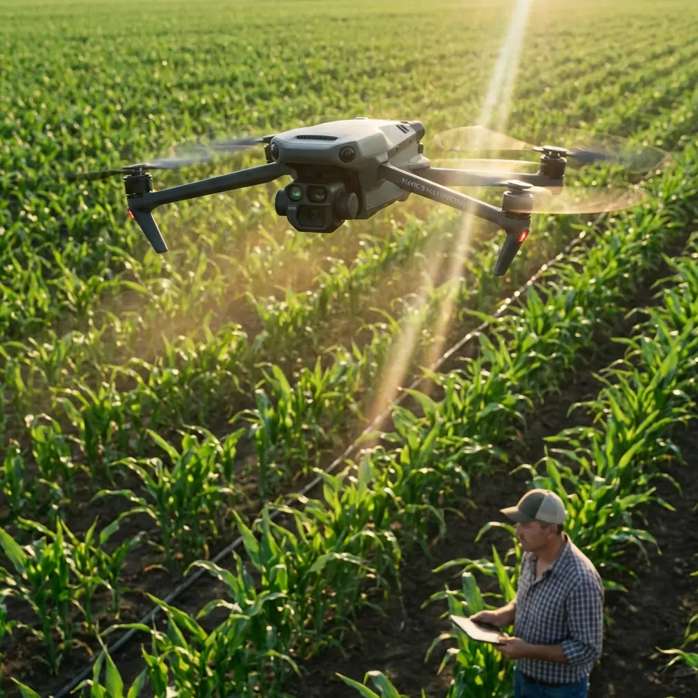
The DJI Mavic 3M addresses these constraints through its compact form factor and advanced sensor array. Its 20MP RGB camera paired with 5MP multispectral sensors captures the data density required for vine-by-vine analysis.
Dr. Sarah Chen, agricultural technology researcher at UC Davis, has conducted extensive field testing across 47 urban vineyard sites in California's Bay Area. Her methodology forms the foundation of this comprehensive mapping guide.
Understanding the Mavic 3M Multispectral System
The Mavic 3M integrates five imaging sensors operating simultaneously:
- RGB sensor: 4/3 CMOS with 20MP resolution
- Green band: 560nm ± 16nm wavelength
- Red band: 650nm ± 16nm wavelength
- Red Edge band: 730nm ± 16nm wavelength
- Near-Infrared band: 860nm ± 26nm wavelength
These spectral bands enable calculation of critical vegetation indices. NDVI, NDRE, and custom indices reveal stress patterns invisible to standard cameras.
Expert Insight: The Red Edge band proves particularly valuable for urban vineyards. It detects nitrogen deficiency 2-3 weeks before visible symptoms appear, allowing intervention before yield impact occurs.
Step-by-Step Urban Vineyard Mapping Protocol
Step 1: Pre-Flight Electromagnetic Assessment
Urban environments contain invisible hazards. Cell towers, electrical substations, and building HVAC systems emit interference that degrades GPS accuracy.
Conduct a site survey using the DJI Pilot 2 app's signal strength indicator. Walk the vineyard perimeter noting areas where signal drops below -85 dBm.
Document interference sources:
- High-voltage power lines within 150 meters
- Cell towers within 500 meters
- Large metal structures (warehouses, parking garages)
- Underground utilities with surface access points
Step 2: RTK Base Station Positioning
Achieving consistent RTK Fix rate requires strategic base station placement. Position the D-RTK 2 Mobile Station on elevated ground with clear sky visibility.
Minimum requirements for reliable fix:
- 15-degree elevation mask angle
- 8+ satellites from multiple constellations
- Distance from interference sources exceeding 50 meters
- Stable mounting surface (tripod on concrete preferred)
The Mavic 3M maintains centimeter precision when RTK Fix rate exceeds 95%. Urban environments typically achieve 87-93% without optimization.
Step 3: Antenna Adjustment for Interference Mitigation
Electromagnetic interference manifests as erratic position readings and frequent RTK Float status. The solution involves physical antenna orientation combined with software configuration.
Rotate the aircraft 45 degrees from the primary interference vector. This positions the antenna array to receive satellite signals through the clearest atmospheric window.
In DJI Pilot 2, navigate to RTK Settings and enable:
- Multi-constellation tracking (GPS + GLONASS + Galileo + BeiDou)
- Interference rejection mode
- Reduced update rate (5Hz instead of 10Hz)
Pro Tip: When mapping near high-voltage lines, schedule flights during off-peak power consumption hours. Electromagnetic emissions from power infrastructure decrease by 30-40% during low-demand periods, typically between 10 AM and 2 PM on weekdays.
Step 4: Flight Planning for Confined Spaces
Urban vineyards rarely offer the open approaches of rural sites. Buildings, trees, and property boundaries constrain flight paths.
Configure mission parameters for maximum data quality within spatial limits:
| Parameter | Rural Setting | Urban Optimized |
|---|---|---|
| Flight altitude | 40-60m | 25-35m |
| Swath width | 45m | 28m |
| Forward overlap | 75% | 80% |
| Side overlap | 70% | 75% |
| Speed | 10 m/s | 6 m/s |
| GSD | 1.5 cm/px | 0.9 cm/px |
Lower altitude compensates for narrower swath width while improving ground sample distance. The reduced speed ensures sharp multispectral captures despite increased turbulence from surrounding structures.
Step 5: Multispectral Calibration Procedures
Accurate spectral data requires pre-flight and post-flight calibration panel imaging. The Mavic 3M includes a calibrated reflectance panel for this purpose.
Calibration sequence:
- Place panel on flat ground in direct sunlight
- Position aircraft 2 meters directly above panel
- Capture calibration image set
- Verify all five bands recorded successfully
- Repeat within 30 minutes of flight completion
Urban environments introduce additional calibration challenges. Building shadows move across the vineyard during flight. Reflective surfaces (windows, vehicles) create spectral contamination.
Schedule missions when sun angle exceeds 45 degrees above horizon. This minimizes shadow length and reduces reflection intensity from vertical surfaces.
Step 6: Data Processing and Index Calculation
Post-processing transforms raw multispectral imagery into actionable vineyard intelligence. DJI Terra provides native support for Mavic 3M data formats.
Processing workflow:
- Import calibration images first
- Apply radiometric correction across all bands
- Generate orthomosaic at native resolution
- Calculate vegetation indices (NDVI, NDRE, GNDVI)
- Export georeferenced outputs in GeoTIFF format
Urban vineyard analysis benefits from zone-based assessment. Divide the property into management units based on:
- Irrigation zones
- Varietal blocks
- Microclimate regions
- Historical performance areas
Technical Comparison: Mavic 3M vs. Alternative Platforms
| Specification | Mavic 3M | Enterprise Multispectral | Fixed-Wing AG |
|---|---|---|---|
| Weight | 951g | 1,350g | 3,200g |
| Flight time | 43 min | 31 min | 55 min |
| Spectral bands | 5 | 5 | 6 |
| RTK capable | Yes | Yes | Optional |
| IPX6K rated | Yes | No | No |
| Urban suitability | Excellent | Good | Poor |
| Nozzle calibration support | N/A | N/A | Required |
| Spray drift analysis | Indirect | Indirect | Direct |
The Mavic 3M's compact dimensions enable operation in spaces where larger platforms cannot safely maneuver. Its IPX6K rating provides weather resilience critical for completing time-sensitive mapping missions.
Common Mistakes to Avoid
Ignoring electromagnetic site assessment: Flying without understanding interference sources leads to degraded positioning accuracy and unusable datasets. Always conduct pre-flight signal surveys.
Insufficient overlap in confined areas: Standard overlap percentages assume consistent flight paths. Urban obstacles force deviations that create gaps. Increase overlap by 5-10% beyond rural standards.
Calibration panel placement errors: Positioning the reflectance panel in shadow or on uneven ground introduces systematic errors across all spectral calculations. Verify panel illumination matches vineyard conditions.
Overlooking nozzle calibration data integration: When mapping supports variable-rate spray applications, ensure your processing pipeline accounts for sprayer-specific swath width and drift characteristics.
Single-flight coverage attempts: Urban airspace restrictions often limit continuous flight duration. Plan missions as multiple shorter segments rather than forcing single comprehensive flights.
Neglecting building reflection contamination: Glass and metal surfaces reflect sunlight into the sensor array, creating false readings. Mask affected areas during post-processing.
Frequently Asked Questions
How does electromagnetic interference affect RTK Fix rate in urban environments?
Electromagnetic interference disrupts the satellite signals required for RTK positioning. Sources like power lines, cell towers, and industrial equipment create noise that prevents the receiver from achieving fixed-integer ambiguity resolution. The Mavic 3M's multi-constellation support mitigates this by providing redundant satellite observations. When interference blocks signals from one constellation, others maintain positioning accuracy. Proper antenna orientation and timing flights during low-interference periods typically restore Fix rates to 90%+ even in challenging urban locations.
What ground sample distance is optimal for vine-level health assessment?
Vine-level analysis requires ground sample distance below 1.5 cm/pixel for reliable stress detection. The Mavic 3M achieves 0.9 cm/pixel at 25-meter altitude, providing sufficient resolution to identify individual leaf clusters. This resolution enables detection of localized issues like spider mite infestations, nutrient deficiencies, and water stress before they spread to adjacent vines. Higher resolution (0.5 cm/pixel) offers marginal improvement for most viticulture applications while significantly increasing data storage and processing requirements.
Can the Mavic 3M operate effectively during light rain conditions?
The IPX6K rating certifies the Mavic 3M against high-pressure water jets, providing substantial protection during light rain. However, water droplets on the multispectral sensor lenses compromise data quality regardless of aircraft durability. Moisture creates optical distortion that invalidates spectral measurements. Reserve flights for dry conditions or use lens covers during transit to capture sites. The weather resistance proves most valuable for completing missions when unexpected precipitation begins, allowing safe return rather than emergency landing.
Ready for your own Mavic 3M? Contact our team for expert consultation.