Mavic 3M for Coastal Construction Monitoring: What a Power
Mavic 3M for Coastal Construction Monitoring: What a Power-Grid X-Ray Inspection Tells Us About Real Field Value
META: A technical review of the DJI Mavic 3M for coastal construction monitoring, using a recent power-line drone X-ray inspection case to explain precision workflows, risk detection, cleaning routines, and operational significance.
By Dr. Sarah Chen
A recent utility inspection story out of Shanxi deserves attention from anyone evaluating the Mavic 3M for construction monitoring in coastal environments.
On April 16, State Grid Shanxi Electric Power announced that it had worked with State Grid Electric Power Spatial Technology to carry out line inspection using an innovative drone-based X-ray flaw detection method. The task was completed successfully, and the stated purpose was straightforward: high-precision detection to identify hidden risks on power lines.
At first glance, that sounds far removed from the Mavic 3M. The Mavic 3M is not an X-ray platform. It is a compact multispectral aircraft built for civilian field intelligence, not radiographic nondestructive testing. But that is exactly why this case matters. The utility sector is showing where drone operations are heading: fewer broad visual checks, more targeted, high-confidence detection workflows. For coastal construction monitoring, that same shift changes how the Mavic 3M should be judged.
The right question is no longer whether a drone can “see the site.” Nearly any modern camera drone can do that. The real question is whether it can support a monitoring process precise enough to surface risk before it becomes a schedule problem, a drainage issue, a material degradation event, or a rework cycle.
That is where the Mavic 3M becomes interesting.
Why an X-ray power-line case is relevant to a Mavic 3M review
The Shanxi inspection effort highlights two operational ideas that transfer directly to coastal construction.
First, high-precision detection is now the benchmark. In the utility example, the drone was not there for general awareness. It was there to help reveal line-related hazards with enough confidence to support maintenance decisions. That same mindset applies on coastal sites, where exposed steel, fill material, drainage corridors, temporary roadbeds, stockpile zones, and shoreline-adjacent structures can change quickly under salt, moisture, wind, and traffic loading.
Second, the stated goal was hazard screening, not image collection for its own sake. That distinction matters. Construction managers do not need another folder of aerial photos. They need a repeatable way to flag anomalies early: water pooling after tide-driven rain events, stressed vegetation along buried utility corridors, uneven site recovery after grading, or thermal and moisture-linked symptoms that begin subtly and spread fast.
The Mavic 3M fits this model when used as a decision-support tool rather than a photography platform.
What the Mavic 3M actually brings to coastal construction monitoring
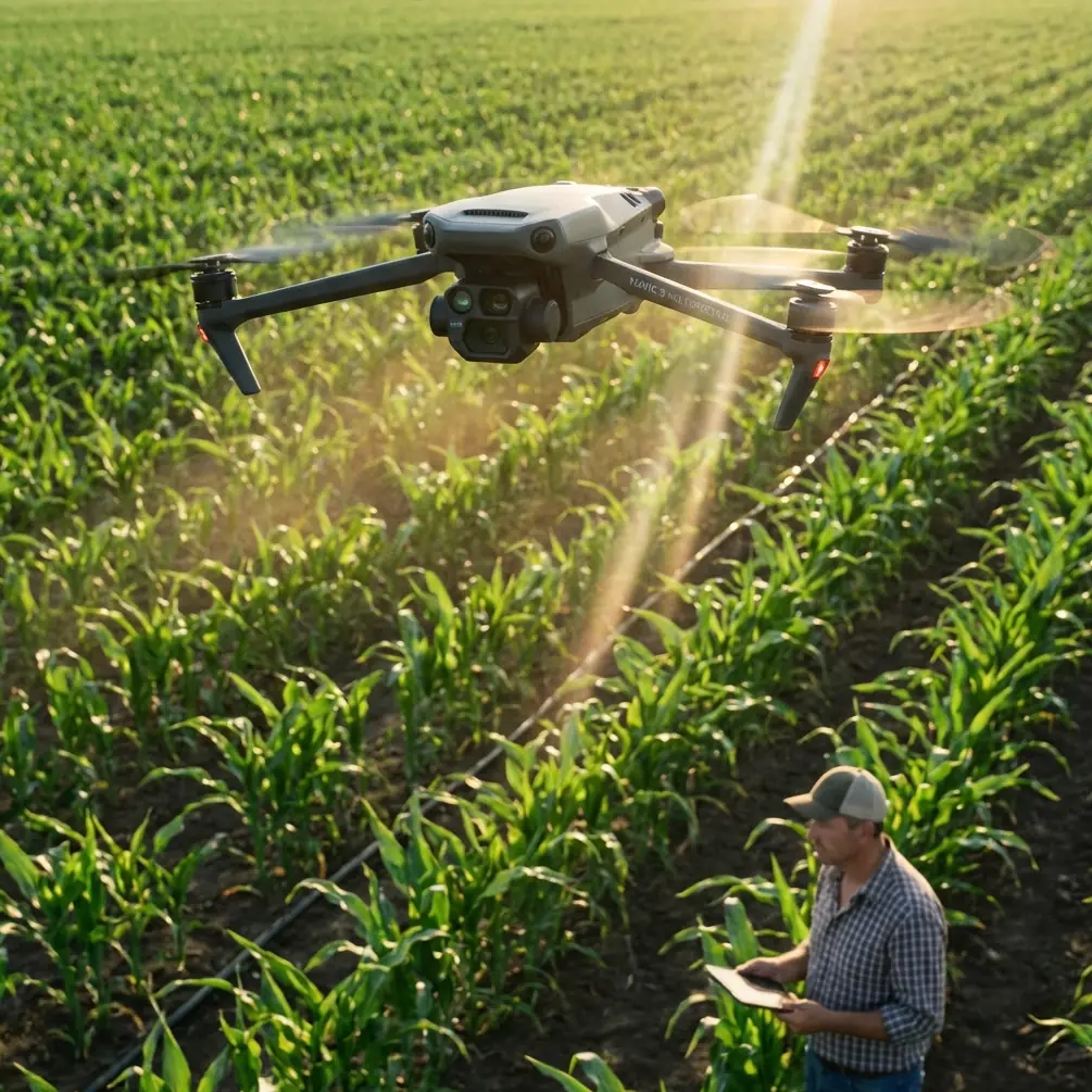
The Mavic 3M’s core strength is multispectral capture combined with high positional accuracy. On a coastal site, that matters more than many teams expect.
Multispectral data is often associated with agriculture, and the LSI vocabulary around spray drift, nozzle calibration, swath width, and IPX6K usually belongs to spraying platforms rather than mapping aircraft. For a construction reader, those terms are mostly a distraction here. The useful concept is not spraying. It is surface condition discrimination.
A coastal project site presents persistent ambiguity to standard RGB imaging. Wet sand can resemble recently compacted fill. Salt staining can be mistaken for minor surface variation. Drainage stress around temporary retention features may blend into ordinary vegetation change. A multispectral payload can help separate those signals. It can show where site conditions are diverging before the divergence is obvious in visible light.
That is operationally significant in at least three ways.
1. Drainage and water intrusion detection becomes earlier and more systematic
Standing water is easy to see. The real problem is transitional moisture. On a coastal construction site, that can point to blocked runoff paths, poor grading tolerance, compromised geotextile behavior, subsurface seepage, or unexpected pooling near utility trenches. By flying repeated missions with consistent geometry and centimeter-class positioning, the Mavic 3M helps teams compare change over time rather than rely on one-off observations.
That repeatability is where an RTK fix rate discussion becomes practical. Teams often treat RTK as a mapping checkbox. It is more than that. Stable RTK performance affects whether changes seen across missions are truly site changes or just alignment noise. If you are monitoring edge settlement near a sea wall tie-in or documenting progress around dewatering zones, centimeter precision has less value if positional consistency is unreliable. A strong RTK workflow is what turns the Mavic 3M from an imaging device into a monitoring instrument.
2. Buried or linear infrastructure corridors can be watched indirectly
The Shanxi news item involved power-line hazard inspection at high precision. That principle translates well to construction corridors. On coastal projects, buried services, temporary cable routes, drainage lines, and trench backfill zones often produce subtle surface signatures before a visible defect appears. The Mavic 3M cannot perform X-ray flaw detection, but it can support early warning by highlighting stress patterns in vegetation strips, uneven moisture retention, and inconsistent surface recovery along linear assets.
This is especially useful on large, active sites where daily foot inspection cannot cover every section with equal attention. A multispectral pass can narrow the search area. Ground crews then verify the anomaly. That division of labor is efficient and safer.
3. Progress documentation gains technical credibility
Aerial progress reports are common. Many are also shallow. They show what has been built, but not whether adjacent site conditions are behaving as expected.
If a coastal contractor is working around erosion control measures, sediment basins, temporary haul roads, or reclaimed land sections, Mavic 3M datasets can add a technical layer to routine updates. You are not just showing movement of equipment and placement of materials. You are showing whether the site is draining, stabilizing, and recovering in line with the construction sequence.
That is a stronger basis for internal review, consultant coordination, and handoff discussions.
The pre-flight cleaning step most teams underestimate
The reference case from Shanxi is about precision defect detection. Precision starts before takeoff.
In coastal environments, salt residue is not an aesthetic issue. It is a sensor and safety issue. A proper pre-flight cleaning routine is one of the most practical ways to protect the Mavic 3M’s reliability.
My recommendation is simple. Before each mission near surf, marine spray, or salt-laden wind corridors, clean the aircraft exterior with particular attention to the vision sensors, camera glass, landing gear contact points, battery interfaces, and arm joints. Use approved materials only, and make sure the surfaces are fully dry before powering on. If the aircraft has been transported in an open vehicle or staged near active dust and spray, inspect again immediately before launch.
Why does this matter?
Because salt film can degrade optical clarity and affect obstacle sensing confidence. It can also accumulate at connection points and create long-term reliability problems. On a site where flights may be short and frequent, teams sometimes skip this step because the aircraft “looks fine.” That is a mistake. When your mission depends on comparing multispectral data across repeated passes, a contaminated lens or sensor cover can quietly corrupt the consistency of your dataset.
In other words, cleaning is not housekeeping. It is part of measurement discipline.
A technical review mindset: where the Mavic 3M is strong, and where it is not
The Mavic 3M is best understood as a compact, fast-deployment monitoring aircraft for repeated intelligence capture. It is not a substitute for every specialist inspection method.
The Shanxi utility project is a useful reminder of that boundary. Drone X-ray flaw detection was chosen there because the inspection problem demanded that level of diagnostic specificity. The Mavic 3M cannot reproduce radiographic inspection of internal power-line defects. If your site requires internal weld testing, structural radiography, or deep subsurface diagnostics, you still need specialized methods and qualified teams.
But on construction sites, the most expensive problems often start above that threshold. They start with drainage drift, material stress, vegetation response, heat retention, and surface inconsistency. These are exactly the kind of patterns that broad visual patrols miss and specialist inspection teams are too costly to apply everywhere, every day.
That middle ground is where the Mavic 3M earns its place.
Coastal workflow recommendations for serious users
If I were building a Mavic 3M operating protocol for a coastal construction program, I would prioritize five practices.
First, fix your flight geometry. Repeated monitoring only works if altitude, overlap, timing, and route structure are consistent. Swath width should be selected for repeatability, not just speed. Wider is not always better if it compromises detail near drainage edges, trench lines, or temporary structures.
Second, protect RTK discipline. A strong RTK fix rate is not just nice to have. It is how you preserve comparison quality from one mission to the next. If corrections are unstable, note it and avoid over-interpreting small changes.
Third, schedule around environmental contamination. Coastal haze, reflective wet ground, and salt spray can degrade data quality quickly. Fly after the site has stabilized enough to show meaningful patterns, not just immediately after every weather event.
Fourth, build anomaly review into the workflow. The drone should not simply upload files to a dashboard. Someone needs to ask: what changed, why here, and what on-foot check follows? The value comes from the handoff.
Fifth, formalize the cleaning step. Put it in the checklist. No exceptions after operations near salt exposure.
If your team is refining that workflow and wants a field-practical discussion rather than a generic brochure explanation, you can message a Mavic 3M application specialist here.
What this means for decision-makers comparing tools
The most useful lesson from the Shanxi case is not about copying an X-ray method. It is about adopting the same inspection philosophy.
State Grid Shanxi Electric Power and its partner did not deploy a drone because drones are fashionable. They used a drone-centered method because it improved the precision and effectiveness of hazard screening on critical infrastructure. That is the standard construction teams should apply when evaluating the Mavic 3M.
Do not ask whether it takes good images. Ask whether it improves the quality of site decisions.
Do not ask whether it is easy to fly. Ask whether it can produce repeatable evidence under difficult coastal conditions.
Do not ask whether multispectral sounds advanced. Ask whether it helps your engineers, environmental managers, and project leads identify site changes earlier than standard visual checks.
Those are better questions. They lead to better tool selection.
Final assessment
For coastal construction monitoring, the Mavic 3M is not compelling because it is small or because multispectral sounds sophisticated. It is compelling when used as part of a precision-driven workflow aimed at finding early indicators of risk.
The recent Shanxi power-line inspection story gives us a sharp benchmark. A successful drone inspection mission was publicly framed around two outcomes: high-precision detection and hidden hazard screening. That is exactly the lens through which serious users should view the Mavic 3M.
It will not replace specialist diagnostic technologies. It will not perform X-ray nondestructive testing. But if your project needs a compact aircraft that can repeatedly map, compare, and highlight site condition changes with centimeter-level positioning discipline, it is a strong technical fit.
Especially on coastal jobs, where salt, moisture, reflectivity, and rapid environmental shifts can turn small site irregularities into bigger operational headaches, the Mavic 3M makes sense when paired with clean data habits, rigorous pre-flight cleaning, and a monitoring plan built around action rather than image collection.
That is the difference between flying a drone and running an aerial inspection program.
Ready for your own Mavic 3M? Contact our team for expert consultation.