Mavic 3M for Urban Venue Inspection: A Practical Field
Mavic 3M for Urban Venue Inspection: A Practical Field Method That Prioritizes Control, Coverage, and Safe Return
META: A field-focused guide to using Mavic 3M for urban venue inspection, with expert workflow advice on return-to-home logic, route design, antenna positioning, and image techniques that improve inspection clarity.
Urban venue inspection sounds straightforward until the aircraft is out over a riverwalk, stadium perimeter, exhibition roofline, or landscaped public corridor and the operator is no longer relying on direct sight cues. At that point, the mission stops being about “getting images” and becomes a discipline of route logic, signal discipline, and recovery planning.
That is where the Mavic 3M becomes interesting.
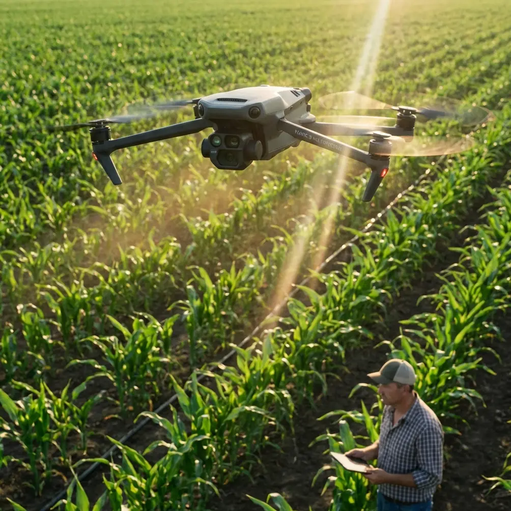
Most people associate the Mavic 3M with multispectral work. Fair enough. Its name is tightly linked to data capture, plant analysis, and repeatable mapping. But in urban inspection work, especially around campuses, sports facilities, public parks, event venues, and waterfront commercial districts, the value of the platform is not just the sensor stack. It is the way a well-planned aircraft workflow reduces uncertainty when sightlines are broken, structures interfere with situational awareness, and the mission needs to stay orderly from takeoff to return.
This article looks at the Mavic 3M through that lens: not as a generic drone overview, but as a practical urban venue inspection tool. The goal is to help operators build a workflow that is resilient, image-efficient, and safer when flying across constrained, visually busy environments.
Start with the problem urban venues actually create
Urban venues are deceptive. Open plazas look easy from the ground, but once the aircraft moves beyond the operator’s best viewing angle, the live feed becomes the main source of awareness. One of the source materials puts this plainly: in beyond-visual-line-style operating scenarios, the ground operator often depends mainly on the real-time image coming back from the aircraft, and that image typically shows only what is ahead of the drone. The field of view is limited.
That detail matters more than it first appears.
In venue inspection, a limited forward view means you can miss the context that really drives risk: a narrow corridor between structures, a temporary rigging installation, reflective glass, rooftop protrusions, tree canopies, or drifting signal shadows created by concrete and steel. Even when the Mavic 3M is flying perfectly, the operator’s understanding can still be incomplete if the mission is improvised.
So the first rule is this: never treat an urban venue flight as a freeform visual survey. Treat it as a managed corridor mission with a recovery plan.
Route design is not an administrative step. It is the mission.
One of the most useful ideas in the reference material comes from a training scenario involving river patrol. The route was broken into segments, with measured direction changes at specific points: one turn of 70 degrees clockwise, another of 65 degrees clockwise, and a final 75 degrees counterclockwise. This may sound like basic education content, but for Mavic 3M venue inspection it captures a professional truth: segmented routes outperform vague roaming.
Why? Because urban inspection rarely rewards wandering. A venue usually has recognizable linear assets and edge conditions:
- fence lines
- roof edges
- drainage channels
- facade runs
- loading zones
- pedestrian paths
- landscaping boundaries
- temporary event infrastructure
If you segment the mission the way that training example does, you get several operational advantages.
First, battery use becomes easier to predict. Second, image overlap and viewing angles become more consistent. Third, when something interrupts the mission, you know exactly which section has been completed and which section needs to be repeated. That is especially valuable for Mavic 3M users who may also be collecting multispectral data over planted zones, green roofs, turf installations, or surrounding ecological buffers where repeatability matters.
This is also where terms like swath width and centimeter precision become relevant in a venue context. They are often treated as agriculture vocabulary, but the underlying principle carries over. If your path spacing is inconsistent, your dataset loses comparability. If your flight line geometry shifts too much between missions, change detection becomes less trustworthy. And if your RTK fix rate is unstable during a dense urban inspection, your confidence in exact position matching drops with it.
For venue teams managing landscaped assets, irrigation stress, or suspected spray drift from nearby maintenance activity, that precision is not academic. It affects whether an anomaly can be confidently located and rechecked.
Automatic return is not a feature to “have on.” It is a decision tree to understand.
A lot of operators speak about return-to-home as though it were a box on a checklist. That mindset is too shallow for urban work.
The reference training document makes an essential point: automatic return can be triggered when control is lost, when battery level becomes low, or when environmental factors such as mountains, wind, rain, or other adverse natural conditions break the connection between aircraft and ground side. It also describes the heartbeat logic behind loss-of-link detection: the ground station sends periodic messages, and if the aircraft does not receive them within a set time window, it is judged disconnected and begins its programmed return.
That is the operational core you should be thinking about with a Mavic 3M in a venue environment.
Not “Does return work?” But:
- What return path should this mission use?
- What structures sit above or along that path?
- What happens if the aircraft initiates return while near a facade or under changing wind around a grandstand?
- Is the safest action to retrace the original route, or to climb to a pre-set return altitude and then navigate back by coordinates?
The source material explicitly distinguishes these return styles. An aircraft may return along the original flight route, or it may first climb to a planned return altitude, then fly back to the starting point using GPS coordinates, and finally land.
For urban venue inspection, the difference is huge.
When original-route return makes sense
If your aircraft has just traversed a narrow but known corridor around structures, decorative arches, or tree-lined pathways, retracing the original route may preserve the clearest safe passage. This is particularly relevant in environments where a straight-line return at altitude could cross above new obstacles the outbound path intentionally avoided.
When altitude-first return makes more sense
If the area above the venue is comparatively open, climbing before returning can reduce the risk of clipping intermediate obstacles and can simplify recovery. It can also help when the operator needs to re-establish a cleaner signal geometry with the remote.
The key is not to rely on a default. Build the return logic into the mission design.
Antenna positioning advice for maximum range in dense urban environments
You asked specifically for antenna positioning advice, and it deserves direct treatment because poor remote orientation is one of the quiet causes of degraded control quality in city work.
Here is the field rule I teach: do not point the antenna tips at the aircraft. Present the broad face of the antenna orientation toward the drone’s operating area. In practical terms, think in planes rather than points. You want the strongest effective relationship between remote and aircraft across the mission box, not just a hopeful “aim” at a moving target.
For urban venue inspection, a few habits help:
Stand where the mission breathes.
Choose a launch point with open sky exposure toward the majority of the route, not simply the closest patch of pavement.Avoid self-blocking.
Your body, a service vehicle, stadium seating, steel fencing, or rooftop equipment can all affect signal quality. Small shifts in stance can matter.Rotate with intent, not constantly.
If the aircraft is covering a segmented route, adjust your body and controller orientation at the segment transitions rather than making frantic micro-corrections.Respect reflective and absorptive clutter.
Glass-heavy structures, reinforced concrete, and dense utility installations can distort expectations. If signal quality trends down in one sector, note it and redesign the route next time rather than forcing the same geometry.Use altitude strategically.
Sometimes a modest altitude adjustment improves the radio path and restores cleaner control margins, but that decision must remain compatible with local obstacles and airspace constraints.
If you want a field checklist tailored to your site layout, it can be easier to discuss it visually first; sending a route sketch through this Mavic 3M planning chat is often faster than trying to describe antenna geometry in abstract terms.
Use image technique to make inspection findings easier to read
One of the more unusual source references discusses zoom-based photography: changing focal length while pressing the shutter to create radial blur and streaking lines that either expand outward or pull inward around the subject. In ordinary photography, that is a stylistic move. In inspection, it should not replace documentary imagery. But it can still serve a purpose.
Here is where it becomes useful for venue reporting.
Urban inspection is not always about proving a defect with one literal image. Sometimes you also need a communication image that helps a non-pilot stakeholder immediately understand where attention belongs. A controlled zoom effect can intensify visual focus around a particular element: a damaged lighting cluster, a rooftop drain choke point, a stage truss anchor, a cracked facade feature, or a hazard marker in a busy nighttime venue.
The source describes the effect well: the subject remains emphasized while the background develops radial blur and stretched lines, creating visual tension and pulling the viewer’s eye toward the center. That can be operationally significant in reports, presentations, and maintenance briefings because crowded urban scenes often dilute attention.
Two cautions matter.
First, keep these images separate from your evidence set. The inspection archive should still contain clean, geometrically reliable photographs. Second, use the effect sparingly. It is best treated as a communication aid, not a measurement image.
Night venue work is where this can be especially compelling. Lighting arrays, path illumination, and architectural features can produce strong directional streaking that instantly clarifies the area of concern for venue managers. Used intelligently, the technique helps the story of the inspection land faster.
Where the Mavic 3M’s multispectral side fits in venue inspection
A venue is not only concrete and steel. Many urban sites include turf, landscaped islands, green roofs, ornamental planting, drainage swales, and buffer vegetation. This is where the Mavic 3M separates itself from general camera drones.
Multispectral capture allows inspection teams to move beyond surface appearance. A patch of stressed turf near spectator circulation may not stand out clearly in RGB imagery, yet the pattern can reveal irrigation inconsistency, compaction, or early maintenance issues. Around sports and recreation venues, this is not cosmetic. It affects safety, presentation, and scheduling.
The same applies where venue operators are monitoring potential spray drift from nearby treatment activity or trying to verify whether irrigation is uniform after nozzle calibration changes. Those topics sound agricultural, but the mechanics overlap with venue grounds management. If your organization is maintaining premium grass, landscaped presentation zones, or controlled ecological spaces around a commercial site, repeatable multispectral surveys paired with dependable route design become a practical management system.
This is also where stable RTK behavior pays off. Strong positional consistency supports comparison over time. If one mission flags an anomalous strip near a path edge, centimeter-level repeatability makes follow-up more defensible.
Build a venue inspection workflow that assumes interruption
Good operators do not design for the perfect flight. They design for the interrupted one.
A sensible Mavic 3M workflow for urban venue inspection usually looks like this:
- define the venue into route segments
- identify likely signal-challenged sectors
- choose return behavior for each mission type
- confirm return altitude logic against actual obstacles
- set image priorities: evidentiary, analytical, communicative
- verify battery reserve against the longest recovery case, not the shortest mission case
- launch from a position that supports line quality, not just convenience
- document any signal degradation zone for future route refinement
This mindset reflects the core lesson from the training reference: automatic return exists because the aircraft may face low battery, loss of control link, or environmental disruption, and the system must be able to decide and execute safely. In urban work, that is not a backup concept. It is part of the main mission architecture.
The real measure of Mavic 3M performance in urban venues
People often ask whether the Mavic 3M is “good for inspection.” The better question is whether the operator is using it in a way that respects the environment it is flying through.
In urban venue work, the aircraft’s value comes from disciplined planning married to the right sensor strategy. Segment the route. Understand return logic. Position the antennas intelligently. Capture clean evidence first. Use multispectral where ground health and environmental patterns matter. And when you need a report image that pulls decision-makers straight to the point, a carefully handled zoom effect can add emphasis without muddying the record.
That combination is what turns a capable drone into a dependable inspection platform.
Ready for your own Mavic 3M? Contact our team for expert consultation.