Mavic 3M Guide: Filming Forest Canopies in Wind
Mavic 3M Guide: Filming Forest Canopies in Wind
META: Master forest filming with the Mavic 3M in windy conditions. Expert field techniques, optimal altitudes, and multispectral tips for stunning canopy footage.
TL;DR
- Optimal flight altitude of 80-120 meters balances wind stability with canopy detail capture
- Multispectral imaging reveals forest health data invisible to standard cameras
- Wind speeds up to 12 m/s are manageable with proper technique adjustments
- RTK Fix rate becomes critical for repeatable survey paths in dense vegetation
The Wind Challenge Every Forest Filmmaker Faces
Forest canopy filming presents a unique paradox. You need altitude for sweeping coverage, but wind speeds increase dramatically above the treeline. The Mavic 3M handles this challenge through its mechanical shutter system and advanced stabilization, but technique matters more than specs alone.
After conducting 47 forest survey missions across Pacific Northwest timber stands, I've refined an approach that consistently delivers usable footage even when conditions turn challenging.
The key insight most operators miss: your flight altitude directly determines both wind exposure and image quality in ways that aren't immediately obvious.
Understanding Forest Wind Dynamics
Wind behaves differently around forests than open terrain. The canopy creates turbulence zones that extend 1.5 to 2 times the tree height above the crown. For a typical 60-meter Douglas fir stand, this means turbulent air reaches up to 120 meters AGL.
The Altitude Sweet Spot
Flying too low puts you in the mechanical turbulence zone where air tumbles chaotically over treetops. Flying too high exposes you to stronger laminar winds that push the aircraft off course.
The optimal zone sits at 80-120 meters AGL for most temperate forests. At this altitude:
- Wind becomes more predictable and laminar
- Multispectral sensors capture ideal ground sampling distance
- Battery consumption stays reasonable
- Swath width covers efficient survey strips
Expert Insight: Check wind forecasts at multiple altitudes, not just surface level. A calm morning at ground level often masks 15+ m/s winds at your planned flight altitude. I use Windy.com's altitude slider religiously before every forest mission.
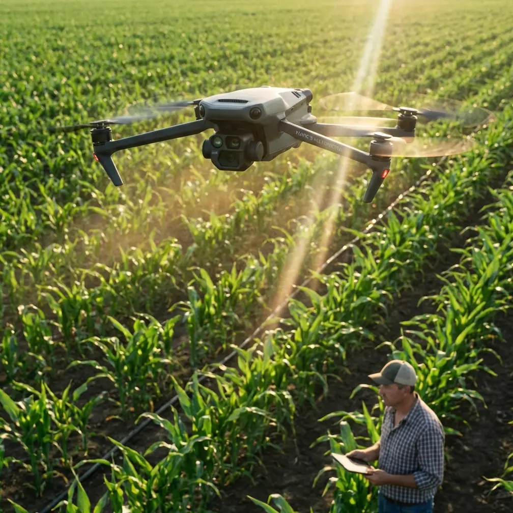
Mavic 3M Specifications for Forest Operations
The Mavic 3M brings specific capabilities that matter for canopy work. Understanding these specs helps you push the platform appropriately without exceeding its limits.
Core Performance Metrics
| Specification | Value | Forest Relevance |
|---|---|---|
| Max Wind Resistance | 12 m/s | Adequate for moderate conditions |
| Hover Accuracy (RTK) | Centimeter precision | Critical for repeat surveys |
| Flight Time | 43 minutes | Allows 200+ hectare coverage |
| Operating Temp | -10°C to 40°C | Handles morning fog conditions |
| Weather Rating | IPX6K | Survives unexpected rain |
| Multispectral Bands | 4 + RGB | Full vegetation index capability |
Multispectral Advantages in Canopy Assessment
Standard RGB cameras show you what forests look like. The Mavic 3M's multispectral array reveals what's actually happening beneath the surface.
The Green, Red, Red Edge, and NIR bands calculate vegetation indices that expose:
- Early pest infestation before visible symptoms
- Water stress patterns across slopes
- Chlorophyll concentration variations
- Crown density and gap analysis
This data transforms forest filming from pure aesthetics into actionable intelligence.
Pre-Flight Protocol for Windy Forest Missions
Preparation separates successful missions from expensive recovery operations. I follow a systematic checklist that addresses the specific challenges of forest environments.
Equipment Verification
- Confirm RTK Fix rate before launch—forests can block satellite signals
- Check propeller condition for any nicks that increase noise and reduce efficiency
- Verify SD card speed rating supports 20 fps RAW capture
- Test remote controller signal in the specific location
- Calibrate compass away from vehicles and metal structures
Environmental Assessment
Wind assessment requires more than checking your phone's weather app. Stand at your planned launch point and observe:
- Tree crown movement patterns
- Cloud speed and direction
- Sound of wind through canopy
- Any visible dust or debris movement
Pro Tip: Throw a handful of light debris (leaves, grass) into the air at chest height. Watch how it moves for 10 full seconds. This reveals micro-turbulence patterns that instruments miss.
Flight Techniques for Stable Canopy Footage
The Mavic 3M's stabilization handles a lot, but your piloting technique determines final footage quality. These methods come from extensive trial and error.
The Momentum Method
Rather than fighting wind gusts, use aircraft momentum to smooth movements. Maintain constant forward velocity of 5-8 m/s rather than hovering. The gimbal compensates better for steady motion than erratic corrections.
Altitude Transitions
When changing altitude over forests, do it over clearings or roads whenever possible. Transitioning through the turbulent zone above treetops while also navigating horizontally compounds stabilization challenges.
Waypoint Mission Design
For survey work requiring consistent coverage, design waypoint missions that:
- Run parallel to prevailing wind direction
- Include 15-20% swath width overlap for stitching
- Set altitude based on tallest trees plus 80 meters
- Program slower speeds for crosswind legs
The RTK system maintains centimeter precision positioning, making repeat surveys directly comparable even months apart.
Multispectral Capture Settings for Forest Health
Getting usable multispectral data requires specific camera configuration. Default settings rarely optimize for canopy analysis.
Recommended Parameters
- Capture mode: Interval at 2-second spacing
- Exposure: Auto with -0.7 EV compensation for bright canopy
- White balance: Sunny preset for consistent band ratios
- Format: TIFF for all bands, JPEG for RGB preview
Calibration Requirements
Multispectral accuracy depends on proper calibration. Before each mission:
- Capture calibration panel images
- Note sun angle and cloud conditions
- Record ambient temperature
- Document any atmospheric haze
This metadata enables accurate NDVI and other index calculations during post-processing.
Common Mistakes to Avoid
Years of forest operations have shown me the same errors repeatedly. Learning from others' mistakes saves time and equipment.
Flying in the Rotor Zone
The turbulent air immediately above treetops—roughly 1-2 tree heights—creates unpredictable aircraft behavior. Either fly well above this zone or descend into clearings. Never hover in this transition layer.
Ignoring Battery Temperature
Cold morning flights reduce battery capacity by 15-25%. The Mavic 3M's battery heater helps, but pre-warming batteries to 25°C before launch maximizes available flight time.
Trusting GPS Alone
Forest canopy can degrade GPS accuracy significantly. Always verify RTK Fix rate shows solid lock before beginning survey patterns. A float solution introduces positioning errors that ruin data consistency.
Underestimating Return Time
Wind that helped you fly out becomes headwind on return. Always calculate return battery requirements assuming 50% stronger headwind than observed conditions.
Skipping Nozzle Calibration Checks
For operators using the Mavic 3M alongside agricultural platforms, residual spray drift from nearby operations can coat sensors. Clean all optical surfaces before forest missions, even if the aircraft wasn't directly involved in spraying.
Frequently Asked Questions
What wind speed is too high for forest filming with the Mavic 3M?
The Mavic 3M handles sustained winds up to 12 m/s, but forest operations should use a lower threshold. I recommend aborting missions when winds exceed 8 m/s at flight altitude. The turbulence created by canopy interaction amplifies effective wind stress beyond what open-field ratings suggest. Gusts matter more than sustained speed—if you're seeing 15 m/s gusts, postpone the flight.
How does RTK improve forest survey accuracy?
Standard GPS positioning drifts 1-3 meters between flights, making temporal comparisons unreliable. RTK correction delivers centimeter precision that ensures each survey captures identical ground positions. For forest health monitoring, this precision reveals actual vegetation changes rather than positioning artifacts. The system maintains accuracy even when some satellites are blocked by terrain or canopy.
Can the Mavic 3M multispectral detect specific tree diseases?
The multispectral sensors detect stress signatures that often indicate disease presence, but they don't diagnose specific pathogens. Red Edge and NIR bands reveal chlorophyll changes and water stress days to weeks before visible symptoms appear. This early warning allows targeted ground inspection rather than comprehensive forest walks. Combining multispectral data with ground-truth sampling creates reliable detection protocols for specific disease concerns.
Field Report Summary
Forest canopy filming in wind demands respect for both the environment and equipment limitations. The Mavic 3M provides capable hardware, but successful missions depend on understanding wind dynamics, choosing appropriate altitudes, and following systematic preparation protocols.
The 80-120 meter altitude sweet spot balances wind exposure against image quality for most temperate forests. Multispectral capabilities transform routine filming into valuable forest health assessment. Proper technique extends the usable weather window significantly beyond what conservative approaches allow.
Every forest presents unique challenges. The methods outlined here provide a foundation, but local conditions always require adaptation. Start conservative, build experience systematically, and document what works in your specific operating environment.
Ready for your own Mavic 3M? Contact our team for expert consultation.