Mavic 3M for High-Altitude Construction Inspection
Mavic 3M for High-Altitude Construction Inspection: How Flight Height Changes What You Can Actually Trust
META: A technical review of Mavic 3M use on high-altitude construction sites, with practical guidance on flight altitude, image precision, RTK workflow, and why security discipline now matters as much as data quality.
High-altitude construction inspection has a strange habit of exposing weak assumptions. A flight plan that works perfectly on flat ground can become unreliable the moment the site climbs, the wind starts shearing across a ridge, or the structure itself introduces complex elevation changes. That is exactly where the Mavic 3M becomes interesting—not as a generic drone, but as a platform whose value depends on how intelligently you manage altitude, control, and image interpretation.
For teams inspecting mountain projects, elevated dam works, hillside access roads, bridge approaches, retaining walls, steel structures, and remote foundations, the central question is not simply whether the aircraft can fly. It is whether the data holds up under terrain-driven distortion and whether the inspection method is precise enough to support engineering decisions.
That is why flight altitude deserves more attention than it usually gets.
Why optimal altitude is the real technical decision
On high-altitude construction sites, “how high should I fly?” sounds like a routine setup parameter. It is not. Altitude determines ground sampling detail, overlap stability, wind exposure, and the usefulness of your measurements for change detection.
A useful clue comes from earlier UAV remote sensing practice in hilly forest environments. In one documented workflow, aerial images were collected over terrain with relative elevation differences within about 200 meters, and the mission used a planned flight altitude of 600 meters above sea level. After processing, the corrected UAV imagery reached 0.2 m spatial resolution, supported by 30 control points, while the reference satellite layer had 0.5 m resolution and was corrected with 17 RTK ground control points.
Those numbers matter operationally for Mavic 3M users in construction, even though the original work was in forest resource investigation rather than civil inspection.
Here is why:
- A 200 m relative height difference is enough to break the illusion that one flight height fits the whole site.
- A workflow that combines reference imagery, ground control, and geometric correction shows that reliable interpretation does not come from the aircraft alone.
- Achieving 0.2 m output demonstrates how much inspection value depends on controlled processing rather than just sensor marketing.
For a high-altitude construction site, the takeaway is straightforward: your optimal flight altitude is the lowest height that safely preserves terrain clearance while still delivering consistent overlap and stable RTK-supported geometry across elevation changes. If you climb too high, you protect coverage but lose crack-level and edge-level detail. If you fly too low on uneven slopes or around exposed structures, your image scale changes too aggressively from one segment to the next, and stitching quality suffers.
With the Mavic 3M, that balance matters even more because many operators are drawn to its multispectral identity and forget that construction inspection still depends first on geometry.
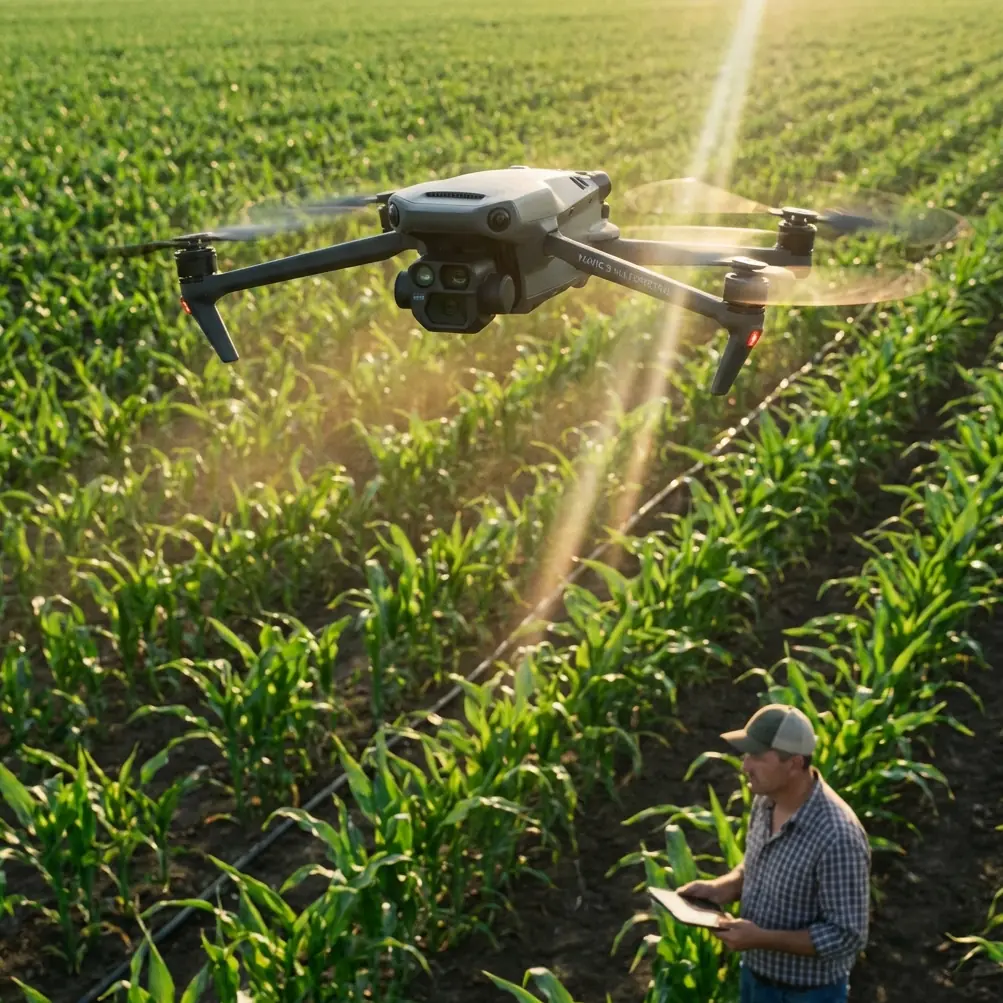
Mavic 3M is not just an agriculture aircraft wearing a hard hat
The Mavic 3M is often discussed through an agriculture lens because multispectral workflows naturally lead people toward crop vigor, stand counts, and prescription logic. But that framing is too narrow for construction. On elevated sites, the aircraft’s real relevance is that it can document broad areas efficiently while maintaining a disciplined, repeatable capture pattern suitable for terrain comparison and surface review.
That aligns surprisingly well with an older engineering argument from digital photogrammetry research. In civil and geotechnical monitoring, UAV-based imaging has been highlighted for observing the full deformation process of materials and structures, especially where traditional point-based electrical measurement methods are too limited. The cited applications are not theoretical window dressing. They include:
- dam deformation in remote areas
- mine surface subsidence
- tunnel collapse monitoring
- surrounding rock convergence
- bridge crack and displacement observation
- steel structure deformation
- building settlement, tilt, and displacement monitoring
That list lands squarely in the kind of work a high-altitude construction reader cares about. The key insight is that drone imaging is most valuable where large-area change must be observed safely and repeatedly. This is exactly the environment where Mavic 3M can fit: not as a replacement for every surveying instrument, but as a fast visual measurement layer between site walkthroughs and full geodetic campaigns.
So what is the right flight altitude for Mavic 3M on a mountain construction site?
There is no universal number, but there is a defensible method.
1. Fly to the surface, not to the launch point
At high-altitude sites, pilots often make the mistake of planning from takeoff elevation instead of terrain-relative altitude. That is manageable over flat pads. It becomes dangerous for cut slopes, switchback roads, tower pads, and embankments. If one edge of the site rises sharply, your effective altitude above ground can collapse, reducing safety margins and distorting image scale.
The better approach is to think in terms of consistent height above the inspected surface. For earthworks, haul roads, retaining walls, and broad structural zones, choose an altitude that holds similar image geometry across changing terrain. This improves mosaicking and helps when comparing flights over time.
2. Use lower altitudes for deformation clues, not just defect spotting
Construction teams often assume lower flights are only for close visual inspection. That misses the point. Lower altitude can also improve the interpretability of subtle movement indicators: joint separation, drainage pattern changes, edge erosion, stockpile shifts, shotcrete variation, and surface displacement around temporary works.
The engineering reference is useful here. It emphasizes that UAV digital photogrammetry supports precise observation of small deformations over large areas and avoids the natural limitations of point-only measurement methods. In practice, the Mavic 3M should be flown low enough to preserve these clues, but not so low that overlap and consistency break down around elevation discontinuities.
3. Split missions by purpose
One altitude rarely serves every inspection need. On a complex high-altitude project, run at least two mission types:
- A broader mapping pass for terrain context, access roads, drainage, stockpiles, and site-wide progress
- A lower-detail pass for deformation-sensitive structures such as crane bases, retaining faces, bridge components, dam shoulders, or steel connections
This is where many Mavic 3M deployments become more reliable. Instead of forcing one compromise altitude, you preserve both site context and engineering detail.
What the forest remote sensing case teaches construction inspectors
The forest study may seem distant from construction, but it offers three habits worth adopting.
Ground control still matters
That workflow used 17 RTK-collected control points to correct the reference imagery and 30 control points to correct the stitched UAV images. Even if your Mavic 3M workflow uses RTK and strong onboard positioning, high-altitude construction sites with steep relief, repetitive textures, or poor visual features can still benefit from independent checks.
Operational significance: when you need to compare slope movement, edge displacement, or platform geometry over time, trusting onboard positioning alone can be risky. A few well-placed checkpoints can reveal whether your apparent movement is real or just geometric drift.
Resolution must match the question
The processed UAV output reached 0.2 m. That is enough for many land-cover or site-shape interpretations, but it is not the same as crack microscopy. Construction teams should define the inspection question before choosing altitude. If the objective is haul-road washout mapping or stockpile boundaries, higher altitude may be fine. If the objective is movement around an abutment seat or subtle erosion along a crest, you need more detail.
Operational significance: “best altitude” is really “best altitude for the engineering question.”
Weather discipline is not optional
The same source noted cloudy weather, light ground wind around force 2 with gusts of 3–4, and a programmed route. High-altitude construction sites amplify weather effects. Even when the takeoff zone feels calm, ridge lines, tower edges, open cuts, and exposed decks can produce inconsistent aircraft behavior and image blur.
Operational significance: if your RTK fix rate is stable but your airframe is working in turbulent crossflow, the resulting model can still degrade. Precision is not only about coordinates. It is also about image quality and repeatability.
Where multispectral actually helps on a construction site
The Mavic 3M’s multispectral capability is not wasted in construction, but it should be used with discipline. On high-altitude projects, multispectral data can be useful for:
- identifying vegetation encroachment along access roads and drainage corridors
- separating disturbed soil from stabilized ground cover
- tracking moisture-related patterns that may correspond to runoff issues or seepage zones
- monitoring reclamation progress on cut-and-fill areas
This is where some agriculture-adjacent concepts become surprisingly relevant. Terms like spray drift, nozzle calibration, and swath width belong primarily to field operations, but they remind us of a larger point: environmental control matters. On mixed-use mountain sites near revegetation areas or erosion control installations, understanding vegetation response and moisture patterns can complement standard RGB inspection.
That said, for structural inspection, multispectral should support—not replace—high-quality visible imaging and careful geometry control.
Security is now part of inspection planning
There is another issue Mavic 3M operators should not ignore: site security.
A 2026 report from New Jersey described the theft of 15 agricultural spraying drones, serious enough to draw the attention of federal investigators and public safety officials. Those aircraft were reportedly designed for chemical spraying, and the incident renewed broader concerns around drone misuse and preparedness.
For construction teams, the lesson is not about agriculture. It is about asset control.
If your Mavic 3M is used on remote high-altitude sites, your operational risk is not limited to wind, terrain, and battery planning. Aircraft storage, access logging, controller management, charging locations, and crew movement all matter. Remote construction compounds, temporary cabins, and roadside staging areas are exactly the kind of places where security habits become lax.
Practical implications:
- do not leave aircraft in lightly secured vehicles overnight
- separate aircraft, batteries, and controllers when possible
- document serials and flight assignment logs
- limit who has access to mission planning files and site imagery
- treat remote launch locations as controlled work zones, not casual staging points
The growing focus on drone security is no longer abstract. It intersects directly with commercial inspection operations.
A field-ready altitude strategy for Mavic 3M
If I were advising a team inspecting a high-altitude construction site with Mavic 3M, I would use this sequence:
- Classify the site by relief, especially whether local elevation variation approaches something like the 200 m range seen in the remote sensing reference.
- Choose terrain-following logic wherever possible instead of a flat-height mission.
- Run a moderate-height overview mission to capture site-wide geometry and logistics.
- Run lower targeted missions over critical assets where deformation, settlement, or displacement matters.
- Validate with checkpoints, even if RTK performance appears strong.
- Review image sharpness and overlap before leaving site, because mountain weather and structural wind effects can quietly damage data quality.
- Secure the aircraft and data chain with the same seriousness as any other technical asset.
If your team wants to compare mission design options for steep terrain, a quick message through this technical support channel can save a wasted site visit.
The real value of Mavic 3M in this scenario
For high-altitude construction inspection, the Mavic 3M earns its place when it is used as a disciplined photogrammetry and monitoring platform rather than a one-click flying camera. The strongest evidence from the reference material points in that direction.
One source shows how controlled correction with 17 and 30 ground points turns raw imagery into something geometrically useful. Another shows why UAV digital photogrammetry matters for real engineering problems such as structural displacement, bridge condition review, and deformation tracking. The New Jersey theft case adds a modern operational layer: drone programs now need security maturity, not just flight competence.
So the optimal flight altitude insight is simple, but not simplistic: on high-altitude construction sites, do not pick altitude for convenience. Pick it for measurement integrity. Fly relative to the surface, separate overview missions from detail missions, and verify geometry instead of assuming it.
That is how the Mavic 3M becomes credible on serious sites.
Ready for your own Mavic 3M? Contact our team for expert consultation.