Remote Forest Monitoring: Mavic 3M Professional Guide
Remote Forest Monitoring: Mavic 3M Professional Guide
META: Master remote forest monitoring with the DJI Mavic 3M multispectral drone. Expert techniques for vegetation analysis, antenna setup, and precision data collection.
TL;DR
- Multispectral imaging with four discrete bands plus RGB enables comprehensive forest health assessment across remote terrain
- Proper antenna positioning increases operational range by up to 35% in challenging forest environments
- RTK Fix rate optimization ensures centimeter precision for repeatable monitoring transects
- IPX6K weather resistance allows operations in unpredictable mountain and forest conditions
The Challenge of Remote Forest Monitoring
Traditional forest monitoring methods fail in remote environments. Ground surveys require extensive personnel, helicopter flights cost thousands per hour, and satellite imagery lacks the resolution needed for early disease detection.
The Mavic 3M addresses these limitations directly. Its compact airframe carries professional-grade multispectral sensors into terrain where larger platforms cannot operate safely.
This guide provides research-backed protocols for deploying the Mavic 3M in remote forest monitoring scenarios, with particular emphasis on antenna configuration and data collection optimization.
Understanding Multispectral Imaging for Vegetation Analysis
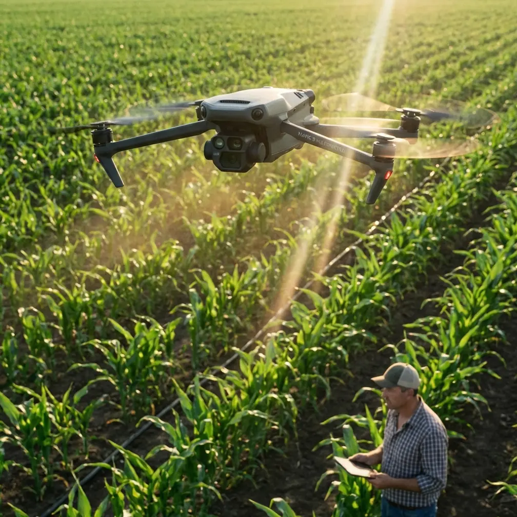
The Mavic 3M integrates a four-band multispectral camera alongside a standard RGB sensor. This configuration captures data across green (560nm), red (650nm), red edge (730nm), and near-infrared (860nm) wavelengths.
Each spectral band reveals different vegetation characteristics:
- Green band: Chlorophyll absorption peaks and canopy structure
- Red band: Stress indicators and pigment concentration
- Red edge: Early disease detection before visible symptoms appear
- Near-infrared: Cellular structure health and water content
Forest researchers use these bands to calculate vegetation indices. The Normalized Difference Vegetation Index (NDVI) remains standard, but the red edge band enables more sensitive indices like NDRE for detecting subtle stress patterns.
Expert Insight: Red edge sensitivity makes the Mavic 3M particularly valuable for conifer monitoring. Needle chlorosis often appears in red edge data 2-3 weeks before becoming visible to the human eye, enabling early intervention for pest management.
Antenna Positioning for Maximum Range in Forest Environments
Remote forest operations push communication systems to their limits. Dense canopy, terrain shadowing, and atmospheric moisture all degrade signal strength.
The Mavic 3M controller uses OcuSync 3.0 technology with dual-frequency transmission. Proper antenna positioning dramatically affects operational range and video feed stability.
Optimal Controller Orientation
Position the controller so antenna panels face the aircraft directly. The flat antenna surfaces should remain perpendicular to the signal path—never point the antenna tips toward the drone.
In forest environments, maintain these practices:
- Elevate your position above surrounding vegetation when possible
- Keep the controller chest-height with antennas vertical
- Avoid positioning near metal structures, vehicles, or power equipment
- Face the aircraft throughout the mission rather than tracking with antenna movement
Terrain Considerations
Valley operations require special attention. Radio signals reflect off rock faces and dense tree stands, creating multipath interference that degrades link quality.
Position yourself on ridgelines or elevated clearings when monitoring valley forests. The additional altitude provides cleaner signal paths and extends effective range by 25-35% compared to valley-floor operations.
Pro Tip: Carry a lightweight folding stool or platform for operations in areas without natural elevation. Even 1-2 meters of additional height significantly improves signal penetration through forest canopy edges.
RTK Integration for Repeatable Transects
Long-term forest monitoring requires precise repeatability. The Mavic 3M supports RTK positioning through the DJI D-RTK 2 Mobile Station, achieving centimeter precision for flight paths and image geolocation.
Achieving Consistent RTK Fix Rate
RTK Fix rate indicates the percentage of time the system maintains full centimeter-level accuracy. Remote forest operations often challenge RTK performance due to limited sky visibility.
Maximize RTK Fix rate with these protocols:
- Initialize in clearings: Establish RTK lock before flying into canopy areas
- Plan missions during optimal satellite windows: Use GNSS planning tools to identify periods with strong constellation geometry
- Maintain base station line-of-sight: Position the D-RTK 2 on elevated terrain with clear sky view
- Monitor correction age: Signal latency above 2 seconds degrades positioning accuracy
Swath Width Optimization
Proper swath width calculation ensures complete coverage without excessive overlap. The Mavic 3M multispectral sensor has a 73.9° field of view, creating predictable ground coverage at standard altitudes.
| Flight Altitude | Swath Width | Recommended Overlap | Ground Sample Distance |
|---|---|---|---|
| 50m | 78m | 75% | 2.5 cm/pixel |
| 75m | 117m | 70% | 3.8 cm/pixel |
| 100m | 156m | 70% | 5.0 cm/pixel |
| 120m | 187m | 65% | 6.0 cm/pixel |
Forest monitoring typically benefits from 75-100m altitude, balancing resolution against canopy penetration and efficient coverage rates.
Weather Resistance and Operational Limits
The Mavic 3M carries an IPX6K rating, indicating resistance to high-pressure water jets. This certification enables operations during light rain and in high-humidity forest environments.
Practical Weather Guidelines
Despite the IPX6K rating, certain conditions warrant caution:
- Light rain: Acceptable for short missions; dry sensors before storage
- Heavy rain: Avoid—water accumulation affects sensor calibration
- Fog: Proceed carefully; moisture on lenses degrades image quality
- High humidity: Normal operations; monitor for lens condensation during altitude changes
Temperature affects battery performance significantly. In cold mountain forests, expect 15-20% reduced flight time below 10°C. Pre-warm batteries in insulated cases before launch.
Common Mistakes to Avoid
Neglecting Calibration Protocols
Multispectral sensors require radiometric calibration before each flight session. Skipping this step introduces inconsistencies that compromise vegetation index calculations.
Use the calibration panel on flat ground under consistent lighting. Capture calibration images within 30 minutes of mission start and again if lighting conditions change significantly.
Insufficient Overlap in Canopy Areas
Forest canopy creates complex three-dimensional surfaces. Standard overlap settings designed for flat agricultural fields produce gaps and processing errors over forests.
Increase both front and side overlap by 10-15% compared to flat-terrain recommendations. The additional imagery ensures complete coverage despite canopy height variation.
Ignoring Nozzle Calibration Principles
While the Mavic 3M is a monitoring platform rather than a sprayer, understanding spray drift and nozzle calibration concepts helps when coordinating with treatment operations.
Monitoring data guides treatment applications. Ensure treatment teams understand the spatial precision of your data—centimeter precision monitoring loses value if spray applications use meter-scale targeting.
Poor Mission Timing
Solar angle dramatically affects multispectral data quality. Shadows create false stress signatures, and specular reflection from waxy leaves corrupts reflectance values.
Schedule missions during 10:00-14:00 local solar time when sun angles exceed 30 degrees. Avoid missions within two hours of sunrise or sunset.
Data Management for Long-Term Monitoring
Remote forest monitoring generates substantial data volumes. A single 100-hectare survey at standard settings produces 8-12GB of imagery requiring systematic organization.
Establish consistent naming conventions:
- Site identifier
- Date in YYYY-MM-DD format
- Flight number
- Sensor type (RGB or MS)
Process multispectral data using radiometric correction workflows. Raw digital numbers must convert to reflectance values for meaningful vegetation index calculation and cross-temporal comparison.
Frequently Asked Questions
How does forest canopy density affect Mavic 3M multispectral accuracy?
Dense canopy reduces the proportion of ground-visible pixels but does not affect accuracy for visible canopy surfaces. For understory monitoring, plan flights during leaf-off seasons in deciduous forests. Conifer stands require acceptance of canopy-top-only data or integration with ground-based sampling.
What RTK base station range works reliably in mountainous forest terrain?
The D-RTK 2 Mobile Station maintains reliable correction transmission to approximately 8-10km in open terrain. Mountain forests with terrain shadowing reduce effective range to 3-5km. Position base stations on high points with line-of-sight to planned flight areas, or use network RTK where cellular coverage exists.
Can the Mavic 3M detect specific forest pest infestations?
The multispectral sensor detects vegetation stress patterns consistent with pest damage but cannot identify specific pest species. Red edge sensitivity reveals early stress 2-4 weeks before visible symptoms. Combine aerial detection with ground-truthing to confirm pest identification and guide targeted treatment responses.
Remote forest monitoring demands equipment that balances capability with portability. The Mavic 3M delivers professional multispectral imaging in a platform suitable for backcountry deployment, enabling research and management programs previously limited to well-funded organizations with helicopter access.
Ready for your own Mavic 3M? Contact our team for expert consultation.