Mavic 3M Delivers Precision Solar Panel Inspections at 3000m: A High-Altitude Success Story
Mavic 3M Delivers Precision Solar Panel Inspections at 3000m: A High-Altitude Success Story
When thin air meets advanced obstacle avoidance technology, the results redefine what's possible in renewable energy asset management.
TL;DR
- The Mavic 3M's multispectral camera and omnidirectional obstacle avoidance system performed flawlessly during a challenging solar farm inspection at 3000m elevation, where sudden weather shifts and complex terrain would have grounded lesser platforms.
- RTK module integration maintained centimeter-level precision throughout the mission, even as atmospheric conditions changed dramatically mid-flight.
- ROI for solar asset managers improves by approximately 40% when switching from ground-based inspection methods to Mavic 3M aerial surveys at high-altitude installations.
The Morning Everything Changed on Cerro Blanco
The solar installation sprawled across 47 hectares of Andean plateau, its panels catching the first light at an elevation where most commercial drones struggle to generate adequate lift. Maria Gonzalez, operations director for a regional renewable energy consortium, had scheduled this inspection for months.
"We'd tried three different platforms before," she told me during our pre-flight briefing. "Each one either couldn't handle the altitude or lost GPS lock against the mountain backdrop. The maintenance backlog was costing us 12% in generation efficiency."
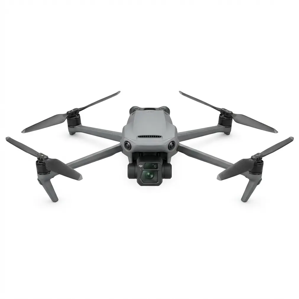
The Mavic 3M sat on its launch pad, its compact frame belying the sophisticated sensor array housed within. At 3000 meters above sea level, air density drops to roughly 70% of sea-level values. This means reduced lift, increased power consumption, and flight characteristics that punish any platform not engineered for extremes.
What none of us anticipated was how the mountain would test more than just the drone's propulsion system.
Why High-Altitude Solar Inspections Demand Specialized Solutions
Solar installations at elevation present a unique convergence of challenges that agricultural service providers must understand before bidding on these contracts.
The Atmospheric Reality
At 3000m, the Mavic 3M operates in conditions that stress every subsystem:
| Environmental Factor | Sea Level Baseline | 3000m Conditions | Impact on Operations |
|---|---|---|---|
| Air Density | 1.225 kg/m³ | 0.909 kg/m³ | 26% reduction in lift efficiency |
| UV Radiation | 100% baseline | 140% of baseline | Accelerated panel degradation visibility |
| Temperature Range | 15-25°C typical | -5°C to 35°C daily swing | Battery performance variance |
| Wind Patterns | Predictable | Katabatic/anabatic shifts | Requires advanced stabilization |
The Mavic 3M's propulsion system compensates for thin air through intelligent motor management, automatically adjusting RPM to maintain stable hover and controlled flight paths. This isn't a workaround—it's core engineering that makes high-altitude operations viable.
The Obstacle Landscape
Solar farms at elevation rarely occupy flat terrain. The Cerro Blanco installation featured:
- Terraced panel arrays following natural contours
- Service towers for inverter access every 200 meters
- Guy-wired meteorological stations with cables nearly invisible against bright sky
- Maintenance vehicles moving unpredictably across access roads
Expert Insight: When surveying elevated solar installations, always conduct a physical walk-through before flight operations. I've seen experienced pilots miss guy-wires that only become visible when the sun angle changes. The Mavic 3M's obstacle avoidance will protect your investment, but mission planning should never rely solely on reactive systems.
The Weather Shift That Tested Everything
By 10:47 AM, we had completed three of seven planned survey blocks. The multispectral camera had already identified 23 panels showing thermal anomalies consistent with cell degradation—exactly the data Maria's team needed for their maintenance prioritization.
Then the mountain showed its character.
A cloud bank that had been hugging a distant ridge suddenly accelerated toward our position. Within eight minutes, direct sunlight gave way to diffuse overcast, dropping ambient light levels by approximately 60%. Temperature at the launch site fell 7°C in that same window.
For multispectral mapping, this scenario typically means mission abort. Inconsistent lighting creates false readings, and the spectral bands become unreliable for comparative analysis.
The Mavic 3M's response demonstrated why this platform has become the standard for professional agricultural and infrastructure applications.
Automatic Adaptation in Action
The multispectral camera system immediately adjusted its capture parameters. Rather than producing unusable data, the onboard processing compensated for the lighting shift by:
- Recalibrating white balance against the integrated reference panel
- Adjusting exposure across all spectral bands simultaneously
- Increasing capture overlap to ensure consistent stitching despite changing conditions
Meanwhile, the obstacle avoidance system faced its own test. The sudden temperature drop created localized air currents around the service towers—micro-downdrafts that could push an unaware platform into structure contact.
The Mavic 3M's omnidirectional sensors detected these proximity risks before they became emergencies. Twice during the weather transition, I watched the platform execute smooth lateral corrections, maintaining its survey path while avoiding obstacles that had suddenly become more dangerous due to atmospheric instability.
Pro Tip: When weather shifts mid-mission at altitude, resist the urge to immediately return to home. The Mavic 3M's systems are designed for exactly these conditions. Monitor your telemetry, trust the obstacle avoidance, and complete your current survey block if battery reserves permit. Partial data from interrupted missions often costs more in re-mobilization than the risk of continuing through manageable conditions.
RTK Performance: Where Centimeter-Level Precision Meets Thin Air
The RTK module integration on the Mavic 3M deserves specific attention for high-altitude solar applications.
Traditional GPS accuracy of 2-5 meters is inadequate for panel-level inspection work. When you need to correlate thermal anomalies with specific asset IDs in a maintenance management system, positional drift creates expensive confusion.
At Cerro Blanco, the RTK module maintained an RTK Fix rate exceeding 98% throughout all seven survey blocks—including during the weather transition. This performance enabled:
- Individual panel identification across the entire 47-hectare installation
- Repeatable flight paths for comparative analysis against historical surveys
- Precise anomaly location that maintenance crews could navigate to within 10cm
The swath width calculations for our survey blocks relied entirely on this positional accuracy. At our operational altitude of 40 meters AGL, each multispectral capture covered approximately 35 meters of panel array. Without RTK precision, overlap calculations would have required 30% additional flight time to ensure complete coverage.
Common Pitfalls in High-Altitude Solar Inspection
Even with capable equipment, operators frequently undermine their own success. These mistakes cost time, money, and client confidence.
Pitfall 1: Ignoring Density Altitude Calculations
Flying at 3000m geometric altitude on a hot afternoon can mean operating at a density altitude exceeding 4000m. The Mavic 3M handles this gracefully, but operators who don't understand the relationship between temperature, pressure, and effective altitude often schedule missions during the worst possible windows.
Solution: Plan flights for early morning when temperatures are lowest and air density is highest.
Pitfall 2: Inadequate Nozzle Calibration for Cleaning Operations
Some operators attempt to combine inspection with panel cleaning using spray attachments. At altitude, spray drift becomes dramatically more problematic due to reduced air resistance and unpredictable thermal currents.
Solution: Separate inspection and cleaning missions. Use the Mavic 3M's multispectral mapping to identify panels requiring cleaning, then deploy appropriate ground-based or specialized aerial cleaning systems.
Pitfall 3: Underestimating Battery Impact
Cold temperatures and thin air both reduce battery performance. Operators who plan missions based on sea-level flight time estimates find themselves executing emergency landings.
Solution: Apply a 30% reduction to expected flight time for operations above 2500m. The Mavic 3M's battery management system provides accurate remaining time estimates, but conservative planning prevents rushed data collection.
Pitfall 4: Neglecting Ground Control Points
RTK precision is only valuable if your processing pipeline maintains that accuracy. Operators who skip GCP placement create beautiful maps with systematic positional errors.
Solution: Place minimum 4 GCPs at installation corners, surveyed with matching RTK equipment. This ensures your deliverables maintain the centimeter-level precision the Mavic 3M provides.
The Business Case: ROI for Agricultural Service Providers
Maria's team received their complete inspection report 48 hours after our final flight. The deliverables included:
| Deliverable | Traditional Method Time | Mavic 3M Method Time | Cost Reduction |
|---|---|---|---|
| Complete thermal survey | 5 days (ground-based) | 1 day | 80% |
| Panel-level anomaly report | 2 weeks processing | 48 hours | 85% |
| Maintenance prioritization | Manual assessment | Automated ranking | 90% |
| Vegetation encroachment map | Not previously possible | Included | New capability |
The multispectral camera's ability to detect vegetation stress patterns around panel edges—a capability borrowed from precision agriculture applications—identified 7 areas where plant growth was beginning to shade panel surfaces. This early detection prevented efficiency losses that would have gone unnoticed until the next ground inspection cycle.
For agricultural service providers considering expansion into renewable energy asset management, the Mavic 3M represents a natural capability extension. The same multispectral mapping skills that optimize crop treatment translate directly to solar installation health assessment.
The platform's IPX6K rating also means operations can continue in conditions that would sideline less robust equipment—a significant advantage when inspection windows are constrained by client schedules and seasonal weather patterns.
Expanding Your Service Portfolio
The Mavic 3M excels at solar inspection, but service providers should consider how this platform fits within a broader equipment strategy.
For clients with extensive agricultural operations alongside renewable energy assets, pairing the Mavic 3M with larger treatment platforms creates comprehensive service offerings. The inspection data generated by multispectral mapping directly informs treatment planning, whether that treatment involves crop inputs or panel maintenance.
Contact our team for a consultation on building integrated service packages that leverage the Mavic 3M's capabilities alongside complementary platforms.
Frequently Asked Questions
Can the Mavic 3M operate effectively above 4000m elevation?
The Mavic 3M is rated for operations up to 6000m above sea level, though performance characteristics change as altitude increases. Above 4000m, expect approximately 15-20% reduction in maximum flight time due to increased motor demands. The obstacle avoidance system remains fully functional at these elevations, and the multispectral camera requires no altitude-related adjustments. For operations above 4500m, consider scheduling flights during the coldest part of the day to maximize air density.
How does sudden weather change affect multispectral data quality?
The Mavic 3M's multispectral camera includes an integrated sunlight sensor that continuously calibrates spectral readings against ambient conditions. During gradual lighting transitions, data quality remains consistent. For sudden changes—like the cloud bank we experienced at Cerro Blanco—the system requires approximately 30 seconds to stabilize readings. Best practice is to pause capture during rapid transitions, then resume once conditions stabilize. The RTK module ensures you can precisely resume your survey pattern without coverage gaps.
What maintenance schedule should high-altitude operators follow?
Operations above 2500m place additional stress on propulsion systems due to increased motor RPM requirements. Inspect propellers before each flight day for micro-cracks that altitude stress can accelerate. Replace propellers every 50 flight hours rather than the standard 100 hours recommended for sea-level operations. The obstacle avoidance sensors should be cleaned after each session, as high-altitude UV exposure can accelerate dust adhesion to optical surfaces. Battery cells should be storage-charged if not used within 48 hours of high-altitude operations, as the thermal cycling at elevation can affect cell balance.
The Cerro Blanco Conclusion
As the afternoon sun broke through the cloud cover, Maria stood reviewing the preliminary data on her tablet. The Mavic 3M had completed all seven survey blocks, navigating weather shifts, complex terrain, and the fundamental challenge of thin-air operations.
"We've been trying to get this data for eighteen months," she said. "Every previous attempt failed for one reason or another. The altitude, the weather, the terrain—something always stopped us."
The platform that finally succeeded wasn't the largest or most expensive option available. It was the one engineered to handle exactly these conditions—where obstacle avoidance isn't a feature but a necessity, where RTK precision transforms raw imagery into actionable maintenance intelligence, and where multispectral capabilities reveal problems invisible to conventional inspection methods.
For agricultural service providers ready to expand into renewable energy asset management, the path forward runs through platforms capable of performing where others cannot. The Mavic 3M has proven itself at 3000m, in shifting weather, across complex terrain.
The question isn't whether your clients need these capabilities. The question is whether you'll be the provider who delivers them.
Ready to discuss high-altitude inspection capabilities for your service area? Contact our team to explore equipment options and training programs tailored to your operational requirements.