Mavic 3M for Remote Wildlife Scouting: Why Composition
Mavic 3M for Remote Wildlife Scouting: Why Composition and Flight Discipline Matter More Than Specs Alone
META: A field-focused guide to using the DJI Mavic 3M for remote wildlife scouting, with practical insight on composition, controlled flight behavior, GIS workflow, and battery management.
Remote wildlife scouting sounds straightforward until you are three batteries deep, half a valley from your launch point, and staring at a screen full of technically usable imagery that still fails to answer the real question: what is actually happening on the ground?
That gap between data capture and usable insight is where most operations succeed or fail with the Mavic 3M.
I want to frame this in a way that may seem unusual for a drone article: the first lesson is not the aircraft. It is composition. A recent photography teaching piece published on May 9, 2026 argued that beginners should solve composition first, because without it, intention, mood, and visual clarity never really land. That idea applies almost perfectly to remote wildlife scouting. If your flight path, camera angle, and scene framing do not support the ecological question you are trying to answer, then higher-resolution data and cleaner telemetry only help you create more irrelevant images.
For Mavic 3M users, especially in remote habitat work, that is the real starting point.
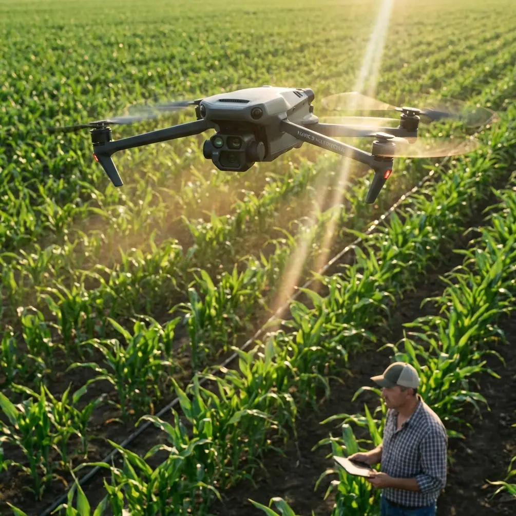
The Mavic 3M is not just collecting images
People often approach the Mavic 3M as if it were a flying sensor package and nothing more. That misses the operational value of the platform. In wildlife scouting, you are not merely documenting terrain. You are building evidence: movement corridors, habitat stress, water access patterns, edge conditions, and changes over time.
This is why composition matters so much. A badly framed scene can hide animal trails behind canopy edges, compress terrain in a way that obscures drainage behavior, or make vegetation boundaries look less distinct than they are. A well-planned composition, by contrast, lets the multispectral payload work harder for you. The aircraft becomes not just a camera in the sky, but a repeatable observation instrument.
That distinction is even more important in remote work, where every launch has a logistical cost.
Start every mission with a “look-around” pass
One of the most useful details from the education material in the reference set is the idea of a drone “look-around” routine. In the example, the aircraft activates the camera, climbs first to 80 centimeters, then rises another 50 centimeters, and performs a 360-degree clockwise rotation before landing. The exact training altitude in that classroom example is tiny, but the logic is excellent: before committing to the full mission, use a deliberate visual scan to let the aircraft “familiarize” itself with the environment.
For Mavic 3M wildlife scouting, I recommend adapting that concept into a short pre-mission environmental scan at safe operational altitude. Not as a theatrical move. As a risk and interpretation tool.
Why it matters operationally:
- It reveals low-contrast hazards that may not stand out on maps, such as isolated branches, wire crossings near field edges, or rising terrain beyond a ridge break.
- It helps you evaluate light direction before your main grid. In remote landscapes, side light can either reveal tracks and game paths beautifully or bury them in deep shadow.
- It improves your first-pass composition decisions. If the question is habitat pressure around a water source, the orbit tells you whether the source should sit centered in the frame, offset to show access paths, or captured obliquely to reveal bank condition.
This is one of those simple habits that saves more time than it costs.
Controlled flight behavior affects image usefulness
Another reference detail worth taking seriously comes from the TT drone education document. It describes how changing stick-input parameters affects flight path: with yaw set to zero, the aircraft moves in a straight diagonal climb or descent; with roll at zero, it can produce a spiral rise or descent; with throttle at zero, it can maintain altitude while tracing a circular path.
That may sound like a student exercise, but it points to something advanced operators already know: flight geometry shapes interpretation.
In wildlife scouting, each movement pattern answers a different kind of question:
Straight, stable transit
When your priority is corridor reconnaissance or quickly checking ridgelines, a clean linear path reduces visual confusion and makes side-by-side comparisons easier.
Circular path at consistent height
A circular pattern around a watering hole, tree island, or nesting buffer is often better than a simple pass-over. It preserves context. You are not just seeing the center feature; you are seeing access routes, vegetation rings, disturbance signatures, and exposure from multiple angles.
Spiral climb or descent
Used carefully, a spiral can reveal layered habitat structure, especially where vertical relationships matter: canopy gaps, scrub-to-grass transitions, slope-face vegetation, or floodplain terraces. It is not the default pattern, but in the right landscape it can expose details a flat orthomosaic tends to flatten.
The broader lesson is this: the Mavic 3M should not be flown as if every mission were a rectangular mapping grid. Remote wildlife scouting is often about selective observation. The aircraft’s value increases when the flight path matches the ecological problem.
Composition in wildlife scouting is about meaning, not aesthetics
The 2026 photography article’s core point was blunt: if composition is not solved first, the image cannot carry the intended meaning. For wildlife work, “meaning” is not artistic in the gallery sense. It is analytical.
A strong scouting image should answer at least one of these:
- Where is the animal pressure concentrated?
- How is vegetation changing across a boundary?
- What route would wildlife most likely use through this terrain?
- Has water availability shifted relative to prior sorties?
- Is the habitat intact enough to justify a follow-up survey?
That requires deliberate framing.
Here are three field-tested composition rules for Mavic 3M scouting:
1. Keep the ecological subject larger than the visual distraction
If your real target is a narrow game trail, do not let half the frame fill with empty sky or irrelevant slope. Many operators waste valuable interpretation bandwidth by capturing too much scene.
2. Include one contextual edge
A waterline, treeline, road edge, rock break, or burn margin gives scale and orientation. Wildlife rarely responds to isolated patches in a vacuum. Edge conditions matter.
3. Repeat the same composition over time
This is where the Mavic 3M becomes a monitoring tool rather than a one-off camera. Repeated framing lets you compare seasonal changes in browse pressure, moisture retention, and vegetation vigor. The multispectral data gains far more value when composition is consistent.
GIS is what turns flights into decisions
One slide in the Esri reference deck cuts through years of drone hype rather neatly. It argues that geographic information workflows are what make drones truly “unmanned,” because the intelligence shifts from the pilot alone to the platform and process: automatic takeoff and landing, automatic charging, automatic data transfer, and automatic result processing.
Even if your wildlife scouting team is not running a fully automated dock-based workflow, the principle still stands. The aircraft is only half the system. The other half is where observations get organized, compared, analyzed, and shared.
This matters even more in remote operations because response windows are short. If a vegetation anomaly appears near a migration route, or if a water source begins to shrink, you do not want field notes trapped in a pilot’s memory card folder. You want georeferenced outputs that can be reviewed against prior flights and broader land data.
The same Esri material also points to RTK-enabled work and cites “1平方公里、1:500” as part of a new workflow model. Strip away the presentation shorthand and the practical takeaway is simple: tighter positioning improves the trustworthiness of repeated comparisons. For Mavic 3M users, centimeter-level consistency is not a bragging point. It is what lets you say with confidence that a change in vegetation pattern is real, not just a shift in vantage or alignment.
For wildlife scouting, that can mean the difference between noticing habitat degradation early and misreading it as imaging noise.
A battery tip from the field that actually changes mission outcomes
Most battery advice is generic: keep them warm, label them, cycle them properly. Fine. Necessary. Not enough.
Here is the practice I have found most useful in remote scouting: do not assign batteries to distance. Assign them to task type.
In other words, reserve one battery set for broad-area reconnaissance, another for repeatable low-variability monitoring passes, and a third for opportunistic investigation. Why? Because battery state influences operator behavior more than people admit.
When a pilot knows they are on a “last useful battery,” they rush composition, skip verification passes, and accept weaker framing. That is exactly how valuable Mavic 3M data becomes merely adequate.
My preferred method is simple:
- Battery A: environmental scan and orientation pass
- Battery B: primary mapping or multispectral capture
- Battery C: targeted follow-up on anomalies or wildlife sign
This sequencing protects decision quality. It also reduces the temptation to squeeze too many objectives into one sortie.
The hardware reference in the Esri deck lists a 31-minute endurance class for a compact 2-kilogram package and 30 minutes for a larger 5-kilogram package. Endurance figures on slides are one thing; field conditions are another. Wind, terrain climb, repeated hovering, and cautious low-speed observation all erode usable time. Treat battery planning as a thinking tool, not just an energy budget.
That discipline pays off fast in remote habitats, where retrieval, weather shifts, and launch access are not trivial.
Why remote scouting benefits from “light capture, heavy application”
Another useful line from the Esri material is the idea of “light capture, heavy application.” That phrase deserves more attention in the Mavic 3M community.
Remote wildlife scouting rarely needs maximum data density everywhere. It needs the right data in the right places, processed into decisions. A huge volume of imagery can actually slow the team down if the mission question was narrow to begin with.
For example:
- If you are checking whether animals are avoiding a newly disturbed corridor, you may not need blanket coverage of the whole reserve.
- If you are comparing vegetation stress around isolated water points, targeted capture often beats over-collecting.
- If you are validating field observations from boots-on-ground teams, short repeatable sorties may outperform one giant mapping mission.
This is where the Mavic 3M earns its keep. Its value is not simply in carrying multispectral capability into the field. It is in allowing efficient capture tied to habitat interpretation and GIS review.
A practical mission flow for Mavic 3M wildlife scouting
Here is the workflow I would use for a remote scouting day.
1. Define the ecological question before launch
Do not fly because the site is visually impressive. Fly to answer one question: route use, vegetation stress, water access, disturbance pattern, or habitat fragmentation.
2. Run a short 360-degree orientation pass
Borrow the educational “look-around” logic. Get the scene into your eyes before you lock in a route.
3. Choose the flight geometry that matches the question
Linear for corridor review. Circular for focal sites. Spiral only when vertical structure matters.
4. Compose for interpretation
Show the subject and one meaningful edge. Remove visual waste. Keep repeatability in mind.
5. Log observations immediately into GIS workflow
Do not leave useful context in voice notes alone. Geotag anomalies while they are fresh.
6. Use batteries by mission role
Orientation, primary capture, then anomaly inspection.
7. Re-fly with consistency
The strongest Mavic 3M wildlife dataset is rarely the first one. It is the third or fourth repeat, framed the same way, under a clear monitoring plan.
If your team is building or refining that workflow, it helps to compare notes with operators who live in both drone operations and mapping systems. A practical place to start is this field workflow chat.
The deeper lesson for Mavic 3M users
The reference materials may seem unrelated at first glance: a photography article about beginners, an educational drone control exercise, and a GIS presentation about industry applications. Put together, they tell a coherent story.
First, framing determines whether an image carries meaning. Second, small changes in aircraft movement create very different observational outcomes. Third, drone value compounds when flights feed a geographic information workflow rather than ending as isolated images.
That is exactly how the Mavic 3M should be used in remote wildlife scouting.
Not as a gadget chasing impressive footage. Not as a sensor collecting data for data’s sake. As a disciplined field instrument where composition, controlled flight behavior, and geospatial processing work together.
When that happens, remote scouting becomes sharper and calmer. Fewer wasted sorties. Better comparisons. Better habitat decisions.
And better answers from the same aircraft.
Ready for your own Mavic 3M? Contact our team for expert consultation.