Mavic 3M Delivering Tips for Urban Solar Farms
Mavic 3M Delivering Tips for Urban Solar Farms: What Actually Matters in the Field
META: Practical Mavic 3M delivery and deployment tips for urban solar farm work, with antenna positioning advice, multispectral workflow insights, and precision-focused field setup guidance.
Urban solar work looks simple from the street. A few rows of panels on a commercial roof. A compact ground-mount installation beside a warehouse. Maybe a utility-scale block pressed up against roads, fencing, buildings, and RF noise. Then you arrive with a Mavic 3M and remember what makes this environment unforgiving: compressed launch zones, reflective surfaces, weak visual texture, interference, and almost no tolerance for bad positioning.
That is where most “tips” articles drift into vague advice. Field reality is less forgiving than that.
If you’re delivering Mavic 3M operations for urban solar farms, the issue is not just getting airborne. The issue is maintaining clean positioning, stable link performance, repeatable data capture, and dependable handoff between pilot, payload, and post-processing. The details that look small on paper are the ones that decide whether your map aligns cleanly or whether your team burns half a day re-flying.
The real problem with urban solar farm deployment
Urban solar sites stack several complications into one mission.
First, the visual environment can be inconsistent. Solar panels repeat the same geometry across a site, and depending on sun angle, they can also produce glare and low-texture surfaces. Second, rooftops and compact city-edge solar arrays often force the aircraft to work near walls, parapets, HVAC units, steel structures, and other obstacles that can disrupt GNSS reception or radio performance. Third, launch areas are often improvised. You may be taking off from a narrow service corridor, a rooftop access point, or a fenced maintenance strip.
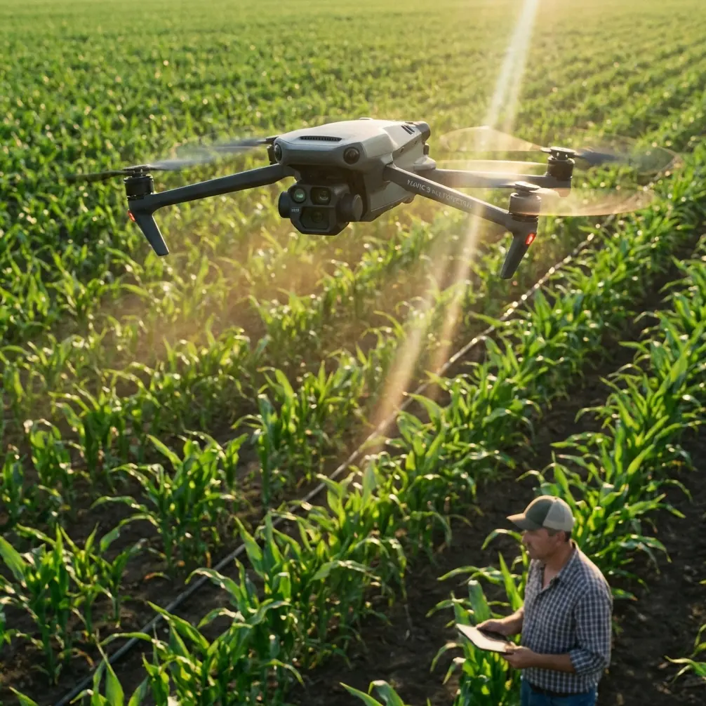
With a Mavic 3M, you’re usually there for more than pretty imagery. You’re there for multispectral analysis, vegetation pressure assessment around arrays, drainage patterns, thermal-adjacent planning workflows, or precision orthomosaic generation to support maintenance and asset management. That means consistency matters more than speed.
This is why I tell teams to think about deployment like a training system, not just a flight. Oddly enough, one of the clearest lessons comes from a very different part of the drone and RC world: break complex actions into discrete, controlled steps.
A training reference on aerobatic model aircraft makes this point very bluntly. Instead of trying to execute a complicated maneuver as one flowing act, you split it into stages and return the stick to neutral between steps. The logic is simple: finish one task before starting the next. For Mavic 3M solar work, that discipline translates directly. Don’t combine setup, link validation, RTK confirmation, route loading, and environmental assessment into one rushed sequence. Stage them. Confirm each one. Then proceed.
That mindset prevents most field errors before the props ever spin.
Why antenna positioning deserves more attention
Let’s get to the practical point many crews overlook: controller antenna positioning.
For urban solar sites, maximum range is rarely the true objective. Clean signal geometry is. The reason range becomes a problem is not because the Mavic 3M lacks capability, but because crews stand in poor locations and point antennas badly while assuming the software will make up the difference.
On a solar job, the best controller position is usually not the most convenient one. It is the place with the clearest line of sight above fencing, vehicles, stacked materials, rooftop obstacles, and metal clutter. If you’re tucked beside a stairwell bulkhead or standing under a roof overhang, you’ve already degraded your link margin.
A few field habits make a real difference:
- Stand where the aircraft remains in open view through the widest part of the mission.
- Avoid positioning yourself directly against large metal structures.
- If working a rooftop, move away from dense equipment clusters when practical.
- Keep your body from blocking the antenna face during outbound legs.
- Re-orient before the aircraft reaches the edge of the planned swath, not after the signal indicator starts dropping.
This is especially relevant on urban solar arrays where the route may pass behind reflective surfaces, parapets, or elevation changes in surrounding structures. The Mavic 3M can maintain strong performance, but only if the operator treats antenna orientation as part of mission planning rather than an afterthought.
If your team wants a simple field checklist for controller stance, antenna angle, and launch-point selection, you can message our operations desk directly and we’ll point you to a practical setup approach.
Precision is not just about RTK status
A lot of operators obsess over the moment the screen shows an RTK fix and stop thinking after that. That is not enough for urban solar work.
Centimeter precision is only useful when the whole workflow supports it. A strong RTK fix rate matters, yes. But so do takeoff conditions, route consistency, obstacle-induced signal reflections, and disciplined overlap planning across the swath width of the mission. On solar farms, where rows are repetitive and edge conditions are tight, any sloppiness can show up later as alignment headaches in vegetation or maintenance analysis layers.
Think about the logic found in educational drone marker-recognition training. In one DJI educational document, challenge-card recognition works only within a very specific height envelope: 30 to 120 centimeters. At 30 centimeters, the recognizable area is 40 cm by 40 cm. At 120 centimeters, it expands to 100 cm by 100 cm. Fly outside that detectable space and the drone cannot correctly acquire the card’s information; related programmed commands fail.
That reference is not about the Mavic 3M directly, but the operational lesson is highly relevant. Machine vision, position-dependent recognition, and autonomous task logic all have working envelopes. If you leave the envelope, performance does not degrade gracefully. It just stops being reliable.
Urban solar operators should apply the same thinking to Mavic 3M deployment:
- Maintain flight parameters that respect the data collection envelope, not just regulatory minimums.
- Avoid ad hoc altitude changes mid-run unless site conditions force them.
- Do not assume every reflective rooftop or panel field provides stable visual context.
- Validate route geometry before the full mission, especially if flying near obstructions or surface glare.
The same document also notes that detection can use either a forward-facing or downward-facing camera, and that the card’s coordinate system is independent of the drone’s heading. Again, different platform, same lesson: stable references matter more than operator intuition. For Mavic 3M work, heading changes should be deliberate and tied to mapping logic, not improvised while chasing visual comfort from the pilot’s perspective.
Multispectral on solar sites: where people get lazy
Mavic 3M crews often understand the payload on paper but underuse it in urban solar operations.
That’s a mistake.
Multispectral data is not only for agriculture. Around solar assets, it can help identify vegetation encroachment near perimeter areas, monitor growth patterns in retention zones, support drainage-related assessments, and improve maintenance planning where site managers need more than a visual map. On some urban-edge sites, especially those with fragmented ground cover or mixed-use adjacent land, multispectral output helps separate operationally relevant vegetation from background clutter.
But this only works if capture discipline is tight.
If your swath width is chosen for speed rather than data quality, or if your overlap is weakened because you are trying to squeeze a mission into a lunch break, the analysis suffers. The Mavic 3M is compact, but compact does not mean casual. Treat the payload as an analytical instrument.
That means checking:
- light consistency across the mission window
- route orientation relative to panel rows and shadow patterns
- overlap that supports clean reconstruction
- stable ground control strategy where needed
- repeatable altitude and speed
The educational reference I mentioned earlier gives a useful example of structured autonomous movement: the aircraft hovers over one marker, then follows an arc route to coordinates such as (20,20,80) and (40,60,80) at 60 centimeters per second. The exact numbers belong to a training environment, but the principle carries over nicely. Predictable waypoint logic beats improvised stick flying every time when your goal is data integrity.
For Mavic 3M solar delivery, your flight path should feel boring. That’s a compliment.
The rooftop launch problem nobody likes to talk about
Urban solar jobs often start with a compromised launch point.
You may have enough room to unfold, but not enough room to relax. Nearby railings, rooftop obstacles, conduit, and HVAC structures all create a launch environment where rushed actions become expensive. This is where the “decompose the task” lesson from aerobatic training is surprisingly useful again.
That training text emphasizes learning a difficult sequence in separated parts rather than trying to understand it while already flying. Same rule here. On a rooftop, do not solve mission design problems in the air.
My preferred sequence for a Mavic 3M rooftop deployment is:
- Confirm launch and recovery path before powering on.
- Assess interference sources and obstacle geometry.
- Establish the pilot’s standing position for the outbound leg.
- Verify antenna orientation and body position.
- Confirm RTK status and satellite quality.
- Load and review the route one more time against the actual roof layout.
- Launch, climb cleanly, pause, and evaluate control/link behavior before committing to the mission lines.
This sequence sounds basic until you compare it with how many urban flights begin: aircraft on the pad, route half-reviewed, pilot standing in a bad RF pocket, and everyone hoping the first leg tells them whether the setup is good enough.
Hope is not a workflow.
Wind, spray drift, and adjacent operations
Even though the Mavic 3M is not a spraying aircraft, solar farms in urban or peri-urban areas often sit near managed landscapes, industrial grounds, or vegetation-control programs. That makes spray drift and nozzle calibration relevant to the broader site workflow, especially when your data informs vegetation management decisions.
If a maintenance contractor is planning treatment around arrays, your mapping output should help reduce guesswork, not amplify it. Clean multispectral mapping can improve targeted interventions, identify uneven growth patterns, and support narrower treatment zones. In practical terms, better Mavic 3M data can lead to fewer blanket applications and fewer follow-up site visits.
That matters in urban settings where overspray risk near hardscape, drainage features, neighboring lots, or pedestrian-access areas is a serious operational concern.
So while “spray drift” may sound outside the Mavic 3M conversation, it really is not. Your mapping quality influences downstream decisions.
What a strong Mavic 3M solar delivery actually looks like
A good urban solar deployment is not flashy. It is methodical.
The aircraft launches from a position selected for line of sight, not operator comfort. The controller antennas are aligned intentionally. RTK is treated as one part of precision, not the whole story. Route geometry is stable. Altitude and speed are chosen to support the multispectral objective. Reflective surfaces and weak visual texture are anticipated before takeoff. And the pilot never tries to “figure it out while flying.”
That last point may be the most valuable one.
The RC training reference on complex maneuvers warns that if a sequence already sounds confusing on the ground, trying to understand it in the air will be much harder. Anyone who has delivered a Mavic 3M mission above an urban solar site knows exactly how true that is. If launch logic, data goals, line-of-sight management, or recovery path are unclear before takeoff, the mission will expose every weakness.
Final field advice from a consultant’s perspective
If I were briefing a crew tomorrow for an urban solar assignment with the Mavic 3M, I would keep it simple:
Protect your link first. That starts with pilot placement and antenna positioning.
Protect your precision next. RTK fix rate is valuable, but it only pays off when the rest of the mission is equally disciplined.
Protect your data quality throughout. Multispectral output is only as useful as the consistency of the flight that produced it.
And protect your workflow from improvisation. Break the operation into steps, confirm each step, then move forward.
That may not sound exciting. It does, however, produce cleaner maps, fewer repeat flights, and more confidence when the deliverable lands on a client’s desk.
Ready for your own Mavic 3M? Contact our team for expert consultation.