What Greenland’s Glacier Drone Mission Teaches Mavic 3M Team
What Greenland’s Glacier Drone Mission Teaches Mavic 3M Teams Working on Coastal Construction Sites
META: A case-study analysis of the Windracers Petermann Glacier mission through the lens of Mavic 3M operations for coastal construction mapping, with practical advice on multispectral workflows, RTK reliability, and antenna positioning for maximum range.
When a heavy-lift research drone is sent to Greenland to study the meeting point of ice and ocean water, most Mavic 3M operators might treat it as interesting but distant news. That would be a mistake.
The planned deployment of Windracers ULTRA at Petermann Glacier in northwestern Greenland is not just a polar science story. It is a sharp reminder that drone operations are defined by environment first, aircraft second. In this case, an international research team is preparing to use dual-use heavy-lift drone technology in one of the harshest places on the map, with fieldwork expected to begin this summer. Their target is operationally demanding: document how ice and ocean water interact in a frigid Arctic system where conditions are unstable, reflective, remote, and unforgiving.
That matters to Mavic 3M crews working along coastlines, especially on construction sites where salt exposure, shifting light, wind corridors, and water-adjacent terrain complicate what should be routine mapping. The aircraft category is different. The mission logic is not.
As someone who studies remote sensing workflows in applied field environments, I see this Greenland mission as a useful case study for coastal Mavic 3M teams. Not because the Mavic 3M is meant to replicate a heavy-lift Arctic platform, but because the same discipline that makes a glacier mission viable is exactly what improves data quality over seawalls, ports, reclamation zones, bridge approaches, and shoreline infrastructure projects.
Why this glacier mission deserves attention from Mavic 3M operators
Two details in the news are easy to overlook, yet they carry real operational weight.
First, the aircraft selected for the Petermann work is a heavy-lift platform. That tells us the mission is being shaped around endurance, payload utility, and resilience rather than convenience. Researchers are not choosing hardware for elegant lab conditions. They are preparing for a location where logistics are thin and margins are narrow. When an operator cannot rely on easy redeployment or repeated short flights, every sortie has to produce decision-grade data.
Second, the mission focus is the interaction between ice and ocean water. That is a dynamic boundary, not a static map subject. In remote sensing terms, boundary zones are where weak planning gets exposed. Water reflects light unpredictably. Surface textures change quickly. Wind patterns are inconsistent. The edge itself moves. That combination is familiar to anyone trying to map coastal construction sites with a Mavic 3M.
A quay extension, tidal embankment, dredging zone, or marine retaining wall may look straightforward on paper. In the field, it is a moving interface of land, water, machinery, glare, airborne moisture, and compressed work windows. The Greenland story underlines a truth that coastal mapping teams already know in practice: transitional environments punish casual workflows.
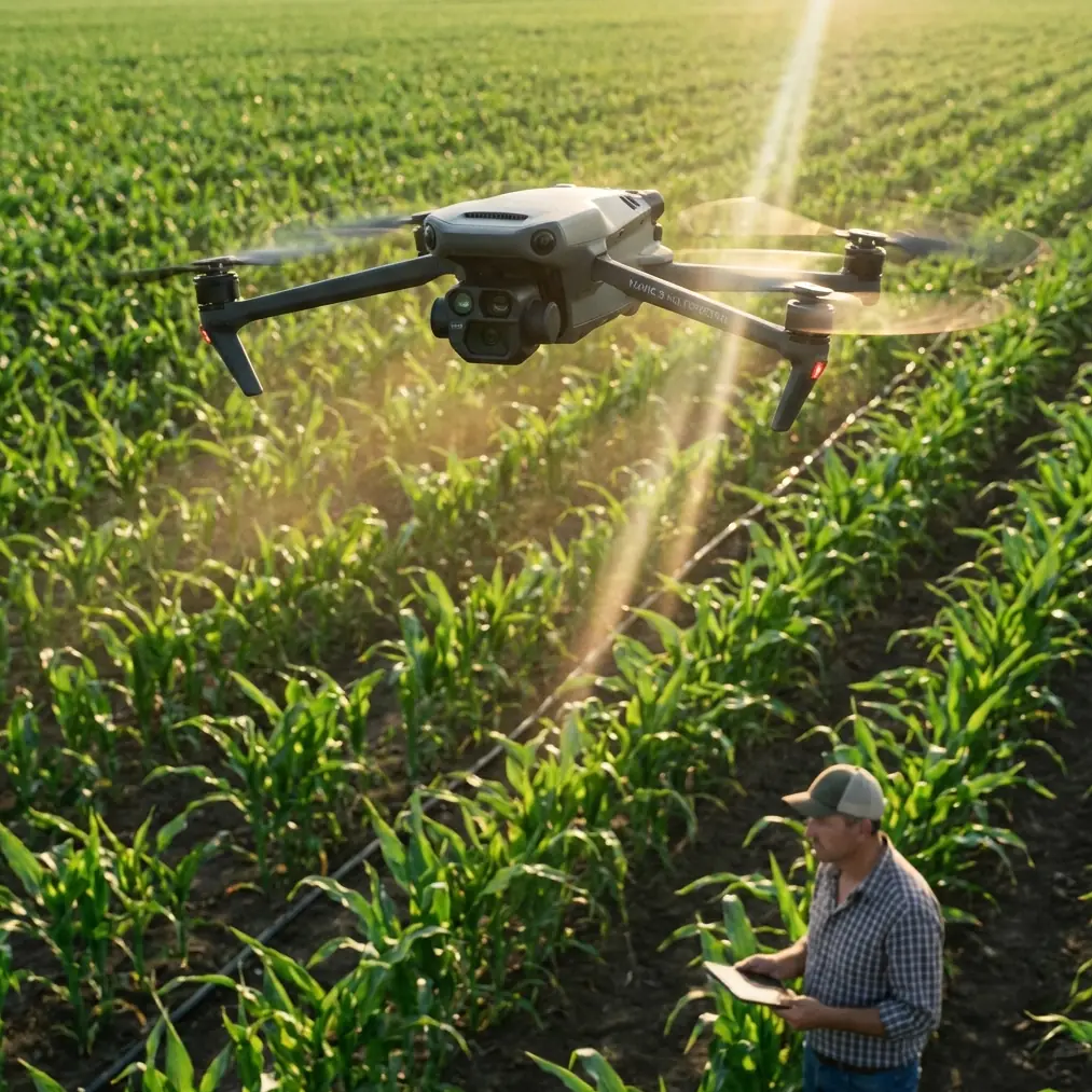
The Mavic 3M lens: what changes on a coastal construction mission
The Mavic 3M earns attention because its multispectral payload opens workflows that go beyond simple orthomosaics. On an active coastal project, that matters more than many teams initially expect.
Most pilots think first about visible-light progress tracking. Useful, but incomplete. A Mavic 3M mission can also help identify subtle moisture distribution, sediment disturbance patterns, stressed vegetation around the project perimeter, and drainage anomalies that do not always show cleanly in RGB outputs. On coastal developments, those signals often affect both construction sequencing and environmental compliance.
This is where the Greenland story becomes relevant. Researchers going to Petermann Glacier are trying to understand an environmental interaction, not merely capture attractive aerial imagery. The same mindset improves Mavic 3M work on coastal sites. Instead of asking, “Can we map this area?” the better question is, “What interaction are we trying to detect and quantify?”
On some sites that interaction is land versus water intrusion. On others, it is fill stability versus saturation. In projects near wetlands or managed buffers, it may be vegetation stress linked to runoff pathways. Multispectral collection becomes valuable when it is tied to a site question, not flown as a box-ticking exercise.
Environmental difficulty is the real common denominator
Northwestern Greenland and a coastal construction zone do not look alike. Operationally, they share more than people assume.
Both environments challenge navigation confidence and image consistency. Large water surfaces can reduce visual texture. Bright ice and bright concrete can both create exposure headaches. Wind accelerates around edges, open surfaces, and elevation changes. Moisture affects equipment handling, launch decisions, and battery management. If the Petermann mission succeeds, it will not be because the aircraft is powerful alone. It will be because the team respects environmental complexity before takeoff.
That same discipline separates average Mavic 3M datasets from high-trust deliverables.
For coastal construction, the most common failure points are not dramatic crashes or obvious pilot error. They are quiet degradations: a weak RTK Fix rate during a critical segment, inconsistent overlap near water glare, poor timing around tide state, or antenna placement that quietly trims link margin when the aircraft reaches the far edge of a corridor mission.
If your deliverable needs centimeter precision, these are not technical footnotes. They define whether your map supports engineering decisions or just looks convincing on a screen.
Case study: applying Arctic mission logic to a shoreline build
Imagine a contractor documenting a coastal flood barrier installation. The site includes temporary haul roads, sheet piles, drainage cuts, and a narrow work strip adjacent to open water. The team wants repeatable weekly surveys with enough consistency to compare progress and flag water-related changes around the perimeter.
A casual plan would launch from the nearest flat spot, fly a standard grid, and trust automation to sort the rest out.
A stronger plan borrows the mindset behind the Petermann Glacier mission.
Start with the boundary condition. Where are land and water most likely to confuse your dataset? In coastal construction, that often includes shallow reflective zones, wet aggregate stockpiles, and transitions where standing water forms after grading. Those areas deserve deliberate flight timing and overlap settings rather than generic templates.
Then address positional reliability. If you need centimeter precision, RTK Fix rate should be treated as a core mission metric, not an afterthought in the export stage. A weak fix in a shoreline corridor can introduce subtle alignment errors that only become obvious when teams compare multi-date outputs. On a site where excavation limits, material quantities, or setback compliance matter, that small drift can create expensive arguments.
Finally, think like the Greenland researchers and assume reflight windows are limited. Coastal weather changes fast. Site access may close around crane operations, vessel activity, or tide. The mission should be planned to maximize useful capture in the first pass, not rely on the hope of “one more quick flight later.”
Antenna positioning advice for maximum range
This is one of the least glamorous topics in drone operations, and one of the most consequential.
For coastal construction mapping with a Mavic 3M, maximum usable range is not simply about the aircraft’s link capability. It is about preserving signal quality by avoiding bad ground habits.
Keep the controller antennas oriented broadside to the aircraft, not pointed directly at it like a flashlight. Many operators still make that mistake. The strongest transmission pattern typically comes off the sides of the antenna faces, so your body position and controller angle matter. Small adjustments help.
Stand where the aircraft has the clearest possible line of sight over the longest segment of the mission. On coastal jobs, that often means moving a few meters away from parked machinery, containers, fencing, or temporary structures that can partially block the path. Avoid setting up low behind a berm or sea defense unit if the aircraft will spend most of the mission beyond it.
Height helps too. If there is a safe and authorized launch area with a slightly elevated vantage point, use it. Not because you need visual drama, but because reducing low-angle obstructions can improve link stability at the outer edge of the grid. Near water, reflections and open-surface geometry can make signal behavior feel deceptively clean at first and then degrade sharply as the aircraft moves farther out.
Another practical rule: plan your mission so the farthest mapping leg is flown with the strongest line of sight, not after you have turned yourself into a poor signal source by facing away, crouching near equipment, or crowding under a temporary canopy. If your team rotates operators, standardize body position and controller orientation as part of the checklist.
If you want a second set of eyes on your site-specific link setup, I usually recommend sharing a simple launch sketch and obstruction photos before the mission. A quick operational review via direct field support chat can save an entire reflight.
Multispectral value on coastal projects is often underestimated
The Mavic 3M is frequently discussed in agricultural contexts, but coastal construction creates its own strong use cases for multispectral work.
Around active builds, multispectral data can help identify stress in vegetation buffers that are being affected by altered drainage or saline intrusion. It can also support inspection of disturbed zones where water retention patterns change after grading or material placement. These are not abstract environmental talking points. They can influence erosion control effectiveness, remediation timing, and documentation for stakeholders who need more than visual impressions.
That said, multispectral success depends on disciplined collection. If light conditions shift sharply, if your overlap is too lean near reflective surfaces, or if your geospatial alignment is weak, the output will invite more questions than it answers. The operational lesson from the Greenland mission is useful here as well: difficult environments demand a mission built around the data objective.
Do not treat multispectral as an add-on payload feature. Treat it as a measurement system.
A quick note on terms people mix up
Some of the common UAV keywords floating around construction and industrial operations can blur together, especially when teams use mixed fleets.
For example, spray drift and nozzle calibration belong to application aircraft discussions, not to Mavic 3M mapping practice. They matter in broader UAV operations, but they are not the performance drivers for this type of coastal capture mission. For Mavic 3M, the closer equivalents are RTK consistency, multispectral integrity, overlap design, and flight timing relative to environmental conditions.
Swath width is still relevant, but in a mapping sense rather than a spraying one. Wider coverage can improve efficiency, yet pushing for speed without protecting image geometry or signal quality usually backfires over complex shoreline sites. It is better to complete a slightly smaller mission with dependable alignment than a larger one that needs interpretation gymnastics later.
IPX6K-style durability conversations also come up often. Coastal crews understandably worry about moisture and exposure. But ruggedness labels should never substitute for conservative field handling around salt air, spray, and wet staging areas. Mission quality starts with sensor cleanliness, dry launch conditions, disciplined battery handling, and realistic weather thresholds.
What the Greenland mission ultimately signals
The Petermann Glacier project is notable not only because it uses a dual-use heavy-lift aircraft, but because it reinforces where the drone industry is heading. Serious UAV work is becoming less about generic capture and more about mission-specialized data collection in difficult environments.
That should resonate with every Mavic 3M team serving coastal construction.
Clients are no longer impressed by the simple fact that a drone flew. They want reliable answers. Is the shoreline edge stable? Has drainage behavior changed? Are protected vegetation zones showing stress? Is the progress model aligned tightly enough to support comparison across survey dates? Can the dataset be defended when conditions are messy?
The Greenland researchers are going to one of the most demanding field settings available to study a live environmental interface between ice and ocean water. Their mission is expected to begin this summer, and the fact that such a project is leaning on drone capability tells us something important: aerial data collection is now trusted in places where field uncertainty is the norm, not the exception.
For Mavic 3M operators, that is the right benchmark. Not cinematic footage. Not oversized promises. Trustworthy data under difficult conditions.
If you are capturing coastal construction sites, the practical takeaway is clear. Build every mission around environmental interaction, guard your RTK Fix rate, protect line of sight through smart antenna positioning, and use multispectral capture only when the collection plan is strong enough to support interpretation. That is how a drone designed for precision mapping earns its place on complex shoreline projects.
Ready for your own Mavic 3M? Contact our team for expert consultation.