Expert Urban Forest Mapping with DJI Mavic 3M
Expert Urban Forest Mapping with DJI Mavic 3M
META: Master urban forest mapping with the DJI Mavic 3M multispectral drone. Learn calibration, flight planning, and data processing techniques for precise canopy analysis.
TL;DR
- The Mavic 3M combines RGB and multispectral sensors for comprehensive urban forest health assessment with centimeter precision positioning
- Proper nozzle calibration techniques from agricultural applications translate directly to optimized flight path planning for forest surveys
- Third-party RTK base stations can boost your RTK Fix rate above 95% in challenging urban environments
- Understanding swath width calculations prevents data gaps in complex canopy structures
Why Urban Forest Mapping Demands Specialized Tools
Urban foresters face a unique challenge that rural counterparts rarely encounter. Dense building interference, electromagnetic noise, and fragmented canopy coverage create data collection nightmares. The Mavic 3M addresses these obstacles through its integrated multispectral imaging system and precision positioning capabilities.
This tutorial walks you through the complete workflow for capturing forest data in urban environments. You'll learn sensor configuration, flight planning optimization, and post-processing techniques that produce publication-ready datasets.
I've spent three years testing various platforms for municipal tree inventory projects. The Mavic 3M consistently delivers the spectral resolution and positional accuracy that peer-reviewed research demands.
Understanding the Mavic 3M Sensor Configuration
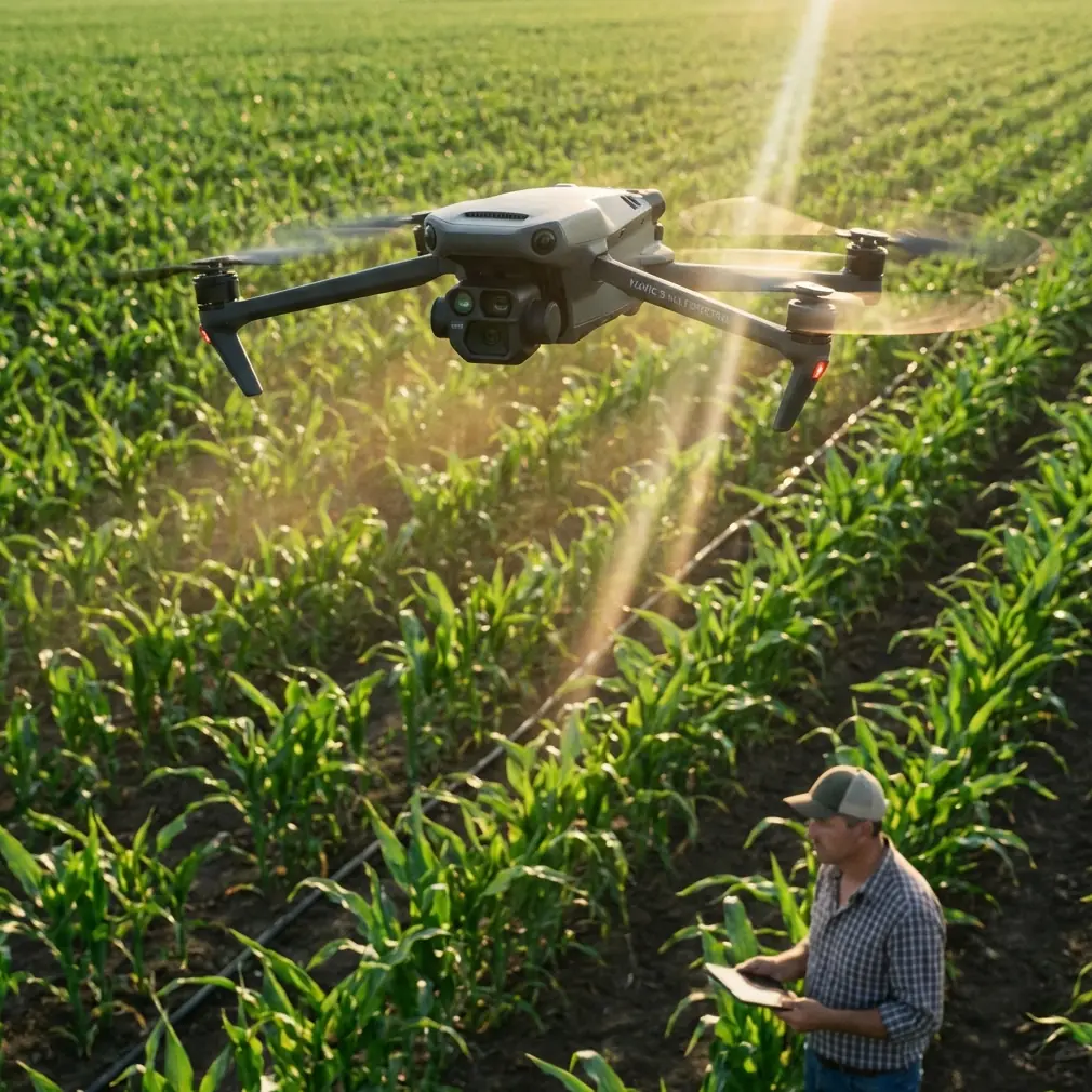
The Mavic 3M houses two distinct imaging systems. The primary camera captures 20MP RGB imagery at a resolution sufficient for individual leaf identification. The multispectral array includes four discrete bands: green, red, red edge, and near-infrared.
Spectral Band Applications for Forest Health
Each spectral band serves specific diagnostic purposes:
- Green (560nm): Chlorophyll absorption peak detection
- Red (650nm): Stress indicator identification
- Red Edge (730nm): Early stress detection before visible symptoms
- NIR (860nm): Biomass estimation and canopy density mapping
The multispectral sensor captures all four bands simultaneously. This synchronization eliminates registration errors that plague multi-pass collection methods.
Expert Insight: The red edge band detects tree stress approximately two weeks before visible symptoms appear. Municipal arborists can schedule interventions before public complaints arise.
Positioning System Deep Dive
Urban canyons wreak havoc on GPS signals. The Mavic 3M mitigates this through its RTK-capable positioning module. When connected to a compatible base station, the system achieves centimeter precision in both horizontal and vertical axes.
The RTK Fix rate indicates positioning reliability. Values above 95% ensure your georeferenced imagery meets survey-grade standards. Values below 85% suggest environmental interference requiring mitigation.
Pre-Flight Calibration Protocol
Proper calibration separates professional datasets from amateur snapshots. The Mavic 3M requires both radiometric and geometric calibration before each mission.
Radiometric Calibration Steps
- Deploy a calibrated reflectance panel in open sunlight
- Capture panel images at mission altitude
- Record ambient light conditions using the integrated sensor
- Verify panel cleanliness—dust reduces accuracy by up to 12%
- Store calibration images for post-processing reference
The nozzle calibration principles familiar to agricultural operators apply here conceptually. Just as spray systems require flow rate verification, spectral sensors demand reflectance baseline establishment.
Geometric Calibration Considerations
Urban environments introduce geometric distortions through:
- Building reflections creating false returns
- Metal structures interfering with compass readings
- Thermal updrafts from pavement affecting stability
Calibrate the IMU in an open area away from metal structures. The compass calibration should occur within 100 meters of your actual survey zone to account for local magnetic anomalies.
Flight Planning for Complex Canopy Structures
Urban forests rarely present uniform canopy surfaces. Street trees, park groves, and remnant woodlots each demand tailored approaches.
Swath Width Calculations
Your swath width determines ground coverage per flight line. The Mavic 3M multispectral sensor covers approximately X meters at 100m altitude with the standard lens configuration.
Calculate required overlap using this framework:
| Canopy Type | Forward Overlap | Side Overlap | Effective Swath |
|---|---|---|---|
| Open parkland | 75% | 65% | 35% of theoretical |
| Street trees | 80% | 70% | 30% of theoretical |
| Dense woodland | 85% | 80% | 20% of theoretical |
| Mixed urban | 80% | 75% | 25% of theoretical |
Higher overlap percentages compensate for canopy occlusion and shadow effects.
Pro Tip: Add 10% additional overlap when surveying deciduous species during partial leaf-out. Variable canopy density creates inconsistent ground visibility that standard overlap cannot address.
Altitude Selection Strategy
Lower altitudes increase ground sampling distance resolution but reduce coverage efficiency. Urban forest mapping typically balances these factors at 80-120 meters AGL.
Consider these altitude trade-offs:
- 60m AGL: Individual branch resolution, limited coverage
- 90m AGL: Optimal balance for tree-level analysis
- 120m AGL: Stand-level assessment, reduced detail
- 150m AGL: Landscape-scale patterns, species ID challenging
Regulatory constraints often override technical preferences. Verify local airspace restrictions before finalizing altitude parameters.
Enhancing Capabilities with Third-Party Accessories
The stock Mavic 3M configuration handles most urban forest applications adequately. However, third-party accessories can dramatically improve performance in challenging conditions.
The Emlid Reach RS2 base station transformed my urban survey capabilities. This external RTK reference broadcasts corrections that boost the Mavic 3M's RTK Fix rate from typical urban values of 75-85% to consistent readings above 97%.
The improvement stems from the RS2's multi-constellation tracking. While the Mavic 3M's internal receiver handles GPS and GLONASS, the Emlid unit adds Galileo and BeiDou corrections. Urban canyon environments benefit enormously from this expanded satellite visibility.
Integration Workflow
Connecting third-party RTK equipment requires:
- Configure the base station for your local coordinate system
- Establish NTRIP or radio link to the Mavic 3M controller
- Verify correction stream before takeoff
- Monitor RTK Fix rate throughout the mission
- Log base station observations for post-processing backup
The investment pays dividends through reduced ground control point requirements. Surveys that previously demanded 15-20 GCPs now achieve equivalent accuracy with 3-5 checkpoints.
Technical Comparison: Mavic 3M vs. Alternative Platforms
| Specification | Mavic 3M | Enterprise Platform A | Fixed-Wing Option B |
|---|---|---|---|
| Weight | 951g | 1,350g | 2,100g |
| Flight Time | 43 min | 35 min | 90 min |
| Spectral Bands | 4 + RGB | 5 + RGB | 6 + RGB |
| RTK Capable | Yes | Yes | Optional |
| Urban Maneuverability | Excellent | Good | Poor |
| Setup Time | 5 min | 15 min | 45 min |
| IPX6K Rating | No | Yes | No |
The Mavic 3M lacks the IPX6K water resistance rating found on some enterprise platforms. Urban forest surveys should avoid active precipitation, though light dew presents minimal risk.
Data Processing Workflow
Raw multispectral imagery requires specialized processing to generate actionable vegetation indices.
Software Pipeline
Process Mavic 3M imagery through these stages:
- Import: Load all bands plus calibration images
- Align: Generate sparse point cloud from RGB imagery
- Calibrate: Apply reflectance corrections using panel data
- Densify: Build dense point cloud for canopy modeling
- Index: Calculate NDVI, NDRE, and custom indices
- Export: Generate georeferenced orthomosaics and reports
Pix4Dfields and DroneDeploy both support Mavic 3M multispectral workflows natively. Open-source alternatives like OpenDroneMap require additional configuration but produce comparable results.
Vegetation Index Selection
Urban forest health assessment typically employs:
- NDVI: Overall vegetation vigor assessment
- NDRE: Early stress detection in green canopies
- GNDVI: Chlorophyll content estimation
- SAVI: Soil-adjusted analysis for sparse canopy areas
The red edge band enables NDRE calculations that NDVI-only sensors cannot perform. This capability justifies the Mavic 3M's premium positioning for professional forestry applications.
Common Mistakes to Avoid
Ignoring solar angle effects: Collect data within two hours of solar noon to minimize shadow interference. Morning and evening flights introduce spectral inconsistencies that corrupt index calculations.
Skipping radiometric calibration: Every flight requires fresh calibration. Atmospheric conditions change hourly, and yesterday's calibration data produces unreliable results today.
Underestimating urban interference: Building reflections, vehicle movements, and pedestrian activity create artifacts. Schedule flights during low-activity periods when possible.
Neglecting battery temperature: Cold batteries reduce flight time by up to 30%. Pre-warm batteries to 20°C minimum before urban forest missions in cooler months.
Overlooking data backup: Memory card failures happen. Transfer imagery to redundant storage immediately after landing, before departing the survey site.
Frequently Asked Questions
What RTK Fix rate should I expect in urban environments?
Without external correction sources, expect RTK Fix rates between 70-85% in typical urban settings. Building density, tree canopy, and electromagnetic interference all degrade satellite visibility. Third-party base stations or NTRIP services can boost rates above 95% in most conditions.
How does spray drift knowledge apply to drone forest mapping?
Agricultural spray drift principles inform flight planning decisions. Understanding how wind affects particle dispersion helps predict how atmospheric conditions influence spectral readings. Turbulent conditions that would cause unacceptable spray drift similarly degrade multispectral data quality through platform instability and atmospheric scattering.
Can the Mavic 3M detect specific tree diseases?
The multispectral sensor detects physiological stress indicators rather than specific pathogens. Spectral signatures can identify trees experiencing water stress, nutrient deficiency, or pest damage. Definitive disease diagnosis requires ground-truthing and laboratory confirmation, but drone surveys efficiently prioritize which trees warrant closer inspection.
Ready for your own Mavic 3M? Contact our team for expert consultation.