Expert Inspecting Forested Mountains With the Mavic 3M
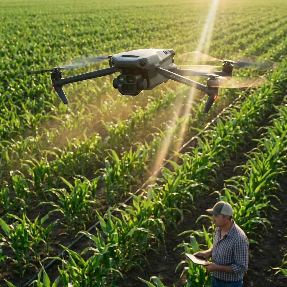
Expert Inspecting Forested Mountains With the Mavic 3M: A Practical Workflow That Goes Beyond Aerial Imaging
META: Learn how the Mavic 3M fits mountain forest inspection with multispectral workflows, precision positioning logic, and autonomous flight principles that matter in real operations.
When people hear “drone,” they still often picture a flying camera. That mental model is outdated, and for mountain forest inspection it is not just incomplete—it leads to poor buying decisions and weak operational planning.
A more accurate definition comes from a recent industry discussion on low-altitude aviation: a UAV is an unmanned aircraft controlled by radio equipment and onboard programmed systems, and its real character is closer to an aerial robot than a simple imaging platform. That distinction matters for the Mavic 3M. In forest work, especially in steep terrain, the aircraft is valuable not because it can take attractive photos, but because it can execute repeatable, data-driven tasks with positional discipline.
For readers evaluating the Mavic 3M for mountainous woodland inspection, that is the right starting point. The question is not “Can it fly over trees?” The better question is: can it collect dependable information under terrain pressure, variable canopy conditions, and limited access, while maintaining enough precision for analysis and follow-up action?
Why the “airborne robot” idea fits the Mavic 3M
The reference material emphasizes that drones have moved far beyond aerial photography into agriculture, inspection, logistics, and emergency response. That shift is exactly where the Mavic 3M belongs. In a mountain forest environment, you are rarely trying to capture a cinematic scene. You are usually solving one of these problems:
- identifying stress patterns across tree stands
- spotting drainage or disease signatures before they are visible from the ground
- documenting slope instability near forest roads
- tracking regeneration performance across elevation bands
- mapping treatment zones for later field crews
- revisiting the same corridor or plot with consistent geometry
This is why multispectral capability matters more than general camera quality alone. A mountain forest changes fast with aspect, moisture, elevation, and canopy density. A platform built around consistent spectral capture gives the operator something far more useful than pretty imagery: comparable evidence.
The Mavic 3M stands out here because it is not merely observing the forest from above. It is conducting a structured sensing mission. That puts it in a different class from conventional camera drones that many competitors still market into inspection roles without fully addressing repeatability, data alignment, or agronomic-style analysis logic.
What mountain forest inspection really demands
Mountain operations punish weak workflows. Signal conditions vary. Launch points are constrained. Valleys distort visual perception. Canopy can hide subtle decline until it spreads. In these conditions, drone performance is not only about endurance or sensor specs. It is about how well the entire flight-and-data chain holds together.
One of the most useful reference details does not come from a forest drone at all, but from an educational autonomous flight exercise. In that material, the aircraft first rises to a point directly above a starting marker at coordinates (0,0,100), then transitions to another marker at (150,0,100), then descends to (0,0,50) over the second point before landing. The logic is simple and powerful: gain safe altitude, establish position directly over a known reference, move laterally with control, then reduce height while re-confirming location before a precise finish.
That sequence has direct operational significance for the Mavic 3M in mountain forests.
A better flight mindset: altitude, reference, transition, re-lock
In forested slopes, many pilots make the mistake of treating waypoint missions as one continuous movement problem. In reality, difficult terrain is easier to manage if you break each mission into four stages:
1. Climb to a safe working height
The educational example uses 100 centimeters only because it is a small-scale competition environment. In mountain forest inspection, the principle remains the same even though the altitude is completely different. You first establish vertical separation from local obstacles and terrain features before any aggressive horizontal movement.
This matters when launching from narrow clearings, ridgelines, or temporary roadside pull-offs. A vertical-first takeoff reduces risk from lateral drift near branches, poles, or uneven slope edges. It also helps the aircraft stabilize before entering the mapping leg.
2. Confirm position over a known point
The challenge-card exercise specifically sends the aircraft to a point directly above its marker before proceeding. Operationally, this is a reminder that precise work begins with positional certainty, not speed.
With the Mavic 3M, that logic becomes especially relevant when the mission depends on multispectral consistency and high RTK Fix rate. If your initial positional solution is weak, the errors ripple through the rest of the dataset. In steep forests, those errors show up later as poor overlap, inconsistent edge matching, or unreliable comparison between flights.
3. Move laterally only after the aircraft is settled
The jump from (0,0,100) to (150,0,100) in the reference material is not just a move. It represents a controlled transition after altitude and position are already established. For Mavic 3M users, this translates into a practical rule: do not rush into terrain-following assumptions or high-speed passes before the aircraft has fully stabilized and your positioning status is trustworthy.
4. Reconfirm before low-altitude precision work
The reference then drops to 50 centimeters over the second marker, specifically to lower altitude while performing another localization step ahead of a precise landing. In mountain inspection, the equivalent is slowing down and validating the aircraft’s positional and environmental state before entering a lower, more detailed segment—such as a boundary edge, a disease pocket, or a narrow road corridor under mixed canopy.
This kind of two-stage positioning discipline is one reason some operators get much cleaner outputs from the same aircraft than others.
Where the Mavic 3M excels against ordinary inspection drones
Many competitor drones can carry a camera and fly a grid. That alone is not enough in forestry. The reason the Mavic 3M earns serious attention is that it aligns three things unusually well for this mission profile:
- spectral data capture
- repeatable automated flight
- positioning precision that supports mapping, not just viewing
That combination is where it pulls ahead of general-purpose prosumer aircraft. A standard RGB-only drone may show you discoloration after a problem becomes visually obvious. A multispectral workflow can reveal vegetation response patterns earlier and across larger areas with more consistency. In mountain forest management, that difference changes how quickly you can intervene and how much ground crew time you waste checking false positives.
This is also why terms like centimeter precision and RTK Fix rate are not just technical decoration. In broadacre agriculture they are discussed often, but they are equally useful in forests when you need to revisit plots, compare seasonal changes, or align treatment boundaries with terrain. A strong RTK solution improves confidence that one mission truly relates to the next, rather than merely resembling it.
Practical tutorial: using the Mavic 3M for mountain forest inspection
Here is the workflow I recommend for forestry teams, consultants, and research operators.
Step 1: Define the inspection objective before opening the flight app
Do not start with the map. Start with the question.
Are you looking for canopy stress? Post-storm damage? Drainage anomalies? Regeneration gaps? Encroachment near access roads? Each objective changes your flight height, overlap, timing, and interpretation approach.
A canopy vigor survey benefits from multispectral consistency across the full stand. A road-adjacent hazard inspection may require more attention to slope breaks and localized low-altitude passes.
Step 2: Segment the mountain into logical flight blocks
Long single missions in mountains are seductive and often inefficient. Split the area by ridgeline, aspect, road access, or canopy type. This improves battery planning and reduces the impact of sudden weather shifts.
Think like the challenge-card exercise: one controlled zone at a time, each with its own positional logic.
Step 3: Use a vertical-first departure habit
From the launch point, climb to a safe observation height before translating. This is the field-scale version of the (0,0,100) principle from the educational reference. It creates a buffer from nearby obstacles and gives the aircraft time to settle into a reliable positioning state.
This habit is especially useful when working from mountain switchbacks or forest cut-ins where branches and terrain edges can create awkward airflow.
Step 4: Verify RTK status before committing to the main lines
If the mission requires comparison over time, your RTK Fix rate deserves active monitoring. Poor fix quality at launch becomes expensive later during processing and interpretation. The Mavic 3M is most valuable when it is treated as a data instrument, not a casual scout.
A few extra minutes here can save an entire reflight.
Step 5: Tune your line spacing to the real target, not the default template
In agriculture, operators often talk about swath width and overlap in relation to crop coverage. In forests, the same idea applies but with more complexity because canopies vary in height and density. Dense conifer slopes and mixed broadleaf areas do not behave identically in the imagery.
Adjust flight lines to preserve useful overlap across terrain transitions. If you under-plan this, steep sections produce uneven datasets and misleading analysis zones.
Step 6: Reserve lower-altitude passes for confirmed areas of interest
After the broad mission identifies unusual signatures, use targeted flights over those sections. This mirrors the reference sequence that descends only after relocating over the second marker. In other words: broad situational awareness first, precise close work second.
That approach is more efficient than trying to fly everything low. It also limits the time spent maneuvering near canopy margins.
Step 7: Interpret multispectral outputs with ground truth in mind
Multispectral data is powerful, but mountain forests are full of confounders: shadow, moisture, recent rainfall, species variation, and understory influence. The Mavic 3M can highlight patterns worth investigating; it does not remove the need for selective field verification.
That balance is what separates professional inspection from blind map worship.
Borrowing lessons from spray work—even in forestry
Some readers will notice terms like spray drift and nozzle calibration usually belong to agricultural operations, not forest inspection. Still, they are useful conceptual reminders. Why? Because both ideas train operators to think in terms of environmental interaction and precision discipline.
Spray drift teaches respect for wind, slope airflow, and timing. Those same factors affect mountain drone imaging quality and consistency. Nozzle calibration teaches that small setup errors compound across an entire operation. In the Mavic 3M context, the equivalent is mission parameter calibration: speed, overlap, altitude, and RTK readiness. Small mistakes repeated across a large forest block turn into misleading outputs.
Operational limits that smart teams plan around
The educational competition rules include another revealing fact: teams get two rounds with no adjustment time between them, and a single match lasts 2 minutes. While that setting is obviously not a forest mission, the lesson is highly relevant—robust operations are built around preparation, not mid-mission improvisation.
For Mavic 3M crews in the mountains, that means:
- check mission geometry before arrival
- predefine emergency landing options
- carry a clear relaunch protocol
- standardize naming, block IDs, and field notes
- avoid changing parameters casually between comparative flights
Mountain work rewards boring discipline.
When to ask for workflow help
The hardware is only half the story. If your team is building a repeatable forestry program with the Mavic 3M and wants help on mission planning or data logic, you can message a technical specialist here and discuss the specifics of your terrain and inspection goals.
The bigger shift: from image capture to operational sensing
The broader low-altitude economy discussion gets one thing exactly right: drones are reshaping work across agriculture, inspection, logistics, and emergency response because they are programmable tools, not novelty aircraft. The Mavic 3M fits this shift perfectly.
For mountain forest inspection, its value is not that it flies where people cannot. Many drones can do that. Its value is that it supports a more structured method of seeing the forest: repeatable routes, multispectral evidence, positional rigor, and usable comparison over time.
That is why I would not frame the Mavic 3M as just another camera platform for woodland surveys. It is better understood as a compact aerial robot for environmental intelligence. Once you use it that way, the workflow improves, the data becomes more defensible, and the results start informing decisions instead of merely decorating reports.
Ready for your own Mavic 3M? Contact our team for expert consultation.