Mavic 3M in Extreme Temperatures: A Field Method
Mavic 3M in Extreme Temperatures: A Field Method for Reliable Multispectral Capture
META: Practical Mavic 3M workflow for extreme-temperature crop capture, covering RTK stability, electromagnetic interference, multispectral data quality, and ArcGIS-ready field collection.
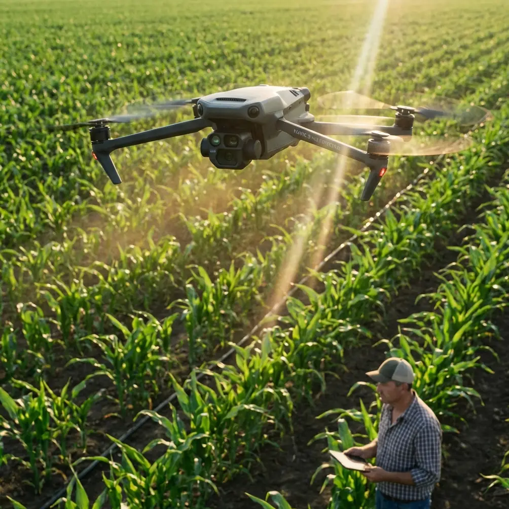
I’ve seen plenty of perfectly capable drone missions fail for a simple reason: the aircraft was fine, but the capture method was sloppy. That matters even more with the DJI Mavic 3M, because this platform is not just taking pretty aerial photos. It is collecting data that can influence crop classification, field statistics, growth diagnosis, and downstream management decisions.
If your job is capturing agricultural venues in extreme temperatures, you need a workflow that protects data integrity before the drone ever leaves the ground. The Mavic 3M is especially useful here because multispectral collection is only as valuable as the consistency behind it. A clean map built in difficult conditions can support far more than visual scouting. It can feed acreage estimation, crop-type verification, chlorophyll assessment, and even early work tied to crop quality indicators.
That last part is often overlooked. Remote sensing in agriculture has moved well beyond simply asking whether a field looks healthy. One of the reference materials points out that hyperspectral and related spectral approaches can be used to monitor chlorophyll content, chlorophyll density, red-edge behavior, and other pigment information. Another source goes further, noting that vegetation indices such as R1500/R610 and R1220/R560 showed a highly significant index relationship with wheat grain protein and starch accumulation after heading. Even if the Mavic 3M is not a hyperspectral payload, that research still shapes how we should think about multispectral field operations: spectral consistency matters because the end user may be trying to infer more than greenness.
So let’s talk about how to capture with the Mavic 3M when temperatures are hostile, radio conditions are messy, and the output still needs to stand up inside a real GIS workflow.
Start with the actual mission objective, not the drone
One of the strongest clues from the ArcGIS field-collection reference is also one of the most practical. The sample task is not abstract. It describes a 200 meter by 200 meter plot where field boundaries have already been roughly outlined from satellite imagery, and the real need is to confirm what crop is planted in each parcel, calculate planted area, and aggregate those statistics up to a county, city, or even provincial scale.
That is a very grounded reminder of what Mavic 3M missions are often for.
You are not flying just to collect imagery. You are trying to reduce uncertainty in a mapped agricultural system. In extreme temperatures, the biggest operational mistake is to chase full coverage at any cost. A better approach is to define what the map must answer:
- Are you verifying crop type by parcel?
- Are you measuring stand uniformity?
- Are you looking for stress patterns before dispatching a ground crew?
- Are you trying to support variable field decisions later in the season?
- Are you creating an ArcGIS-ready orthomosaic for interpretation and statistics?
Those questions determine your altitude, overlap, flight timing, and tolerances for retakes.
Extreme temperatures change the capture logic
Hot and cold conditions stress more than batteries. They affect reflectance behavior, flight efficiency, and the consistency of your image set.
In heat, the key issue is often drift in operational rhythm. Crews rush because the aircraft, controller, and operator are all under thermal load. In cold, the opposite happens: people move more slowly, batteries sag, and the temptation is to shorten the checklist. Both patterns create inconsistent data.
For Mavic 3M work, inconsistency hurts you twice. First, it can weaken the orthomosaic. Second, it can distort how spectral variation is interpreted across the venue.
A field that appears to have chlorophyll variation may just reflect changing acquisition conditions. That becomes especially dangerous when stakeholders want to compare zones or relate image output to agronomic indicators. The hyperspectral reference specifically highlights the value of monitoring red-edge characteristics and leaf carbon-nitrogen relationships during active growth phases. The operational lesson is straightforward: if your capture conditions are unstable, your map may imply biology where the real cause was method.
Build around RTK discipline
The Mavic 3M earns its place on serious farms because it can support precise mapping workflows, and centimeter-class positioning is central to that value. In practical terms, your RTK Fix rate is one of the first things I monitor when the venue is difficult.
Extreme temperatures can affect setup habits more than signal physics. The common failure mode is a rushed base or network check, followed by blind trust once the aircraft arms. Don’t do that.
Before capture:
- Confirm your RTK source is stable and has not just briefly connected.
- Watch the fix behavior over time, not at a single instant.
- Verify that the planned flight zone does not push the aircraft near structures, metal roofs, utility installations, or parked machinery that can distort your confidence in the solution.
If the fix is unstable, your orthomosaic may still look acceptable at first glance, but the value drops quickly once you need repeatability. That is a problem if you are mapping the same plots over time, comparing parcels, or integrating the output with ArcGIS for interpretation and statistics.
When the goal is parcel-level crop survey, precision is not cosmetic. It affects whether the field edge belongs to one polygon or the next, whether area calculations remain trustworthy, and whether a follow-up team can revisit the same spot.
Handling electromagnetic interference with antenna adjustment
This is where field experience usually separates operators from button-pushers.
Electromagnetic interference rarely announces itself dramatically. More often, it shows up as intermittent signal instability, strange compass behavior, or patchy RTK performance near infrastructure. In agricultural venues, likely culprits include pump stations, solar equipment, power lines, metal sheds, communications hardware, and parked service vehicles with active electronics.
My first response is not to force the mission through. It is to adjust the ground setup.
Here’s the method I use:
- Move the pilot station away from metal surfaces and vehicles.
- Reorient the controller antennas so their broadside faces the aircraft’s expected path rather than pointing the tips at it.
- If you are using an RTK network or external support device, separate equipment physically instead of stacking everything into one cluttered working position.
- Recheck signal health before takeoff, then again after the aircraft reaches mission altitude.
That antenna adjustment sounds minor, but in the field it often cleans up a mission. The reason is simple: when you are already operating in temperature extremes, you want to eliminate every avoidable source of instability. Otherwise, teams waste time blaming weather for what is actually a poor radio posture.
If you need a second opinion on a noisy site plan or RF setup, I’d point crews to this quick field contact option: message our drone team directly.
Timing matters more than people admit
Agricultural capture is never just about available daylight. In extreme conditions, timing also controls thermal stress on gear and variability in surface response.
For crop survey with Mavic 3M, avoid casually mixing passes from different environmental windows unless your workflow explicitly accounts for that. If you start a mission in cool morning conditions and finish after the field has heated sharply, your image set may carry subtle shifts that complicate interpretation. That matters when your users care about spectral differences rather than just visible structure.
The hyperspectral reference makes this point indirectly by emphasizing how spectral response is tied to plant properties such as chlorophyll, pigments, and carbon-nitrogen status. If spectral relationships can be meaningful enough to support grain protein and starch analysis research, then operators should be cautious about introducing collection variability that muddies those signals.
In plain terms: don’t create your own noise.
Think in layers: capture, orthomosaic, interpretation, statistics
The ArcGIS solution document outlines a practical chain: import GIS data, conduct field investigation, organize flight imagery, generate an orthophoto, create interpretation sample points, then perform interpretation and statistics. That sequence is useful for Mavic 3M operations because it forces discipline.
A lot of drone users stop at image collection. Serious agricultural users do not.
With Mavic 3M, the image set should be captured with the downstream stack in mind:
- Existing parcel outlines should be loaded before flight.
- Flight range should fully cover the analytical area, not just the visually interesting part.
- Overlap should be conservative enough to support a stable orthomosaic in difficult conditions.
- Sample points or ground observations should be captured while the crop condition is current.
- Output naming and geospatial organization should be standardized before the team leaves the site.
That last step sounds administrative, but it saves projects. The value of a multispectral mission increases when it can be compared over time and linked to field notes. If your orthomosaic exists in isolation, you have a picture. If it is organized within a GIS workflow, you have a usable dataset.
What multispectral actually adds in this scenario
When readers search for Mavic 3M, they often want to know whether multispectral is worth the added operational rigor. For extreme-temperature venue capture, the answer is yes, but only if the project demands more than visual inspection.
The reference materials help explain why. Spectral monitoring can reveal more than obvious canopy stress. The cited research points toward relationships with chlorophyll density, red-edge behavior, pigment characteristics, and crop quality indicators. Another section notes that remote sensing for crop quality came later than standard vigor monitoring, but is becoming increasingly meaningful in production and applied research.
That matters for Mavic 3M users because many field programs are evolving. What starts as a crop-type survey may become a seasonal analytics program. What begins as acreage verification may later support nutrient management zones or targeted ground sampling.
A stable, well-georeferenced Mavic 3M capture gives those programs a foundation.
A note on spray drift, nozzle calibration, and what not to confuse
Since related search traffic often blends imaging drones with application platforms, let’s clear up a common misconception. Mavic 3M is a sensing tool, not a spraying aircraft. It can support decisions around treatment planning, but spray drift and nozzle calibration belong to the application workflow, not the mapping flight itself.
Still, there is a strong operational link. If a multispectral map identifies uneven vigor or suspicious stress bands, that output may influence where an agronomy team checks nozzles, reviews application records, or evaluates off-target movement. The drone is not replacing those steps. It is making them more targeted.
That distinction keeps projects honest. Good remote sensing narrows uncertainty; it does not magically diagnose every field issue by itself.
Practical checklist for extreme-temperature Mavic 3M capture
Here is the field version I give crews:
1. Define the analytical unit
Know whether the job is about a whole farm, a block, or a 200 m × 200 m sample plot tied to existing parcel boundaries.
2. Preload GIS layers
Bring parcel outlines or prior satellite-derived boundaries into the planning environment before arriving.
3. Protect RTK quality
Do not launch on a weak or unstable fix. Watch consistency, not just connection status.
4. Control EMI at the pilot station
Move away from vehicles and metal clutter. Reorient antennas deliberately. Recheck signal once airborne.
5. Fly within one environmental window where possible
Avoid mixing cool-hour and high-heat passes in the same analytical block unless necessary.
6. Capture for the orthomosaic, not for visual drama
Overlap and swath width decisions should support clean stitching and reliable interpretation.
7. Tie imagery to field truth
Ground notes, crop observations, and sample points make the map useful rather than merely attractive.
8. Organize outputs immediately
Sort imagery, orthomosaics, and interpretation layers before leaving the venue.
The real standard for expert Mavic 3M work
Expert operation is not about flying faster. It is about making sure the resulting dataset can survive scrutiny after the aircraft is packed away.
That is the standard Mavic 3M users should hold themselves to, especially in harsh environments. The aircraft can absolutely deliver strong multispectral results in demanding temperatures, but only if the operator respects the chain from radio setup to RTK stability to GIS integration.
The source material behind this discussion points in a useful direction. One document anchors the mission in concrete agricultural surveying needs, down to a 200 meter by 200 meter sample area and the requirement to derive crop-type and area statistics. Another reminds us that spectral data can support much deeper agronomic interpretation, including red-edge behavior, chlorophyll-related measures, and research relationships like R1500/R610 and R1220/R560 for wheat quality traits. Put those together, and the lesson is clear: with Mavic 3M, capture quality is not just about image appearance. It shapes the reliability of every decision that follows.
Ready for your own Mavic 3M? Contact our team for expert consultation.