Mavic 3M on Heat-Stressed Job Sites: What Actually Matters
Mavic 3M on Heat-Stressed Job Sites: What Actually Matters in the Field
META: A field-focused look at using Mavic 3M workflows on construction sites in extreme temperatures, with practical lessons from ArcGIS crop survey methods, orthomosaic processing limits, and data-sharing discipline.
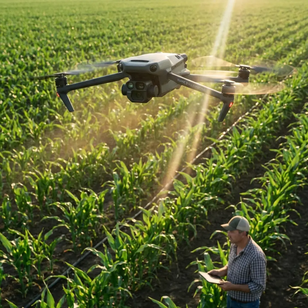
Construction teams working through brutal summer afternoons don’t need another broad summary of what the Mavic 3M is. They need to know whether its data can hold up when the ground is radiating heat, deadlines are compressed, and every revisit costs time, crew energy, and site disruption.
That is where the conversation gets more interesting.
The most useful lens for understanding the Mavic 3M on hot, demanding construction sites does not come from marketing copy. It comes from two very grounded references: ArcGIS-based lightweight UAV survey workflows and the operational reality of image processing, interpretation, and data management. Those references were written around agricultural investigation, yet the lessons translate cleanly to construction logistics, progress verification, stockpile context mapping, drainage review, and thermal-stress monitoring across active sites.
The short version: the aircraft is only half the system. The real value comes from how you capture, process, interpret, and share the output under pressure.
The problem on extreme-temperature sites is not just flight endurance
On paper, the challenge sounds simple. Fly the site, collect imagery, produce a map, make decisions.
In practice, extreme temperatures create a chain reaction. Crews shorten outdoor exposure. Equipment staging becomes harder. Site surfaces shimmer. Dust increases. The margin for repeat flights gets smaller. When operations are rushed, teams often assume that a higher-resolution orthomosaic alone will answer every question.
That assumption is usually wrong.
One ArcGIS workflow reference makes this painfully clear. Even after generating a measured high-resolution orthomosaic, the operators still could not identify crop type simply by zooming in and trying to “see the leaves.” That detail matters far beyond agriculture. On a construction site, the equivalent mistake is assuming a clean top-down map will automatically distinguish material conditions, moisture differences, rework zones, compacted versus disturbed ground, or early stress patterns in temporary vegetation and drainage corridors.
For Mavic 3M users, this is exactly where multispectral capture earns its place. The point is not prettier imagery. The point is better interpretation when visual RGB alone reaches its limit.
Why multispectral matters when visible detail stops being enough
The Mavic 3M sits in a category where “can I see it?” is less useful than “can I classify it reliably?”
That distinction is operationally significant on heat-stressed construction sites. Bare-eye interpretation can miss subtle condition differences across haul roads, retention edges, revegetation strips, sediment-control zones, or utility corridors. In hot weather, these small indicators can shift fast. If your site team is monitoring erosion control performance, landscape establishment, disturbed-soil recovery, or surface uniformity before handover, multispectral data gives you a stronger base than RGB alone.
The ArcGIS crop-survey example shows why. In that case, analysts could infer that plots 51, 52, and 69 held the same crop even when some plots had no interpretation sample points, because the image context and classification logic supported the conclusion. That is a powerful idea for construction use. You will not always ground-check every corner of a large site. If one verified zone shows a known condition, and nearby areas share the same spectral and spatial characteristics, you can extend interpretation more intelligently instead of treating the site as a collection of isolated images.
That saves field time, which matters when the weather is punishing and site access windows are narrow.
Heat changes workflow economics more than most teams expect
One of the strongest facts in the ArcGIS material has nothing to do with sensors. It is about labor efficiency.
The reference compared a traditional tablet-based field collection method with a UAV-plus-ArcGIS workflow. A 7-person team using conventional outdoor collection could handle only one sample area per day. By contrast, a 2-person inside/outside team using the drone workflow completed 3 sample areas in one working day. The measured efficiency gain was about 10.5 times.
That number deserves attention from construction managers.
In extreme temperatures, efficiency is not a soft benefit. It is a safety and continuity issue. Less time spent walking reflective surfaces, cut slopes, incomplete roadbeds, or obstacle-heavy temporary works zones directly reduces crew exposure. The reference also explicitly notes improved safety and comfort in harsh outdoor conditions and difficult terrain. Again, although the original use case was crop investigation, the same field logic applies to construction sites where heat, uneven ground, and access constraints erode productivity.
For Mavic 3M deployments, this means the aircraft should be evaluated not just as a mapping tool, but as a crew-exposure reduction tool. If your current site inspection method still depends on prolonged manual traversal in peak heat, that is the bottleneck worth fixing.
Orthomosaic output is useful, but processing choices decide whether it stays practical
Another reference gets into a part of drone operations that many field teams underestimate: processing discipline.
The workflow specifically recommends enabling initial processing and generating only the orthomosaic, while not creating a digital surface model in that step. That choice matters because it narrows output to what is needed and avoids unnecessary processing load. On demanding projects, especially when same-day turnaround is expected, that kind of restraint is what keeps the operation useful instead of bloated.
The same document reports that processing time for one plot ranged from about 1 to 6 hours depending on image resolution, photo count, and hardware conditions, especially CPU core count and memory. That range is highly relevant to Mavic 3M operations on construction projects. If your team promises rapid progress maps after every hot-weather flight but runs the job on underpowered hardware or insists on generating every possible output every time, the drone becomes a delay multiplier rather than a decision tool.
A practical takeaway: define the question before you fly.
If the site team needs a fast orthomosaic for logistics staging, access-route review, or progress verification, keep the workflow lean. If they need elevation products later, schedule that as a separate processing branch. This is the kind of operational maturity that makes the Mavic 3M fit into real construction timelines.
Data sharing is where many drone programs quietly fail
Collecting good imagery is difficult. Getting the right people to use it in time is often harder.
The ArcGIS reference points to Portal for ArcGIS as a way to share orthomosaics, sample points, and oblique models across organizations and devices. That sounds administrative until you think about a construction site in extreme weather. Site leadership, subcontractors, safety coordinators, environmental teams, and remote consultants may all need access to the same updated geospatial context, but not from the same location.
When a drone program grows, image accumulation becomes its own problem. The source material warns that once UAV imagery products pile up, it becomes very hard to quickly find outputs by time period, area, or resolution unless image management is handled systematically. It even notes that a city- or province-level campaign may generate thousands of orthomosaic products in a single survey cycle.
Translate that to recurring construction flights across long projects, and the risk becomes obvious. Without disciplined naming, metadata, and portal-based sharing, teams stop trusting the archive because finding the right dataset takes longer than requesting another flight.
The Mavic 3M is at its best when each mission contributes to a searchable operational record, not a folder graveyard.
A note on map offset and why preflight setup still matters
One detail in the ArcGIS crop-survey reference is easy to overlook but has serious field consequences: domestic satellite imagery can carry positional offset, and operators are advised to enable the correct domestic map setting in DJI GO and Altizure before takeoff so they can more accurately locate sample areas and plan the flight boundary.
Even if your Mavic 3M workflow today uses updated enterprise planning tools rather than the exact software named in that document, the principle is unchanged. Base map alignment errors can propagate into mission planning, waypoint placement, and field verification. On a construction site, that can mean missed overlap on a key area, inaccurate edge capture around temporary works, or wasted battery on a corrective refly.
This is where centimeter precision and RTK fix discipline come into the conversation. Precision is not just about the final map looking professional. It is about making sure the aircraft is collecting the right footprint, on the right alignment, the first time, under difficult conditions.
If your RTK fix rate is unstable, solve that before you blame the sensor.
Antenna positioning advice for maximum practical range
You asked for field advice, so here is the piece that usually gets skipped.
On large construction sites, especially in heat haze and around steel structures, operators often focus on battery percentage and forget link quality habits. For the best practical range and a steadier transmission margin, keep the controller antennas oriented broadside to the aircraft rather than pointing the antenna tips directly at it. Think of the flat faces doing the work, not the ends. Maintain a clear line of sight whenever possible, and avoid standing next to containers, vehicles, reinforced concrete walls, or large temporary power equipment that can reflect or obstruct signal.
If the site has elevation variation, move yourself before the mission degrades. A small repositioning uphill or into a clearer corridor can matter more than any setting tweak. In high heat, when you want to avoid unnecessary hover time, this kind of antenna discipline helps preserve a stable mission flow.
If your team needs a second opinion on mission layout or communications setup, I usually recommend sending the site sketch and intended route here: share your flight plan directly.
Where the Mavic 3M fits best on construction sites
The Mavic 3M is not a replacement for every survey instrument or every site walk. It is best used where repeatable, georeferenced, condition-sensitive aerial data creates better decisions with less field strain.
That includes:
- progress documentation over broad, changing work fronts
- environmental compliance checks around drainage and disturbed soils
- revegetation and landscape establishment monitoring
- stockpile and laydown-area context review
- heat-season inspections where reducing crew exposure is a priority
- pre-handover visual baselining for large external works packages
The drone becomes especially valuable when the site team needs consistent revisits rather than one-off visuals. The reference to drone light-show operations in Guizhou, though unrelated in application, highlights a service concept worth borrowing: the shift toward an integrated, one-stop operating model from planning through execution, delivered as a routine service rather than a novelty. That is the right mindset for serious Mavic 3M construction work too. The aircraft should be embedded into a repeatable operating pattern—planning, capture, processing, interpretation, sharing—not treated as an occasional add-on flight.
That is how you get from isolated maps to dependable site intelligence.
What experienced teams do differently
Teams that extract real value from the Mavic 3M on extreme-temperature projects tend to follow a few habits.
They do not assume high-resolution RGB answers every question.
They limit outputs when fast decisions matter, instead of processing everything by default.
They treat data organization as part of flight operations, not office cleanup.
They use field-verified interpretation logic to extend conclusions across similar areas, rather than ground-checking every square meter.
And they understand that a drone mission is only successful if the resulting information arrives fast enough to change the next decision.
That last point is the one most worth remembering. A map delivered too late is just documentation. A map delivered on time is operations.
The real takeaway
For construction sites operating through extreme temperatures, the Mavic 3M makes the most sense when you pair its capture capability with disciplined geospatial workflow. The reference material supports that view from multiple angles: a measured 10.5x efficiency gain in UAV-based field collection, practical limits of orthomosaic-only interpretation, processing windows of 1 to 6 hours per plot depending on compute conditions, and the need for structured sharing through portal-based GIS systems.
Those are not abstract points. They are the difference between a drone program that looks impressive and one that quietly removes friction from hot-weather site delivery.
If you are deploying Mavic 3M in this environment, start by asking three questions:
- What decision must this flight support today?
- Is RGB enough, or do we need multispectral evidence?
- Can the data be processed and shared quickly enough to matter before conditions change?
Get those right, and the aircraft starts paying for its place in the workflow.
Ready for your own Mavic 3M? Contact our team for expert consultation.