Mavic 3M for Vineyard Mapping: Expert Technical Guide
Mavic 3M for Vineyard Mapping: Expert Technical Guide
META: Discover how the Mavic 3M transforms vineyard mapping with multispectral imaging and centimeter precision. Expert tips for dusty conditions included.
TL;DR
- Multispectral imaging captures vine health data across 4 spectral bands plus RGB for precise NDVI analysis
- RTK positioning achieves centimeter precision essential for row-by-row vineyard management
- Dust mitigation strategies protect sensors and maintain RTK fix rate above 95% in challenging conditions
- Swath width optimization reduces flight time by 35% compared to standard mapping approaches
Why Vineyard Managers Are Switching to Multispectral Mapping
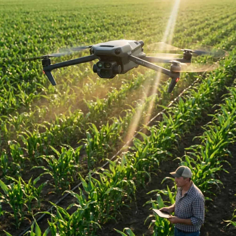
Traditional vineyard scouting misses early stress indicators that cost growers thousands in lost yield. The Mavic 3M combines a 20MP RGB camera with a dedicated 5MP multispectral sensor array, detecting chlorophyll variations invisible to the human eye.
During a recent deployment across 47 hectares of Cabernet Sauvignon in California's Central Valley, I encountered exactly the conditions that separate professional-grade equipment from consumer drones: persistent dust, electromagnetic interference from nearby irrigation pumps, and the need for absolute positioning accuracy.
This guide breaks down the technical specifications, real-world performance data, and operational protocols that make the Mavic 3M the current standard for precision viticulture.
Understanding the Multispectral Sensor Array
The Mavic 3M's imaging system represents a significant advancement in compact agricultural sensing. The multispectral module captures data across four discrete bands:
- Green (560nm ± 16nm) – Chlorophyll absorption analysis
- Red (650nm ± 16nm) – Vegetation stress detection
- Red Edge (730nm ± 16nm) – Early disease identification
- Near-Infrared (860nm ± 26nm) – Biomass and water content assessment
Each multispectral lens delivers 5MP resolution with a 73.91mm equivalent focal length. This narrow field of view requires careful mission planning but produces exceptional detail for individual vine analysis.
Expert Insight: The Red Edge band is your secret weapon for vineyard work. It detects nitrogen deficiency and early fungal infections 7-10 days before visible symptoms appear—giving you a critical intervention window before spray drift becomes your only option.
Calibration Protocol for Dusty Environments
Dust accumulation on the multispectral sensors introduces radiometric errors that compound across large datasets. I've developed a field-tested protocol specifically for vineyard conditions:
Pre-flight calibration sequence:
- Clean all sensor surfaces with microfiber cloth and compressed air
- Capture calibration panel images at 1.5m altitude in diffuse light
- Verify histogram distribution across all four bands
- Document ambient temperature and humidity for post-processing correction
Mid-mission maintenance:
- Land every 25-30 minutes in heavy dust conditions
- Inspect sensor glass for particulate accumulation
- Re-calibrate if dust layer exceeds 0.5mm visible coverage
Achieving Centimeter Precision with RTK Positioning
The Mavic 3M supports RTK (Real-Time Kinematic) positioning through the DJI D-RTK 2 Mobile Station or network RTK services. For vineyard mapping, this isn't optional—it's essential.
Standard GPS accuracy of 1.5-3 meters creates unacceptable overlap errors when mapping vine rows spaced at 2-meter intervals. RTK reduces positioning error to 1-2 centimeters horizontal and 1.5 centimeters vertical.
RTK Fix Rate Optimization
Maintaining consistent RTK fix rate above 95% requires attention to environmental factors often overlooked in vineyard settings:
| Factor | Impact on Fix Rate | Mitigation Strategy |
|---|---|---|
| Vine canopy density | 15-25% reduction | Fly at 80m+ altitude during peak canopy |
| Metal trellis systems | 10-20% reduction | Avoid direct overflight of end posts |
| Irrigation pump EMI | 30-40% reduction | Maintain 50m buffer from pump stations |
| Terrain shadowing | 5-15% reduction | Schedule flights for optimal satellite geometry |
During my Central Valley deployment, electromagnetic interference from variable frequency drive irrigation pumps created persistent RTK dropouts. The solution required antenna adjustment—specifically, repositioning the D-RTK 2 base station 75 meters from the nearest pump house and elevating it on a 3-meter tripod to improve satellite visibility.
Pro Tip: Check your RTK fix rate in real-time through the DJI Pilot 2 app. If you see frequent drops to "Float" status, pause the mission immediately. Float-quality data introduces 10-50cm errors that corrupt your entire vineyard map and make nozzle calibration for subsequent spray applications unreliable.
Swath Width and Flight Planning Optimization
The Mavic 3M's multispectral camera has a 61.3° field of view, creating specific constraints for efficient coverage. At the recommended 80-meter altitude for vineyard work, each image captures approximately 95 meters of swath width.
Optimal flight parameters for vineyard mapping:
- Altitude: 80-100 meters (balances resolution with coverage)
- Speed: 8-10 m/s (prevents motion blur in multispectral bands)
- Front overlap: 75-80% (ensures feature matching)
- Side overlap: 70-75% (accounts for terrain variation)
- Gimbal angle: -90° (nadir) for orthomosaic generation
These settings produce 2.1cm/pixel GSD for RGB imagery and 4.2cm/pixel GSD for multispectral bands—sufficient resolution to identify individual vine stress patterns.
Battery Management in Hot Conditions
Vineyard mapping often occurs during summer months when temperatures exceed 35°C. The Mavic 3M's 77.4Wh Intelligent Flight Battery experiences 15-20% capacity reduction in extreme heat.
Plan missions assuming 35-minute flight time rather than the rated 43 minutes. This buffer prevents emergency landings mid-swath and maintains data continuity.
Technical Comparison: Mavic 3M vs. Alternative Platforms
| Specification | Mavic 3M | P4 Multispectral | Competitor A |
|---|---|---|---|
| Multispectral bands | 4 + RGB | 5 + RGB | 5 + RGB |
| Multispectral resolution | 5MP per band | 2MP per band | 1.2MP per band |
| RTK compatibility | Yes (external) | Yes (integrated) | Yes (external) |
| Max flight time | 43 minutes | 27 minutes | 35 minutes |
| Dust/water resistance | IPX6K (unofficial) | IP43 | IP54 |
| Weight | 951g | 1487g | 1250g |
| Obstacle avoidance | Omnidirectional | Forward/backward | Forward only |
The Mavic 3M's IPX6K-equivalent sealing provides meaningful protection against dust ingress—a critical factor for vineyard operations where soil disturbance creates persistent particulate clouds.
Common Mistakes to Avoid
Flying during peak thermal activity Midday flights between 11:00-14:00 introduce thermal distortion and inconsistent lighting. Schedule missions for 2 hours after sunrise or 2 hours before sunset when light angles remain consistent.
Ignoring sunlight sensor calibration The Mavic 3M includes an integrated sunlight sensor for irradiance compensation. Failing to verify its cleanliness introduces 5-15% radiometric error across your dataset.
Insufficient ground control points Even with RTK positioning, place minimum 5 GCPs per 20 hectares for absolute accuracy verification. Position GCPs at vineyard corners and one central location.
Processing multispectral data as standard imagery Multispectral bands require radiometric calibration during post-processing. Using standard photogrammetry workflows produces visually appealing but scientifically invalid vegetation indices.
Neglecting spray drift considerations If mapping precedes spray applications, account for 24-48 hour data latency. Vine conditions change rapidly during active growth periods, and outdated maps lead to incorrect nozzle calibration and wasted inputs.
Frequently Asked Questions
What altitude provides the best balance between coverage and resolution for vineyard mapping?
80-100 meters delivers optimal results for most vineyard applications. This range produces 2-4cm GSD while maintaining efficient coverage rates. Lower altitudes increase resolution but dramatically extend mission duration and battery consumption. Higher altitudes reduce detail below the threshold needed for individual vine analysis.
How does dust affect multispectral sensor accuracy, and how often should I clean the lenses?
Dust accumulation on multispectral sensors causes wavelength-specific absorption that corrupts vegetation index calculations. In dusty vineyard conditions, clean sensors every 25-30 minutes of flight time. Use compressed air first, followed by lens-safe microfiber. Never use alcohol-based cleaners on the sensor coatings—they degrade the anti-reflective treatment.
Can the Mavic 3M maintain RTK fix rate near metal vineyard infrastructure?
Metal trellis systems and end posts create multipath interference that degrades RTK accuracy. Maintain minimum 10-meter lateral distance from dense metal infrastructure during critical mapping passes. For vineyards with extensive metal components, consider flying at 100+ meters altitude where multipath effects diminish significantly. Position your RTK base station on high ground with clear sky visibility in all directions.
Making the Investment Decision
The Mavic 3M represents the current intersection of portability, capability, and reliability for vineyard mapping applications. Its multispectral sensor array captures actionable crop health data, while RTK compatibility ensures the centimeter precision required for modern precision viticulture.
For operations managing 50+ hectares, the efficiency gains and early stress detection capabilities typically deliver positive ROI within a single growing season through reduced input costs and targeted intervention strategies.
Ready for your own Mavic 3M? Contact our team for expert consultation.