Mavic 3M Field Report for Coastlines: Why This Week’s Drone
Mavic 3M Field Report for Coastlines: Why This Week’s Drone News Changes How I Plan Every Mission
META: A field report on what Volatus Aerospace’s TSX move and a power-line shutdown case reveal about safer, smarter Mavic 3M coastline surveying operations.
When I brief a coastline survey team on the Mavic 3M, I rarely start with sensors. I start with consequences.
That may sound backwards for a platform best known for multispectral capture, centimeter-grade mapping workflows, and dependable RTK-assisted positioning. But in coastal operations, the real difference between a productive sortie and a headline-making mistake often comes down to something less glamorous: discipline before takeoff, especially around load assumptions, airspace awareness, and the physical condition of the aircraft.
Two recent drone stories sharpen that point in very different ways. One comes from the capital markets. Volatus Aerospace moved to the Toronto Stock Exchange on March 20, 2026, under the ticker FLT, a step that signals larger ambitions in integrated uncrewed systems and autonomy for commercial and government users. The other is a hard operational warning from Sichuan, where a drone pilot moving timber allegedly flew in violation of rules, snagged a towing line on high-voltage wires, caused a regional power outage, and triggered both an 8,000 yuan company payout and a 5-day administrative detention for the pilot.
If you fly a Mavic 3M along coastlines, neither of these stories is abstract. Together, they tell you where the drone sector is going and what still destroys missions on the ground: scale is rising, scrutiny is rising with it, and basic operational errors remain brutally expensive.
This is not just “industry news” if you map shorelines
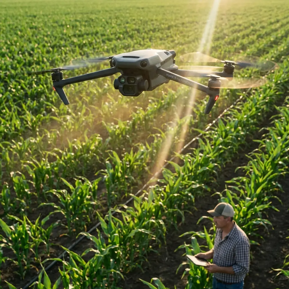
The Mavic 3M sits in an interesting place in the market. It is not a heavy-lift logistics aircraft. It is not a spray platform. It is a compact, highly capable data-collection tool that shines when the mission demands multispectral insight, repeatable route execution, and field efficiency. Coastal users rely on it for vegetation stress assessment, erosion tracking, marsh analysis, drainage patterns, and change detection across difficult, wind-exposed environments.
So why should a stock exchange listing and a power-line accident matter to someone scanning dunes, estuaries, or saltmarsh edges?
Because coastline work is increasingly being judged by two standards at once.
First, the data has to be better. Stakeholders now expect more than pretty orthomosaics. They want repeatability, traceable workflows, and outputs they can trust in planning, environmental compliance, and infrastructure protection. That is where the Volatus story matters. A company does not graduate to the senior Toronto market under the symbol FLT just because drones are fashionable. The market is rewarding operators building integrated systems for commercial and government demand. That tells me clients will keep pushing toward mature programs, not ad hoc flying.
Second, operations have to be cleaner. Not cleaner in the marketing sense. Cleaner in the physical, procedural, and legal sense. The Sichuan incident is a blunt reminder that one bad decision around line clearance or mission suitability can move an operation from “routine” to “detention” fast. Coastal work may not involve timber sling loads, but it does involve utility corridors, shoreline substations, communication lines, harbor infrastructure, and a lot of hidden complexity near built environments.
The lesson for Mavic 3M operators is straightforward: the market is professionalizing, but the penalties for sloppy flying are not waiting for the market to catch up.
The Volatus signal: autonomy is becoming normal, not experimental
Let’s look closer at the Volatus development. The key detail is not merely that Volatus Aerospace listed on the Toronto Stock Exchange on March 20, 2026. The operational significance lies in what the move represents: confidence in scaling integrated uncrewed systems and autonomy solutions for commercial and government customers.
That matters to Mavic 3M users because coastline survey contracts are moving in the same direction. Buyers no longer see UAV work as a one-off field service. They increasingly expect drone operations to plug into broader systems: GIS pipelines, compliance reporting, environmental monitoring programs, asset management platforms, and recurring inspection schedules.
For a Mavic 3M team in coastal environments, that changes how you should think about the aircraft. The value is not just in collecting multispectral frames. The value is in delivering a repeatable decision product. A marsh health baseline today must be comparable with the same corridor six weeks later after storm surge, seasonal salinity shifts, or tidal-channel movement. That puts pressure on RTK fix rate stability, flight path consistency, overlap discipline, and launch procedures that do not introduce avoidable errors.
This is where many otherwise competent teams underperform. They buy a capable aircraft, then operate it as if precision were optional.
It is not. Not if your work supports government habitat management, coastal engineering, or shoreline resilience planning.
When a company like Volatus gains visibility at that level, it reinforces a broader reality: customers are looking for drone programs that behave like infrastructure, not hobbies. If you fly the Mavic 3M in coastal zones, you should align with that expectation now.
The Sichuan incident: the oldest mistake in drones still wins
The second news item is less polished and more valuable. According to the report, a pilot moving timber on March 19 caused a towing line to become entangled with high-voltage power lines, leading to a regional outage. The company reportedly paid 8,000 yuan, and the licensed pilot received 5 days of administrative detention for illegal operation.
There are several reasons this should get the attention of Mavic 3M operators, even though the aircraft and mission type were different.
First, certification did not prevent the violation. The report specifically notes the pilot was licensed. That matters because too many teams confuse qualifications with immunity. A certificate proves baseline legitimacy. It does not compensate for poor mission design.
Second, the trigger was not a sensor failure or some exotic autonomy bug. It was an operational decision involving a line near power infrastructure. In other words, a preventable mistake. That should resonate with anyone who has ever looked at a coastal map and thought, “We’ll just keep clear of the obvious hazards.”
In the field, “obvious” is often where crews get hurt. Along coastlines, wires can blend into low-angle light. Service lines can run behind vegetation. Temporary work zones appear near seawalls, ports, pumping stations, and drainage assets. Wind shifts and gusts around cliffs, breakwaters, or industrial structures can alter aircraft behavior quickly, especially during low-altitude legs or return-to-home transitions.
Third, the consequences spread beyond the drone itself. The outage affected an area, not just the operator. That is the part many mission planners underweight. In coastline work, your error can ripple through utilities, access roads, public safety response, marine operations, or ecological sites under management controls.
The Mavic 3M is built for sensing. But it only protects you when the mission itself makes sense.
My non-negotiable pre-flight cleaning step for coastal Mavic 3M work
This is where I want to get practical, because the safest teams build habits that look almost trivial from the outside.
Before every coastal Mavic 3M flight, I require a short cleaning and inspection step focused on the aircraft’s vision and positioning surfaces. Not a cosmetic wipe-down. A targeted pre-flight reset.
Salt haze, fine sand, and moisture residue accumulate fast near shorelines. I want the forward, rear, and downward sensing areas checked and cleaned with the correct materials. I want the camera glass reviewed for salt film. I want the RTK-related setup verified clean and unobstructed. I also want the landing gear area and body seams checked for grit that can affect stability on takeoff or landing.
Why is this a safety feature issue rather than just housekeeping?
Because fouled sensors and dirty optical surfaces reduce your margin. In coastal environments, that margin is already narrow. Glare off water, irregular terrain reflectance, wind gusts, and intermittent GNSS conditions near structures can all complicate automated or semi-automated behavior. If the aircraft’s sensing chain is compromised before liftoff, you are starting the mission with preventable uncertainty.
That same mindset is what separates a disciplined survey operation from the kind of improvisation that ends up near power lines, roads, or restricted infrastructure.
I also add a “line and corridor” verbal check to the briefing. Even though the Mavic 3M is not a sling-load platform, I want the crew to explicitly identify overhead hazards, utility crossings, and return-to-home risk paths. The Sichuan case is a dramatic example, but the deeper lesson is universal: crews often fail around hazards they stop actively naming.
What coastline operators should actually change after these stories
The wrong reaction to these news items would be to shrug and say they apply to bigger companies or more reckless pilots. The right reaction is to tighten the parts of your workflow that produce reliable results and reduce avoidable exposure.
For Mavic 3M users, I would focus on five areas.
One: treat precision as a deliverable, not a spec-sheet bullet. If you claim centimeter precision, your RTK fix rate, control strategy, and route repeatability have to support that claim in the field. Coastline projects often depend on change detection, and loose execution destroys comparability.
Two: separate the aircraft’s mission from neighboring drone use cases. I noticed the context cues around spray drift, nozzle calibration, swath width, and IPX6K-type durability. Those are useful neighboring concepts in agriculture and industrial UAV discussions, but the Mavic 3M’s strength in coastal work is sensing integrity, not pretending to be every drone class at once. That distinction matters when teams get tempted to stretch mission profiles beyond what the platform is designed to do.
Three: build a utility-risk layer into every shoreline mission plan. Not just no-fly zones. Actual utility awareness. Shoreline pumping systems, substations, overhead lines, radar-adjacent zones, harbor equipment, and temporary site electrics deserve a place in pre-flight review.
Four: standardize the pre-flight clean-and-check routine. Coastal grime is not optional, so your response cannot be optional either.
Five: communicate maturity to clients through process. The Volatus listing is a signal that the market rewards scalable, integrated operations. Your Mavic 3M workflow should look auditable and repeatable. That means clean logs, consistent naming, route version control, and clear post-processing documentation.
If you want to compare field workflows for shoreline mapping, I’m happy to share a practical checklist here: https://wa.me/example
The bigger shift: drone operators are being sorted into two camps
This is what I think these stories really reveal.
One camp is building durable flight operations that can survive procurement reviews, public-sector oversight, and higher-stakes infrastructure work. They think in systems. They clean their equipment properly. They plan around corridors and contingencies. They understand that multispectral outputs are only as defensible as the flight discipline behind them.
The other camp is still relying on the illusion that experience alone will smooth over weak procedures.
That gap is widening.
For Mavic 3M users in coastal surveying, this is actually good news. The aircraft is well suited to the kind of structured, repeatable missions the market increasingly values. Its multispectral capability is useful because coastal decisions are often about subtle environmental signals, not just geometry. Its compact footprint helps in locations where access is awkward and launch windows are short. Its precision-oriented workflows support repeat missions over shorelines that change incrementally until they suddenly do not.
But none of that excuses poor operational habits. If anything, it raises the bar.
A capable aircraft attracts more serious work. More serious work attracts more scrutiny.
That is the thread connecting a Canadian aerospace firm stepping onto the Toronto Stock Exchange and a regional outage caused by a bad drone operation in China. The drone sector is becoming more institutional at the top while remaining unforgiving at the field level. That tension is exactly where most Mavic 3M coastline teams now operate.
If you want better outcomes, act like both stories apply directly to your next launch.
Because they do.
Ready for your own Mavic 3M? Contact our team for expert consultation.