Mavic 3M in Remote Vineyard Work: The Adapter Lesson Drone
Mavic 3M in Remote Vineyard Work: The Adapter Lesson Drone Operators Should Not Ignore
META: A practical expert guide for remote vineyard inspections with Mavic 3M, using a key industry lesson about legacy compatibility, antenna setup, multispectral workflow, and dependable field operations.
Remote vineyard inspection has a technical problem that rarely gets enough attention: the aircraft is only one part of the system. The real bottleneck is usually compatibility across the tools you already own, the workflows your team trusts, and the pressure to keep moving when you are far from the truck, farther from the office, and well outside easy cellular coverage.
That is why a seemingly unrelated camera-industry story matters to anyone flying a Mavic 3M over vines.
In a recent report, Canon users were described pulling an old EF-EOS R adapter out of a drawer before even fully enjoying a new RF-mount camera body. That small ring, with no glass inside and only a few electronic contacts, allows EF lenses first introduced in 1987 to work on RF bodies launched from 2018 onward. Autofocus, aperture control, and stabilization remain available. One working photographer reportedly moved from a 5D Mark IV body to an R5 while keeping a 24-70mm f/2.8L II lens, gaining quieter operation, better subject tracking, and smoother burst shooting without discarding trusted optics.
On the surface, that has nothing to do with a Mavic 3M. In practice, it has everything to do with remote agricultural operations.
The lesson is simple. Smart professionals do not throw away proven field assets just because a new platform arrives. They preserve what already works, then connect it intelligently to what works better. In drone terms, that means your Mavic 3M is most valuable when it fits into an inspection chain that respects existing agronomy records, established scouting routines, known block boundaries, and the crew habits that reduce mistakes under field pressure.
For remote vineyard managers, that mindset can be the difference between a useful multispectral flight and a pretty map that never changes a decision.
Why this story matters for Mavic 3M operators
The Canon example hinges on two hard facts. First, a low-complexity adapter preserved practical functionality across two generations of hardware. Second, the operator did not lose operational capability by keeping older glass in service. In fact, the new body improved performance around it.
That is exactly how a Mavic 3M should be introduced into vineyard inspection.
The aircraft’s multispectral capability is the headline feature, but the operational value comes from continuity. If your team already tracks vigor trends by block, monitors irrigation variability, compares canopy development across rows, or flags recurring stress zones before harvest, the drone should strengthen those workflows rather than replace them wholesale. A good deployment looks less like a dramatic technology reset and more like an upgrade path with minimal friction.
This matters even more in remote sites. Once you are operating in vineyards where access roads are rough, battery swaps are deliberate, and every return-to-home decision carries real time cost, smooth integration is not a luxury. It is field efficiency.
A lot of crews make the mistake of obsessing over raw image capture while overlooking system coherence. They fly excellent missions, then lose time reconciling maps with older data sets, explaining inconsistent labels, or debating whether a stress signature is real or just the result of a changed collection pattern. That is the drone equivalent of buying a new camera body but leaving the useful lens kit behind for no reason.
The right way to set up a remote vineyard inspection mission
For Mavic 3M work in vineyards, especially in remote terrain, the planning stage determines whether your data will support action. The field goal is not simply to generate a multispectral layer. The goal is to identify where intervention matters and where it does not.
Start with block logic, not flight logic. Divide the property by agronomic meaning before you think about sorties. Vine age, trellis design, varietal differences, slope exposure, irrigation zones, and known weak areas all deserve separation. Multispectral maps are only as valuable as the operational decisions they can support.
Then standardize your collection conditions. If one mission is flown at a very different time of day, under inconsistent cloud conditions, or with a different swath width strategy, comparison gets messy. Remote vineyard teams often need to compare current stress patterns against previous flights to decide whether a weak section is expanding or stabilizing. Consistency is what turns imagery into trend analysis.
This is also where centimeter precision becomes more than marketing language. If you are aligning repeat inspections to the same rows and problem spots, positional discipline matters. Strong RTK Fix rate performance is not just a technical bragging point. It supports clean repeatability, tighter alignment to known vineyard features, and more confidence when you assign field crews to inspect a precise patch of canopy rather than a vague zone somewhere between two rows.
That same precision becomes useful when your inspection findings inform spraying plans later. Even if the Mavic 3M is not the aircraft doing the application, its outputs can shape where attention goes next. Areas showing irregular vigor or moisture stress may influence subsequent checks for spray drift exposure, canopy penetration concerns, or nozzle calibration issues in neighboring operations.
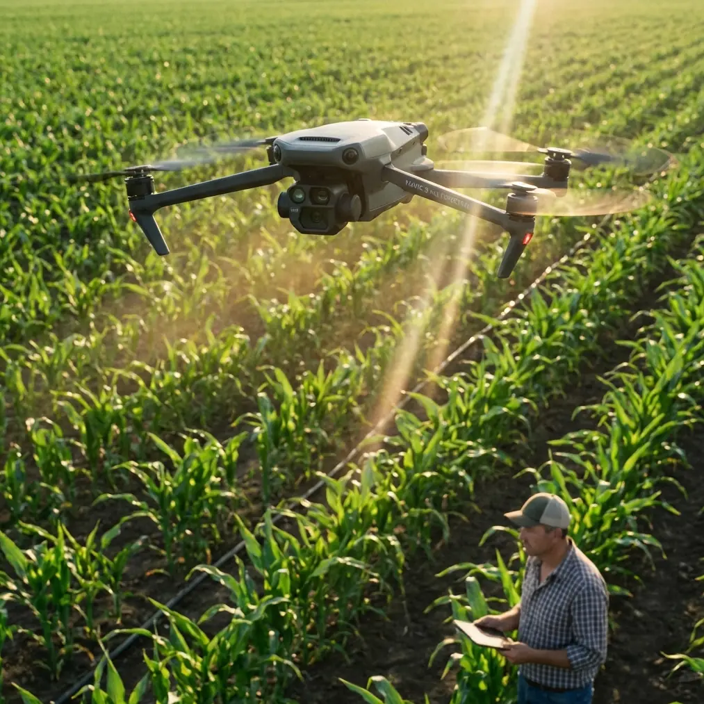
Antenna positioning advice for maximum range
Remote vineyards often produce one predictable error: pilots blame terrain, aircraft, or firmware when the real problem is controller handling.
Antenna positioning is one of the easiest range and link-quality gains available, and it is ignored constantly.
For the strongest connection, do not point the antenna tips directly at the aircraft. That feels intuitive, but it is usually wrong. The broad side of the antenna pattern should face the drone. In practical terms, keep the controller oriented so the flat face of the antenna alignment is presented toward the aircraft’s general direction of travel. If the drone moves laterally across a slope or down a long row, subtly rotate your own body and controller so that relationship stays clean.
In terraced or rolling vineyard terrain, elevation changes can trick operators into holding the controller too low. Raise it to keep your body from blocking the signal path. Your torso is a surprisingly effective piece of interference. If you are standing beside a truck, metal posts, a water tank, or dense trellis infrastructure, move. A few meters can improve link stability more than any menu adjustment.
Also think ahead about flight geometry. Maximum range in remote inspection is not only about power. It is about maintaining line-of-sight conditions as long as possible. Launch from a point that gives you the best visual and RF advantage over the target blocks rather than the most convenient parking spot. In hill vineyards, that often means taking the extra minute to walk to a cleaner ridge shoulder or a row break with less structural clutter.
If your team wants a field checklist for controller setup and link discipline, send the coordinates and block layout through our WhatsApp field support channel and build the procedure around your site rather than relying on generic habits.
Multispectral data only helps if you know what to look for
The Mavic 3M earns its place when it shortens the distance between image capture and a real vineyard decision.
That means interpreting patterns with vineyard context, not treating every color shift as a crisis. In remote inspections, a multispectral anomaly can reflect irrigation inconsistency, early disease pressure, compaction, root-zone stress, canopy management differences, or even a recurring topographic effect. The aircraft gives you a map of where to look. It does not remove the need for good agronomic judgment.
This is where the earlier Canon story carries a second useful lesson. The adapter preserved autofocus, aperture, and stabilization, but the photographer’s real gain was workflow continuity with better performance layered on top. The same principle applies here. Your best Mavic 3M missions do not replace vineyard knowledge. They make that knowledge faster, sharper, and more spatially precise.
For example, if a block has a history of weaker vigor along wind-exposed margins, a multispectral pass can show whether the pattern remains edge-bound or is spreading inward. That changes the next step. Edge-bound stress may point to exposure or drift-related concerns. A spreading signature may justify irrigation checks, soil inspection, or a deeper disease review. The aircraft is not the answer. It is the fastest way to ask better questions.
Remote inspection discipline beats overflying everything
Many operators assume more coverage equals more value. In vineyards, that is often false.
If a property is large and remote, battery planning should favor decision-critical areas first. Fly the blocks with known variability, high-value varietals, difficult irrigation history, or current field complaints before broad routine capture. This is especially true when the weather window is narrow or the terrain makes recovery slower.
Swath width decisions matter here. A wider swath can improve throughput, but if the mission sacrifices the consistency or detail needed to identify row-level variability, you may end up reflying anyway. The best setting is the one that preserves the agronomic usefulness of the data while matching your time and battery reality. In other words, optimize for decisions per flight, not acres per screenshot.
This field discipline also protects downstream operations. If your multispectral review reveals irregular crop response near treatment areas, the next conversation may involve spray drift assessment or checking whether nozzle calibration has stayed consistent across the sprayer setup. That connection between inspection and intervention is where the system pays off.
Reliability in the field is about more than airframe specs
When crews discuss remote work, they often reduce reliability to weather resistance and battery count. Those matter, of course. So does a rugged operational mindset.
An aircraft used around dust, moisture, and uneven access conditions benefits from a field protocol that treats every mission as part of a larger chain: preflight validation, controller placement, mission parameter consistency, RTK status confirmation, battery temperature awareness, and immediate post-flight review before leaving the block. If your platform or supporting gear is rated to handle harsh conditions, such as equipment classes associated with IPX6K-style resilience, that helps. But ratings do not replace discipline.
The real-world failure point is usually human inconsistency. Different takeoff points. Different mission overlap. Different naming practices. Different assumptions about whether a fix is good enough. Those small deviations are what break long-term comparison and slow down response when the vineyard team needs a confident answer quickly.
The bigger takeaway for Mavic 3M buyers and operators
The camera story is not really about mounts. It is about continuity under change.
A metal adapter with a few contacts allowed a system designed in 1987 to remain useful on bodies introduced after 2018. A photographer moved from a 5D Mark IV to an R5 and kept a proven 24-70mm f/2.8L II lens in active service. Operationally, that meant less disruption and better results.
That is the right mental model for Mavic 3M deployment in remote vineyards.
Do not treat the aircraft as an isolated purchase or a one-off flying camera. Treat it as a bridge between what your team already knows and what your operation now needs to know faster. Preserve field knowledge. Standardize collection. Protect repeatability. Use centimeter precision and strong RTK habits to make return missions comparable. Position antennas correctly so the aircraft stays linked where terrain tries to work against you. Interpret multispectral outputs in relation to real vineyard conditions, not color alone.
The operators who get the most from the Mavic 3M are rarely the ones chasing novelty. They are the ones who understand integration. New platform, old wisdom, tighter execution.
That is how remote vineyard inspection becomes more than a flight. It becomes a dependable management tool.
Ready for your own Mavic 3M? Contact our team for expert consultation.